 -- -----
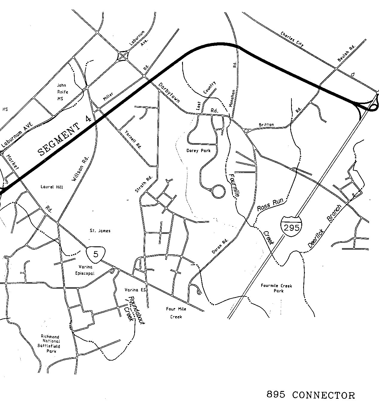
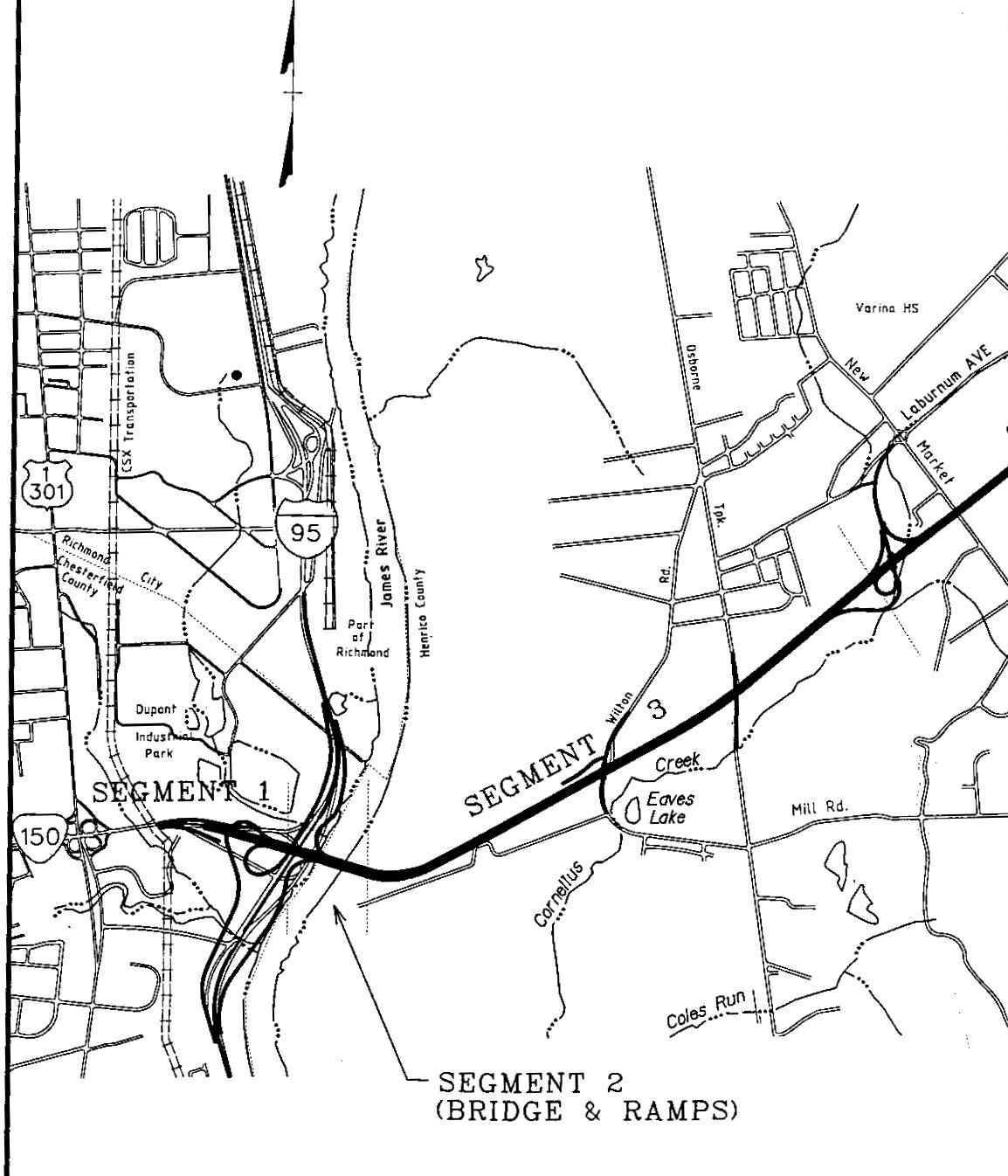
Route 895 Connector Map
On paper, this map is 11" x 17" and the scanned version here is divided into two images, separated vertically in the middle. The joint venture building the road, Fluor Daniel/Morrison Knudsen, provided VDOT with the map. I have copied it with VDOT's permission. North is upward.
-- -----
Click
West Map for full-size version ------------------ Click East Map for full-size versionI plan on scanning some more plans and maps of the Route 895 project.
By Scott M. Kozel,
Roads to the Future(Created 9-8-00 6:35 PM; counter 34,576)