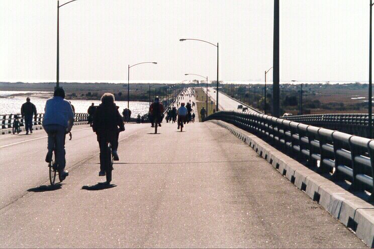
Above, northbound span of Fisherman Inlet Bridge, heading south at the beginning of the trip. Fisherman Island is straight ahead, and on the horizon you can see the Atlantic Ocean.
CBBT - Go to Sea on Your Bike
Pardon me for modifying the old CBBT slogan "Go to sea in your car"...
JOn November 15, 1998, the Chesapeake Bay Bridge and Tunnel District had a one-time "Family Day" where hikers and bikers could use parts of the original trestle span, which is presently closed for major rehabilitation, following the opening of the entire new parallel trestle.
Above, northbound span of Fisherman Inlet Bridge, heading south at the beginning of the trip. Fisherman Island is straight ahead, and on the horizon you can see the Atlantic Ocean.
Above, looking north from the North Channel Bridge. The New North Channel Bridge is in front, Fisherman Island is behind that, and the Fisherman Inlet Bridges are in the distance, and the Eastern Shore is on the horizon.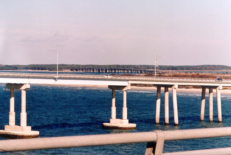
Above, looking north from the North Channel Bridge (highest point on the CBBT at 85 feet above water). Fisherman Island is straight ahead, and on the horizon is the Atlantic Ocean on the right and the Eastern Shore is on the left. You can see the Cape Charles Lighthouse at the left edge of the photo. 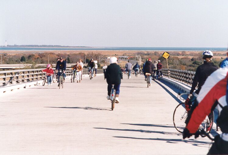
Above, looking south from the North Channel Bridge. The new trestle is in the distance, and Chesapeake Bay is straight ahead, and Hampton is over the horizon 16 miles away.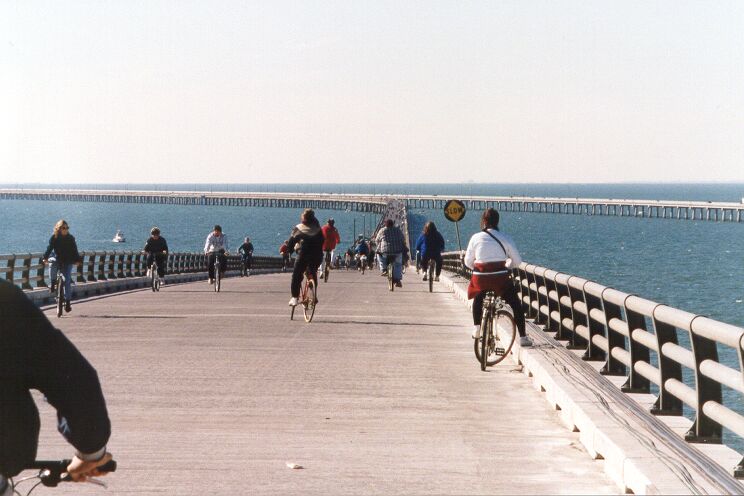
Above, original span, just north of the northernmost manmade island, photo taken from new emergency bay. The North Channel Bridges are in the distance on the right. 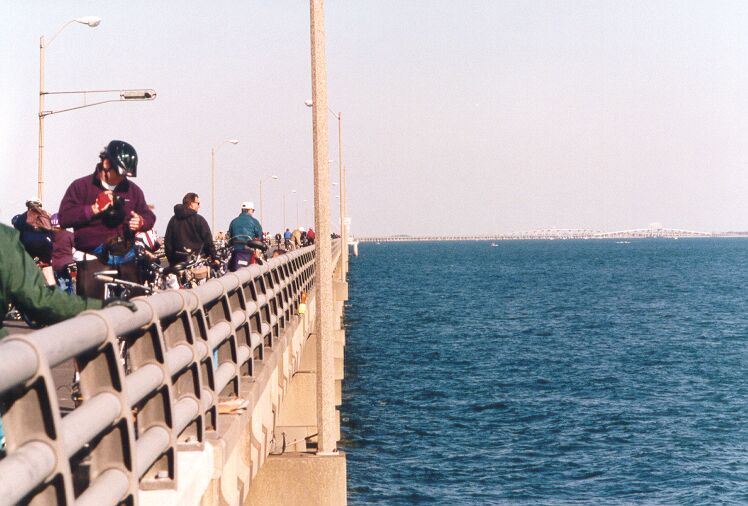
Above, original span, just north of the northernmost manmade island. Notice the new asphalt surface that has been placed on the 34-year-old trestle. The North Channel Bridges are in the distance on the right. Richmond Times-Dispatch - Sunday, November 15, 1998 "Family day set on bridge-tunnel / Events planned for bicyclists, walkers on span" Excerpts: "Walkers and bicyclists will get a rare chance on Saturday to travel portions of the 17.6-mile Chesapeake Bay Bridge-Tunnel, which spans the bay mouth from Virginia Beach to Cape Charles. The management of the bridge-tunnel is staging a free "family fun day" on Nov. 21 to commemorate the building of a parallel trestle system that will eliminate two-way traffic on the span except in the tunnels". "A portion of the north end of the old trestle will be open to bicyclists and a portion of the south end will be open to walkers from 8 a.m. to 4 p.m. [...] Bicyclists will be able to travel an 8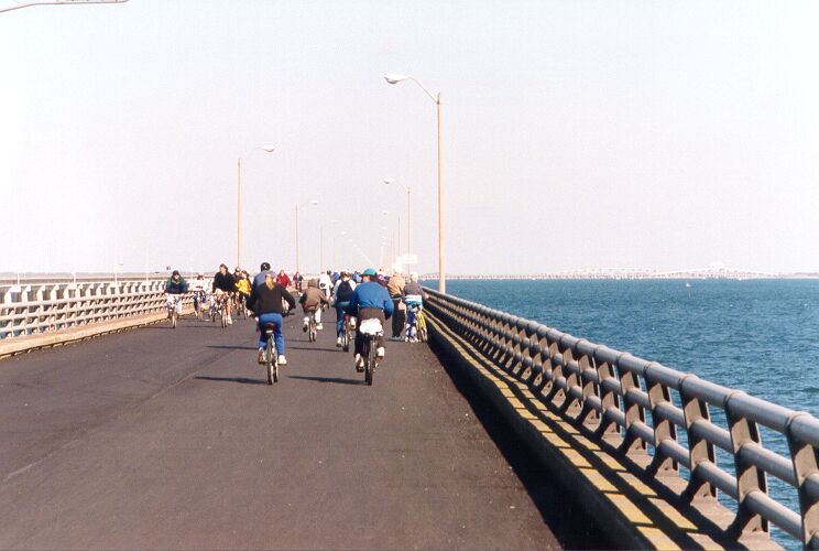
We went to the northern section, which had the bike trip. The trip was loooong, no it was loooooooooong, but very enjoyable, and rather unique! There were thousands of bicyclists (literally!) on the span when we got there at 11:30 AM. Some turned around at the North Channel Bridge (highest point on the CBBT at 85 feet above water) about 31/2 miles from the north staging area, but most made the entire 81/2-mile trip to the northernmost manmade island. Some took the bus back, but most rode their bikes back. The weather was mostly sunny, about 55 degrees, and windy.
It was a lot of fun, there were all kinds of folks there, from babies to senior citizens. The CBBT crosses Fisherman Island, which is just offshore from the southern tip of the Eastern Shore; it is a national wildlife refuge with sand dunes and tidal wetlands; very interesting. The south trestle was loaded with walkers; we didn't have time to do that one.
I don't see any reason why this won't become an annual event, just like the Chesapeake Bay Bridge Walk that is held on that facility, which is near Annapolis, Maryland. Indeed, there has been talk in the Norfolk/Hampton Roads newspapers about making this an annual event. I'll certainly go back! The Maryland event only allows pedestrians, since the 2-lane eastbound 4.3-mile-long bridge is closed and used for this one day, and mixing bicycles and pedestrians would be too difficult. My website article Chesapeake Bay Bridge Walk has a photo tour (5 photos) of my attendance of that event in 1987. The advantage of the CBBT is that two long trestles can be used just like in the 1998 event; bicyclists only on the 81/2-mile-long section of the original span from the Eastern Shore to the northernmost manmade island, and pedestrians only on the 31/2-mile-long section of the original span from Virginia Beach to the southernmost manmade island.
The entire parallel trestle is now open to traffic in November 1998, with 2-way traffic operating on it while the original trestle is closed for rehabilitation.
Photos by Scott Kozel.
© Copyright June 1999 by Scott Kozel. All rights reserved.
By Scott M. Kozel,
Roads to the Future(Created 2-6-99 8:00 PM; counter 10,920)