
| Road Trip to Florida |
Road Trip to Florida
I visited the areas of Melbourne and Belle Glade over the Memorial Day weekend in 1991. This article has 29 photos that I took on the trip, with a wide assortment of mostly highway and bridge photos from Savannah, Georgia, to South Florida, including the areas of Jacksonville, Cape Canaveral, Melbourne, Sebastian, Fort Lauderdale, Miami, the Everglades, and Lake Okeechobee, with a variety of commentary and external links interspersed.
Click the thumbnail photo for a larger photo (they range in size from 51 KB to 184 KB, and most are less than 110 KB).
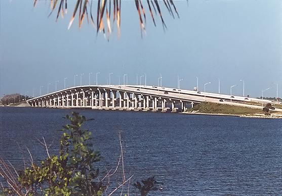 |
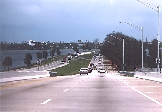
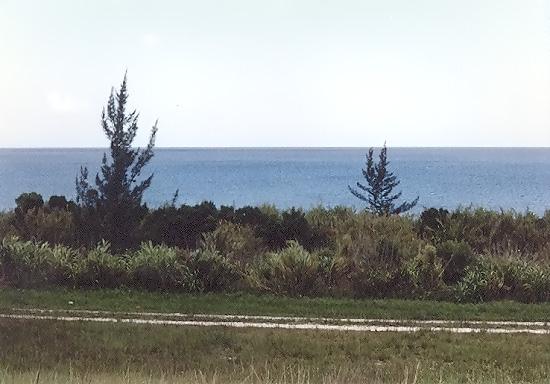
Melbourne Causeway, US-192, crosses the Indian River and connects Melbourne to the beachfront barrier island in the town of Indialantic.
|
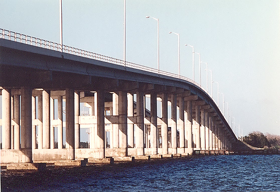 |
Melbourne Causeway, US-192, crosses the Indian River and connects Melbourne to the beachfront barrier island in the town of Indialantic.
|
 |
Melbourne Causeway,
US-192, crosses the Indian River and connects Melbourne to the beachfront
barrier island in the town of Indialantic.
Looking eastbound toward Melbourne,
with the eastern relief bridges in the foreground, and the high-level bridges
over the Intracoastal Waterway (ICW) in the distance. The bridges over the
ICW have 65 feet of vertical navigational clearance. |
 |
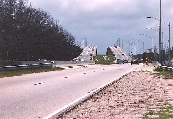
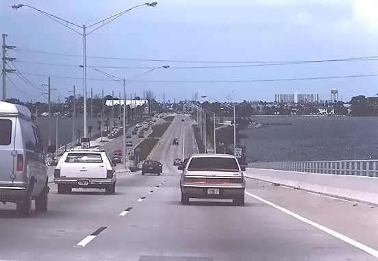
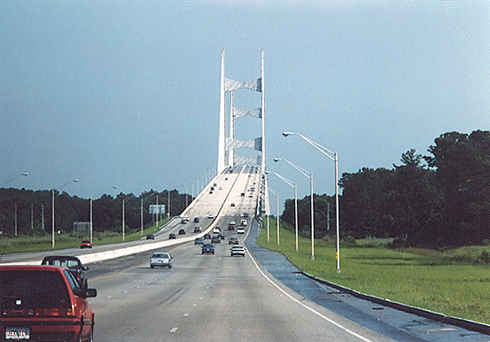
Melbourne Causeway, US-192, crosses the Indian River and connects Melbourne to the beachfront barrier island in the town of Indialantic. Traveling westbound toward Melbourne, approaching the high-level bridges.
|
 |
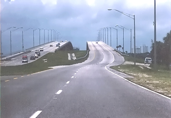
Melbourne Causeway, US-192, crosses the Indian River and connects Melbourne to the beachfront barrier island in the town of Indialantic. Traveling westbound toward Melbourne, having passed the highest point of the high-level bridge.
|
 |
Melbourne Causeway, US-192, crosses the Indian River and connects Melbourne to the beachfront barrier island in the town of Indialantic. Traveling eastbound toward Indialantic, having passed the highest point of the high-level bridge.
|
The first bridge between Melbourne and Indialantic was completed in 1921. A
modern causeway and 2-lane bridge with a swingspan was completed in 1947, and
the swingspan had about 20 feet of vertical navigational clearance when the
swingspan was closed. Most of the length of the causeway is built on earthen
fill in the river. The
westbound 2-lane high-level bridge was opened in 1978, with 2-lane eastbound
traffic relegated to the 1947-built bridge. The eastbound 2-lane high-level
bridge was opened in 1985, and the 1947-built bridge was demolished. During
the construction of the high-level bridges, the earthen causeways were
widened, and new relief bridges were built near each shoreline. The high-level
bridges pass over the Intracoastal Waterway and have 65 feet of vertical navigational clearance.
Source: correspondence with Florida Department of Transportation.
Causeway Bridge
- The bridge built by Ernest Kouwen-Hoven was started in 1919 and completed in
1921. It was 9,706 feet long and 16 feet wide. In July 1921, Melbourne paved the
section of New Haven avenue from the railroad east to the bridge. This was
Melbourne's first paved street.
IMAGES From Nostalgiaville FLORIDA - Melbourne, FL, see photo of CAUSEWAY
historical marker about halfway down the webpage. This discusses the original
causeway and the 2-lane causeway that was opened in 1947. Quote (in blue text):
The Indian River Journal, Volume 1, Number 1 Fall 2002,
has this cite about the causeway. Excerpt (in blue text):
Melbourne Beach Historical Trail
has this information about the three versions of the Melbourne Causeway. Excerpt
(in blue text):
20....Melbourne Causeway
Ernest Kouwen-Hoven bought property here and came here to inspect it in 1914.
He became friends with Don Beaujean, who was developing Melbourne Beach. Kouwen-Hoven
planned Indialantic as a beautiful modern resort with a ferry link to the mainland.
He then decided that a bridge would be better, and he built it in stages. Whenever
he stopped, Melbourne residents predicted that it would end there, and called
it "Kouwen-Hoven's Folly". He started it in 1919 and completed it in April of
1921. It was made of wood and was lit with kerosene lamps which were often knocked
over by fishermen, setting the bridge on fire. A new concrete bridge opened in
1947. In 1977, a new high level bridge was built for westbound traffic, and in
the early 1980s a new high level eastbound span replaced the 1947 cement and steel
swing bridge.
City of Melbourne, Florida -
official website.
Excerpt (in blue text):
Town of Indialantic - official website
Town of Melbourne Beach - official website
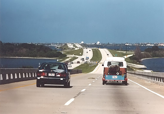 |
Pineda
Causeway, FL-404, heading eastbound. I am at the top of the bridge over
the Indian River navigational channel, and the first landfall ahead is
Merritt Island where FL-404 has an interchange with FL-3. Beyond Merritt
Island is the Banana River, which has another set of FL-404 bridges over
its navigational channel. Beyond the Banana River is beachfront barrier
island, and FL-404 passes along the southern boundary of Patrick Air Force
Base, and FL-404 ends in a junction with FL-A1A. Currently, the west end
of FL-404 is at its interchange with US-1. A future extension of FL-404 to
I-95, is in the planning stages.
The Pineda Causeway opened in 1971. The high-level bridges over the Indian River pass over the Intracoastal Waterway, and have 64 feet of vertical navigational clearance. The high-level bridges over the Banana River have 43 feet of vertical navigational clearance. Source: FDOT correspondence. |
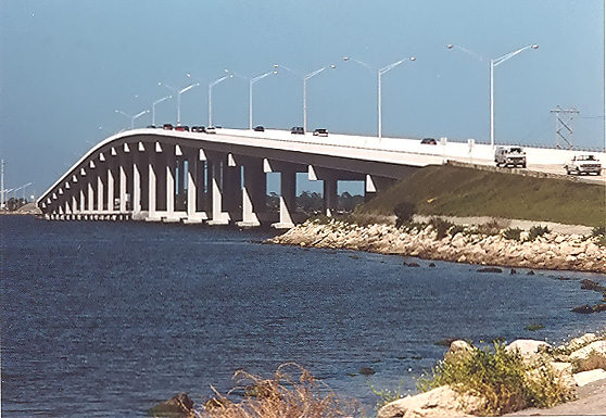 |
Eau Gallie Causeway, FL-518, crosses the Indian River and connects the Eau Gallie section of Melbourne to the beachfront barrier island just south of Indian Harbor Beach. |
A 2-lane Eau Gallie Causeway with a swingspan bridge was opened about 1950, very similar in design to the 2-lane Melbourne Causeway that opened in 1947. The current 4-lane high-level bridge was completed in one project in 1988, and the high-level bridge passes over the Intracoastal Waterway and has 65 feet of vertical navigational clearance. The old 2-lane bridge was removed. Source: FDOT correspondence.
Like the Melbourne Causeway, the Eau Gallie Causeway had a predecessor wooden bridge that was built in the 1920s:
Eau Gallie Historical Trail, by Steve Rajtar.
Excerpt (in blue text):
Eau Gallie Causeway
3....Dr. W.J. Creel Bridge
The first bridge across the Indian River at this point was built by Grover
Fletcher and opened on February 22, 1926. It frequently caught fire in the
1920s and 1930s. After having his sleep interrupted by 16 bridge fires in a
14-night period, fire chief Joe Wickham resigned. In 1927, John R. Mathers constructed a toll bridge from the mainland to
Merritt Island, known as Mathers' Bridge, located elsewhere. This bridge named
after Dr. W.J. Creel was constructed later.
Mathers Bridge connects the lower end of Merritt Island to Indian Harbor Beach on the oceanfront barrier island.
The Eau Gallie Causeway bridge is called the Dr. W. J. Creel Bridge. The following
Dr. W. J. Creel History cites who he was (excerpt in blue text):Dr. Creel was mayor of Eau Gallie three different times, went to the state legislature in 1927 but served only one term. In 1972 a school was built and named as the new Dr. W. J. Creel School.
 |
NASA Causeway, Kennedy Space Center, in Brevard County.
|
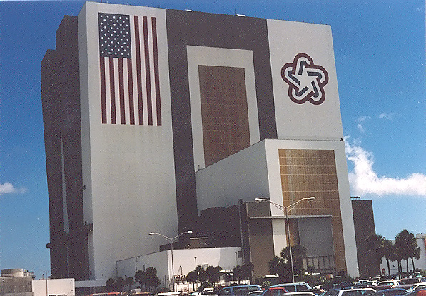 |
Vehicle Assembly Building, Kennedy Space Center, in Brevard County. The Vehicle Assembly Building is the building where the Apollo/Saturn V vehicles were assembled for launch, and it is now utilized for assembly for launch, the Space Shuttle vehicles. |
 |
Bridge over Sebastian Inlet, connecting two sections of oceanfront barrier island that are divided by the inlet. This is heading northbound, and the Atlantic Ocean is visible on the right. North of the inlet is Brevard County, and south of the inlet is Indian River County. The inlet connects the Indian River to the Atlantic Ocean. |
Brevard Metropolitan Planning Organization
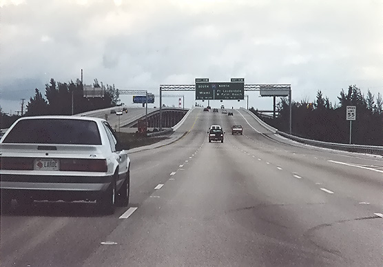 |
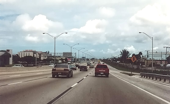
I-595 Port Everglades Expressway, Broward County.
|
 |
I-595 Port Everglades Expressway, Broward County.
|
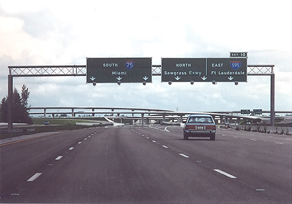 |
Interchange between I-75, I-595 and the FL-869 Sawgrass Expressway, west of Miami.
|
I-595 Port Everglades Expressway
, by Earth Tech. Excerpt (in blue text):The Port Everglades Expressway is 400 feet wide and passes through a heavily developed urban area. Minimizing the economic or social impacts to the community was critical to the success of the project. The relocation of utilities and the acquisition of right-of-way amounted to almost half of the project cost. Maintaining access to business and preserving traffic flow on local and state roads as well as on I-95 were major accomplishments.
history of the Port Everglades Expressway, by Tropical Turnpikes. , by APM Terminals. Excerpts (in blue text):The Port Everglades Expressway (I-595) provides instant access to I-95, I-75 and the Florida Turnpike. This highway link gives the shipping community the most direct access to the interstate highway system from any port on the Atlantic coast.
Broward County official website.Port Everglades port official website.
 |
Palmetto Expressway, Florida Route 826, southbound. This freeway forms a partial beltway around Miami.
|
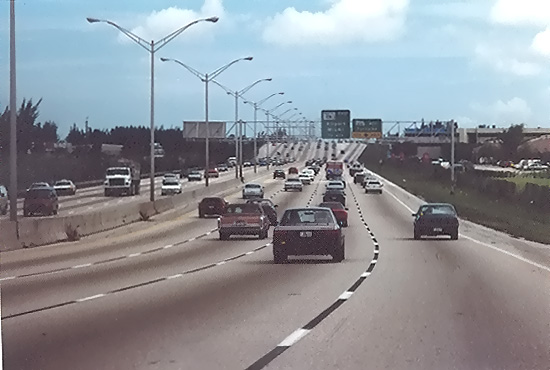 |
Palmetto Expressway, southbound. This freeway forms a partial beltway around Miami.
|
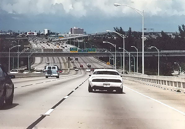 |
East-West Expressway, Florida Route 836, in Miami. The overpassing bridge in the foreground is the Metrorail rapid rail transit line.
|
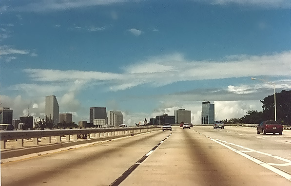 |
I-95 in downtown Miami.
|
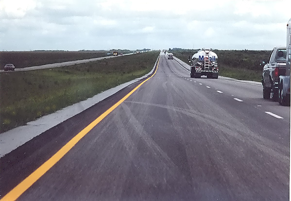 |
I-75 "Alligator Alley" in the Everglades, about 20 miles west of the I-75/I-595 interchange.
|
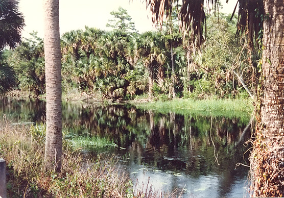 |
Everglades, near Immokalee.
|
 |
Everglades, near Immokalee.
|
 |
Everglades, near Immokalee.
|
 |
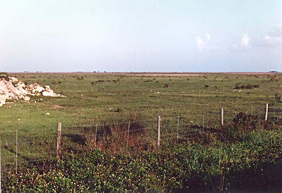
Lake Okeechobee, viewed from a levee near Canal Point. The lake is over 25 miles wide and is therefore wide enough so that you cannot see land on the opposite side of the lake. Click for larger image (300 KB). |
The
South Florida Water Management District has a webpage Lake Okeechobee, which has a lot of information and links about the lake. The elevation of the lake above sea level is significant, and there is a graph that shows that it has ranged from 11 1/2 feet to 17 feet between January 2002 and December 2003. Lake Okeechobee Photos. Excerpt from main page (in blue text):The Everglades Ecosystem, Everglades National Park, National Park Service, U.S. Department of the Interior.
Everglades Florida, Southwest Florida's Everglades, Chokoloskee, Everglades City and the 10,000 Islands offer tourists and Florida residents outdoor recreational opportunities, fishing, boating, canoeing, bird watching, camping and more.
Everglades National Park, Welcome to the Everglades National Park Page, unofficial site.
Everglades Excursions, offers complete eco-tours including a Jungle Cruise, Safari Wagon tour, Gator exhibit, airboat sightseeing, historical Everglades sites.
Everglades Online, A Guide to Everglades Florida and other Florida City Guides.
 |
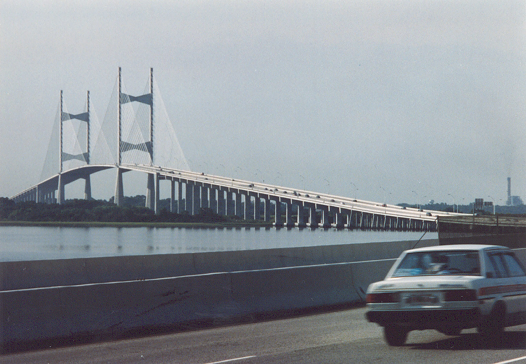
Dames Point Bridge, Jacksonville, Florida, on State Route 9A (future I-295).
|
 |
Dames Point Bridge, Jacksonville, Florida, on State Route 9A. Click for larger image (533 KB).
|
Aesthetic Lighting of Florida Bridges
- Florida DOT site that has a nighttime photo of the Dames Point Bridge. , by Mike Strong, with an excellent aerial photo of the Dames Point Bridge. Excerpt (in blue text):From the
Dames Point Bridge Fact Sheet, the Cornell School of Civil & Environmental Engineering. (excerpts of data in blue text):The last 3 photos are at Savannah, Georgia.
 |
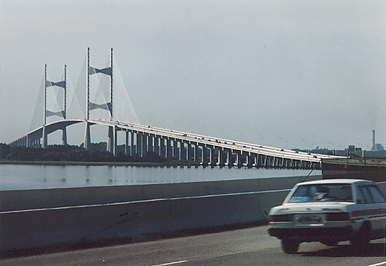
US-17 cable-stayed bridge over Savannah Front River under construction at Savannah, Georgia. The new 4-lane cable-stayed bridge had just opened to traffic, and it has 185 feet of vertical navigational clearance, and the old 2-lane cantilever bridge is in the process of being dismantled. The bridge is named the Eugene Talmadge Memorial Bridge (the old bridge had the same name). Photo taken from Savannah, the south end of the bridge. |
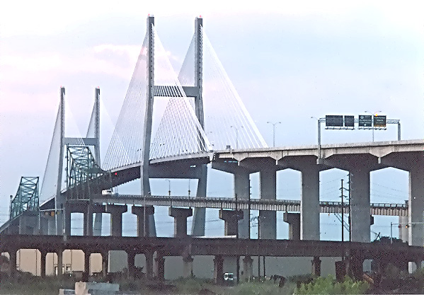 |
US-17 cable-stayed bridge over Savannah Front River under construction at Savannah, Georgia. This photo was taken from the same vantage point as the previous photo, but it was taken with a 135mm (2.7x) telephoto lens, instead of the 50mm (1.0x) regular lens used previously. |
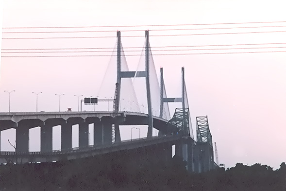 |
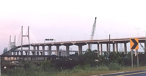
US-17 cable-stayed bridge over Savannah Front River at Savannah, Georgia. Photo taken from Hutchinson Island, the north end of the bridge.
|
The Georgia Department of Transportation has a website about the
Eugene Talmadge Memorial Bridge, with details and photos of the old and new bridges. Excerpt (in blue text):GDOT hired Greiner Engineering Services in 1981 to study a bridge replacement. In July, 1987, bids were opened for the construction of the mainspan, a cable stayed span. The contract was awarded to Guy F. Atkinson Company and S.J. Groves & Sons Company for $25,702,607. The project was completed and opened to traffic in March of 1991. The approaches and related roadwork was contracted separately in 1988 to The Hardaway Company for $45,202,502. Their work was completed in 1991. The bridge replacement project was funded with state and federal funds. In 1988, the road over the Talmadge Bridge was designated as US Route 17. The new Talmadge Bridge has a vertical clearance of 185 feet at high tide and a horizontal clearance of 1,023 feet with both main piers located on land outside of the Savannah River.
I read about the Talmadge Bridge project in Engineering News-Record when it was under construction, and that it had just opened a month before my trip, so I made sure and got off I-95 to go into the city to see it. Providing higher shipping clearance was the biggest single goal of the project, as I recall, since the Port of Savannah believed that the existing 136-foot clearance was restricting the growth of the port, and the new 185-foot clearance bridge removed that obstacle. Given that the original bridge was opened in 1954, it likely would have been structurally adequate for years to come. The original bridge suffered two ship collisions, and with the new bridge having both main piers located on land outside of the river, the new bridge is protected from ship collisions.
The connector to the bridge from I-16 in the city of Savannah has 4 or more
lanes, but the bridge between Hutchinson Island and South Carolina,
was the original 2-lane bridge, and about 4 miles of US-17 just north of
there, was 2 lanes also. I understand that those sections are still 2 lanes in
January 2004.
It seems to me that after spending all that money to replace the
Talmadge bridge and approaches with a 4-lane facility, that it would
have been appropriate to make all of US-17 four lanes in South Carolina up to I-95.
There are a lot of wetlands on that section, maybe that is the obstacle to
widening that section.
Copyright © 2004 by Scott Kozel. All rights reserved. Reproduction, reuse, or distribution without permission is prohibited.
By Scott M. Kozel,
Roads to the Future(Created 1-1-2004, minor updates 2-19-2004)