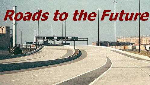
Roads to the Future
Highway and Transportation History Website
Roads to the Future
Highway and Transportation History Website
For Virginia, Maryland, and Washington, D.C.
Following is a list of linked articles on this site:
Norfolk/Hampton Roads Area
Washington, D.C. Area
Henry G. Shirley Memorial Highway
14th Street Bridge Complex (I-395 and US-1)
14th Street Bridge, the Air Florida Crash and Subway
Disaster
Capital Beltway (I-495 and I-95)
Woodrow Wilson Bridge (I-495 and I-95)
Springfield Interchange Project
Intercounty Connector (ICC)
Washington Outer
Beltway
Washington Bypass Studies
Washington D.C. Interstates and Freeways
Interstate 66 and Metrorail Vienna Route
Franconia-Springfield Metrorail Line Completion
Metrorail Glenmont Route
Metrorail Mid-City Line Opening
Metrorail Branch Avenue Route Completion
Washington Metrorail Photos
Virginia Railway Express (VRE) Commuter Rail Lines
Dulles-Loudoun Metrorail Extension
Dulles Transportation Corridor
I-270 and I-370 in Maryland
Interstate 595 in Maryland (US-50 from I-95/I-495
to Annapolis)
Washington D.C. Area Interstate HOV is a Success
Baltimore Md. Area
Baltimore City Interstates
Baltimore Interstate System Map
Baltimore Harbor Interstate System Map
Baltimore 10-D
Interstate System Map
Baltimore Early Expressway Planning
Fort McHenry Tunnel
Baltimore Beltway (I-695)
Francis
Scott Key Bridge (Outer Harbor Crossing)
Baltimore Outer Harbor Crossing Replacement Proposal (New article)
Baltimore Harbor Crossings
Baltimore Central Light Rail Line
Baltimore Metro Subway
Interstate 97 in Maryland
Interstate 795 in Maryland
Maryland General
Richmond Va. Area
Virginia General
West Virginia:
Kentucky/Tennessee:
Delaware:
General Issues:
Road Trips:
Photo Highlights has a photo of the Chesapeake Bay Bridge-Tunnel, a photo of I-95 at Woodbridge, Virginia, and a photo of the aircraft carrier U.S.S. Dwight D. Eisenhower docked at Norfolk, Virginia.
|
Website by Scott M. Kozel Virginia, U.S.A. |
This information is the result of over 55 years of personal study of highway and transportation development. I worked for 10 years (1974-1984) in highway safety improvement design, highway construction inspection, and highway location & design; and in information technology 1984-2017. My highest education level is a masters degree in business information systems and a masters degree in biblical studies. This site is privately developed, and has no association with VDOT, MDOT, WMATA, FHWA, or any other local, state, or federal transportation agency.
Website Change Log
(**Check here for updates**)
As you can see in the
Website Change Log, there have been very few updates since 2009, therefore
some articles will contain some obsolete data and some dead hyperlinks, but
every webpage has a Last Updated Date at the very bottom of the webpage, so be
sure and check that if you have any question about the currency of the data.
Website Site Map - Roads to the Future - this site map lists all lead articles, with subordinate articles indented. This shows the direct hierarchical structure of my website, from parent to child to grandchild. All these entries are hyperlinked to the article.
Feel free to e-mail me and offer advice and/or additional material.
All photos taken by Scott Kozel unless otherwise credited.
"King
of the Roads", by Earl Swift,
The Virginian-Pilot,
August 21, 2005, an article featuring the Roads to the Future
website and the author. Excerpt (in blue text):
HIS DAY OFF, and Scott
Kozel is devoting it to something he loves: He's behind the wheel of his big
Buick, steering it around a curve on a just-opened highway outside of
Richmond, admiring the concrete and steel all around. The road's surface,
unstained ash-gray, shimmers under the midday sun. Overpasses are unblemished
by time and vandals. The median is crisply mowed, the shoulders free of litter
and weeds. It looks less a highway than a computer simulation. What Kozel
fastens on, however, are things that might easily escape attention. The way
the highway banks ever so slightly as it sweeps left. Its arc as it does
so, no doubt true to the state's prescribed minimum radius of 1,821 feet for a
flat-terrain freeway designed for travel at 70 mph. Interchanges overbuilt in
anticipation of ratcheting traffic loads. Collector-distributor lanes
straddling the main line, siphoning away congestion at especially busy
crossroads. “A very ample design,” Kozel muses. He points to a diamond-shaped
interchange. “Built with enough room to add a cloverleaf, should that be
warranted in the future.” He nods, cataloging the details. In a short while,
he’ll steer his LeSabre home, post the data he’s gathered on his Web site –
which specializes in the arcana of highway history and design in Virginia, the
D.C. area, Maryland and West Virginia – and share it with the world.
Thanks to Lowell V. Paden, Jr., who scanned the first 150 photos that I put
on my websites.
Copyright © 1997-2025 by Scott M. Kozel. All rights reserved. Reproduction, reuse, or distribution without permission is prohibited.
My other highway and transportation history website, for Philadelphia and the Delaware Valley - PENNWAYS.
My article
Interstate Highway System in Virginia is a website in its own right, and while the link is listed above, I'll repeat it here. It has links to 17 articles, one for each route, with detailed description of towns and cities served, route topography, transportation barriers crossed, segment opening dates, segment traffic volumes, segment lane widths, and widening projects.
![]() Happy Birthday Interstate! This
year marks the 50th anniversary of the Eisenhower Interstate System. Since its
initiation on June 29, 1956, the Dwight D. Eisenhower System of Interstate and
Defense Highways has had a tremendous impact on our nation. Celebrate this
momentous occasion at this Federal Highway Administration anniversary Web site and come back often as
they
update it continually throughout 2006. Visit the online exhibit:
Happy Birthday Interstate! This
year marks the 50th anniversary of the Eisenhower Interstate System. Since its
initiation on June 29, 1956, the Dwight D. Eisenhower System of Interstate and
Defense Highways has had a tremendous impact on our nation. Celebrate this
momentous occasion at this Federal Highway Administration anniversary Web site and come back often as
they
update it continually throughout 2006. Visit the online exhibit:
Celebrating 50 Years:
The Eisenhower Interstate Highway System
The American
Association of State Highway and Transportation Officials (AASHTO), which
represents the state departments of transportation in the 50 states, the
District of Columbia, and Puerto Rico, will introduce you to the history of
the Interstate Highway System, plans to "Celebrate the Interstate!" both
nationally and in individual states, and some of the policy questions the
nation faces as we look to the next 50 years in U.S. transportation.
AASHTO: Interstate 50th Anniversary
Virginia Department of Transportation (VDOT) 50th anniversary website
for the Interstate highway system
VDOT: 50 Years of the Interstate
Official Websites
Virginia
Department of Transportation (VDOT)
Virginia Department of Rail and Public
Transportation (VDR&PT)
Maryland Department of Transportation
(MDOT)
Maryland State Highway Administration (MDOT SHA)
District Department of Transportation (DDOT)
Washington
Metropolitan Area Transit Authority (WMATA)
United States
Department of Transportation (US DOT)
Federal
Highway Administration (FHWA)
Richmond
Metropolitan Authority (RMA)
Dulles Greenway
Metropolitan
Washington Council of Governments (MWCOG)
Baltimore
Metropolitan Council
Richmond Regional Planning District Commission
Hampton
Roads Planning District Commission
Appalachian Corridor "H" (WVDOT website)
Website created August 14, 1997.