I-195 Beltline Expressway - Construction Photos

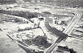
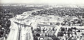
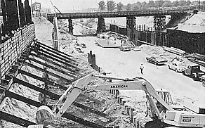
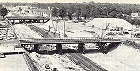
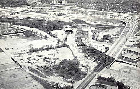
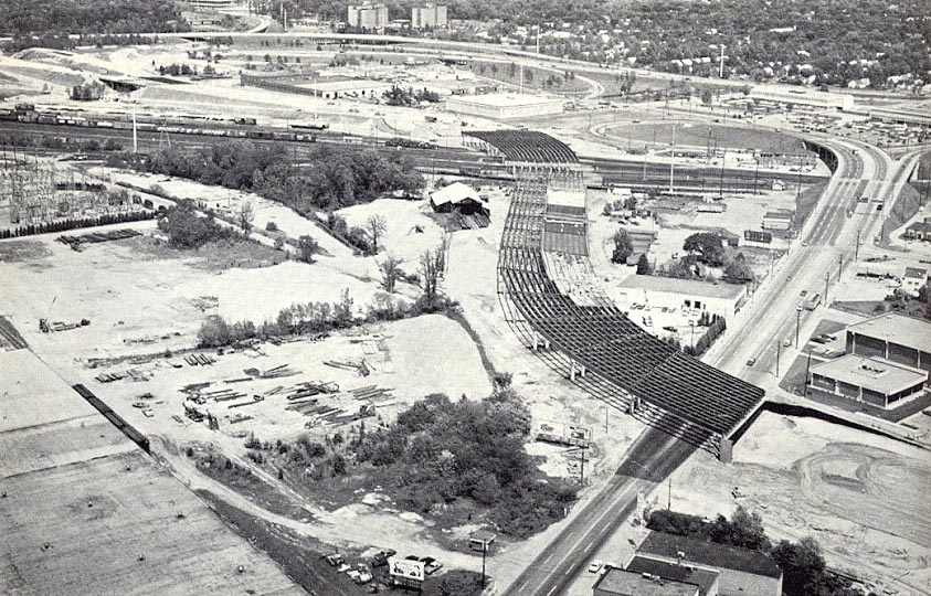
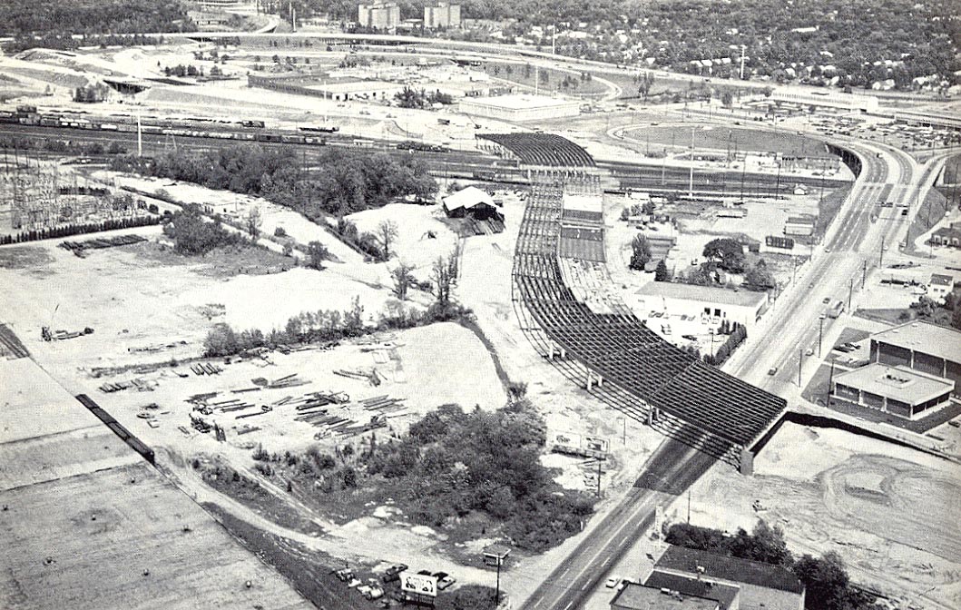
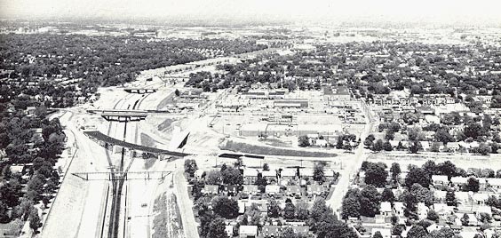
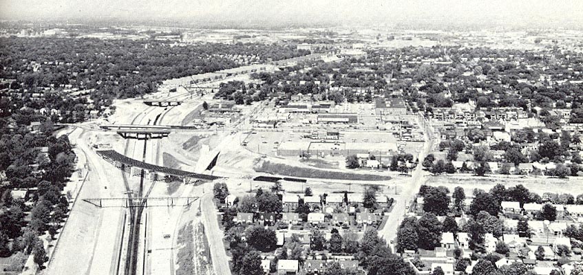
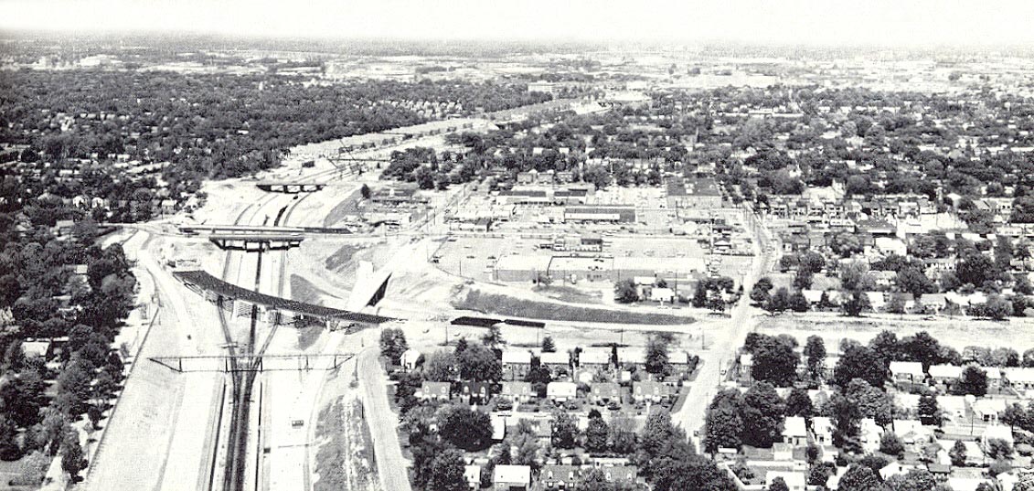
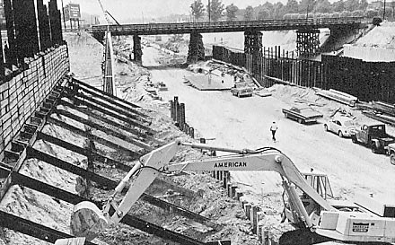
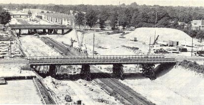
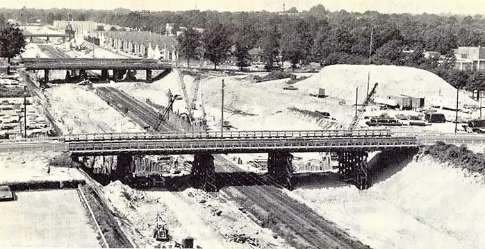
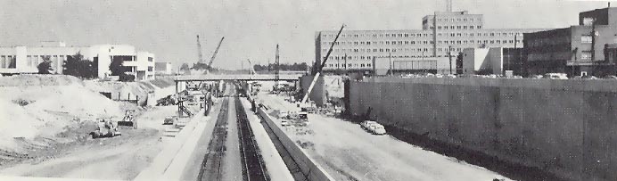
I-195 is 3.5 miles long, and runs from the I-95/I-64 Bryan Park Interchange to the VA-195 Downtown Expressway in Richmond. The road was opened to traffic in 1975, and is mostly six lanes, and has a four lane connector to VA-195. Here are some photos of the highway when it was under construction. These are from fairly small black-and-white photos, and I did the best I could with my HP ScanJet 5300C scanner and Adobe PhotoDeluxe Business Edition, to get the best images possible. The first three worked pretty well and the last two were somewhat harder. I hope to eventually find some quality color photos of the construction, but so far I haven't been able to.


Click for larger images: Medium (65K), Large (162K), Extra Large (240K). Use "Back" button to return.

Near the northern terminus of I-195 is the S-curved 1,858-foot-long bridge spanning Westwood Avenue (foreground) and R.F.&P.'s Acca Railroad Yards (center). The Acca Yards Bridge has three 12-foot-wide lanes in each direction with full 10-foot-wide shoulders on each side of each roadway. The complex Bryan Park Interchange between I-195, I-64 and I-95 begins at the northern end of the bridge, which was completed in August 1974. This aerial photo was taken in early 1973 by the Virginia Department of Highways and Transportation (today's VDOT).

.

Click for larger images: Medium (67K), Large (128K), Extra Large (197K). Use "Back" button to return.


I-195 swings from the east (lower right) into the Cary Street interchange, then north through the long-established Beltline Railroad corridor to the I-95/I-64 Bryan Park Interchange about two miles away. The flyover ramp for I-195 from south to east (a two-lane 50 mph roadway) is visible with the steel girders placed awaiting the casting of the reinforced concrete bridge deck. The Powhite Parkway was opened January 24, 1973, and it is visible with the completed mainline ending just south of the flyover, with ramps connecting up to Cary Street (the closest left-right overpass). In the construction area above there, you can see where the two railroad tracks are temporarily relocated outboard of their original and final place, so that the railroad bed could be built four feet lower so that higher-clearance rail cars can be used on the completed facility. This aerial photo was taken in May 1973 by the Virginia Department of Highways and Transportation (today's VDOT).

The following I-195 construction photos were taken at ground level.

Click for larger images: Medium (56K), Large (118K). Use "Back" button to return.


I-195 depressed trench under construction. Metal sheet piling and timber served as a temporary retaining wall until the permanent reinforced concrete gravity retaining walls were constructed. Sheet piling was also used in the same way to construct the inner retaining walls built between the railroad tracks and the highway roadways, and the railroad tracks are being built four feet lower than the highway grade. Massive concrete footings were needed for the outer retaining walls, with the walls over 20 feet high in most places, and a large hydraulic backhoe (seen in the photo) was used to excavate for the footings. Existing streets were maintained over the construction area on temporary detour bridges, while the new bridges were being built. This photo was taken in July 1973 by the Virginia Department of Highways and Transportation (today's VDOT).

.

Click for larger images: Medium (34K), Large (88K). Use "Back" button to return.


I-195 depressed highway under construction, looking south, first phase of construction about 12 months after work began. The temporary two-lane detour bridge in the foreground carried Broad Street traffic while a new six-lane bridge for Broad Street was being built a half at time. In the distance are the temporary bridges for Monument Avenue and Patterson Avenue; new four-lane bridges were built for each of those thoroughfares too. This photo was taken in August 1972 by the Virginia Department of Highways and Transportation (today's VDOT).

.

Click for larger image: Large (35K). Use "Back" button to return.


I-195 depressed highway under construction, looking north from Monument Avenue overpass bridge. The overpass bridge in the distance is the Broad Street bridge, half of which is complete in this photo. The outer concrete retaining wall has been completed on the east side of the highway. The inner retaining walls built between the railroad tracks and the highway roadways, have been completed also, and the railroad tracks are back in their original place, but lowered. The large office building in the center and right, is the Seaboard Coast Line Railroad building, a familiar Richmond landmark.

This photo was taken in September 1974 by the Virginia Department of Highways and Transportation (today's VDOT).

Lead article for I-195 Beltline Expressway

Copyright © 2001-2003 by Scott Kozel. All rights reserved. Reproduction, reuse, or distribution without permission is prohibited.

Back to top

By Scott M. Kozel, Roads to the Future

(Created 8-5-2001, last updated 8-1-2003)