
| National Freeway (I-68) |
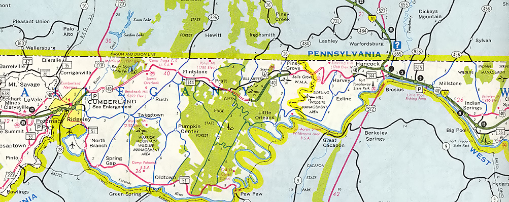
Interstate 68 is the 116-mile-long freeway between I-79 at Morgantown, West Virginia, and I-70 at Hancock, Maryland, and it is Appalachian Corridor "E". It was one of the approved highway corridors in the 1965 Appalachian Regional Development Act. The highway is built to full four-lane freeway standards.
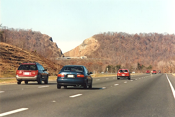
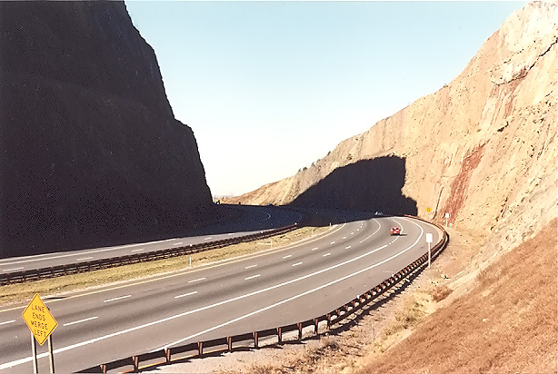
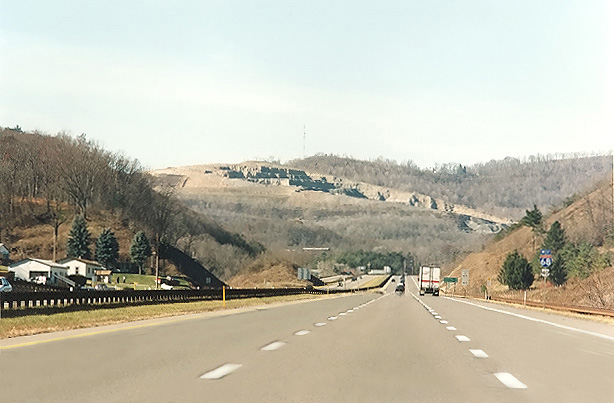
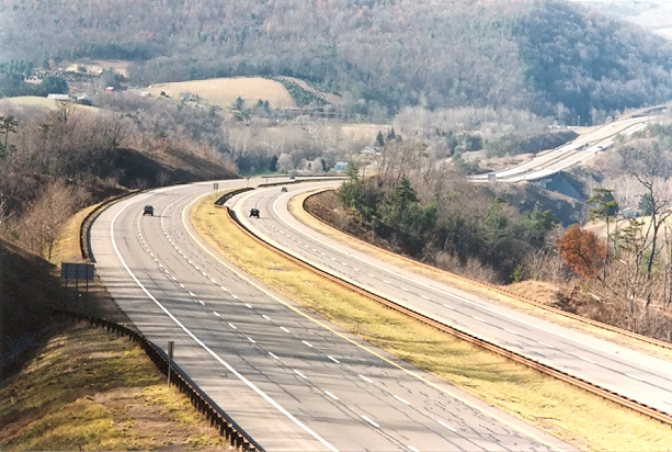
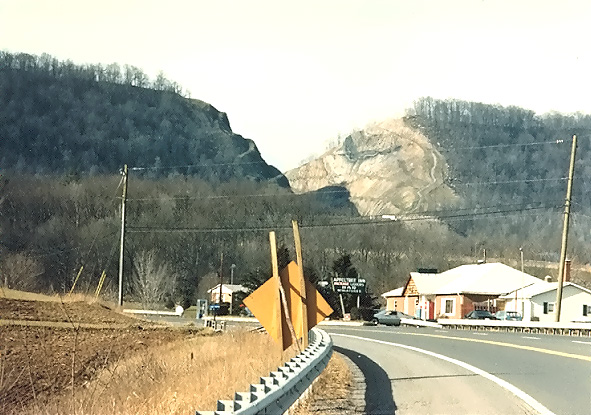
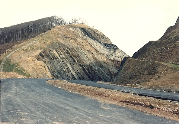
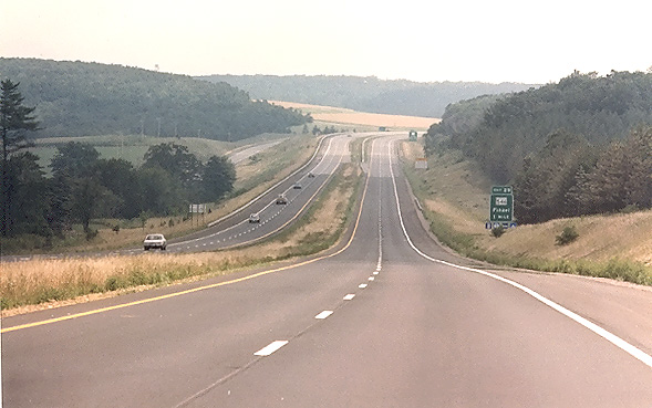
Above, westbound on I-68 National Freeway, approaching
the Sideling Hill Cut. Notice the overpass and visitor center right in front of
the cut. This is a popular Maryland tourist site. There are diagrams inside the
visitor center showing the geology of the cut.
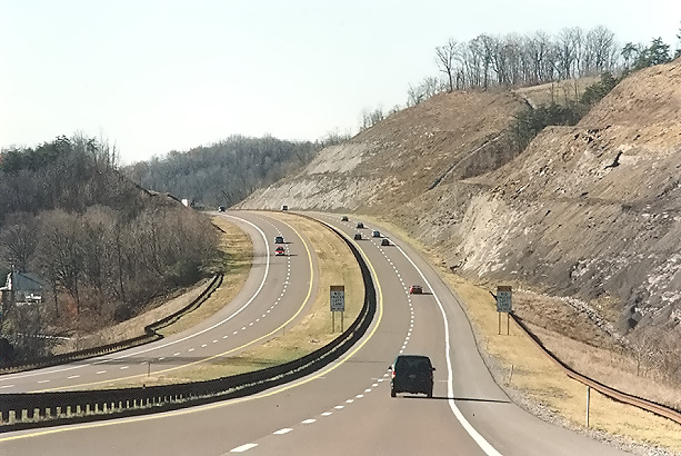
I-68 near Flintstone, heading westbound.
Maryland has always used the name "National Freeway" for this highway from the time that it was first planned, and the reason why is because it parallels the corridor of the old National Road built back in the 1800s. The US-40 National Pike replaced the National Road. So the freeway bypass of US-40 was named the National Freeway. US-40 actually leaves Maryland near the northwest corner of the state and heads northwest into Pennsylvania. I-68 continues west to Morgantown, West Virginia. West Virginia did not and does not have a name for their section of the highway.
The Interstate designation was not planned for this highway until it was nearly completed. The Interstate I-68 designation was planned for the reconstructed US-50 John Hanson Highway from the Capital Beltway to Annapolis, and that highway was approved for Interstate construction as I-68, in the mid-1980s, and construction, involving widening to three lanes each way, and new interchanges, ran from 1990 to 1995. When the National Freeway in Western Maryland was completed in 1991, it was given the I-68 designation, and US-50 was given I-595 (never posted). See my article Interstate 595 in Maryland (US-50 from I-95/I-495 to Annapolis).
Maryland's main justification for the National Freeway was to provide modern highway access and economic development to Western Maryland. Garrett and Allegany Counties were formerly somewhat isolated, limiting economic development.
I-68 is one of the few mainline Interstate highways that does not directly serve a major metropolitan area (e.g. 500,000 or more population). However, it fits very well into the national Interstate highway grid, handling westerly traffic to/from the Baltimore-Washington area, heading to the Ohio Valley and west.
Construction of Appalachian Corridor "E" (one and the same with what is today designated I-68) spanned 28 years from 1963 to 1991, at a total cost of $481 million. I-68 in West Virginia was built as Appalachian Corridor E (US-48) between 1970 and 1976 at a cost of $113 million and stretches 31.8 miles from an interchange with I-79 at Exit 148 to the Maryland border. The US-48 National Freeway in Maryland was completed in several major segments: The 6-mile-long section near Piney Grove (opened 1967) and a 4-mile-long section between the Sideling Hill section and I-70 at Hancock (opened 1966), was built at a cost of $26 million, the 44-mile portion of the freeway from the West Virginia line to the eastern part of the city of Cumberland was built between 1964 and 1976 at a cost of $126 million, and was designated as US-48. The 4.5-mile Sideling Hill Cut segment opened on August 15, 1985, and the entire 8.7-mile Sideling Hill section was completed in 1986, and it includes a huge cut 380 feet deep through the ridge of the mountain, at a cost of $44 million, and it was designated as US-48. The 19-mile Cumberland-Green Ridge section had construction started in May, 1987, and the $182 million section was completed on August 2, 1991, and on that day the whole of Appalachian Corridor "E" between I-79 at Morgantown WV and I-70 at Hancock MD, was designated as Interstate I-68, and the US-48 designation was removed.
I-68 in conjunction with I-79 provides a toll-free alternate route to the I-70 portion of the Pennsylvania Turnpike. Between the I-70/I-79 junction at Washington PA and the I-68/I-70 junction at Hancock MD, the distance is 150 miles on I-70, and 163 miles on I-68 and I-79. The Turnpike route mostly has a lower speed limit (mostly 55 mph, while I-68 in Maryland is mostly 65 mph and I-68 in West Virginia is mostly 70 mph) and it passes through Breezewood (a gap in I-70 which requires travel through that town) and through two toll plazas, and that section of the PA Turnpike has 22 miles of major reconstruction as of February 2004, and the PA Turnpike has more major reconstruction projects planned over the next 5 years. I-68 has steeper hills than the PA Turnpike in some places, but that section of the PA Turnpike has a lot of horizontal and vertical curvature. Comparatively, I-68 has 1) better pavement surface, 2) a modern depressed grass median, 3) wider clear roadsides, 4) closer interchange spacing, 5) no tunnels, 6) less traffic, and 7) no toll. Overall, I find I-68 to be faster and better.
Annual average traffic volumes for 2002 on I-68 in Maryland are 12,825 at the Maryland/West Virginia state line, 16,825 at MD-495, 18,325 at US-219 north, 20,175 at Finzel, 15,922 at Frostburg, 26,925 at MD-53, 39,825 at US-220 south, a high of 49,825 in downtown Cumberland, 31,025 at US-40 Alt./MD-952, 19,525 at US-220 north, 17,025 at MD-144 at Flintstone, 17,225 at Exit 68/Orleans Road, 22,425 at the Sideling Hill Cut, and 20,325 just east of the I-70/I-68 interchange. This data is from MDOT SHA and is detailed on the webpage Interstate 68 - Annual Average Daily Traffic by AA Roads. I haven't yet accessed the West Virginia I-68 traffic volumes.
Completing the National Freeway
The following are my comments about the National Freeway Location Study, Cumberland-Hancock Corridor, Stage II Report, November 1973, public hearing brochure, by Maryland Department of Transportation. At this point, of the 82 miles of the National Freeway in Maryland, all was built except for 19 miles just east of the city limits of Cumberland, and 8 miles in the Sideling Hill area. This highway location study evaluated 4 alternative routes for the 19-mile section and 5 alternative routes for the Sideling Hill section.
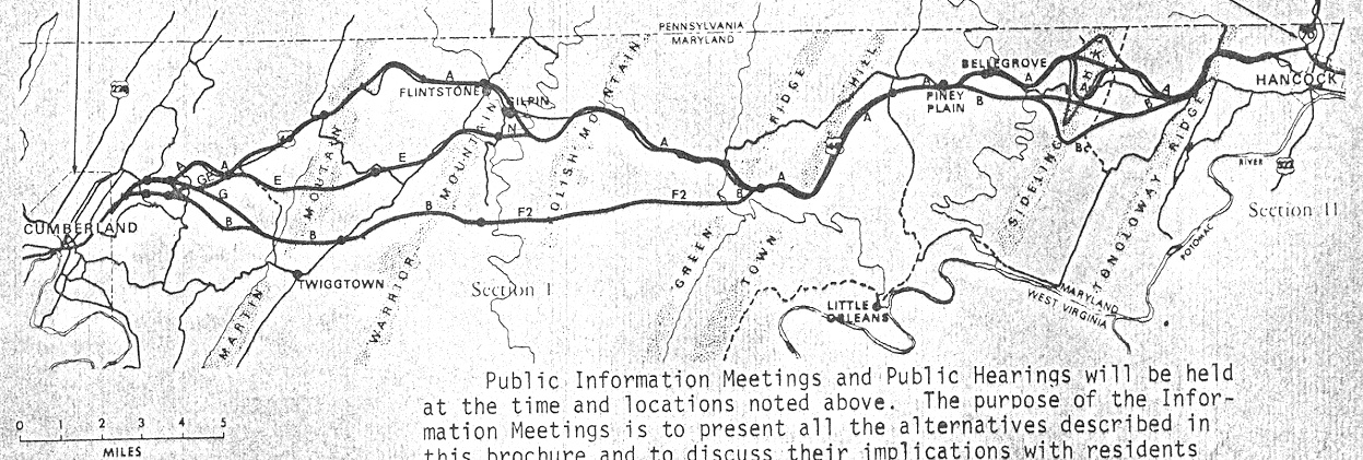 |
| Map of alternates from
National Freeway Location Study, Cumberland-Hancock Corridor, Stage II Report,
November 1973, public hearing brochure, by Maryland Department of Transportation.
The routes that were close to what was ultimately built, was the "AGEA" route
on the western section, and the "AJA" route on the eastern section. "North"
is straight upward. Large image (337 kilobytes). |
The 19-mile Cumberland-Green Ridge section of US-40 had 10 miles of 4-lane
divided highway (not freeway) and 9 miles of 2-lane highway. Between Cumberland
and I-70 at Hancock, there were previously-built sections of US-48 National Freeway;
a 6-mile-long section near Piney Grove (opened 1967), and a 4-mile-long section
between the Sideling Hill section and I-70 at Hancock (opened 1966). The two remaining
unbuilt sections of the National Freeway would join seamlessly with these previously
built sections of the freeway, making one continuous freeway.
One of the alternatives studied on the Cumberland-Green Ridge section paralleled
closely to the existing US-40, usually within 1/4 mile or less, 19.3 miles long,
and this basic concept was what was ultimately chosen and built. Another alternative
would have been well to the south of US-40, as much as 6 miles to the south, and
it was 16.9 miles long (this alternative was actually chosen by MDOT SHA and FHWA
in 1980, but those agencies restudied the route in 1984 and in 1986 changed the
decision to the closely paralleling route). Another alternative had the western
portion relocated to the south, with the eastern portion paralleled closely to
the existing US-40. The full relocation alternative compared to the alternative
that paralleled closely to the existing US-40 throughout, would have had more
than twice as many acres of land acquisition, and would have cost 36% more to build,
and the eastern section would pass through a major state forest; also, the Sierra
Club and several other environmental groups voiced their opposition to the full
relocation alternative, and favored the closely paralleling alternative.
The full Cumberland-Green Ridge relocation alternative would have passed through
very rural areas and not near enough to provide local service to the villages
and residents along US-40, while the alternative that parallels closely to the
existing US-40 throughout would provide good service to the villages and residents
along US-40, and the freeway could be built just far enough away from US-40 that
it would have little or no impacts to the residents, so there was very little
local opposition to the latter alternative. This explains why MDOT SHA and FHWA
selected the alternative that paralleled closely to the existing US-40 throughout,
although it does contain several small relocations, each a mile long or less,
including at Martin Mountain and at Flintstone.
For the 8 miles of the National Freeway in the Sideling Hill area, there were
5 alternatives studied, 3 of which would have involved an open cut through the
mountain, and 2 of which would have involved a tunnel through the mountain. The
northernmost open cut alternative involved a 350-foot-deep open cut through Sideling
Hill, with a total segment length of 8.7 miles and a cost estimate in 1973 at
$24.2 million, and that is the one which was ultimately selected. A tunnel alternative
on the northern alternative would have involved a tunnel 1.76 miles (9,293 feet)
long, with a total segment length of 7.2 miles and a cost estimate in 1973 at
$44.3 million.
The tunnel alternative would have avoided making a huge cut in the mountain, providing
less impacts to the natural environment, but it would have cost 83% more to build
the 8-mile Sideling Hill area segment of highway, and a tunnel has high round-the-clock
operational costs for personnel and electrical power for ventilation and lighting,
and a tunnel usually has major restrictions on HAZMAT (hazardous material) cargoes
which would cause most of those vehicles to utilize the original 2-lane US-40
over the top of the mountain, a highway with not nearly the safety as the design
of a freeway. It was decided to build the open cut through Sideling Hill, the
final design of which involved the removal of 3.5 million cubic yards of soil
and rock and a cut up to 380 feet deep. Sideling Hill is a mountain with a peak
elevation in Maryland of 1,760 feet, about one mile south of the Pennsylvania
border.
This 1973 report also had a brief discussion of what to do in the future about
the US-40 freeway in the city of Cumberland, which the completed National Freeway
would utilize as one of its segments. This 4-lane freeway was opened about 1965
as an 8-mile-long bypass of US-40 through Cumberland, the US-40 Cumberland Thruway,
and it includes a one-mile-long elevated section with a winding 40-mph alignment
in downtown Cumberland. Even back in 1973 it was recognized that the completion
of the National Freeway (and the rest of Appalachian Corridor “E” in West Virginia
to I-79 at Morgantown) would eventually lead to traffic volumes that would exceed
the design of the Cumberland Thruway. Here is a direct excerpt from the National
Freeway Location Study, Cumberland-Hancock Corridor, Stage II Report (excerpt
in blue text):
Building the National Freeway, Special Edition of Maryland Roads, August 2, 1991, by Maryland State Highway Administration. Eight page brochure with articles and photos commemorating the completion of the National Freeway (I-68) in Western Maryland. Full quote (in blue text):
In the 1950s, when new Interstate highways were beginning to reshape the landscape and lifestyles of much of Maryland and the nation, U.S. 40 from Hancock to Keyser’s Ridge was not much more than a winding country road. |
The restudy on the 19-mile Cumberland-Green Ridge section in the mid-1980s produced a change in one of the alternates which was not ultimately selected, as seen with Tie Line "C" on the map below, where the freeway would have followed the southern line on the western section, Tie Line "C" on the central section, and along existing US-40 on the eastern section.
 |
|
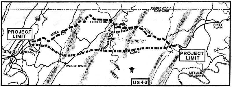
Map of alternates from Informational
Meeting - National Freeway - U.S. 48, brochure for public meeting, Allegany
Community College and Fort Hill High School, Cumberland, Maryland, April 30,
1985. "North" is straight upward. The route that was ultimately built, was the "AGEA" route, which closely follows US-40. |
Building the National Freeway, Special Edition of Maryland Roads, August 2, 1991. Article “Exhibit Center to Have Geologic Info”. Full quote (in blue text):
The new Sideling Hill Exhibit Center promises to make the Sideling Hill Cut a major tourist attraction. |
The following map excerpt is from the official Maryland state highway map, 1983.
 |
| In 1983, all of the
National Freeway was complete except for 19 miles just east of Cumberland
and 8 miles in the Sideling Hill area. "North" is straight upward.
Large image (332 kilobytes). Extra Large image (516 kilobytes). Road types: Freeway - 3 black lines with green filler, Highway (non-limited access) with 4 or more lanes - double red line, Highway with 2 lanes - single red line. |
These are the MDOT SHA public hearing brochures that I have and reference for this article:
National Freeway Location Study, Cumberland-Hancock
Corridor, Stage II Report, November 1973, public hearing brochure, by Maryland
Department of Transportation. This covers both the 19-mile Cumberland-Green
Ridge
section of the National Freeway, and the 8-mile Sideling Hill area section of
the National Freeway.
Supplemental Corridor Public Hearing, National Freeway Section I, From Wolf
Mill to M.V. Smith Road, January 24, 1978, public hearing brochure, by Maryland
Department of Transportation, State Highway Administration. This is the 19-mile
Cumberland-Green Ridge section of the National Freeway.
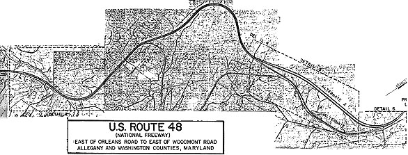
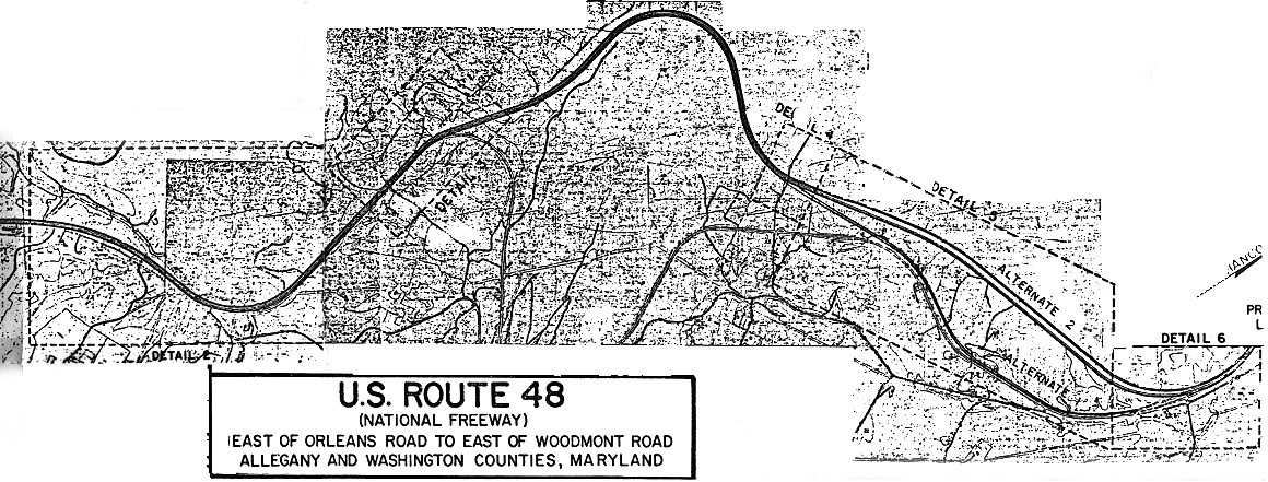
Design Public Hearing, U.S. Route 48 (National Freeway), East of Orleans Road
to East of Woodmont Road, December 12, 1978, public hearing brochure, by Maryland
Department of Transportation, State Highway Administration. This is the 8-mile
Sideling Hill area section of the National Freeway.
Informational Meeting, National Freeway U.S. 48, April 30, 1985, public
hearing brochure, by Maryland Department of Transportation, State Highway Administration.
This covered the 19-mile Cumberland-Green Ridge section of the National Freeway.
Building the National Freeway, Special Edition of Maryland Roads,
August 2, 1991, by Maryland State Highway Administration.
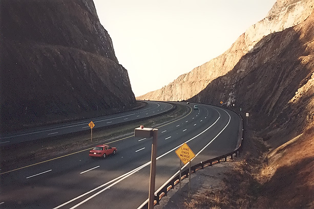
I-68 Sideling Hill Cut
Geology Of The Sideling Hill Road Cut - prepared by Maryland Department of Natural Resources, Maryland Geological Survey. An excellent official webpage about the Sideling Hill Cut, with diagrams of the geology of the mountain as seen in the cut.
Interstate 68 Cut Through Sideling Hill, by Federal Highway Administration, Maryland Division Office. Excellent aerial photo of the Sideling Hill Cut.
I-68 in Maryland, about 1/3 the way down
from the top of the webpage,
Dwight D. Eisenhower System of Interstate and Defense
Highways - Engineering Marvels, by Richard
F. Weingroff, 1996. The webpage has a nice aerial photo of the I-68 Sideling Hill
Cut. Excerpt (in blue text):
Sideling Hill in western Maryland
had been an obstacle to transportation for centuries. Old U.S. Route 40, the modern
descendant of the National Road (initiated as a federal project in 1806), executed
a treacherous hairpin curve to get around the obstacle. When Maryland officials
decided to build an Interstate highway through western Maryland to connect I-79
in Fairmont, W.Va., with I-70 and I-81 in Hagerstown, Md., they decided they needed
a straightforward crossing of the mountain. To avoid a prohibitively steep grade,
they would blast a 116-meter-deep cut into the top of the 536-meter (m) mountain.
Doing so required blasting, scraping, and hauling 3.44 million cubic meters of
shale, sandstone, and other rock while maintaining traffic on U.S. 40. In addition,
stringent erosion and sediment control requirements, aimed at protecting the trout
streams that crisscross the route, complicated the task. An article about the
cut noted that when the blasters were done, "They had achieved an engineering
marvel: a breathtakingly beautiful man-made rock wall, revealing in tilted, multi-colored
layers of sedimentary rock 350 million years of geologic history." When I-68 opened
in August 1991, it included the Sideling Hill Exhibition and Tourist Information
Center, housing geological exhibits. The center includes a fenced walkway onto
the Sideling Hill road cut, as well as a fenced pedestrian bridge across I-68.
 |
| The above map depicts
the proposed National Freeway in the Sideling Hill area. The proposed freeway
where it was ultimately built, follows the heavy black line that curves upward,
and the double black line (Alternate 2). The topmost curve is where the Sideling
Hill Cut was built. The thinner single black line is the original US-40.
"North" is straight upward.
Large image (317 kilobytes). The map diagram comes from the
following document: |
Photos of National Freeway and I-68
I took the following 12 photos on one day in December, 1997.
|
|
Westbound on I-68 National Freeway, approaching the Sideling Hill Cut. Notice the overpass and visitor center right in front of the cut. This is a popular Maryland tourist site. There are diagrams inside the visitor center showing the geology of the cut |
 |
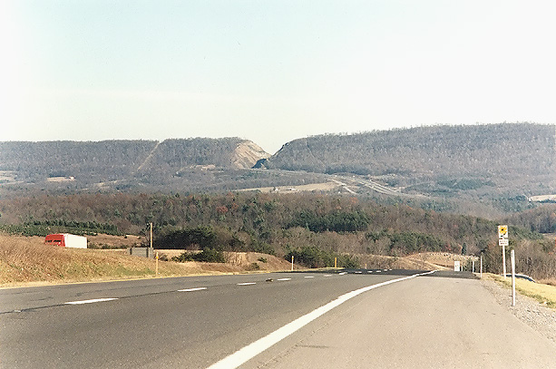
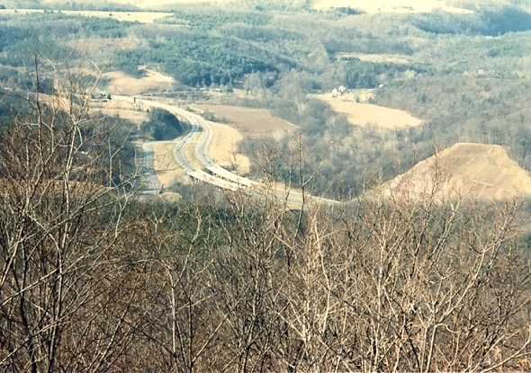
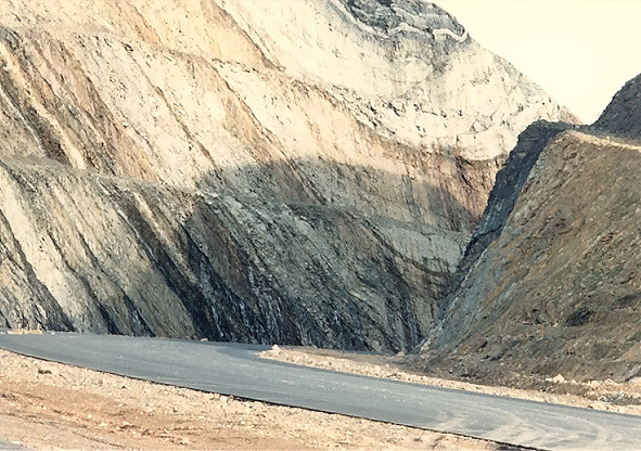
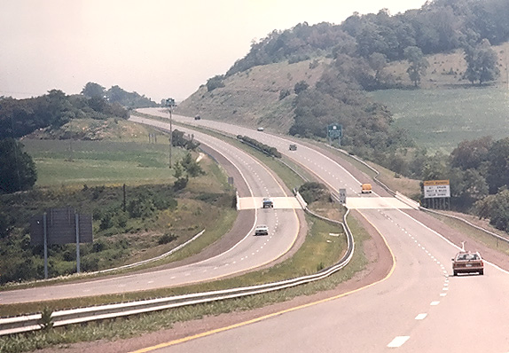
I-68 National Freeway, looking west from the overpass at the Sideling Hill visitor's center. Notice third climbing lane westbound. |
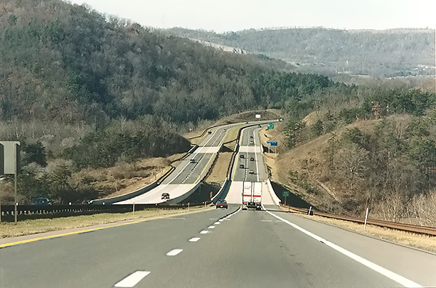 |
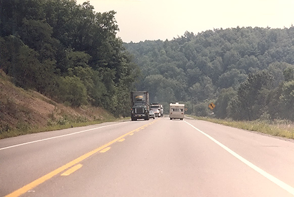
I-68 National Freeway, east of Flintstone. Heading westbound. |
 |
I-68 National Freeway, east of Flintstone. Heading westbound, about a mile after the previous photo. |
|
|
I-68 National Freeway, west of Flintstone. Heading westbound. |
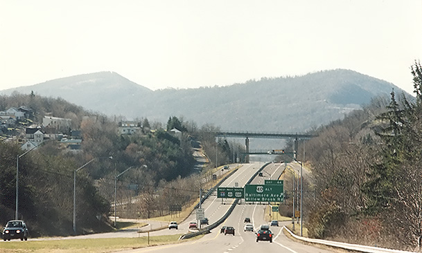 |
I-68 National Freeway, east of Cumberland near the city limits. Heading westbound. |
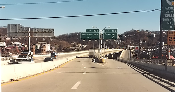 |
I-68 eastbound in Cumberland, Maryland. This winding elevated roadway is about a mile long, goes through the center of the city, passes over streets and rail lines, and was completed in 1965 as part of the US-40 Cumberland Thruway. The speed limit is 40 mph. |
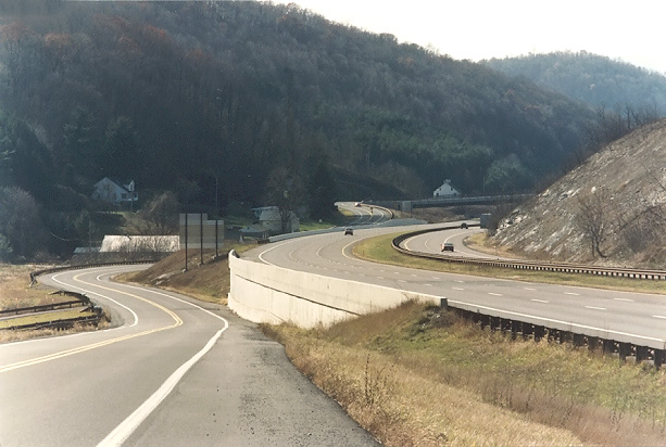 |
I-68 National Freeway, near Pratt, looking westward. Notice how I-68 is supported by a concrete retaining wall as it passes close to the old 2-lane US-40. |
 |
I-68 National Freeway, near Pratt, looking westward from an overpass. |
 |
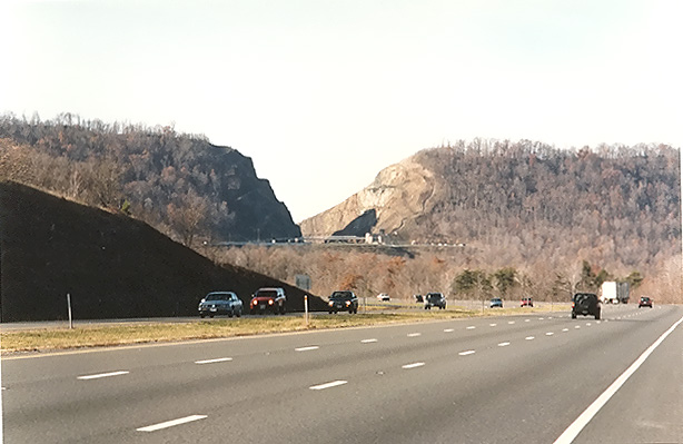
Looking east on I-68, a couple miles from the Sideling Hill Cut. |
 |
Westbound on the I-68 National Freeway, approaching the Sideling Hill Cut. Notice the overpass and visitor center right in front of the cut. This is a very similar vantage point to the first photo in this group, but taken in the late afternoon, so the sun lighting angle is different. |
 |
I-68 National Freeway, Sideling Hill Cut, looking west from the overpass at the visitor's center. Notice the third climbing lane westbound. This is a very similar vantage point to the second photo in this group, but taken in the late afternoon, so the sun lighting angle is different. |
I took the following 6 photos on one day in February 1985, showing National Freeway construction in the Sideling Hill area.
 |
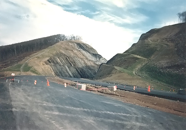
Sideling Hill Cut under construction in February 1985. The photo was taken from the shoulder of US-40, looking west toward the east side of the cut. If you look closely just above the roofline of the house, you can see the grade of the new freeway under construction a few hundred yards behind the house. |
 |
Looking west from the top of Sideling Hill. The US-40 four-lane divided highway is visible down below, with its twin bridges over Sideling Hill Creek. That 2-mile-long section of highway was incorporated into the National Freeway. |
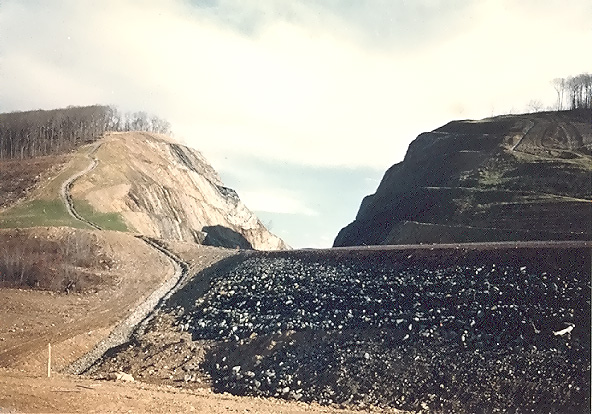 |
Sideling Hill Cut under construction in February 1985. The photo was taken from below the highway embankment, looking east toward the west side of the cut. |
 |
Sideling Hill Cut under construction in February 1985. The photo was taken from the highway which has had asphalt base courses placed, looking east toward the west side of the cut. |
 |
Sideling Hill Cut under construction in February 1985. The photo was taken from the highway, looking east toward the west side of the cut. I walked down the highway from the last photo vantage point, closer to the cut. |
 |
Sideling Hill Cut under construction in February 1985. The photo was taken from the highway, looking east toward the west side of the cut. This photo was taken from the same vantage point as the previous photo, but it was taken with a 135mm (2.7x) telephoto lens, instead of the 50mm (1.0x) regular lens used previously. |
I took the following 5 photos on one day in July, 1984.
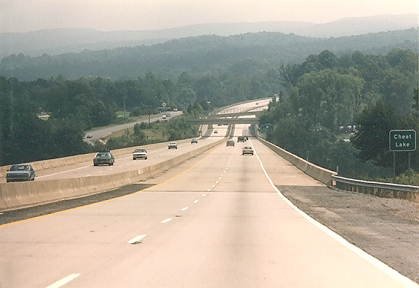 |
Eastbound on I-68, approaching the bridges over Cheat Lake, just east of Morgantown, West Virginia. |
 |
Eastbound on I-68, just east of Morgantown, West Virginia. |
 |
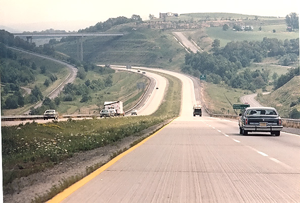
Eastbound on I-68, approaching the MD-546 Finzel interchange. |
 |
Eastbound on I-68, near Frostburg, Maryland. |
 |
US-40 National Pike, west of Flintstone, Maryland. I-68 had not yet been built on a 19-mile section just east of Cumberland, so this section of US-40 was still serving as the main east-west highway. |
Appalachian Development Highway System
The Appalachian Development Highway System (ADHS) is a 3,025-mile highway network that was authorized by the U.S. Congress in the Appalachian Development Act of 1965, and it reached 85% completion in 2003.
Appalachian Development Highway
System, by Appalachian Regional Commission,
quote (in blue text):
In 1964, the President’s Appalachian
Regional Commission (PARC) reported to Congress that economic growth in Appalachia
would not be possible until the Region’s isolation had been overcome. Because
the cost of building highways through Appalachia’s mountainous terrain was high,
the Region had never been served by adequate roads. Its network of narrow, winding,
two-lane roads, snaking through narrow stream valleys or over mountaintops, was
slow to drive, unsafe, and in many places worn out. The nation’s Interstate Highway
System had largely bypassed the Appalachian Region, going through or around the
Region’s rugged terrain as cost-effectively as possible.
The PARC report and the Appalachian governors placed top priority on a modern
highway system as the key to economic development. As a result, Congress authorized
the construction of the Appalachian Development Highway System (ADHS), a 3,025-mile
highway network, in the Appalachian Development Act of 1965. The ADHS was designed
to generate economic development in previously isolated areas, supplement the
Interstate system, connect Appalachia to the Interstate system, and provide access
to areas within the Region as well as to markets in the rest of the nation.
By the end of FY 2002, 2,571 miles—approximately 85 percent of the ADHS—were complete
or under construction. Of these, 2,441 miles were open to traffic. Many of the
remaining miles will be among the most expensive to build. The most current estimate
(2002) puts the cost to complete the ADHS at $8.5 billion in 2000 dollars. The
federal share of that amount is $4.5 billion (in 2000 dollars). Completion of
the ADHS remains a top priority for ARC.
I-68 Extension in West Virginia
In October, 2003, the Federal Highway Administration (FHWA) approved West Virginia’s request extend I-68 from I-79 at Morgantown to WV-2 at Moundsville. A close reading of this news release, and from what I have heard, indicates that this extension will have 4 lanes and will be limited access, but will include at-grade intersections at major public roads and will have interchanges at major junctions, so the highway will not actually be built to Interstate standards nor will it carry an Interstate route designation.
I-68 Extension
Now Eligible for Federal Funding, West Virginia
Department of Transportation news release, October 31, 2003. Excerpt (in blue
text):
The Federal Highway Administration
has approved West Virginia’s request to add an extension of I-68 from I-79 at
Morgantown to WV 2 at Moundsville to the National Highway System. Approval means
that the traveled way between Moundsville and Morgantown, including Monongalia
County 19/24, US 19, WV 7 and US 250, has been reclassified as part of the State
Principal Arterial System. The 73 miles of roadway will be added to the existing
1749-mile National Highway System and become eligible for federal funding, if
and when such monies become available.
External Links
Sideling Hill WMA, Sideling Hill WMA, Sideling Hill Exhibit Center, Sideling Hill Wildlife Management Area, Maryland Department of Natural Resources.
Maryland Scenic Byways: Western Region , National Freeway, by Maryland State Highway Administration.
I-68/US 40 Multiplex, Central PA/MD Roads, by Timothy Reichard.
Sideling Hill Syncline Roadcut
Sandor Gulyas' Delmarva Peninsula Trip 2000 and Maryland-West Virginia Trip 2001. See "Sideling Hill on I-68" for photos.
Western Maryland Freeway Junctions, by Mr. Yamamoto. About 1/3 the way down from the top of the webpage is a diagram of the I-68/I-70/US-522/US-40 interchange.
Interstate 68 - Interstate Guide, by AA Roads.
Historic National Road - Maryland, by National Scenic Byways Online.
Maryland Scenic Byways, by Maryland State Highway Administration.
The National Road: Maryland, by Adam Prince.
Copyright © 1997-2004 by Scott Kozel. All rights reserved. Reproduction, reuse, or distribution without permission is prohibited.
By Scott M. Kozel, Roads to the Future
(Created 8-14-1997, updated 6-26-2004)