
| I-70, I-170, I-95, I-395, I-83 Interchanges |
I-70, I-170, I-95, I-395, I-83 Interchanges
These maps show plan views of the unbuilt interchanges of I-95/I-70 and I-70/I-170 in West Baltimore, the interchange of I-95/I-395 near downtown Baltimore, and the unbuilt interchange of I-95/I-83 in East Baltimore. These are high-capacity semi-directional freeway-to-freeway interchanges.
 |
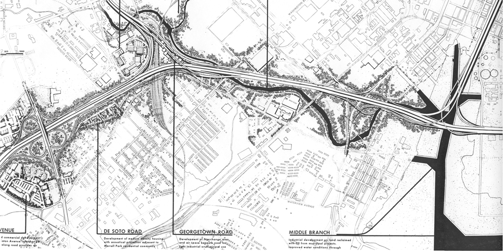
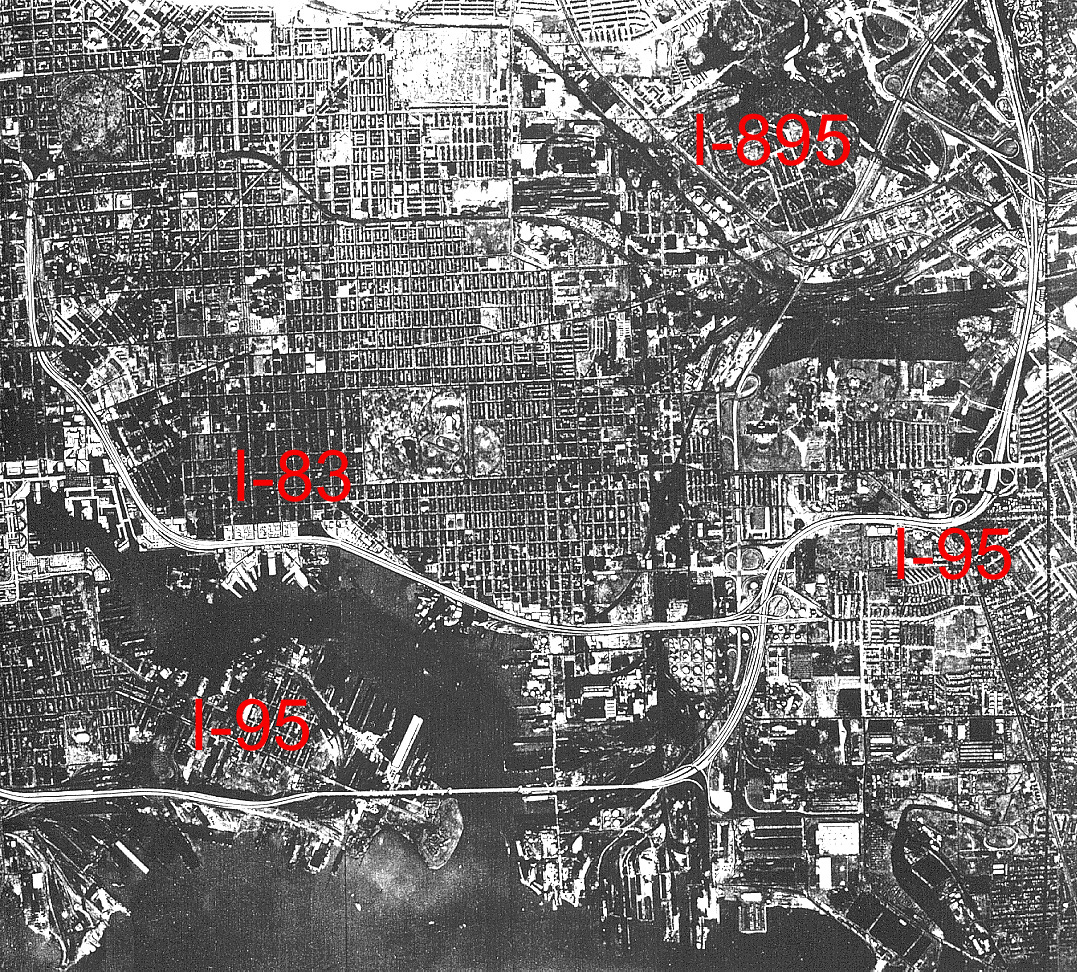
| This map shows I-95 in West
Baltimore. The interchanges, from left to right, are Caton Avenue, I-70, Washington
Boulevard, MD-295/Russell Street, and I-395. This is almost identical to the design
as it was ultimately built, except for the unbuilt I-70. The depicted proposal
to fill in much of the Middle Branch of the Patapsco River, with earthen fill
for urban development, was never built. Click for larger map images: Medium (451 kilobytes), Large (1,535 kilobytes). |
I-70 between I-695 and I-95, as approved in the Baltimore 3-A Interstate and Boulevard System, was to have interchanges at Security Boulevard, Hilton Parkway, I-170, Wilkens Avenue, and I-95. I-70 was built to the interchange with Security Boulevard at the Baltimore city line, but the proposed 4.0-mile-long section inside the city was cancelled in 2 segments in 1981 and 1983.
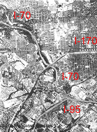 |
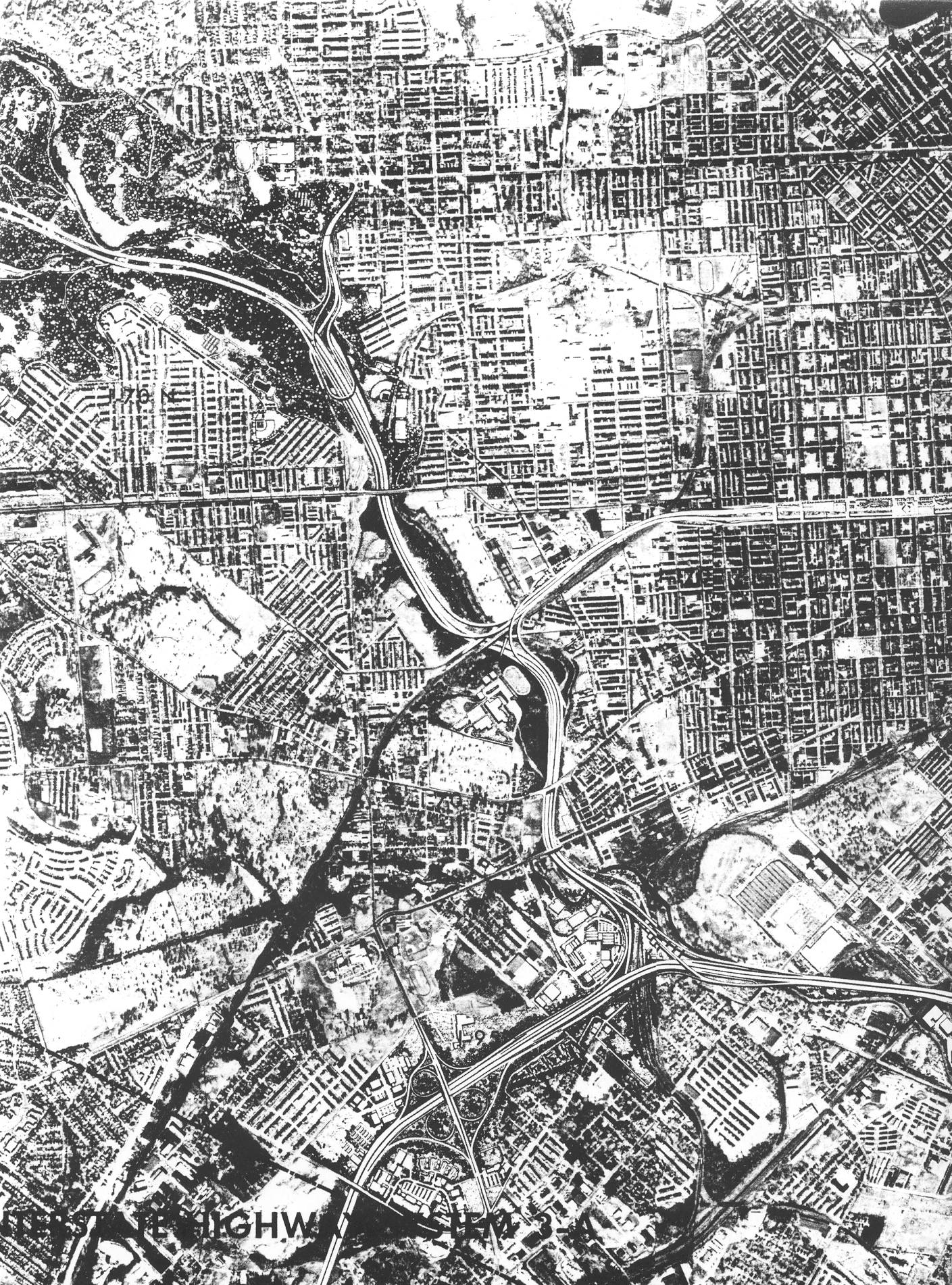
This map shows
a section of the western part of the Baltimore 3-A Interstate and Boulevard
System. I-95 traverses left to right in the lower part of the image, I-70
branches upward and leftward from the triangular interchange of I-95/I-70
in the lower right of the image, the eastern part of Leakin Park is in the
upper left of the image, and I-170 branches rightward from I-70 in the center
of the image. Click for larger map images: Medium (694 kilobytes), Large (2,487 kilobytes). |
I-95 in the City of Baltimore, as approved in the Baltimore 3-A Interstate and Boulevard System, was proposed to have an interchange with I-83 in East Baltimore, and I-83 would have been extended 4.4 miles from its terminus in the downtown, to I-95. This proposed section of I-83 was officially canceled in September 1982.
 Click for larger map images: Medium (857 kilobytes), Large (1,450 kilobytes), Zoom-in on I-95/I-83 interchange (418 kilobytes). |
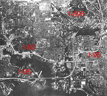
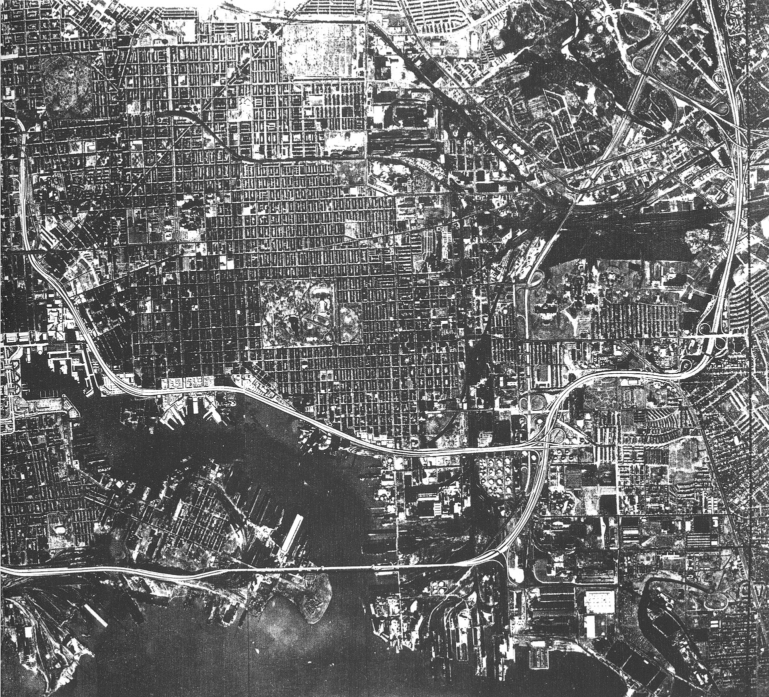
This map shows of
the eastern part of the Baltimore 3-A Interstate and Boulevard System.
I-95 traverses left to right in the lower part of the image, including the
high-level double-decked harbor bridge near Fort McHenry, and then I-95 curves
northeastward along the right edge of the image. I-83 traverses left to
right in the mid part of the image, and includes the elevated freeway in
the northern part of the Fells Point neighborhood. Downtown Baltimore and
the Inner Harbor is
near the middle left edge of the image, and I-83 curves upward as the
Jones Falls Expressway. The I-95/I-83 interchange is in the lower right
part of the image, and it includes semi-directional ramps and a loop ramp,
with an easterly 4th local leg connecting to Boston Street and O'Donnell
Street.
This was the proposed 3-A system design as of December 1970, and the design was later revised to include the I-95 Fort McHenry Tunnel, the I-83 Fells Point Tunnel, and the full-semi-directional I-95/I-83 interchange. |
Source for all above material: Final Joint Development, Baltimore Interstate Highway System 3-A, by Urban Design Concept Associates (a joint corporate venture of Skidmore, Owings & Merrill; J.E. Greiner Company, Inc., Parsons, Brinckerhoff, Quade & Douglas; Wilber Smith & Associates), December 1970. This document was prepared for the Interstate Division for Baltimore City (a joint city/state agency) on behalf of the City of Baltimore and the State Roads Commission of Maryland in cooperation with the United States Department of Transportation, Federal Highway Administration.
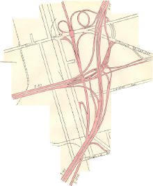 |
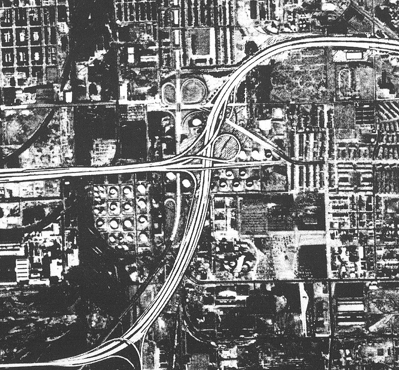
This diagram
shows the last proposed design of the interchange between I-95 and I-83.
It would have been a 3-way freeway-to-freeway
interchange with semi-directional ramps on all of the connections between
I-95 and I-83, with an easterly 4th local leg connecting the freeways to
Boston Street and O'Donnell Street.
Roads to the Future traced this from a fading December 1976 MDOT SHA highway design plan sheet, very accurately with drafting equipment, about 1980. The freeways and ramps are colored in red.
|
Roads to the Future article Baltimore City Interstates - Cancellations
Lead article Baltimore City Interstates
Copyright © 2006-2007 by Scott Kozel. All rights reserved. Reproduction, reuse, or distribution without permission is prohibited.
By Scott M. Kozel, Roads to the Future
(Created 3-19-2006, last updated 5-8-2007)