
| Interstate 77 New River Bridge |
I-77 in Virginia crosses over the New River and US-52 on twin high-level bridges, in Wythe County, 5 miles south of Fort Chiswell and 2 miles north of Poplar Camp. The 9.2-mile-long section of I-77 from VA-69 at Poplar Camp to I-81 at Fort Chiswell opened on December 4, 1978, completing I-77 from North Carolina to I-81; and that section includes the New River Bridges.
The I-77 New River Bridges are twin bridges of the plate girder design. The southbound bridge is 1,808 feet long and the northbound bridge is 1,798 feet long. At the centerline of the northbound bridge, the average river elevation is 1,915 feet above sea level; and the maximum roadway elevation over the river is 2,040.5 feet above sea level. So the maximum height of the roadway above the average river level is 125.5 feet. The bridges have multiple main spans each 300 feet long, with shorter end spans, and the girders are 12 feet deep. Source: VDOT bridge design plans for project for rehabilitation of the bridge decks on the I-77 New River Bridges. The rehabilitation project will involve widening each bridge with one additional lane and a full emergency shoulder on the inside roadway of each bridge. Each existing bridge has two 12-foot lanes with a 10-foot right shoulder and a 4-foot left shoulder. The widening will involve building new superstructure between the two bridges. After traffic is shifted to the new sections and temporarily removed from the existing bridge deck, those portions of superstructure will be completely rehabilitated. After construction is complete, each bridge will have three 12-foot lanes and two 10-foot shoulders. The bridge design will be compatible with future 6-lane widening of I-77, and the each inside lane will remain closed until that future roadway widening takes place. Archer Western Contractors, LTD, is the contractor for this project, (F0)0077-098-105, C501, B623, B624, Route 77, Wythe Co.
According to the VDOT Dashboard
on March 27, 2004, several data points about the
I-77 bridge rehabilitation project:
Construction Start Date: 4-1-2002
Estimated Completion Date: 9-21-2004
Contract Award Amount: $36,649,000
Inspector's Estimated Amount to Complete: $38,925,100
I took the following photos on 10-5-2001.
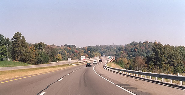
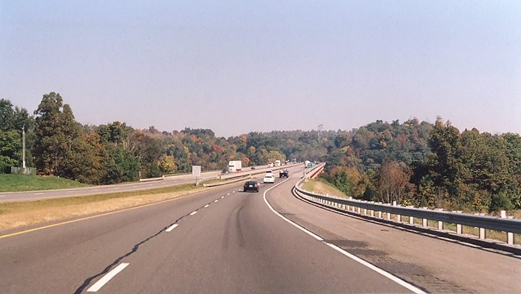
Above, viewed from the highway, the bridges
are not remarkable, although the motorists can briefly see nice views of the shallow,
rocky New River, to the side of the bridges. This view is heading northbound,
approaching the bridge.
See large more
dense image (242 kilobytes).

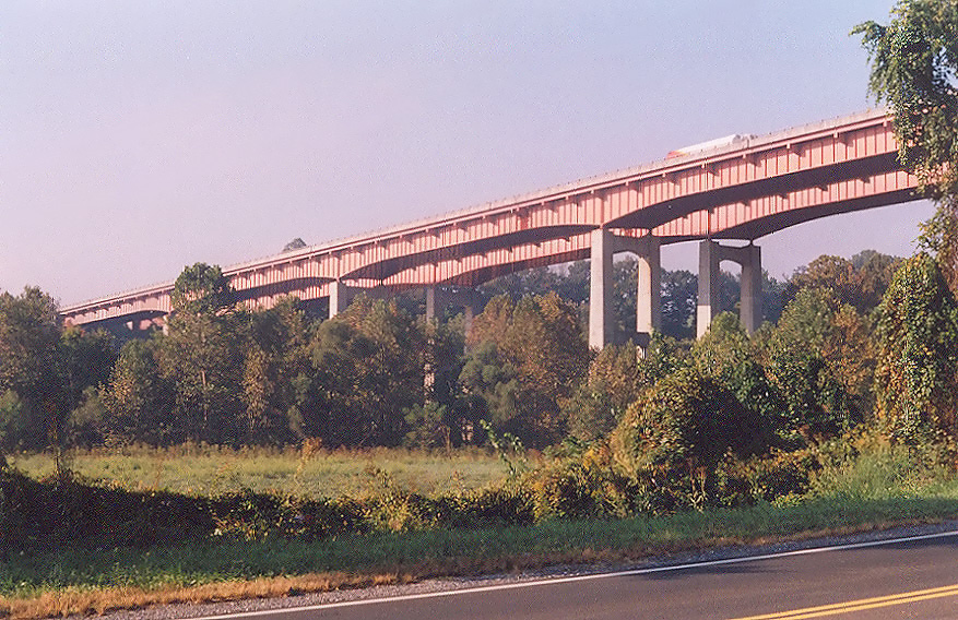
Above, looking from near US-52 toward the
bridges.
See large more
dense image (353 kilobytes).

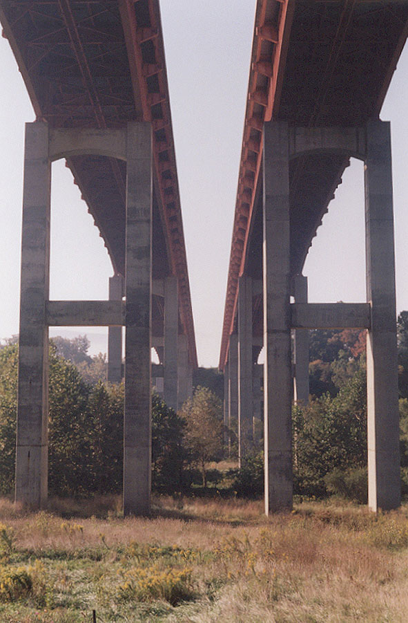
Above, looking from near US-52 just below
the bridges, upward at the bridges.
See large
more dense image (136 kilobytes).
Interstate 77 New River Bridge Construction - my article with 5 photos of the bridge under construction in 1977 and 1978. These photos were taken by personnel of the Hillsville Residency Office of the Virginia Department of Transportation (VDOT), and I am using them by their permission.
Interstate 77 Bridges, The Shot Tower, and the Shorts Creek Trestle on the New River Trail - a website with a USGS map of the area around the I-77 New River Bridge.
All photos taken by Scott Kozel.