Metrorail Glenmont Route
This article mainly covers the Glenmont Route in Montgomery County, Maryland. My main purpose here is to cover the completion of the route with the opening of the
Glenmont Station on July 25, 1998, discuss the Maryland portion, and post 5 photos that I took on the opening day.
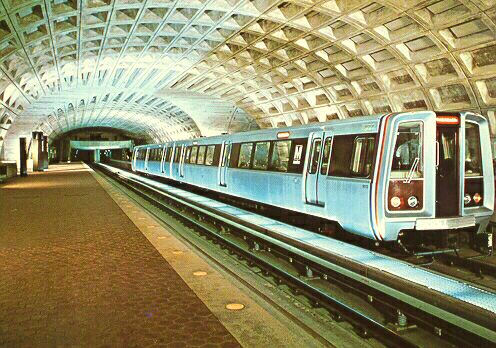
Metro Center Station, from a 1970s post card. The post card photo was taken some time in 1975 before opening in 1976. Notice supplemental lighting used in the photo. The train is on the Shady Grove platform showing taillights and Rhode Island Avenue Station destination sign, no surveillance camera hung from ceiling.
=====================================================================
Glenmont Station Opens July 25, 1998
There was an article about the new
Glenmont Station and line in the Washington Times 7-22-98. It mentioned that the new subway line is 1.8 revenue miles long, cost $291 million, and the station is about "45 feet deep" (I assume that is the elevation below street level down to the platform). A parking garage next to the station will hold over 1,800 cars, and the station has bus bays and kiss-n-ride areas.The B Route (Red Line) transitions from surface to subway just north of the Silver Spring Station, and is in subway all the way to the northern terminal at Glenmont Station. Interestingly, due to the topography north of the station, the tail track and transit car storage yard is on the surface.
I went to the opening ceremonies 7-25-98. Maryland Governor Parris Glendening (and other dignitaries) spoke at the ceremony, which had about 1,000 people there.
The Glenmont Station was nice, with the half-circular vault design, the modification of the original barrel-vault design. It is located parallel to and just west of north-south Georgia Avenue (MD-97) near the intersection with Layhill Road. There are entrances on both sides of Georgia Avenue. The Glenmont Station was built by cut-and-cover, and on the last 1/2-mile or so of the line, the grass on the west side of the road is new; that's where the subway tunnel and station was built. Riding south on the line, it is apparent that nearly all the rest of the construction is bored-tunnel, down to just north of Silver Spring Station, where the tunnel portal is. The tunnel wall has the circular cross-section that is typical for a bored tunnel, and the street above is the old undisturbed street.
The northern tail track is in a tunnel that curves sharply to the east, and the service and inspection yard is in a long enclosed building on the surface. The yard is covered by a building, because of the residential nature of the surrounding area. Georgia Avenue has a rolling vertical alignment, while the subway underneath looks like it has a fairly flat grade. That's probably the reason for the extreme depth of some sections of the Glenmont Route in Maryland.
The station is not under Georgia Avenue, but just west of there, I recalled the layout that I saw there. There was a feeling of being under the road, but actually it isn't. I entered the entrance just east of the road, walked through a passageway to the mezzanine/faregates, but the other entrance (west of the road) was before reaching the mezzanine/faregates, e.g., I had walked completely under Georgia Avenue before reaching the actual station.
For several blocks along Georgia Avenue, the Glenmont Greenway is planned on the surface where the cut-and-cover subway tunnel lies beneath. This will be a strip park with hiking/biking trails.
I stopped at the Forest Glen Station, which is just north of the I-495 Capital Beltway. It is the deepest subway station in North America, the platform is about 195 feet below the street. The station has 2 small circular train halls, at least 100 feet apart, with a passageway connecting them. There is a bank of 6 elevators that run from the platform level to the mezzanine (faregate) level. The elevators are large and fast. Very interesting station. It is located at Georgia Avenue and Forest Glen Road.
There is one station between Forest Glen Station and Glenmont Station, the Wheaton Station, which is at Wheaton Plaza on Georgia Avenue and Reedie Drive.
Here is the official
WMATA System Map.=====================================================================
WMATA Baseline System Inventory - 1986 Update
Description of Glenmont Route (direct excerpt)
Glenmont (B) Route
The Glenmont (B) Route begins in subway at the east end of the Metro Center Station (E-W) and proceeds eastward in subway under G Street to 6th Street, then southeastward under Judiciary Square, eastward under D Street, and northward in subway along the west side of Union Station. The route then continues northward on the surface along the railroad [CSXT, old B&O] to the District of Columbia-Maryland Boundary.
In Maryland the route continues northward on the surface along the railroad through Silver Spring, then in subway under 16th Street and Georgia Avenue to a terminus at Glenmont.
The following stations are provided: Gallery Place Station (E-W) along G Street at 7th and at 9th Streets, N.W.; Judiciary Square Station along 4th Street between D and E Streets and along F Street between 4th and 5th Streets, N.W.; Union Station Station along the west side of Union Station; Rhode Island Avenue Station along the railroad at Rhode Island Avenue, N.E.; Brookland-CUA Station along the railroad between Monroe Street and Michigan Avenue; Fort Totten Station (N-S) along the railroad at Galloway Street; Takoma Station along the railroad at Cedar Street; Silver Spring Station along the railroad at Colesville Road; Forest Glen Station along Georgia Avenue at Forest Glen Road; Wheaton Station along Georgia Avenue at Reedie Drive; and Glenmont Station along Georgia Avenue at Layhill Road. A Transit Car Storage Yard including a Facilities Maintenance Field Base (FMFB) is provided northeast of the Glenmont Terminal Station; and a Major Repair Yard, including a temporary Facilities Maintenance Field Base (FMFB), are provided at Brentwood just south of the Rhode Island Avenue Station.
=====================================================================
John Cambron's Review of Glenmont Station Opening and Other Metro Info
The following information comes from posts by John R. Cambron of North Beach, Maryland. John is a transit and road buff and a knowledgeable regular poster in the Usenet newsgroups
news:misc.transport.urban-transit and news:misc.transport.road; these are professional newsgroups on the Internet that cover mass transit and roads/highways.WMATA Metrorail opened the Glenmont Station today Saturday 07-25-1998. This is the 76th station to open. This brings the route miles up to 95. WMATA estimates that 7,000 passengers are expected to be using the station on the average weekday in 6 months.
This station is very typical of the newer design that WMATA uses on its younger cut-and-cover poured-in-place concrete subway stations. The train hall is the same as two of the three new stations north of Gallery Place-Chinatown, Mount Vernon Square and Shaw-Howard U. These three stations use the 6-coffer design as opposed to the 22-coffer design used on stations WMATA built in from 1960s to the mid-1980s.
The station layout is an island platform station with a single mezzanine at mid-platform. It has surface entrances on both east and west sides of Georgia Avenue (MD SR 97). It also has 2 elevators from the surface to the mezzanine again on both east and west sides of Georgia Avenue. The station is not under Georgia Avenue proper, the station is under the properties that front Georgia Avenue on the west side of the street.
Now let's look at access. The station has 2 kiss-and-ride drop-off lots, one on each side of Georgia Avenue, these lots are also used for mid-day short term off-peak parking using parking meters. It has 2 on-street bus boarding areas that are on the northbound side of Georgia Avenue. It also has an off-street bus terminal with 6 boarding bays. It also has an 1,800 space multi-level parking structure. The Station in served by 2 transit agencies, WMATA's own Metrobus and Montgomery County RIDE ON. According to the Montgomery County's RIDE ON map dated Sunday 07-26-1998, there are 17 bus routes serving the Glenmont station. 10 of the routes are served by RIDE ON all but 1 of these routes uses Glenmont Station as terminal. These routes are 10, 26, 31, 33, 39, 40, 41, 49, 51, and 53. The 10 is the route that does not use Glenmont Station as a terminal. Metrobus has 6 bus routes serving Glenmont Station. These routes are C8, Y7, Y9, Z1, and Z4. 3 of these routes do not use Glenmont Station as a terminal Y7, Y8, and Y9.
Website for
RIDE ON Montgomery County Transit for more details on their bus routes.Website for
WMATA Bus and Rail Schedules for more details on their routes.The Glenmont Station is pretty typical of the stations on WMATA. There is a couple of things that stand out about this station, in my view. This is the only station that I know of that has 2 elevators on opposite sides of a street serving one mezzanine from the surface. The north end of the station has knockouts in the tunnels to extend the line further out Georgia Avenue. There are tunnels that now lead to a yard about 1/4-mile north of the station.
Exiting the parking structure can be fun for the first time user. You may enter the parking structure right off Georgia Avenue on to the 2nd level, this entrance is only accessible from northbound Georgia Avenue, however to exit you must use one of the two exits to Glenallen Avenue on the 1st or 2nd levels, or use the Layhill Road exit on the 3rd level. You may also enter the parking structure from Glenallen Avenue to the 1st level (this is the entrance you would use from southbound Georgia Avenue, turn left on to Glenallen Avenue to entrance) or use Layhill Road (MD SR 182) entrance to the 3rd level (this exit will get you to southbound Georgia Avenue, there is no left turn onto Layhill Road from this exit, road divided with island must use one of the Glenallen exits to get to north bound Layhill Road). You really need a map to see the all of the entrances and exits to better understand the layout. The signage in the parking structure directing you to the exits, in my opinion, could be a little better.
Concerning the Forest Glen Station: The high-speed elevators are in a 60-foot round shaft, there are stairs behind each bank of elevators with intermediate levels with access to elevators. In all stations with emergency exits at end of platforms there are all way stairs to surface. The depth of the line is because the bedrock is deeper than it is on the (A route) Shady Grove line. Wheaton also has twin train halls, but has escalators to surface, longest in system. There is a 2% + grade from Silver Spring portal to Forest Glen and 2% + grade up to Wheaton just south of station. There is a 2% + grade up to where the cut-and-cover starts just north of Randolph Road. All of these rock tunnels were excavated using the blasting method, as opposed to boring machine used on the (A route) Shady Grove line from Rock creek next to Taft Bridge on Connecticut Avenue to Pookshill Road and Rockville Pike (MD SR 355) just south of Capital Beltway (MD I 495).
(End of John Cambron's information)
Here's John's
WMATA Metro and Other Stuff web page.=====================================================================
|
Glenmont Route openings |
||
|
Section (listed from south to north) |
Length (miles) |
Opening Date |
|
Metro Center to Rhode Island Avenue (incl. M.C. to Farragut North |
4.6 |
3-27-76 |
|
Rhode Island Avenue to Silver Spring |
5.7 |
2-6-78 |
|
Silver Spring to Wheaton |
3.2 |
9-22-90 |
|
Wheaton to Glenmont |
1.8 |
7-25-98 |
Source - Official
WMATA History Link.=====================================================================
Directory of my pages with photos
Forest Glen Metro Station
Glenmont Metro Station
All photos taken by Scott Kozel.
©
Copyright June 1998 by Scott Kozel. All rights reserved.Official website
Washington Metropolitan Area Transit Authority (WMATA).By Scott M. Kozel,
Roads to the Future(Update 8-3-98)