
| Pinners Point Interchange Construction Photos - April 2005 |
Here are 13 photos of the Pinners Point Interchange (Port Norfolk Connector) project under construction, taken by the Roads to the Future author on April 10, 2005. Click the thumbnail photo for a larger photo (they range in size from 163 to 206 kilobytes, with most being less than 185 kilobytes).
This photo article was published 12 months after the photos were taken, and the article is written in the tense as of when the photos were taken. The entire project was completed and fully open to traffic before this article was published.
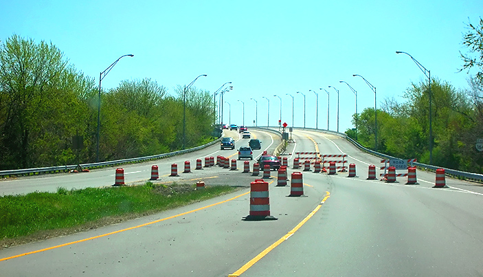 |
VA-164 Western Freeway, eastbound, approaching the West Norfolk Bridge. The 4-lane freeway is temporarily reduced to 2-lane 2-way traffic on the westbound roadway, with the 2-lane eastbound roadway temporarily closed. |
 |
Extension of the VA-164 West Norfolk Bridge, the Port Norfolk Connector bridge, open to traffic with 2-lane 2-way traffic on the new westbound bridge, driving eastbound. This point is near where the original bridge transitions to the new bridge. The eastern 1,200 feet of the 3,630-foot-long West Norfolk Bridge is being reconstructed and realigned slightly northward so that it will make a seamless freeway connection with the new Port Norfolk Connector bridge. |
 |
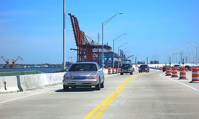
Extension of the VA-164 West Norfolk Bridge, the Port Norfolk Connector bridge, open to traffic with 2-lane 2-way traffic on the new eastbound bridge, driving eastbound. The 2 lanes that are open are transitioning from the new westbound bridge to the new eastbound bridge, in this photo. The gantries at the Portsmouth Marine Terminal are visible ahead. |
 |
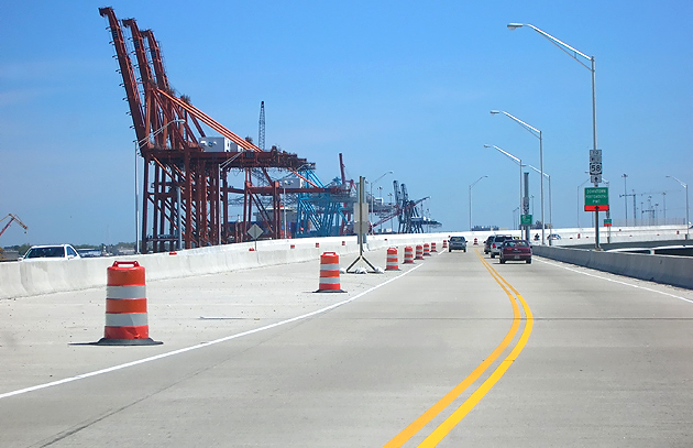
Extension of the VA-164 West Norfolk Bridge, the Port Norfolk Connector bridge, open to traffic with 2-lane 2-way traffic on the new eastbound bridge, driving eastbound. The 2 lanes that are open transitioned from the new westbound bridge to the new eastbound bridge, between the previous photo and this photo. The gantries at the Portsmouth Marine Terminal are visible ahead. |
 |
The local combined offramp for VA-164 eastbound (from West Norfolk Bridge) and US-58 southbound (from Midtown Tunnel) is being temporarily used for 2-lane 2-way VA-164 traffic. This photo is looking westbound toward the West Norfolk Bridge. The high embankment to the right is for the 2-lane ramp under construction from VA-164 eastbound to US-58 MLK Freeway southbound. |
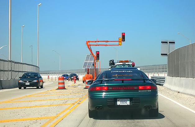 |
Extension of VA-164 Western Freeway, open to traffic with 2-lane 2-way traffic on the new 2-lane eastbound bridge that will connect VA-164 to the MLK Freeway, driving westbound, passing over the Portsmouth Marine Terminal, approaching the point where the completed 3-lane eastbound VA-164 roadway will split into a 2-lane roadway to the Midtown Tunnel and a 2-lane roadway to the US-58 MLK Freeway southbound. This includes the first 2 lanes of the extension of the VA-164 Western Freeway to Cleveland Street, with 2-lane 2-way traffic, but it also includes the two ramp connections between the Western Freeway and the Midtown Tunnel, and a better connection between the Midtown Tunnel and the MLK Freeway which now uses a rebuilt bridge over Cleveland Street. All these movements are on one-lane roadways that will have 2 or more lanes when the whole project is complete. There is a center lane for left turns controlled by a temporary traffic signal, for eastbound VA-164 traffic heading to the Midtown Tunnel, where they turn across westbound VA-164 and utilize a temporary one-lane ramp movement to access the Midtown Tunnel. |
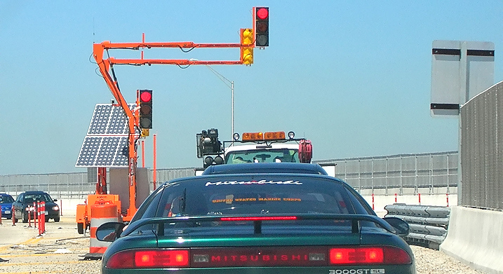 |
This is a zoom-in excerpt of the previous photo, and shows details of the temporary traffic signal, which received its electric power from a photovoltaic array. |
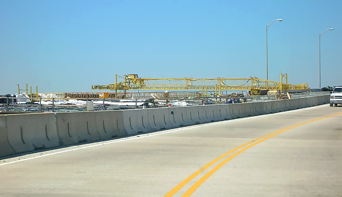 |
Extension of the VA-164 West Norfolk Bridge, the Port Norfolk Connector bridge, open to traffic with 2-lane 2-way traffic on the new westbound bridge, driving westbound. The eastern 1,200 feet of the 3,630-foot-long West Norfolk Bridge is being reconstructed and realigned slightly northward so that it will make a seamless freeway connection with the new Port Norfolk Connector bridge. The construction of the eastbound bridge is visible, the operation to cast the reinforced concrete roadway deck. |
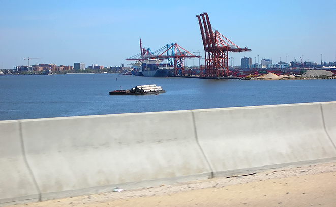 |
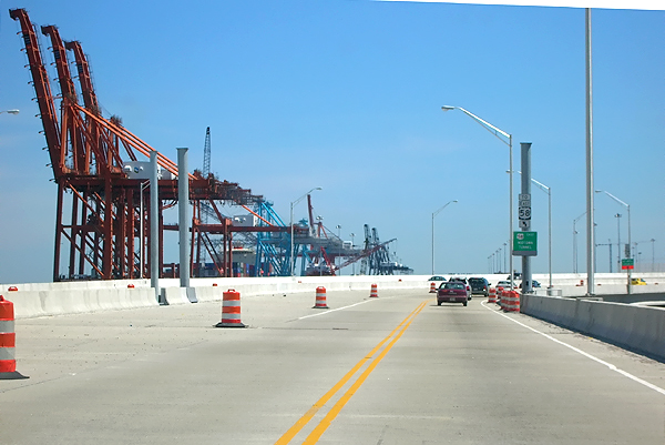
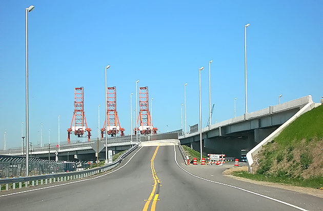
VA-164 Western Freeway, West Norfolk Bridge eastbound, looking across the bridge parapet toward the Portsmouth Marine Terminal in the distance. |
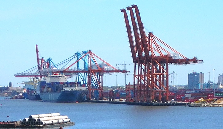 |
The dock and gantries at the Portsmouth Marine Terminal, with a ship at the dock. This photo is a zoom-in excerpt from the previous photo. |
 |
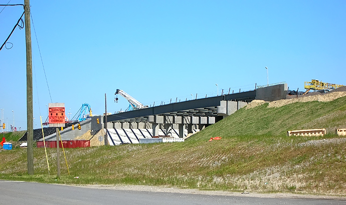
The local combined offramp for VA-164 eastbound (from West Norfolk Bridge) and US-58 southbound (from Midtown Tunnel) is being temporarily used for 2-lane 2-way VA-164 traffic. This photo is looking eastbound toward Cleveland Street at the traffic signal. The high embankment to the left is for the US-58 MLK Freeway under construction, and the large bridge passes over two local roads and a railroad line. |
 |
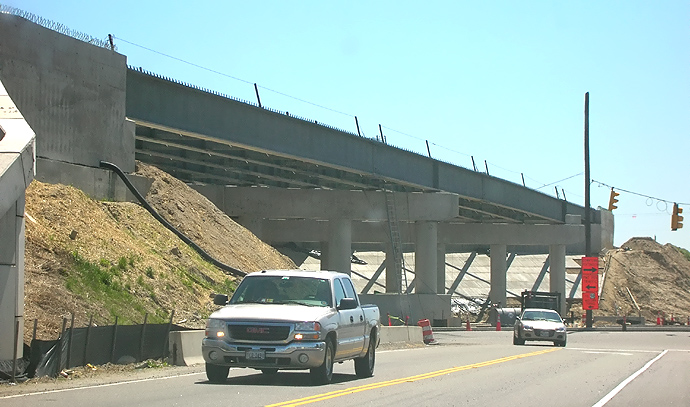
US-58 Martin Luther King Freeway bridge under construction over Cleveland Street. The bridge has 4 lanes each way, and it passes over two local roads and a railroad line. |
 |
US-58 Martin Luther King Freeway bridge under construction over Cleveland Street. The bridge has 4 lanes each way, and it passes over two local roads and a railroad line. |
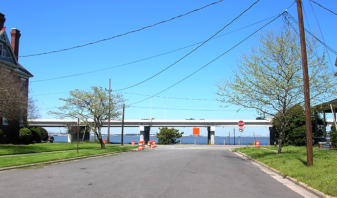 |
Looking north, from Maryland Avenue with its intersection with Bayview Boulevard in the Port Norfolk neighborhood just ahead, and the Elizabeth River and Port Norfolk Connector bridge beyond. Most of the river view still exists between the bridge piers and the bridge superstructure, and the freeway roadway is 33 feet above river mean high water level, and the bridge is about 400 feet offshore at this point. |
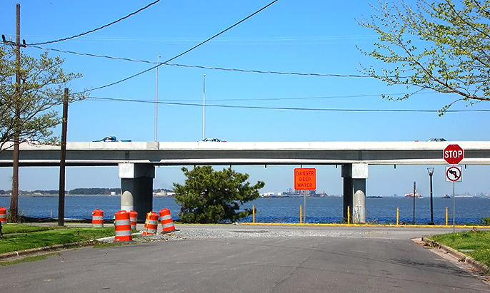 |
Looking north, from Maryland Avenue with its intersection with Bayview Boulevard in the Port Norfolk neighborhood just ahead, and the Elizabeth River and Port Norfolk Connector bridge beyond. The view out into the river is mainly that of an industrial harbor. |
Lead article Parallel Midtown Tunnel / Pinners Point Interchange / Martin Luther King Freeway Extension
All photos by Scott Kozel.
Copyright © 2006 by Scott Kozel. All rights reserved. Reproduction, reuse, or distribution without permission is prohibited.
By Scott M. Kozel, Roads to the Future
(Created 5-1-2006)