
| Richmond Downtown Aerial Photos |
Richmond Downtown Aerial Photos
The first 5 photos are of downtown Richmond, Virginia, looking south, and panning to the west. The last photo is looking north up the Shockoe Valley. The photos were taken in August 1997, and Roads to the Future took the photos from the 19th floor of the James Monroe state office building, which is right next to I-95 in downtown Richmond. The building is 25 stories tall, and at 460 feet tall is the tallest building in Richmond.
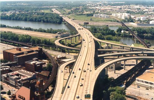
Above, the I-95 Richmond-Petersburg Turnpike (opened 1958), and its interchange
with the VA-195 Downtown Expressway (opened 1977). The highway interchange is superimposed
over a mainline railroad interchange. The roof of the Main Street Station is visible
in the lower left corner. The concrete wall that weaves under the interchange is
the James River Floodwall, completed in 1994.
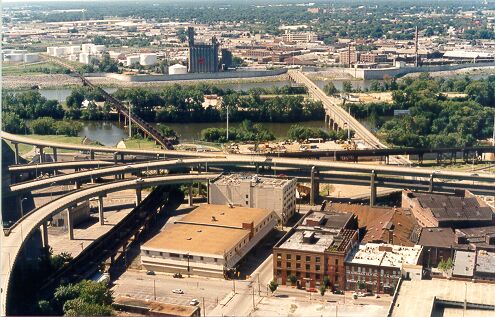
Above, the bridge to the right is the Mayo Bridge (14th Street Bridge). The
Downtown Expressway ramps merge into a double-decked expressway. The famous
Three-Level
Railroad Crossing is located where the two railroad trestles cross in the
left center of the picture.
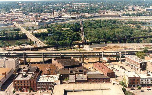
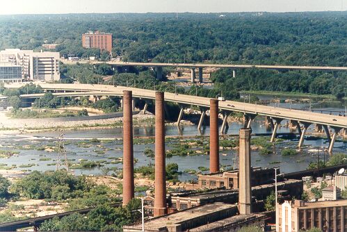
Above, the red dirt under the Downtown Expressway is the Kanawha Canal restoration
underway. Notice the floodwall on the both sides of the river. It's designed for
a 270-year storm. Hurricanes Camille in 1969 and Agnes in 1972 were 200-year storms,
and flooded huge areas on both sides of the river. The floodwall cost about $142
million.
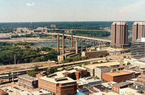
Above, the double-decked expressway returns to ground level with side-by-side
roadways.
Above, the Manchester Bridge was opened in 1972 and has six lanes. The bridge
in the background is the Robert E. Lee Bridge; its six-lane replacement was opened
in 1989. The original 4-lane Robert E. Lee Bridge was opened in 1934, and removed
after the new one was built.
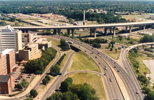
Above, looking north at I-95 and the Broad Street interchange. Buildings on left
are the edge of the Medical College of Virginia campus (VCU/MCV). The high-level
bridge is the Leigh Street Viaduct (Martin Luther King, Jr. Bridge) over the Shockoe
Valley. It has six lanes and was opened in 1976.
The Interstate 95 James River Bridge is 4,185 feet long and a maximum of 96 feet high and it opened in 1958. The Martin Luther King, Jr. Bridge is 2,151 feet long and a maximum of 107 feet high and it opened in 1976. The Manchester Bridge is 2,909 feet long and a maximum of 110 feet high and it opened in 1972. The Robert E. Lee Bridge is 3,760-feet-long and a maximum of 100 feet high and it opened in 1989. The Mayo Bridge is 1,374 feet long (north and south sections combined) and is a maximum height of 30 feet, and it opened in 1913. Source: Inside Richmond "River Crossings".
I-95 James River Bridge Reconstruction - Roads to the Future article about the project where the I-95 James River Bridge was rehabilitated and redecked from 1999 to 2002. There are more aerial photos in this article.
I-95 James River Bridge Restoration - Photos - Roads to the Future article with 5 aerial photos of completed project taken by Roads to the Future, and 9 photos of construction taken by VDOT.
Copyright © 1997-2003 by Scott Kozel. All rights reserved. Reproduction, reuse, or distribution without permission is prohibited.
By Scott M. Kozel, Roads to the Future
(Created 8-14-1997, last updated 8-1-2003)