
| US-29 Lynchburg / Madison Heights Bypass |
The US-29 Lynchburg / Madison Heights Bypass was planned since the 1980s as an eastern bypass of Lynchburg, Madison Heights and Monroe. It is also referred to as the US-29 Madison Heights Bypass.
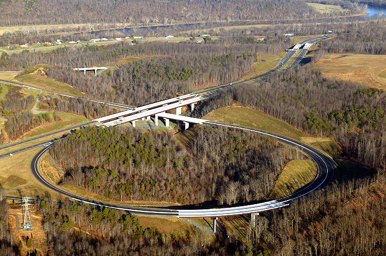
A total of nine construction contracts comprised the entire US-29 Lynchburg / Madison Heights Bypass project, and the new 12-mile-long bypass included two connectors. The US-29 bypass opened in 3 sections, US-460 to VA-210 on December 21, 2004, VA-210 to VA-130 on May 25, 2005, and VA-130 to US-29 at Amherst on October 6, 2005. The project was administered by the Virginia Department of Transportation (VDOT), and the total cost for engineering, right-of-way and construction, was $272 million. The mainline of the bypass has continuously reinforced concrete pavement.
The new bypass meets all current Interstate highway design standards. The mainline alignment is built to 4-lane full freeway standards, it is designed for 70 mph, and is currently signed for 65 mph. The graded median is 54 feet wide. There is 25 feet of clear roadside to the right of the roadways. The concrete pavement on each 2-lane directional roadway is 26 feet wide, the asphalt paved right shoulder is 8 feet wide, and the asphalt paved left shoulder is 4 feet wide. The concrete pavement has lines painted to provide two 12-foot-wide lanes, and the rightmost 2-foot width of the concrete pavement along with the 8-foot width of asphalt paved right shoulder, provides a designated 10-foot-wide right shoulder. Mainline bridges carry the same shoulder widths as does the mainline roadways. Interchange ramp designs are quite ample.
The new bypass provides an alternative to the congested US-29 Business route (which is 4-lanes divided throughout) through the City of Lynchburg, through the community of Madison Heights, and to the Town of Amherst in Amherst County. The Bypass traverses east of the pre-existing US-29 and has major terminal interchanges on the south end at existing US-460 in Campbell County near the east Lynchburg city limits, and on the north end at the existing US-29 Amherst Bypass at the south end of the Town of Amherst. There are two connections from the US-29 Bypass to the pre-existing US-29, one at the VA-210 interchange in Madison Heights and the other at VA-130 in Monroe. A 2-mile-long section of US-460 was relocated onto a new 4-lane alignment so that the new US-29 interchange could be properly connected to US-460, and the new US-29 bypass seamlessly connects with the US-29 Amherst Bypass as a continuous 4-lane freeway with a 65 mph speed limit. The new US-29 Madison Heights Bypass relieves the traffic congestion on US-29 north and south from Lynchburg to Amherst, Virginia.
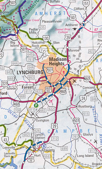 |
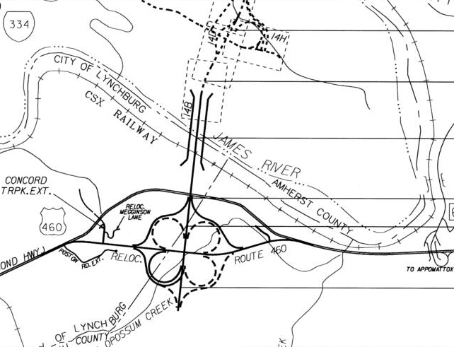
The VDOT 2002 map
shows the Lynchburg / Madison Heights Bypass. The scale is large, but it shows
the planned new US-29 highway and the two connectors (VA-210, VA-130) pretty
accurately. The new US-29 is a 4-lane freeway, with a cloverleaf interchange
with relocated US-460 at the south end, interchanges with the two 4-lane connectors,
and a rebuilt Sweet Briar interchange at the north end with a seamless freeway
movement between the new highway and the existing Amherst Bypass. The then-proposed
roads are shown with dashes.
Click image for larger image. |
I visited the new US-29 Madison Heights Bypass on October 16th, and the weather was beautifully clear. I took dozens of photos. The new 12-mile-long bypass was fully open to traffic, including its two connectors.
The bypass is getting substantial usage, as the following photos show. I rode
it throughout 3 times in each direction, including the now overlapped section
of US-460 where US-29 and US-460 overlap between the south end of the new bypass
and where US-29 Wards Road (a 4-lane divided highway) crosses the US-460 Lynchburg Bypass
(a 4-lane freeway) south of the city.
The newly opened US-29 Madison Heights Bypass actually seemed a bit busier than
the overlapped section of US-29 and US-460. Perhaps that is because the now-Business
US-29 Lynchburg Expressway (a 4-lane freeway) and US-29 through Madison Heights and Monroe, while
now carrying much lighter traffic than before the new bypass opened, still carry
substantial traffic. In other words, there are now two parallel US-29
four-lane highways
through the area, the business route and the bypass route.
There are large overhead directional signs on US-29 northbound, where US-460 Bypass
crosses US-29 Wards Road south of the city, that direct US-29 through-traffic
to the US-460 Bypass eastbound, with Charlottesville as a control city. There
is also an advance notice directional sign on US-29 northbound one mile south
of US-460, for the US-29 through route.
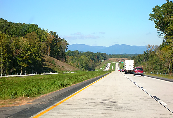
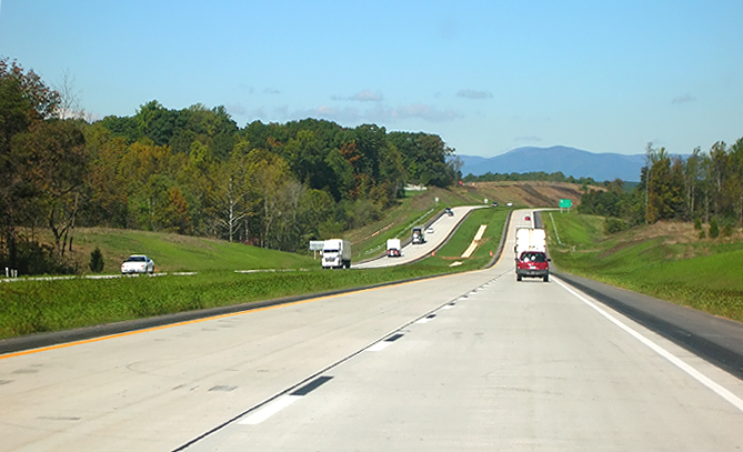
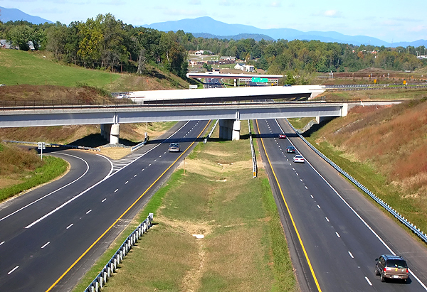
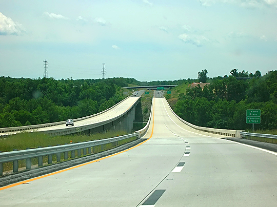
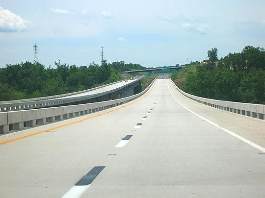
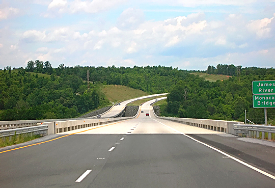
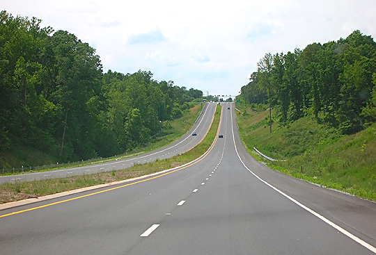
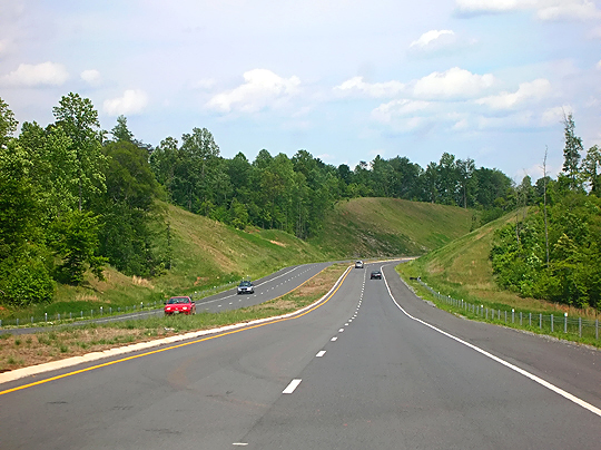
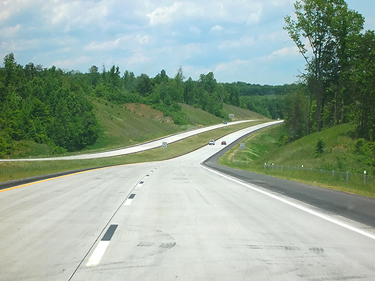
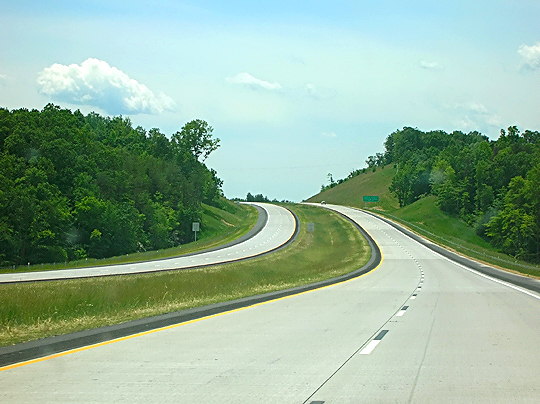
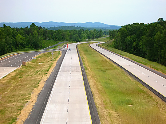
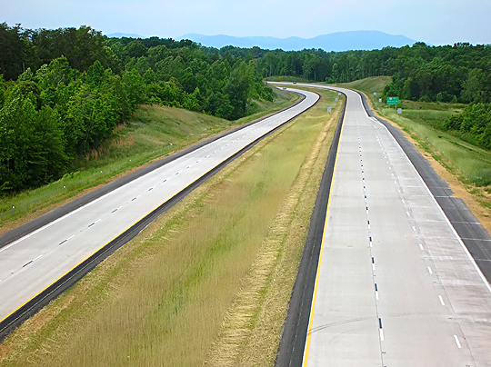
| The following 13 photos are the new US-29 Madison Heights Bypass, in driving sequence, along the 6-mile-long final segment that opened to traffic on October 7, 2005. The photos were taken on October 16, 2005. Click thumbnail for large photo. | |
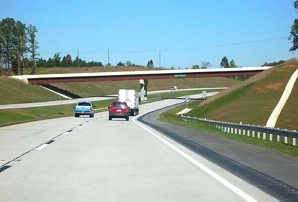 |
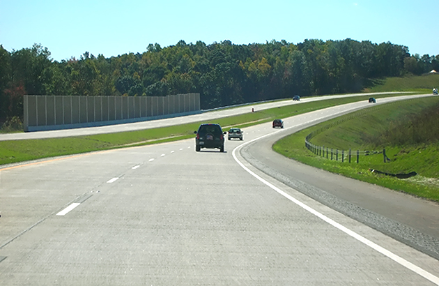
US-29 bypass northbound, 1/4 mile north of VA-130. |
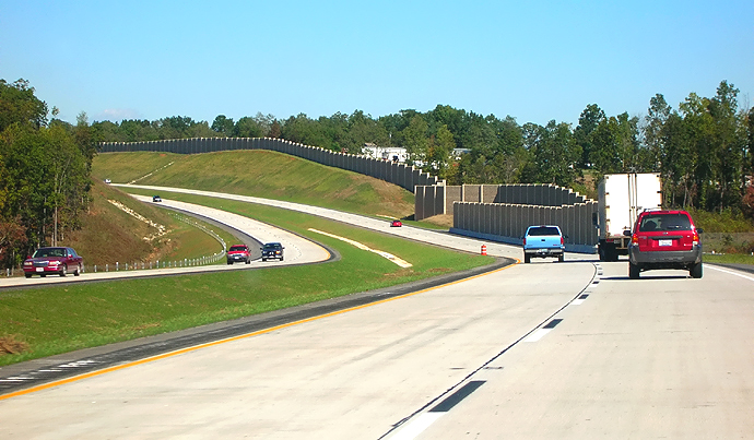 |
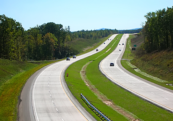
US-29 bypass northbound, notice sound barriers on right. Telephoto lens exaggerates curvature, as highway is signed for 65 mph. |
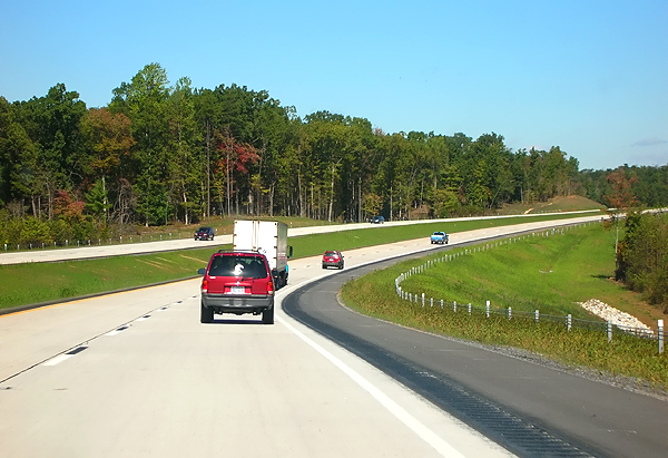 |
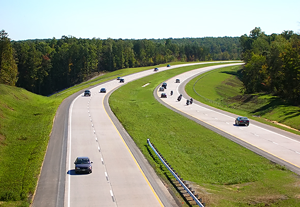
US-29 bypass northbound, in sequence. |
 |
US-29 bypass northbound, in sequence. |
 |
US-29 bypass northbound, in sequence. |
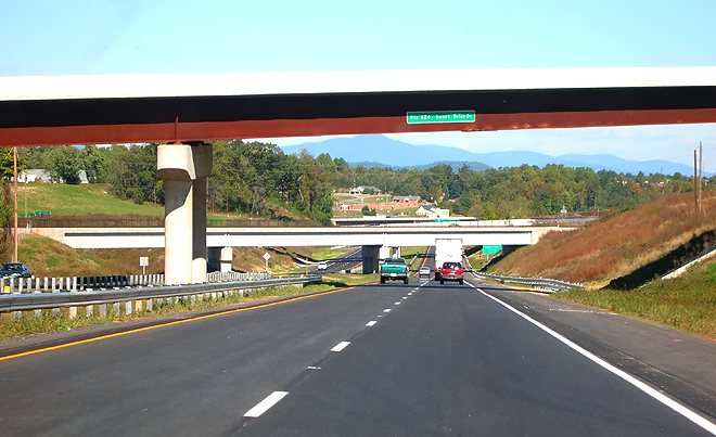 |
US-29 bypass northbound, approaching the Sweet Briar Interchange, at the northern end of the new Madison Heights Bypass, the junction of US-29 Bypass, US-29 Business, and South Main Street in Amherst. The new bypass seamlessly connects into the US-29 Amherst Bypass as one continuous freeway. |
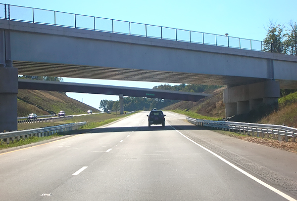 |
US-29 bypass southbound, passing the Sweet Briar Interchange, the bridge in the foreground is the CSXT Railroad. |
 |
US-29 bypass southbound, in sequence. |
 |
US-29 bypass southbound, in sequence. |
 |
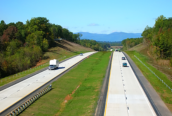
US-29 bypass, looking south from overpass, notice truck weigh station in distance on right. |
 |
US-29 bypass, looking south from overpass. |
 |
US-29 bypass, looking north from overpass. |
 |
US-29 bypass, looking north from overpass, Sweet Briar Interchange ahead, bridges are, first, the railroad, then the Business US-29 bridges. |
Following is information and photos from the
two previous segment openings of the US-29 Lynchburg / Madison Heights Bypass.
On December 21, 2004, the first section of the new US-29 bypass opened, the 2
miles of the US-29 bypass between US-460 and the new VA-210 Connector,
and 2 miles of the new 4-lane VA-210 Connector between the bypass and existing US-29
in Madison Heights, including a new US-29 James River bridge. The VA-210
Connector connects the new US-29 bypass to Madison Heights, and the project
included widening the VA-210 bridge over Business US-29 to four lanes, with
ramp improvements to the pre-existing VA-210/Business US-29 interchange.
The May 25, 2005 opening extended the bypass 3 miles from VA-210 to the VA-130 Connector. The 2-mile-long 4-lane VA-130 Connector was completed in 2004, and it connects the new Business US-29 and VA-130 in Monroe, to the US-29 bypass and to two secondary roads east of the bypass.
The October 6, 2005 opening extended the bypass 7 miles from VA-130 to the
US-29 Amherst Bypass, completing the new bypass.
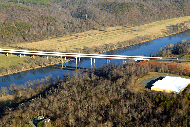
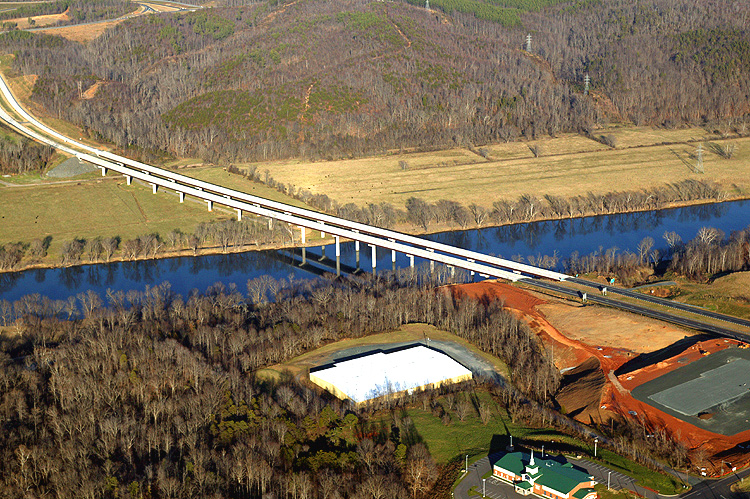
The new James River bridge is comprised of twin 2-lane bridges, the northbound
bridge is 2,391 feet long, and the southbound bridge is 2,299 feet long. The twin
bridges are named the Monacan Bridge, and they are on a interesting sag vertical
curve as they pass high over the river and its flood plains.
| The following 5 photos are the new US-29 Madison Heights Bypass and connectors, along the segment between US-460 and VA-210. The photos were taken on May 29, 2005. Click thumbnail for large photo. | |
 |
US-29 bypass southbound, notice the Monacan Bridge, which passes over the James River. |
 |
US-29 bypass southbound, notice the Monacan Bridge. |
 |
US-29 bypass northbound, notice the Monacan Bridge. |
 |
VA-210 Madison Heights Connector. This connects the new US-29 bypass to Business US-29 and Madison Heights. |
 |
VA-210 Madison Heights Connector. This connects the new US-29 bypass to Business US-29 and Madison Heights. |
| The following 5 photos are the new US-29 Madison Heights Bypass and connectors, along the segment between VA-210 and VA-130. The photos were taken on May 29, 2005. | |
 |
US-29 bypass, north of VA-210 Madison Heights Connector. |
 |
US-29 bypass, north of VA-210 Madison Heights Connector. |
 |
US-29 bypass, looking south from the Route 622 overpass. Notice the truck weigh station under construction. |
 |
US-29 bypass, looking north from the Route 622 overpass. Notice the truck weigh station under construction. |
 |
VA-130 Monroe Connector. This connects the new US-29 bypass to Business US-29, Monroe and the pre-existing VA-130. |
The VA-130 Connector has been named the Amelon Expressway, a name that exactly matches its design. Both the VA-130 and the VA-210 connectors are limited access highways with at-grade intersections. VA-130 is 2.1 miles long between existing US-29 and the new bypass, and the western 0.4 mile is an existing road, Amelon Road, that was upgraded to 4 lanes divided and is nonlimited access; and the remaining 1.7 mile of VA-130 to the new bypass, is limited access.
The following 5 photos were taken by VDOT on December 22, 2004, and are posted here by their permission. Click on the photo to get a large version of the photo. They range from 282 to 343 kilobytes in size. In later versions of Netscape and Internet Explorer, you probably will need to use Full Screen mode (the F11 key can be utilized to swap back and forth between Full Screen and Regular) to see the full size of the large photo without browser-induced image shrinkage.
 |
US-29 bypass, looking north, across US-29/US-460 interchange, with the Monacan Bridge and the VA-210 interchange visible in the distance. |
 |
US-29 bypass, looking northeast, across US-29/US-460 interchange, notice the high-level bridges over a creek and ravine. |
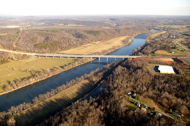 |
US-29 bypass, looking east, notice the Monacan Bridge, which passes over the James River. The new James River bridge is comprised of twin 2-lane bridges, the northbound bridge is 2,391 feet long, and the southbound bridge is 2,299 feet long. The twin bridges are named the Monacan Bridge, and they are on a interesting sag vertical curve as they pass high over the river and its flood plains. |
 |
US-29 bypass, looking east, notice the Monacan Bridge, which passes over the James River. |
 |
US-29
bypass, looking north, notice the Monacan Bridge, which passes over the James
River.
|
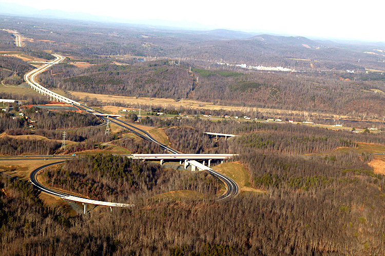
The design plans for the US-29/US-460 interchange show that the ultimate design
is a well-spread-out cloverleaf with 4 loops and 4 outer ramps, all traversable
at 35 mph or more. The mainline for the future bypass extension extends on a line
directly south of US-460. It appears that all of the necessary right-of-way was
acquired for the ultimate design, and the southern limit of the acquired right-of-way
is where the future outer ramps will meet the future US-29 mainline south of US-460.
The presently built US-29/US-460 permanent ramps are --
US-460 westbound to US-29 northbound (outer ramp)
US-29 southbound to US-460 westbound (outer ramp)
US-29 southbound to US-460 eastbound (loop)
There is a temporary semi-directional ramp that utilizes part of the future US-460
eastbound to US-29 southbound outer ramp, and a widened portion of the above loop;
and this temporary semi-directional ramp connects US-460 eastbound to US-29
northbound. A creek runs through that interchange, and there are several interesting
new high-level bridges over the creek ravine.
 |
Excerpt of location map of the VDOT design documents for the project that
includes the US-29/US-460 interchange. The current ramps are solid lines
and the future ramps are dashed lines. Click image for larger image. |
As said before, US-29 and US-460 now overlap on the US-460 segment between US-29 Wards Road south of Lynchburg and the new US-29 bypass east of Lynchburg, and this overlap will exist until the US-29 bypass is in the future extended south of US-460 to US-29 well south of Lynchburg.
VDOT project websites
US 29 Lynchburg / Madison Heights Bypass
Sweet Briar Interchange - Northern interchange of Madison Heights Bypass
Madison Heights Bypass Mainline II
Madison Heights Bypass Mainline I
The Seminole Trail: Lynchburg, Great Virginia Drives: US 29 The Seminole Trail, by Adam Prince, Gribble Nation.
"U.S. 29 - Building the Bypass", Lynchburg News & Advance, October 9, 2004. Long article with interactive map and 29 photos of the project.
"Bypass
opening prompts talk of a new one",
Lynchburg News & Advance,
October 16, 2005. Excerpts (blue text):
A number of folks who live in Amherst
County and work in Lynchburg wondered if they would ever see the Madison Heights
bypass completed. It had only been on the drawing board for some 30 years where
it thrashed around in search of construction money from one six-year plan to the
next.
After all those years and after all those public hearings and pleadings by members
of the Amherst County Board of Supervisors, the bypass is open - all 12 miles
of it. County and state officials snipped the ceremonial ribbon on the final leg
of the roadway earlier this month completing the $272 million project with time
to spare - time to spare, that is, between the state and English Construction
Co. For completing the final 5.5-mile section of the four-lane, divided highway
nearly two months ahead of schedule, the firm will receive an extra $1 million.
Nice bonus, thanks to the taxpayers.
The new highway, which was built essentially to interstate standards with a speed
limit of 65 mph, could pave the way for a boom in economic development in Amherst
County.
The bypass also opens up parts of the county to economic development - and jobs
- that were not available before. That’s particularly true for areas along the
two connectors between the bypass and what’s now referred to as Business 29. One
is the Virginia 210 connector, an exit for Madison Heights proper, and the other
is the Virginia 130 connector north of Madison Heights.
Construction of new roads, nonetheless,
is a job that’s never quite finished. Just after the last barricade had been removed
opening the Madison Heights bypass, highway department officials began talking
about the U.S. 29 Campbell County bypass around Lynchburg. Since the two of them
will eventually tie together, completion of the northern end has raised new questions
about the best route for continuing 29 east of Lynchburg and through Campbell.
Dale Grigg, the construction engineer for the Virginia Department of Transportation’s
Lynchburg District, said that the Madison Heights bypass opening represented the
culmination of the work “of a lot of people over a lot of years.” But in the next
breath, he said, a U.S. 29 bypass south of U.S. 460 still needs to be built. “There
are plenty of challenges ahead.”
Not the least of those challenges is finding the money. A political challenge
lies ahead in determining the route of the bypass that will ultimately extend
from the Madison Heights bypass either onto the existing U.S. 460 or to a new
easterly route through Campbell County that would parallel U.S. 501 and run just
west of Rustburg. One of those routes would tie back into the existing 29 near
Yellow Branch, while two other would stretch a little farther south before connecting
back into 29.
The article said that VDOT studied 3 alternatives for the future southern
extension of the US-29 Lynchburg / Madison Heights Bypass. A full Location and Environmental Impact Statement study
will need to be conducted before a location can be selected. The US-29 Rustburg
route would be an outer bypass far from Lynchburg, and the US-29 bypass
route proposed by Lynchburg officials would be a closer-in bypass that would follow
a section of the existing US-460 Lynchburg Bypass (a 4-lane freeway), and west of the existing US-29
Wards Road, would then branch on new location to the south to where it would bypass
US-29 to the south.
The US-29 bypass route proposed by Lynchburg officials would most likely require
six-lane widening of the section of the US-460 Bypass that it would overlap, plus
a freeway upgrade or a freeway bypass of the 1-mile section of nonlimited-access
US-460 that is between the east end of the US-460 Lynchburg Bypass and the US-460
interchange of the new US-29 Madison Heights Bypass.
A closer-in eastern alternative US-29 Lynchburg Southern Bypass that does not
overlap any portion of US-460, might be more optimum. That would extend the US-29
bypass directly south from where it now ends at US-460, cross US-501 about halfway between
Rustburg and US-460, and then seamlessly merge into US-29 about two miles south
of the VA-24 junction. I have checked the corridor on VDOT's GIS system, and the
terrain along the route is rolling to gently rolling, with no major obstacles,
and with very little development.
Given the increasing urban development along US-29 Wards Road to the south
of US-460, the completion of the US-29 bypass to the south will provide the
necessary high-speed freeway bypass of the entire Lynchburg metropolitan area,
for the US-29 corridor which is a 4-lane divided rural principal arterial
highway between I-40 at Greensboro N.C. and I-66 at Gainesville, Virginia.
Copyright © 2006 by Scott Kozel. All rights reserved. Reproduction, reuse, or
distribution without permission is prohibited.
All photos by Scott Kozel unless otherwise noted.