
| Route VA-288 Construction - August 2004 |
Here are 44 photos of Virginia Route 288 under construction, taken in August, 2004. Click the thumbnail photo for a larger photo (they range in size from 83 to 253 kilobytes, with most being less than 140 kilobytes).
Route 288 is named the World War II Veterans Memorial Highway, along its entire length between I-95 in Chesterfield County and I-64 in Goochland County, and the twin-span 3,642-foot-long Route 288 James River bridge is named the World War II Veterans Memorial Bridge.
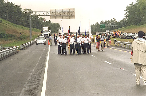
I attended the August 13, 2004 renaming ceremony, which was held on a platform
about 100 feet north of the north end of the southbound Route 288 James River
bridge. Access was via the VA-711 Huguenot Springs Road interchange
about a mile south of the river, where vehicles entered the highway
northbound, crossed the James River bridge, and were directed to angle parking
on the highway just north of the river.
The following 11 photos were taken of the opening ceremony.
 |
The color guard for the World War II veterans, preparing for the dedication ceremony on August 13, 2004, where the highway and James River Bridge were named for the World War II Veterans. |
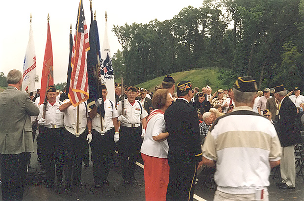 |
The color guard for the World War II veterans, preparing for the dedication ceremony. |
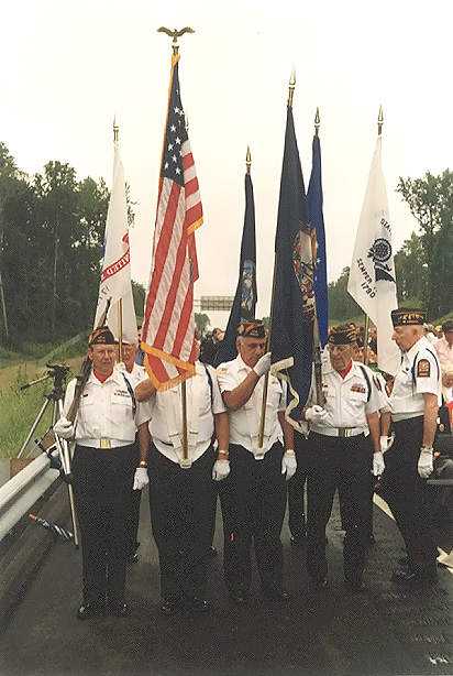 |
The color guard for the World War II veterans, preparing for the dedication ceremony. |
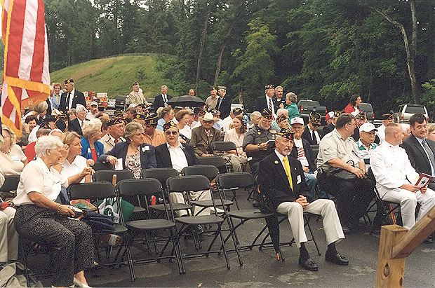 |
The audience had many veterans, relatives and other attendees. |
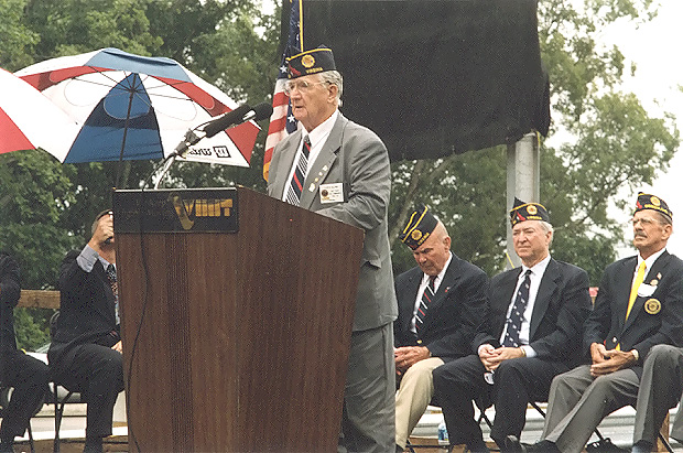 |
Floyd B. Callihan speaking, he is a World War II veteran from Goochland County, and he was the first to suggest naming Route 288 for the WWII veterans. He is the former State Vice Commander of the American Legion. |
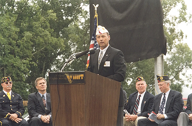 |
William R. (Bill) Janis speaking, member of the House of Delegates of the General Assembly of Virginia, 56th District (includes Counties of Goochland, part of Henrico, and Louisa). |
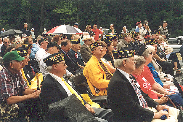 |
The audience had many veterans, relatives and other attendees. |
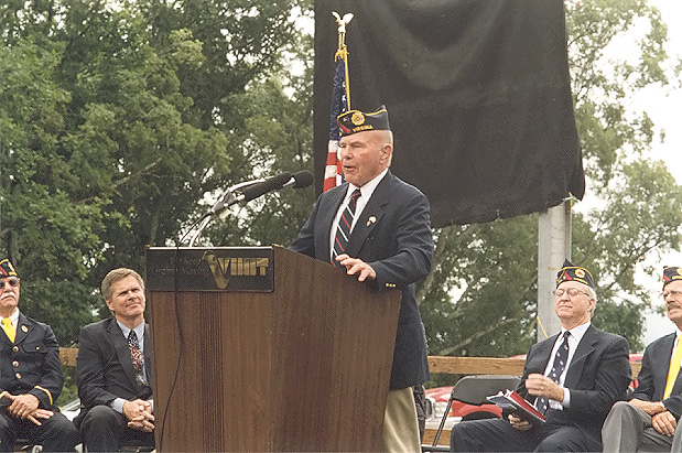 |
Frank D. Hargrove, Sr. speaking, member of the House of Delegates of the General Assembly of Virginia, 55th District (includes part of County of Hanover). |
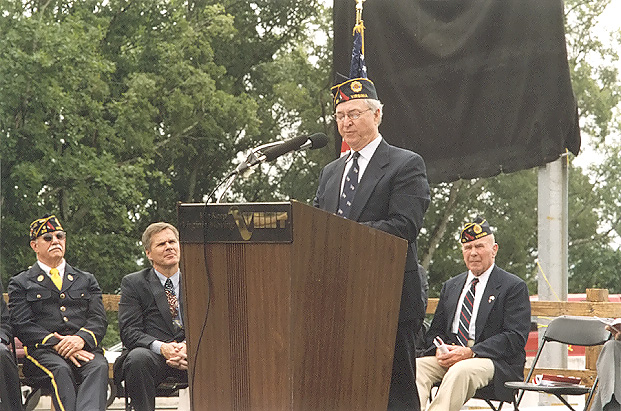 |
Walter A. Stosch speaking, member of the Senate of the General Assembly of Virginia, Majority Leader of Senate, 12th District (includes part of Goochland County; part of Henrico County, part of Richmond City). |
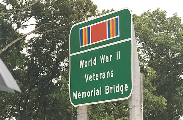 |
A large highway sign was unveiled at the end of the bridge, and it has the WWII campaign ribbon, and the name World War II Veterans Memorial Bridge. The south end of the bridge will have one also. |
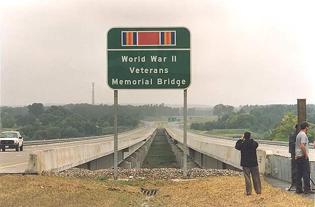 |
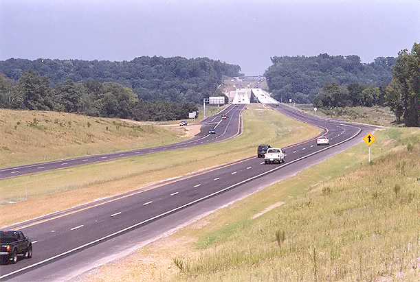
The sign was unveiled a few minutes before I took this photo, The twin-span 3,642-foot-long Route 288 James River bridges are visible, and in the far distance the VA-711 Huguenot Trail overpass and interchange is visible. |
The following 5 photos are of the twin-span 3,642-foot-long Route 288 James River bridges, taken at the renaming ceremony.
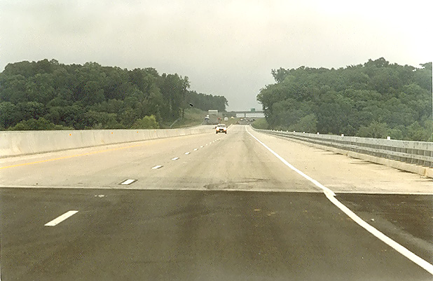 |
Route 288 northbound, approaching the south end of the James River bridge. |
 |
Route 288 northbound, about midpoint on the James River bridge. |
 |
Route 288 southbound, the James River bridge. The end of the bridge is visible at the bottom of the photo. The platform for the dedication ceremony is about 50 feet behind me. |
 |
Route 288 southbound, the James River bridge. This photo was taken from the same vantage point as the previous photo, but it was taken with a 135mm (2.7x) telephoto lens, instead of the 50mm (1.0x) regular lens used previously. |
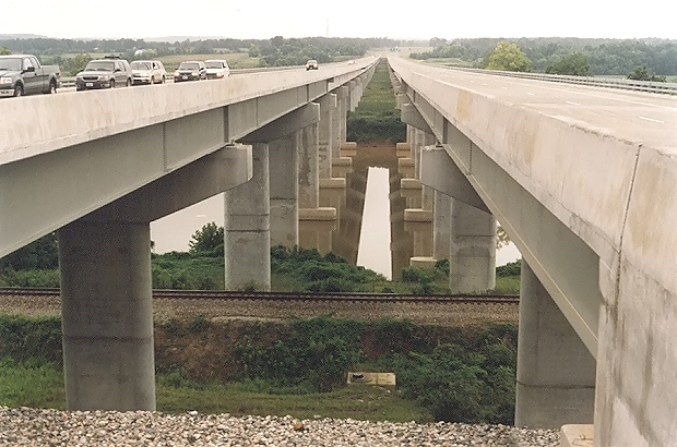 |
The 3,642-foot-long VA-288 James River Bridge. I am standing near the abutments, between the two bridges. The CSXT Railroad line is visible in the foreground, and the James River is just beyond that. |
The following photo was taken from Genito Road in Chesterfield County.
 |
From the Genito Road overpass looking north onto Route 288. Route 288 ended here until the current project extended it in November 2002 to Lucks Lane. The project to extend Route 288 northward provided a new full cloverleaf interchange with northbound and southbound Route 288 collector-distributor roadways along with three new bridges over VA-76. Route 288 was widened with a third lane each way from south of Genito Road to north of VA-76. |
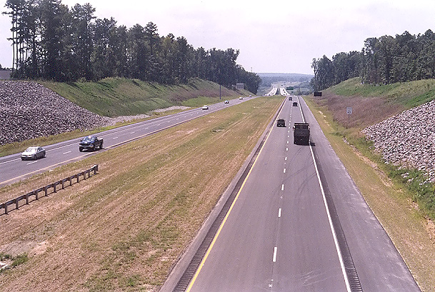
The following 6 photos were taken from US-60 Midlothian Turnpike in Chesterfield County, in mid-August.
 |
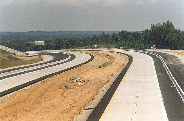
Looking south from the overpass where US-60 Midlothian Turnpike crosses Route 288. Paving operations are nearly complete on this section of Route 288, with continuously reinforced concrete pavement on the two 2-lane mainline roadways, asphalt on the shoulders, and asphalt on the collector-distributor (C-D) roadways. At this interchange area, Route 288 will have two mainline 2-lane roadways and two collector-distributor roadways, and the interchange will be a full cloverleaf design, with all the Route 288 ramp terminals interfacing with the C-D roadways. |
 |
Looking south from the overpass where US-60 Midlothian Turnpike crosses Route 288. The Route 288 overpasses over the Norfolk-Southern Railway are visible in the distance. This photo was taken from the same vantage point as the previous photo, but it was taken with a 135mm (2.7x) telephoto lens, instead of the 50mm (1.0x) regular lens used previously. |
 |
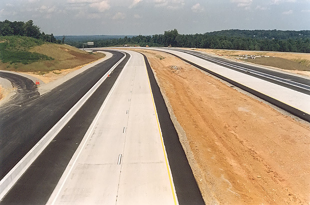
Looking north from the overpass where US-60 Midlothian Turnpike crosses Route 288. This photo was taken a few minutes after the previous photo, but looking in the opposite direction. |
 |
Looking north from the overpass where US-60 Midlothian Turnpike crosses Route 288. This photo was taken from the same vantage point as the previous photo, but it was taken with a 135mm (2.7x) telephoto lens, instead of the 50mm (1.0x) regular lens used previously. |
 |
Looking north from the overpass where US-60 Midlothian Turnpike crosses Route 288. This photo was taken a few minutes after the previous photo, but standing over the southbound Route 288 roadway. |
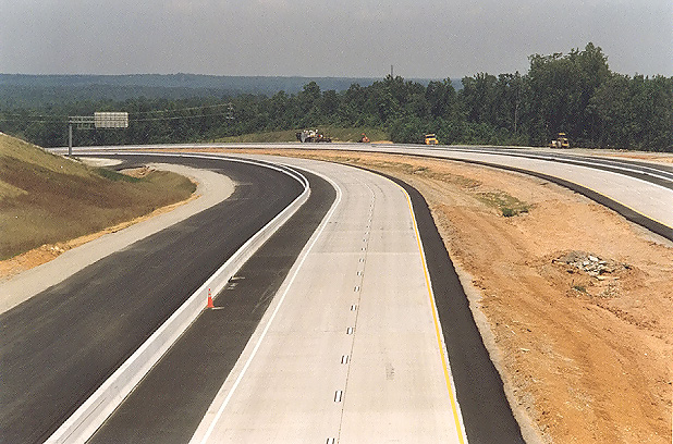 |
Looking north from the overpass where US-60 Midlothian Turnpike crosses Route 288. This photo was taken from the same vantage point as the previous photo, but it was taken with a 135mm (2.7x) telephoto lens, instead of the 50mm (1.0x) regular lens used previously. |
The following 21 photos were taken on August 28th, a day after the August 27th opening of the 6.7-mile-long segment of Route 288 between US-60 Midlothian Turnpike and VA-6 Patterson Avenue.
The following 2 photos were taken from VA-711 Huguenot Trail in Powhatan County.
 |
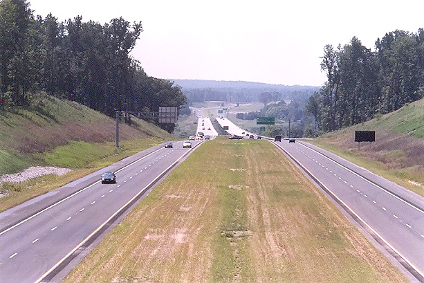
Looking north from VA-711 Huguenot Trail, at the completed Route 288. The completed twin 3,642-foot-long bridges over the James River are visible in the distance, along with the large earthwork cut just north of the river, and the VA-650 River Road overpass is visible at the very limit of visibility. VA-711 Huguenot Trail has a diamond interchange with VA-288. South of the river (this side) is in Powhatan County, and north of the river is in Goochland County. |
 |
Looking north from VA-711 Huguenot Trail. This photo was taken from the same vantage point as the previous photo, but it was taken with a 135mm (2.7x) telephoto lens, instead of the 50mm (1.0x) regular lens used previously. |
The following 6 photos were taken from VA-650 River Road in Goochland County.
 |
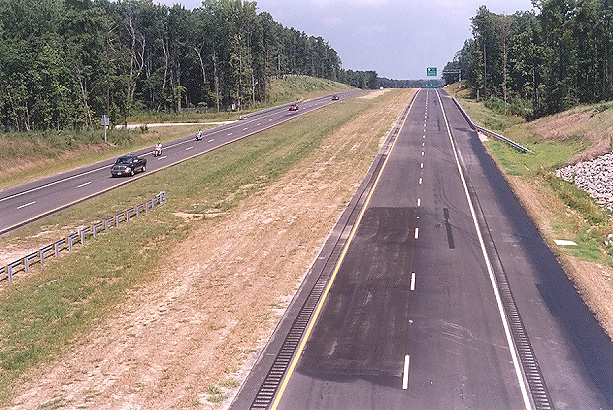
Looking south from the VA-650 River Road overpass, at the completed Route 288, photo of the large earthwork cut just north of the VA-288 James River Bridge, with the completed river bridges visible in the distance. This side of the river is in Goochland County, the other side of the river is in Powhatan County. |
 |
Looking south from the VA-650 River Road overpass. This photo was taken from the same vantage point as the previous photo, but it was taken with a 135mm (2.7x) telephoto lens, instead of the 50mm (1.0x) regular lens used previously. The completed twin 3,642-foot-long bridges over the James River are visible in the distance, and the VA-711 Huguenot Springs Road overpass is visible at the very limit of visibility. |
 |
Looking south from the VA-650 River Road overpass. This photo was taken from a similar vantage point and lens as the previous photo, but from about 50 feet to the left. |
 |
Looking south from the VA-650 River Road overpass. This photo was taken from the same vantage point as the previous photo, but it was taken with a 135mm (2.7x) telephoto lens, instead of the 50mm (1.0x) regular lens used previously. |
 |
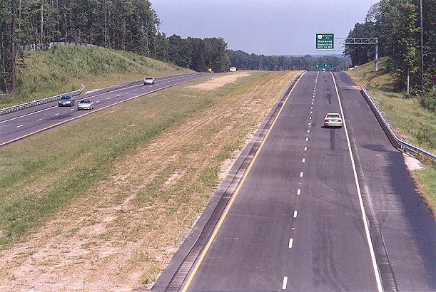
Looking north from the VA-650 River Road overpass, at the completed Route 288. This is in Goochland County. |
 |
Looking north from the VA-650 River Road overpass. This photo was taken from the same vantage point as the previous photo, but it was taken with a 135mm (2.7x) telephoto lens, instead of the 50mm (1.0x) regular lens used previously. |
The western 17.5-mile-long section of Route 288 will have continuously reinforced concrete pavement on the 6.5-mile-long southern portion, and asphalt pavement on the 11.0-mile-long northern portion, with the pavement type change point being about 50 feet north of the county line between Chesterfield County and Powhatan County.
The following 2 photos were taken from US-60 Midlothian Turnpike in Chesterfield County.
 |
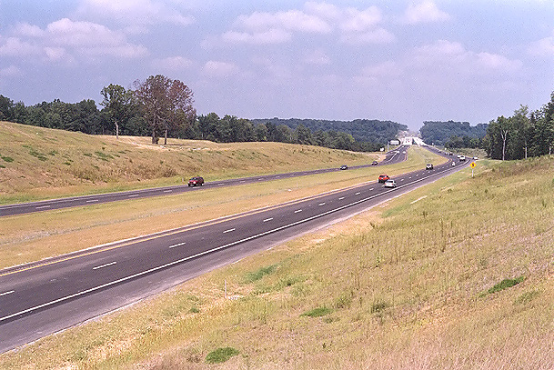
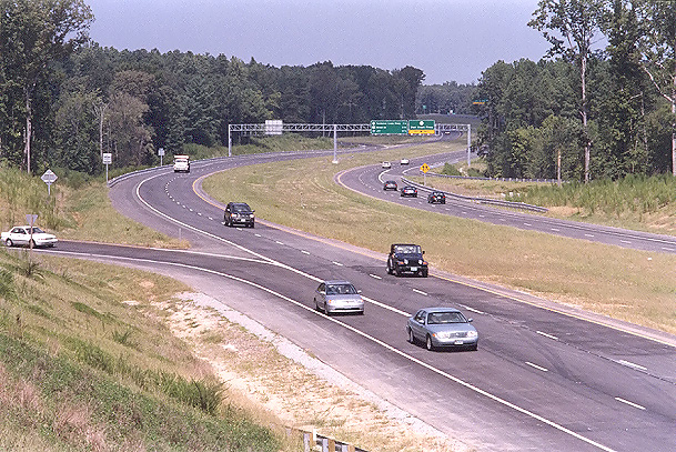
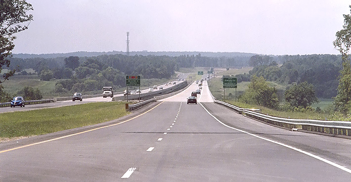
Looking north from the overpass where US-60 Midlothian Turnpike crosses Route 288. The mainline Route 288 roadways at US-60 are not yet open, and the Route 288 traffic to and from US-60 utilizes collector-distributor (C-D) roadways which accesses the ramps to US-60. |
 |
Looking north from the overpass where US-60 Midlothian Turnpike crosses Route 288. This photo was taken looking over the southbound roadway. Route 288 currently ends at US-60, and the Route 288 segment between US-60 and Lucks Lane is planned to open in late November 2004, completing the last section of Route 288. |
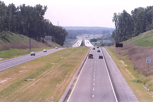
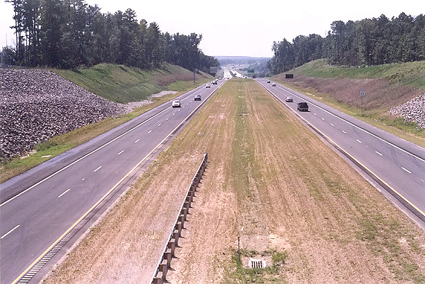
The following 3 photos were taken from VA-6 Patterson Avenue in Goochland County.
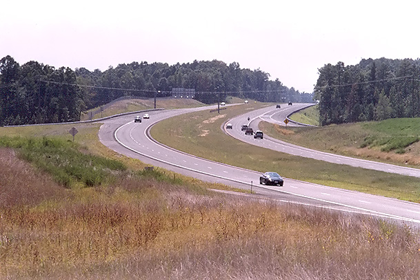 |
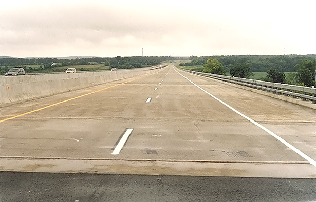
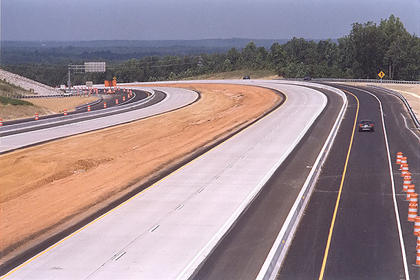
Looking south, from VA-6 Patterson Avenue, at Route 288. This photo was taken with a 135mm (2.7x) telephoto lens, which accentuates the curve on the highway, which is designed for 70 mph. The current Route 288 speed limit is 65 mph. |
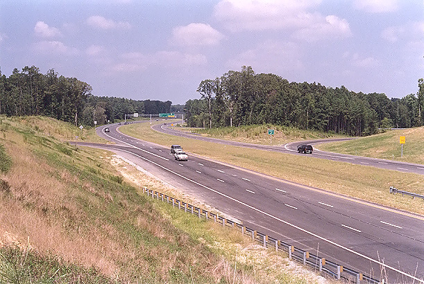 |
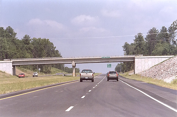
Looking north, from VA-6 Patterson Avenue, at Route 288, which was opened to traffic from VA-6 northward on May 1, 2004. |
 |
Looking north, from VA-6 Patterson Avenue, at Route 288. This photo was taken from the same vantage point as the previous photo, but it was taken with a 135mm (2.7x) telephoto lens, instead of the 50mm (1.0x) regular lens used previously. |
The following 8 photos were taken from an August 28th drive of the new section that opened to traffic on August 27th.
 |
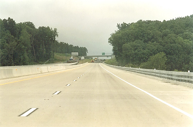
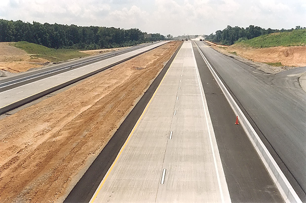
Route 288 northbound, a mile north of US-60 Midlothian Turnpike. Notice the continuously reinforced concrete pavement. The right lane is still closed, as shoulder and guardrail construction is still underway on the northbound roadway for 2 miles north of US-60 Midlothian Turnpike. |
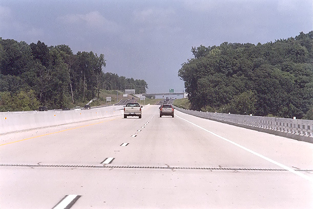 |
Route 288 northbound, about midpoint on the 3,642-foot-long James River bridge. |
 |
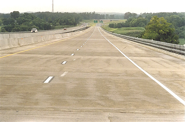
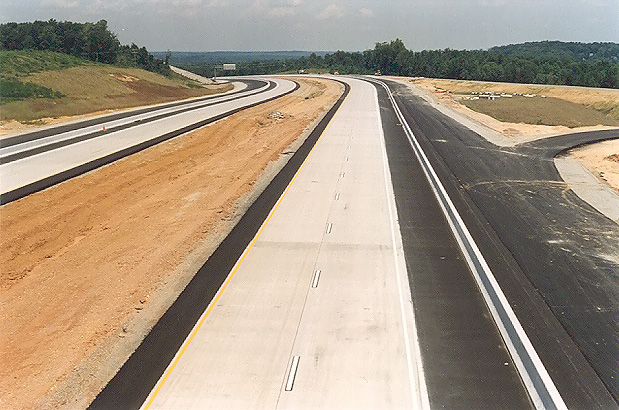
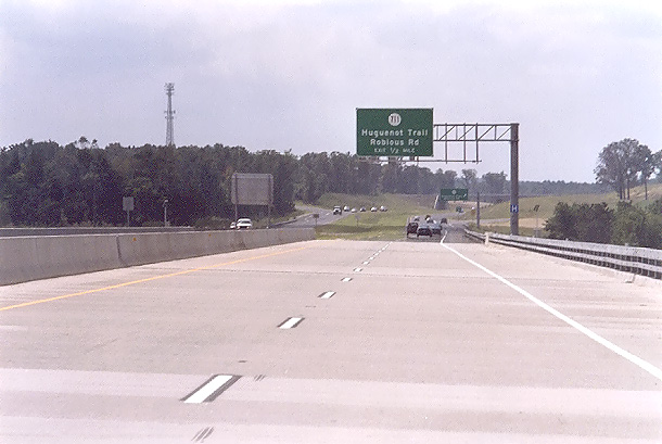
Route 288 northbound, about 1/4 mile north of the James River bridge, approaching the VA-650 River Road overpass. |
 |
Route 288 southbound, approaching the James River bridge. |
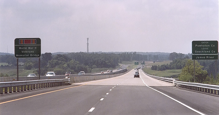 |
Route 288 southbound, approaching the James River bridge. The highway sign on the left has the WWII veterans campaign ribbon, and the name World War II Veterans Memorial Bridge. |
 |
Route 288 southbound, on the 3,642-foot-long James River bridge, approaching the south end of the bridge, and the VA-711 Huguenot Springs Road overpass and interchange is ahead. |
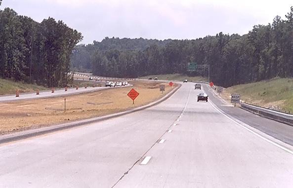 |
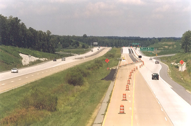
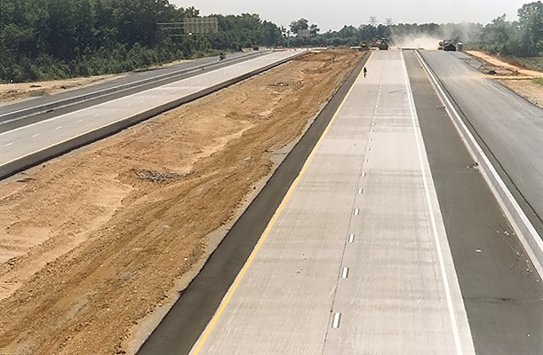
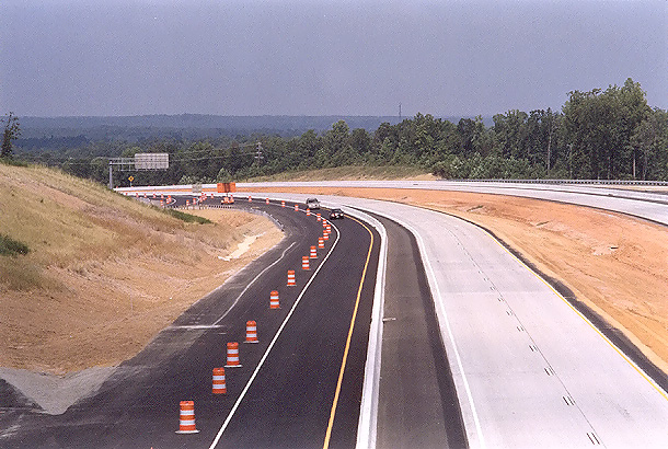
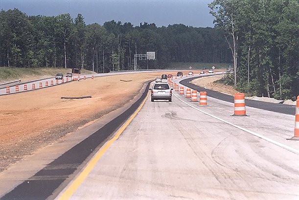
Route 288 southbound, 2 miles north of US-60 Midlothian Turnpike. Notice the continuously reinforced concrete pavement. |
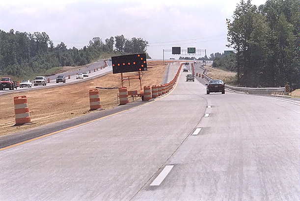 |
Route 288 southbound, one mile north of US-60 Midlothian Turnpike. The line of barrels on the left is set to close the left lane and to channel all Route 288 southbound traffic off of the mainline roadway onto the collector-distributor (C-D) roadway which accesses the ramps to US-60. Route 288 currently ends at US-60, and the Route 288 segment between US-60 and Lucks Lane is planned to open in late November 2004, completing the last section of Route 288. |
Lead article for
Route VA-288 Construction - Western SectionAll photos taken by Scott Kozel.
Copyright © 2004 by Scott Kozel. All rights reserved. Reproduction, reuse, or distribution without permission is prohibited.
By Scott M. Kozel, Roads to the Future
(Created 11-1-2004)