
| Route VA-288 Construction - December 2004 |
Here are 43 photos of Virginia Route 288, taken in December, 2004. Click the thumbnail photo for a larger photo (they range in size from 87 to 207 kilobytes, with most being less than 128 kilobytes).
On November 19, 2004, the last remaining unopened section of Route 288 mainline opened to traffic, the 3.7 miles of Route 288 between Lucks Lane and US-60 Midlothian Turnpike in Chesterfield County, and this included the opening to traffic of the two northerly-access ramps at Lucks Lane, the two southerly-access ramps at US-60, the two southerly-access loops at US-60, the remaining sections of the Route 288 collector-distributor (C-D) outer roadways at the Lucks Lane and US-60 interchanges, north of Lucks Lane and south of US-60; and a total length of 6.1 miles of Route 288 mainline (inner) roadways opened to traffic that day, given that the main Route 288 traffic previously was shifted off of the Route 288 mainline 0.6 mile south of Route VA-76 Powhite Parkway and was temporarily using the Route 288 C-D roadways between there and Lucks Lane, and given that the main Route 288 traffic previously was shifted off of the Route 288 mainline 0.9 mile north of US-60 and was temporarily using the Route 288 C-D roadways between there and US-60. Subsequent to this opening, all of the mainline of Route 288 is open to traffic, along with all the ramps, loops and C-D roadways at the interchanges of Powhite Parkway, Lucks Lane and US-60, being now open to traffic. The only portion of the Western Route 288 project not open to traffic on November 19, 2004, was the Woolridge Road interchange and the 0.9-mile 4-lane Woolridge Road extension, and that opened to traffic on January 13, 2005, marking the completion of major construction on the 17.5-mile Western Route 288 project.The following 4 photos were taken from Lucks Lane in Chesterfield County. The Route 288 mainline (inner) roadways here opened on November 19, 2004, along with the 3.7 miles of Route 288 between Lucks Lane and US-60 Midlothian Turnpike in Chesterfield County.
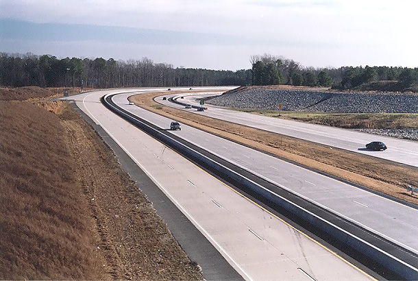 |
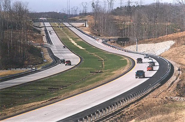
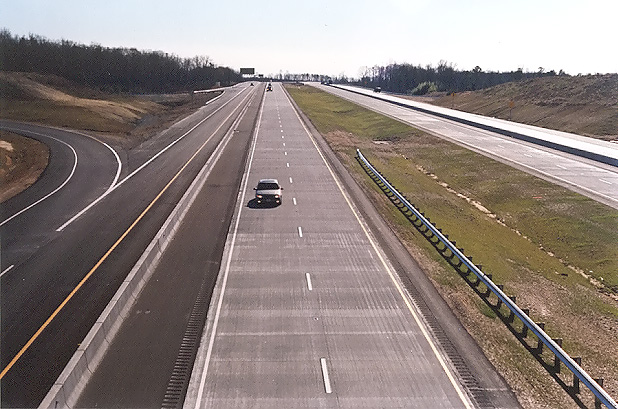
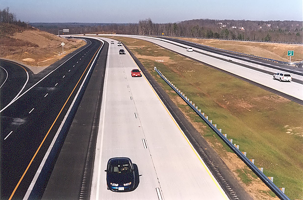
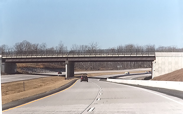
Route 288, open to traffic, looking south from Lucks Lane. Route 288 in the Lucks Lane / VA-76 Powhite Parkway interchange area has 2-lane mainline (inner) roadways and 2-lane collector-distributor (C-D) outer roadways. These C-D roadways are almost 2 miles long, and are built to full freeway standards, and each have one exit from and one entrance back to the mainline roadway,and intercept all the ramp movements for the Lucks Lane and Route 76 interchanges, so Route 288 in this area is an 8-lane freeway on a 2x2x2x2 lane configuration. |
 |
Route 288, open to traffic, looking south from Lucks Lane. This photo was taken from the same vantage point as the previous photo, but it was taken with a 135mm (2.7x) telephoto lens, instead of the 50mm (1.0x) regular lens used previously. The telephoto lens exaggerates the amount of horizontal curvature on the highway, as the curve is safe at 65 mph, and the speed limit is 65 mph. The center depressed median is 15 meters (49.2 feet) wide, between the two mainline roadways. |
 |
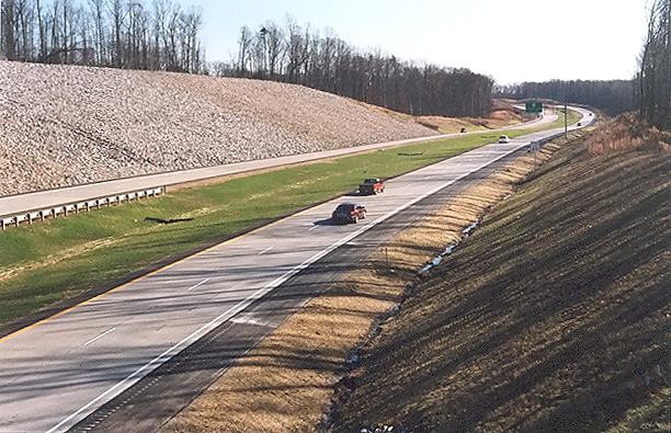
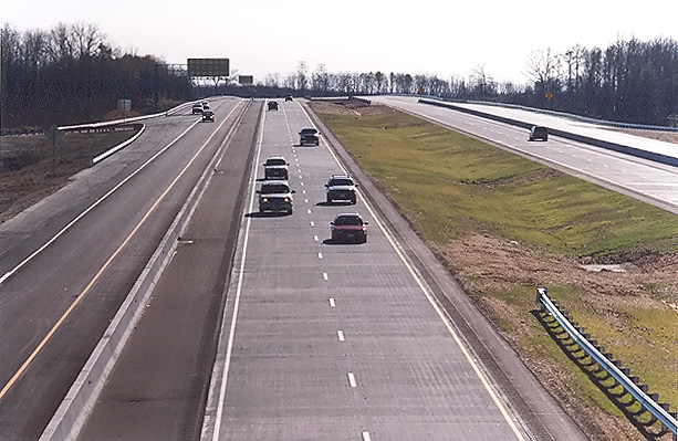
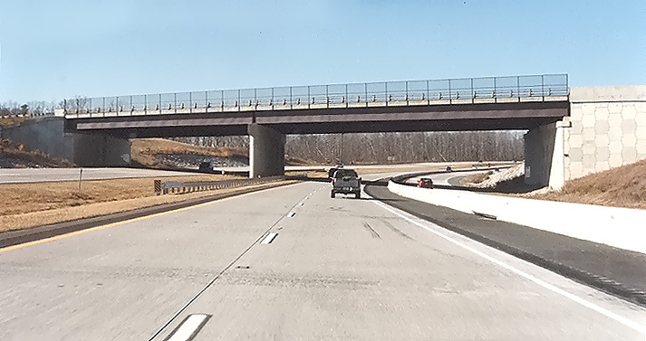
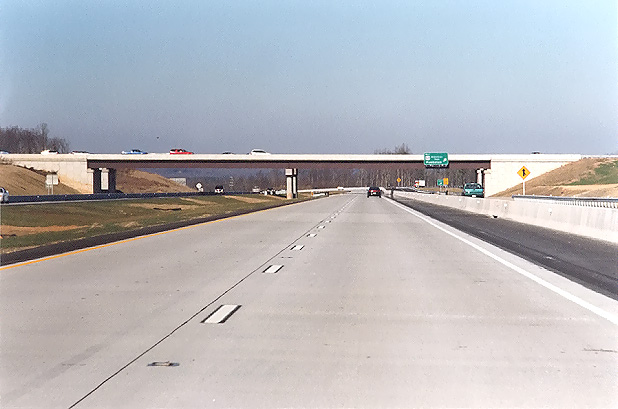
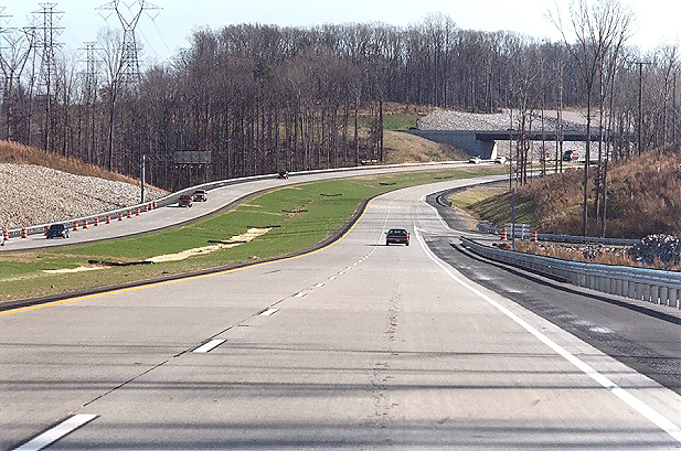
Route 288, open to traffic, looking north from Lucks Lane. |
 |
Route 288, open to traffic, looking north from Lucks Lane. This photo was taken from the same vantage point as the previous photo, but it was taken with a 135mm (2.7x) telephoto lens, instead of the 50mm (1.0x) regular lens used previously. The telephoto lens exaggerates the amount of horizontal curvature on the highway, as the curve is safe at 65 mph, and the speed limit is 65 mph. |
The following 4 photos were taken from Genito Road in Chesterfield County.
 |
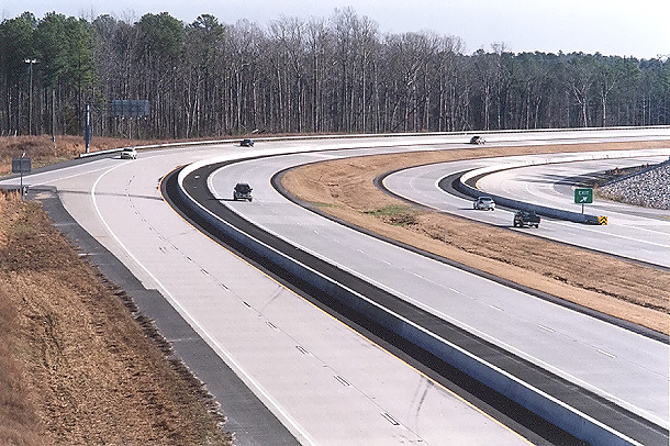
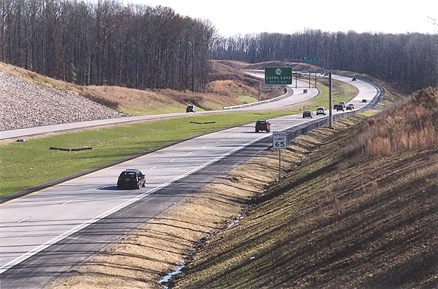
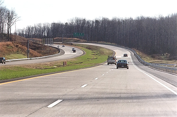
Route 288, open to traffic, looking north from the Genito Road overpass. Route 288 ended ahead at VA-76 Powhite Parkway until the current project extended it in November 2002 to Lucks Lane. The project to extend Route 288 northward provided a new Route 76 full cloverleaf interchange with northbound and southbound Route 288 2-lane collector-distributor (C-D) roadways along with three new bridges over Route 76. |
 |
Route 288, open to traffic, looking north from the Genito Road overpass, a few minutes after the previous photo and from about 50 feet to the left. The light-colored concrete pavement is the new pavement, the darker brown concrete pavement was placed in 1988 when Route 288 ended ahead (at the limit of pavement visibility) at Powhite Parkway. |
 |
Route 288, open to traffic, looking north from the Genito Road overpass, a few minutes after the previous photo and from about 50 feet to the left. Traffic began using the Route 288 C-D roadways to Lucks Lane in November 2002. These C-D roadways are almost 2 miles long, and are built to full freeway standards, so Route 288 in this area is an 8-lane freeway on a 2x2x2x2 lane configuration. |
 |
Route 288, open to traffic, looking north from the Genito Road overpass, a few minutes after the previous photo and from about 50 feet to the left. The Route 288 mainline (inner) roadways here opened on November 19, 2004, along with the 3.7 miles of Route 288 between Lucks Lane and US-60 Midlothian Turnpike in Chesterfield County. |
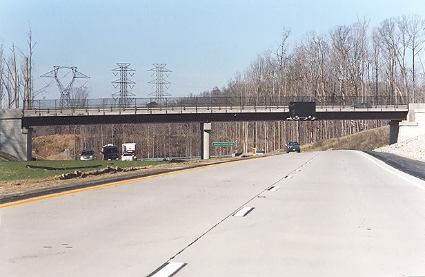
The following 7 photos were taken from Charter Colony Parkway in Chesterfield County.
 |
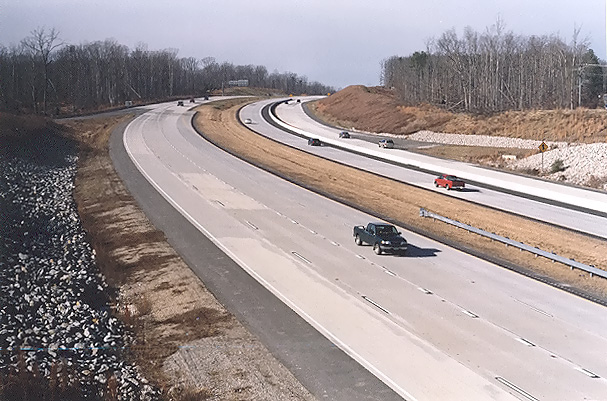
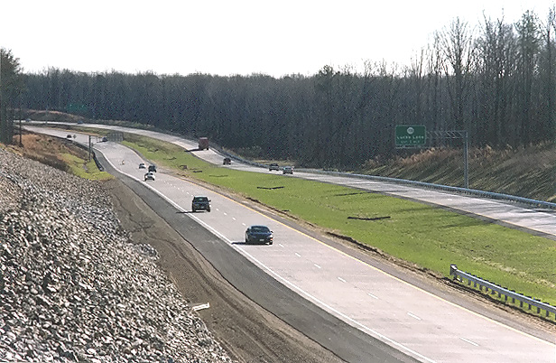
Route 288, open to traffic, looking south from the Charter Colony Parkway overpass over Route 288. The mainline roadways are comprised of continuously reinforced concrete pavement, placed in a 10-inch-deep concrete slab. I have details of the concrete pavement design on my webpage Route VA-288 Construction - October 2003. |
 |
Route 288, open to traffic, looking south from the Charter Colony Parkway overpass over Route 288. This photo was taken from the same vantage point as the previous photo, but it was taken with a 135mm (2.7x) telephoto lens, instead of the 50mm (1.0x) regular lens used previously. |
 |
Route
288, open to traffic, looking south from the Charter Colony Parkway overpass
over Route 288. This vantage point is from the opposite side of Route 288
as the previous two photos.
A high fence on this side of the overpass prevented taking photos directly over the highway. |
 |
Route 288, open to traffic, looking south from the Charter Colony Parkway overpass over Route 288. This photo was taken from the same vantage point as the previous photo, but it was taken with a 135mm (2.7x) telephoto lens, instead of the 50mm (1.0x) regular lens used previously. |
 |
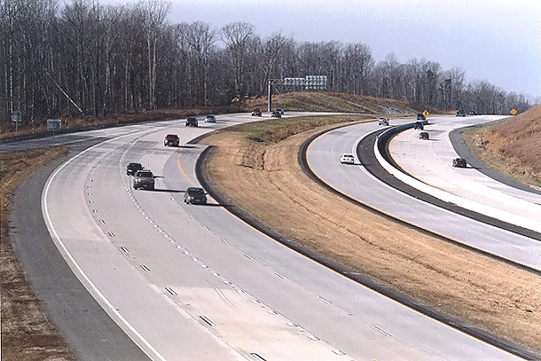
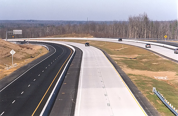
Route 288, open to traffic, looking north from where Charter Colony Parkway crosses Route 288. |
 |
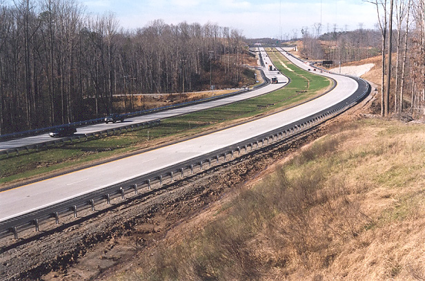
Route 288, open to traffic, looking north from where Charter Colony Parkway crosses Route 288. This photo was taken from the same vantage point as the previous photo, but it was taken with a 135mm (2.7x) telephoto lens, instead of the 50mm (1.0x) regular lens used previously. The interchange and overpass for Woolridge Road is visible in the distance. |
 |
Route 288, open to traffic, looking north from the Charter Colony Parkway overpass over Route 288. |
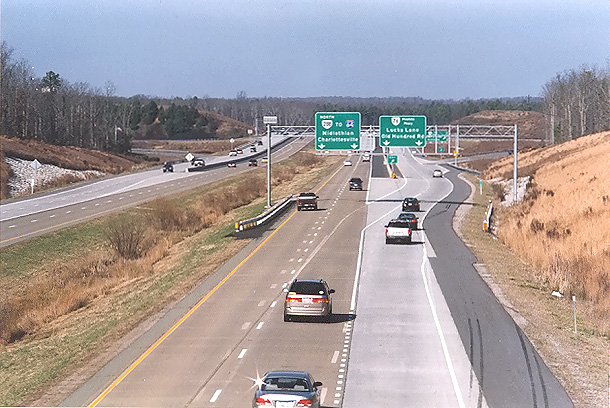
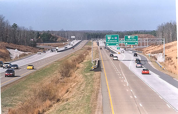
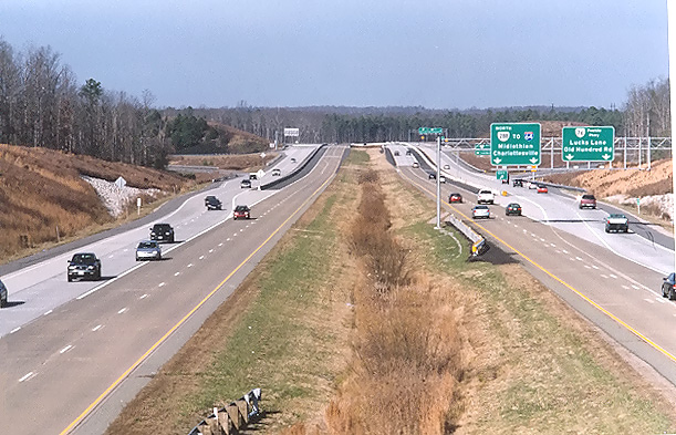
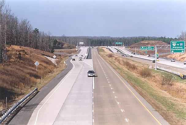
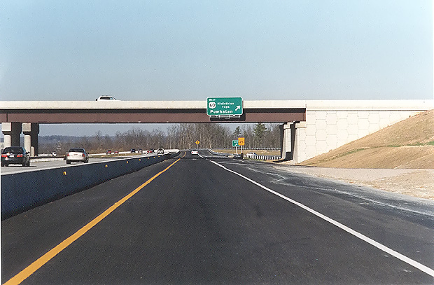
The following 8 photos were taken from the US-60 Midlothian Turnpike overpass over Route 288 in Chesterfield County, in mid-December. The Route 288 concrete mainline (inner) roadways here opened on November 19, 2004, along with the 3.7 miles of Route 288 between Lucks Lane and US-60 Midlothian Turnpike in Chesterfield County, the final section of Route 288 to open. All US-60 ramps and collector-distributor (C-D) roadways are now open to traffic.
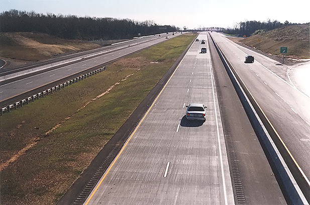 |
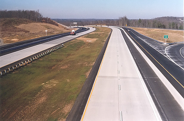
Route 288, open to traffic, looking south from the overpass where US-60 Midlothian Turnpike crosses Route 288. The mainline roadways are comprised of continuously reinforced concrete pavement. At this interchange area, Route 288 has two mainline 2-lane roadways and two asphalt collector-distributor (C-D) roadways, and each C-D roadway has one exit from and one entrance back to the mainline roadway, and the interchange is a full cloverleaf design, with all the Route 288 ramps and loops interfacing with the C-D roadways. |
 |
Route 288, open to traffic, looking south from the overpass where US-60 Midlothian Turnpike crosses Route 288. The Route 288 overpasses over the Norfolk-Southern Railway are visible in the distance. This photo was taken from the same vantage point as the previous photo, but it was taken with a 135mm (2.7x) telephoto lens, instead of the 50mm (1.0x) regular lens used previously. |
 |
Route 288, open to traffic, looking south from the overpass where US-60 Midlothian Turnpike crosses Route 288. This photo was taken a few minutes after the previous photo, but standing over the northbound Route 288 roadway. |
 |
Route 288, open to traffic, looking south from the overpass where US-60 Midlothian Turnpike crosses Route 288. This photo was taken from the same vantage point as the previous photo, but it was taken with a 135mm (2.7x) telephoto lens, instead of the 50mm (1.0x) regular lens used previously. |
 |
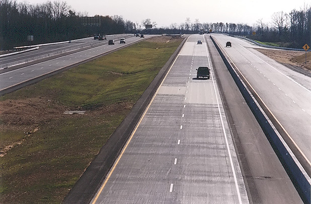
Route 288, open to traffic, looking north from the overpass where US-60 Midlothian Turnpike crosses Route 288. This photo was taken a few minutes after the previous photo, but looking in the opposite direction. The mainline roadways are comprised of continuously reinforced concrete pavement. At this interchange area, Route 288 has two mainline 2-lane roadways and two asphalt collector-distributor (C-D) roadways, and each C-D roadway has one exit from and one entrance back to the mainline roadway, and the interchange is a full cloverleaf design, with all the Route 288 ramps and loops interfacing with the C-D roadways. |
 |
Route 288, open to traffic, looking north from the overpass where US-60 Midlothian Turnpike crosses Route 288. This photo was taken from the same vantage point as the previous photo, but it was taken with a 135mm (2.7x) telephoto lens, instead of the 50mm (1.0x) regular lens used previously. |
 |
Route 288, open to traffic, looking north from the overpass where US-60 Midlothian Turnpike crosses Route 288. This photo was taken a few minutes after the previous photo, but standing over the southbound Route 288 roadway. |
 |
Route 288, open to traffic, looking north from the overpass where US-60 Midlothian Turnpike crosses Route 288. This photo was taken from the same vantage point as the previous photo, but it was taken with a 135mm (2.7x) telephoto lens, instead of the 50mm (1.0x) regular lens used previously. The light-colored (concrete) roadway is the Route 288 southbound mainline roadway, and the dark-colored (asphalt) roadway is the Route 288 southbound C-D roadway. |
The following 20 photos were taken on a mid-December drive of the new section of Route 288 that opened to traffic on November 19, 2004, the 3.7 miles of Route 288 between Lucks Lane and US-60 Midlothian Turnpike in Chesterfield County, the final section of Route 288 to open to traffic.
|
NORTHBOUND |
|
 |
Route 288 northbound, approaching the Route 76 Powhite Parkway interchange. |
 |
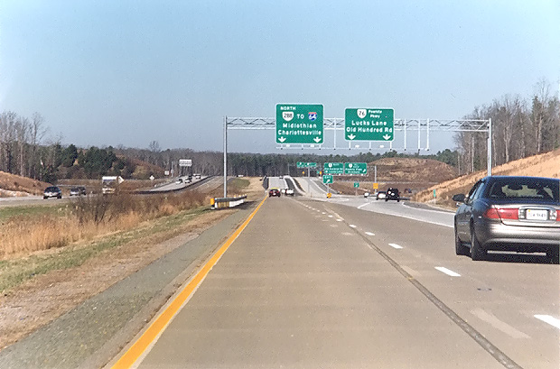
Route 288 northbound,
approaching the Route 76 Powhite Parkway interchange. The entrance to the
Route 288 northbound 2-lane collector-distributor (C-D) roadway is
ahead to the right. These Route 288 C-D roadways are almost 2 miles long,
and are built to full freeway standards, and intercept all the ramp movements
for the Lucks Lane and Route 76 interchanges. The line-shadow visible just ahead, is where a temporary yellow line was placed along with a line of barrels, to shift the Route 288 mainline traffic off onto the C-D roadway between there and Lucks Lane, to access the ramps at Route 76 and Lucks Lane. The mainline roadways opened to traffic on November 19, 2004. Route 288 previously temporarily ended at Lucks Lane, and the Route 288 segment between US-60 and Lucks Lane opened on November 19, 2004, completing the last section of Route 288. |
 |
Route 288 mainline roadway northbound, approaching the crossing over Route 76 Powhite Parkway. The Route 288 2-lane C-D roadway is to the right. The light-colored concrete pavement is the new pavement, the darker brown concrete pavement was placed in 1988 when Route 288 ended at Powhite Parkway, and the joint between the new and the older pavement is visible just ahead. |
|
|
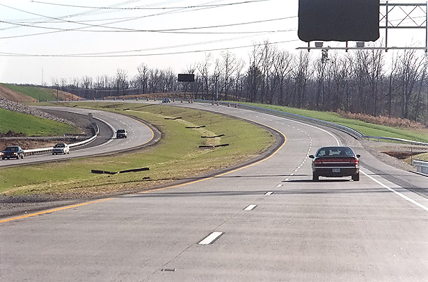
Route 288 northbound, on the long curve between Route 76 Powhite Parkway and Lucks Lane. |
 |
Route 288 northbound, approaching the Lucks Lane overpass, which is a 4-lane bridge. |
 |
Route 288 northbound, approaching the Lucks Lane overpass. This photo was taken from a similar vantage point as the previous photo, but it was taken with a 50mm (1.0x) regular lens used, instead of the 135mm (2.7x) telephoto lens lens used previously. |
 |
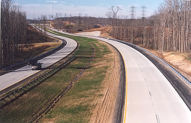
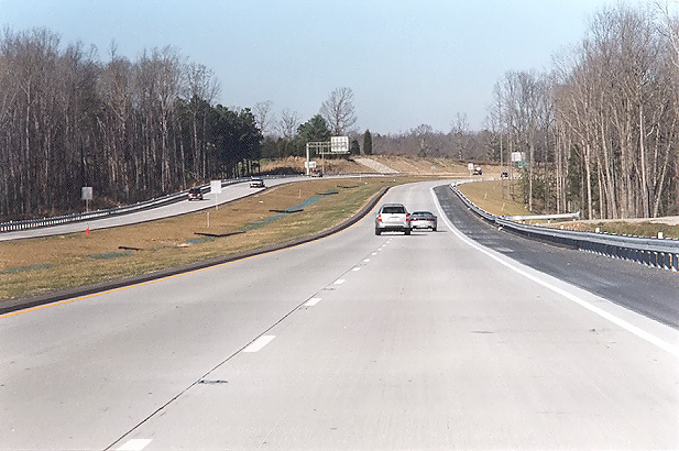
Route 288 northbound, approaching the Charter Colony Parkway overpass. |
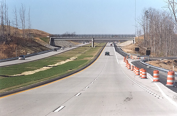 |
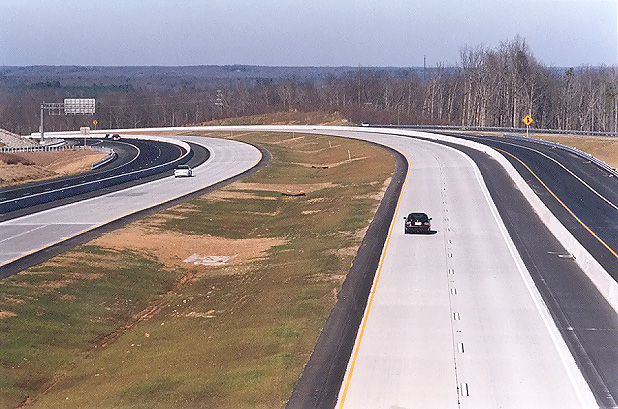
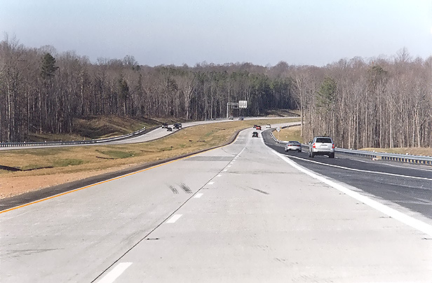
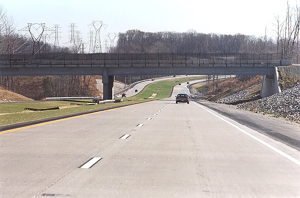
Route 288 northbound, approaching the Woolridge Road overpass and interchange. The orange barrels are blocking the off-ramp to Woolridge Road in this mid-December photo, as the Woolridge Road interchange didn't open until January 13, 2005. |
 |
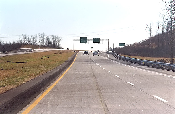
Route 288 northbound mainline roadway, approaching the US-60 Midlothian Turnpike overpass. This overpass is comprised of two 3-lane bridges, and it spans both Route 288 mainline roadways and both Route 288 collector-distributor roadways. |
 |
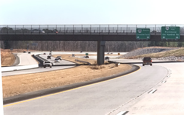
Route 288 northbound collector-distributor roadway, approaching the US-60 Midlothian Turnpike overpass and loop ramps. The US-60 interchange is a full cloverleaf design, with all the Route 288 ramps and loops interfacing with the Route 288 C-D roadways. US-60 does not have C-D roadways at this interchange; the ramps and loops interface directly with US-60. |
 |
Route 288 northbound, north of US-60 Midlothian Turnpike. The Route 288 northbound collector-distributor roadway ends and merges into the Route 288 mainline, visible just ahead. |
 |
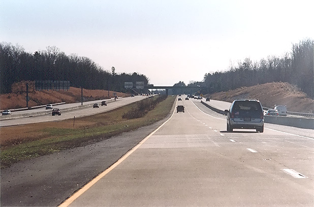
Route 288 northbound, one mile north of US-60 Midlothian Turnpike. |
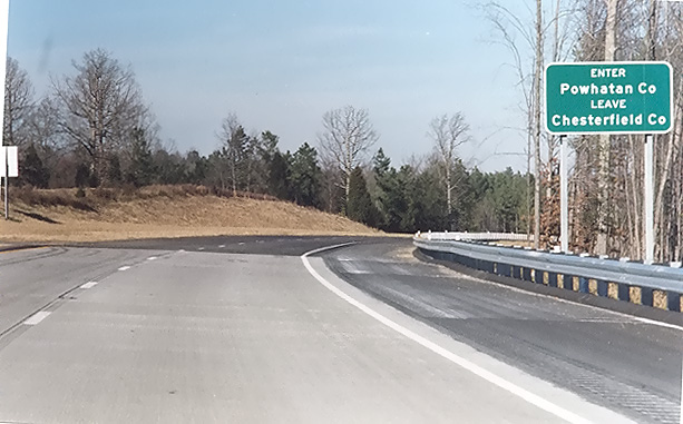 |
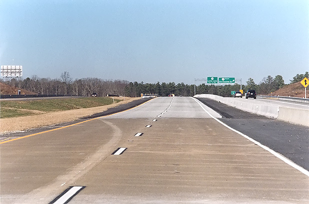
Route 288 northbound, two miles north of US-60 Midlothian Turnpike. The sign denotes the boundary between Chesterfield County and Powhatan County, and this is the point where the Route 288 continuously reinforced concrete pavement to the south of there transitions to the asphalt pavement to the north of there, and the pavement transition is visible ahead. |
| SOUTHBOUND | |
 |
Route 288 southbound, one mile north of US-60 Midlothian Turnpike. The line-shadow visible just ahead, is where a temporary yellow line was placed along with a line of barrels, to shift the Route 288 mainline traffic off onto the collector-distributor (C-D) roadway between there and US-60, to access the ramps at US-60. Route 288 previously temporarily ended at US-60, and the Route 288 segment between US-60 and Lucks Lane opened on November 19, 2004, completing the last section of Route 288. |
 |
Route 288 southbound, one mile south of US-60 Midlothian Turnpike. |
 |
Route 288 southbound, approaching the Woolridge Road overpass and interchange. |
 |
Route 288 southbound, at the Woolridge Road interchange, with the Charter Colony Parkway overpass visible in the distance. |
 |
Route 288 southbound, just south of Charter Colony Parkway. |
 |
Route 288 southbound, approaching the Lucks Lane overpass. |
 |
Route 288 southbound, just south of Route 76 Powhite Parkway. Construction of the 17.5-mile-long Western Route 288 project, ends 1/2 mile ahead where the collector-distributor roadways merge back into the portion of Route 288 that was opened to traffic in 1988. |
Lead article for Route VA-288 Construction - Western Section
All photos taken by Scott Kozel.
Copyright © 2005 by Scott Kozel. All rights reserved. Reproduction, reuse, or distribution without permission is prohibited.
By Scott M. Kozel, Roads to the Future
(Created 2-1-2005)