
| Route VA-288 Construction - June 2004 |
Here are 17 photos of Virginia Route 288 under construction, taken in June, 2004. Click the thumbnail photo for a larger photo (they range in size from 67 to 184 kilobytes, with most being less than 125 kilobytes).
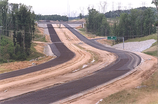 |
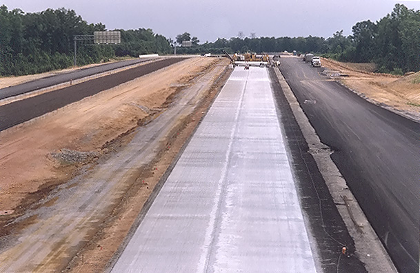
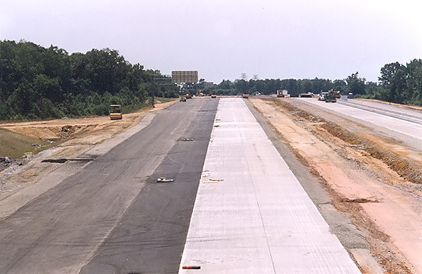
Route 288 construction, looking north from the Charter Colony Parkway overpass over Route 288, with the Woolridge overpass and interchange in the distance. Paving operations are underway on Route 288, with placement of the layer of aggregate base stone, with an asphalt stabilized open graded drainage layer on top of the aggregate base, and with a grid of reinforcing steel rods ("re-bar") being placed on top of the asphalt stabilized open graded drainage layer. Continuously reinforced concrete pavement will placed on top of the asphalt stabilized open graded drainage layer, with the re-bar grid encased inside the 10-inch-deep concrete slab. I have details of the concrete pavement design on my webpage Route VA-288 Construction - October 2003. This is in Chesterfield County. |
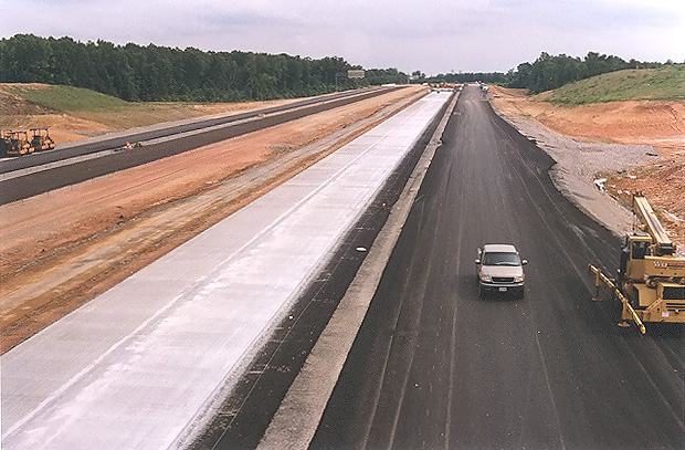 |
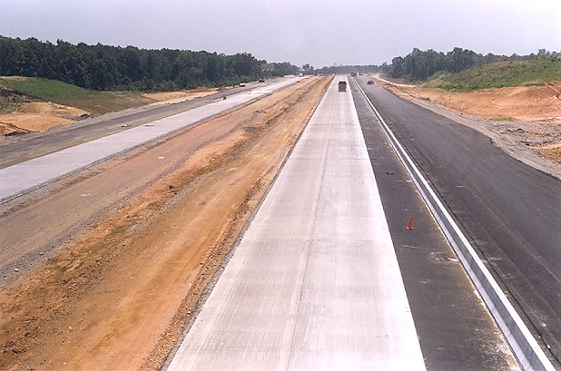
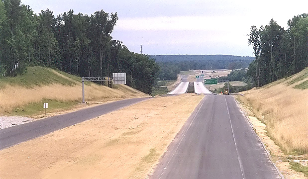
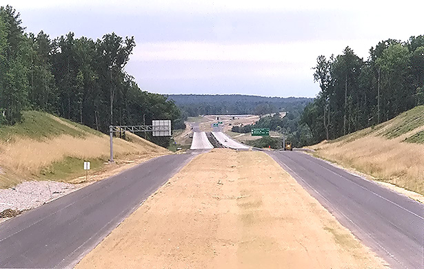
Looking south from the overpass where US-60 Midlothian Turnpike crosses Route 288. Paving operations are underway on Route 288, with placement of continuously reinforced concrete pavement.The Route 288 overpasses over the Norfolk-Southern Railway are visible in the distance. At this interchange area, Route 288 will have two mainline 2-lane roadways and two collector-distributor 2-lane roadways, and the interchange will be a full cloverleaf design. |
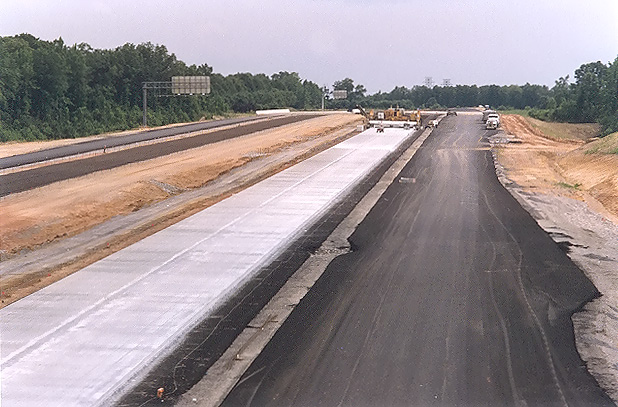 |
Looking south from the overpass where US-60 Midlothian Turnpike crosses Route 288. This photo was taken from the same vantage point as the previous photo, but it was taken with a 135mm (2.7x) telephoto lens, instead of the 50mm (1.0x) regular lens used previously. The concrete paving train (not operating when I took the photo) is visible ahead. |
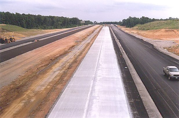 |
Looking south from the overpass where US-60 Midlothian Turnpike crosses Route 288. Similar vantage point to previous photo, but about 50 feet to the left. |
 |
Looking south from the overpass where US-60 Midlothian Turnpike crosses Route 288.This photo was taken from the same vantage point as the previous photo, but it was taken with a 135mm (2.7x) telephoto lens, instead of the 50mm (1.0x) regular lens used previously. The concrete paving train (not operating when I took the photo) is visible ahead. |
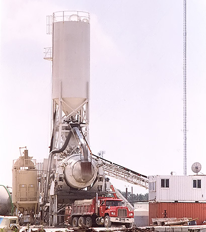 |
A central mix concrete plant was set up on the southeast quadrant of the
interchange between US-60 and Route 288. This is being utilized to produce
the concrete for the Route 288 roadway between Route 76 Powhite Parkway and the
Chesterfield-Powhatan county line. The plant was running when I took the
photo. The dump truck will transport the load of concrete to the concrete
paving train. A central mix concrete plant works on the same basic principle as a ready-mix concrete truck, with a rotating steel barrel to mix the concrete, but the central mix plant is designed for greater capacity output. The barrel on a truck would be about 8 to 10 cubic yards in mix volume, and the barrel at a central mix plant would be about 20 to 30 cubic yards in mix volume. With either type of concrete production, the concrete plant injects the materials into the barrel for mixing, in order of injection: aggregate, sand, cement, water, and admixtures. Modern concrete plants are automated (mechanically, electronically, and computerized) so that the proper quantities of each material are injected into the mixing barrel. |
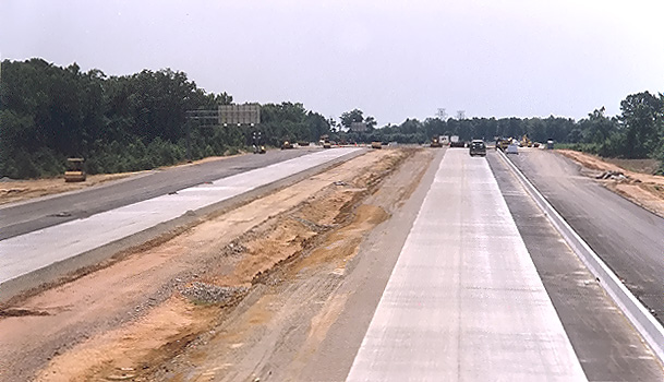
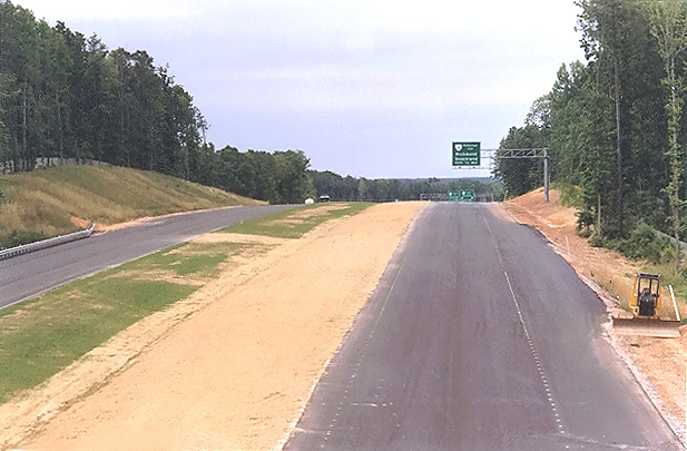
The next 4 photos were taken a week after the previous 5 photos. The mainline concrete pavement placing has been completed in this area, and Jersey Barrier is being constructed between the mainline and the collector-distributor roadways.
 |
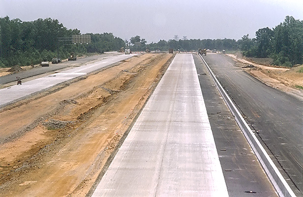
Looking north from the overpass where US-60 Midlothian Turnpike crosses Route 288. |
 |
Looking north from the overpass where US-60 Midlothian Turnpike crosses Route 288. This photo was taken from the same vantage point as the previous photo, but it was taken with a 135mm (2.7x) telephoto lens, instead of the 50mm (1.0x) regular lens used previously. |
 |
Looking south from the overpass where US-60 Midlothian Turnpike crosses Route 288. |
 |
Looking south from the overpass where US-60 Midlothian Turnpike crosses Route 288.This photo was taken from the same vantage point as the previous photo, but it was taken with a 135mm (2.7x) telephoto lens, instead of the 50mm (1.0x) regular lens used previously. |
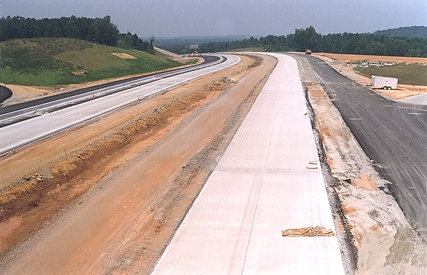
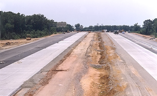
The next 3 photos were taken a week after the previous 4 photos. The mainline concrete pavement placing has been completed in this area, and Jersey Barrier is being constructed between the mainline and the collector-distributor roadways. The inside shoulders are being constructed.
 |
Looking south from the overpass where US-60 Midlothian Turnpike crosses Route 288. |
 |
Looking south from the overpass where US-60 Midlothian Turnpike crosses Route 288. This photo was taken from a similar vantage point and lens as the previous photo, but from about 50 feet to the left. |
 |
Looking south from the overpass where US-60 Midlothian Turnpike crosses Route 288. This photo was taken from a similar vantage point and lens as the previous photo, but from about 50 feet to the left. |
The western 17.5-mile-long section of Route 288 will have continuously reinforced concrete pavement on the 6.5-mile-long southern portion, and asphalt pavement on the 11.0-mile-long northern portion, with the pavement type change point being about 100 feet south of the county line between Chesterfield County and Powhatan County.
 |
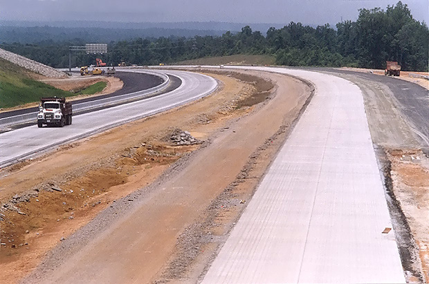
Looking south from the Route 650 River Road overpass, photo of the large earthwork cut just north of the 3,642-foot-long Route 288 James River Bridge, with the completed river bridges visible in the distance. All paving has been completed on both Route 288 roadways. This side of the river is in Goochland County, the other side of the river is in Powhatan County. |
 |
Looking south from the Route 650 River Road overpass. This photo was taken from a similar vantage point and lens as the previous photo, but from about 50 feet to the left. The twin-span 3,642-foot-long Route 288 James River bridges are visible, and in the far distance the Route 711 Huguenot Trail overpass and interchange is visible. |
 |
Looking north from the Route 650 River Road overpass. |
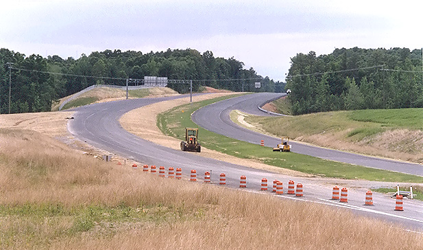 |
Looking south, from VA-6 Patterson Avenue, at Route 288. This photo was taken with a 135mm (2.7x) telephoto lens, which accentuates the curve on the highway, which is designed for 70 mph. |
Lead article for Route VA-288 Construction - Western Section
All photos taken by Scott Kozel.
Copyright © 2004 by Scott Kozel. All rights reserved. Reproduction, reuse, or distribution without permission is prohibited.
By Scott M. Kozel, Roads to the Future
(Created 8-1-2004)