
| Route VA-288 Construction - May 2004 |
Here are 44 photos of Virginia Route 288 under construction, taken in May, 2004. Click the thumbnail photo for a larger photo (they range in size from 77 to 212 kilobytes, with most being less than 135 kilobytes). As usual, the grouping sequence is from south to north. Each group was taken in the same 'photo session' of 30 minutes or less.
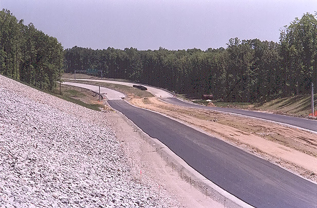
The following 5 photos were taken from: the first 4, from Lucks Lane, and the last, near VA-76 Powhite Parkway, in Chesterfield County.
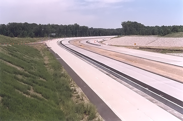 |
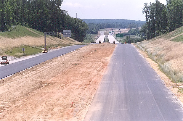
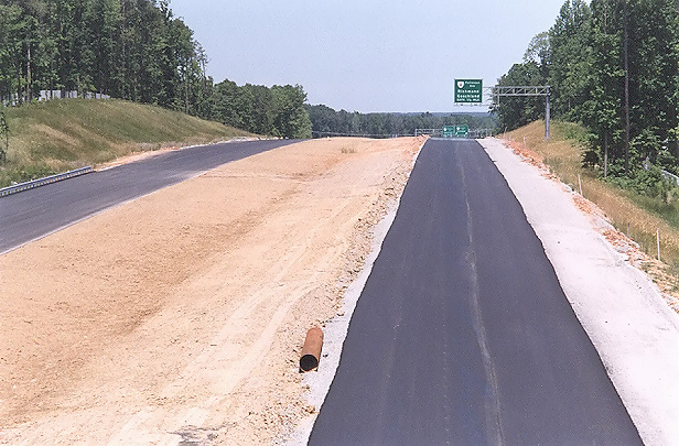
Route 288 construction, looking south from Lucks Lane. The northbound and southbound mainline roadways have been paved with concrete pavement, completing the concrete paving operation on Route 288 between south of VA-76 Powhite Parkway and north of Lucks Lane. The concrete Jersey Barriers were just installed. |
 |
Route 288 construction, looking south from Lucks Lane. This photo was taken from the same vantage point as the previous photo, but it was taken with a 135mm (2.7x) telephoto lens, instead of the 50mm (1.0x) regular lens used previously. |
 |
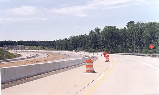
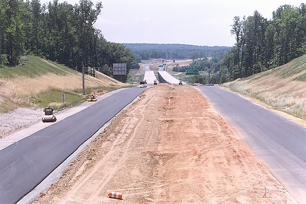
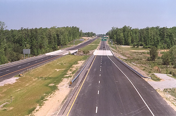
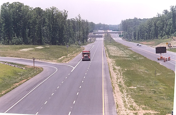
Route 288 construction, looking north from Lucks Lane. The concrete Jersey Barriers were just installed. |
 |
Route 288 construction, looking north from Lucks Lane. This photo was taken from the same vantage point as the previous photo, but it was taken with a 135mm (2.7x) telephoto lens, instead of the 50mm (1.0x) regular lens used previously. The 135mm lens exaggerates the amount of horizontal curvature on the highway, as the curve will be safe at 60 mph. |
 |
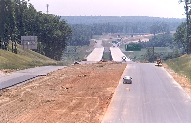
Route 288 construction, between VA-76 and Lucks Lane, looking north, a closer view of the roadway that was just paved. The section of Route 288 between VA-76 and Lucks Lane, opened in November 2002, with traffic utilizing the collector-distributor roadways (this photo was taken from the northbound collector-distributor roadway). |
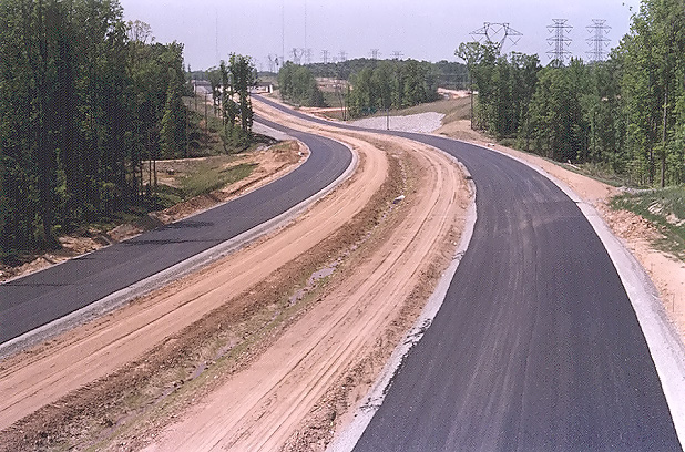
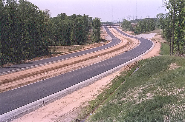
The following 7 photos were taken from Charter Colony Parkway in Chesterfield County.
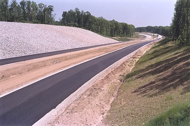 |
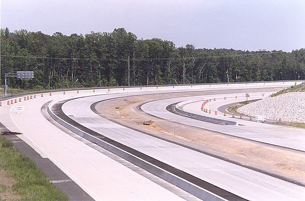
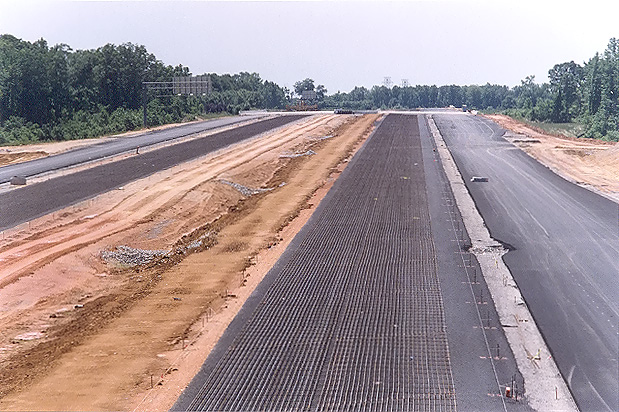
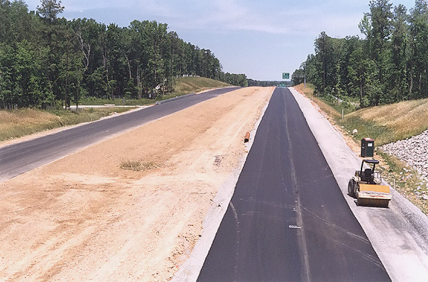
Route 288 construction, looking south from the Charter Colony Parkway overpass over Route 288. Visible in the distance, is the north end of the completed VA-288 section from VA-76 to north of Lucks Lane. The completed portion visible here is north of Lucks Lane and is not yet open to traffic. Paving operations are underway on Route 288, with placement of the layer of aggregate base stone, with an asphalt stabilized open graded drainage layer on top of the aggregate base, and with a grid of reinforcing steel rods ("re-bar") being placed on top of the asphalt stabilized open graded drainage layer. Continuously reinforced concrete pavement will placed on top of the asphalt stabilized open graded drainage layer, with the re-bar grid encased inside the 10-inch-deep concrete slab. I have details of the concrete pavement design on my webpage Route VA-288 Construction - October 2003. This is in Chesterfield County. |
 |
Route 288 construction, looking south from the Charter Colony Parkway overpass over Route 288. This photo was taken from the same vantage point as the previous photo, but it was taken with a 135mm (2.7x) telephoto lens, instead of the 50mm (1.0x) regular lens used previously. |
 |
Route 288 construction, looking south from the Charter Colony Parkway overpass over Route 288. This vantage point is from the opposite side of Route 288 as the two previous two photos. |
 |
Route 288 construction, looking south from the Charter Colony Parkway overpass over Route 288. This photo was taken from the same vantage point as the previous photo, but it was taken with a 135mm (2.7x) telephoto lens, instead of the 50mm (1.0x) regular lens used previously. |
 |
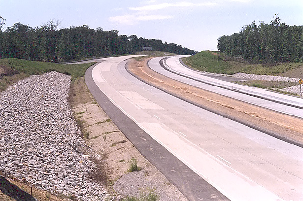
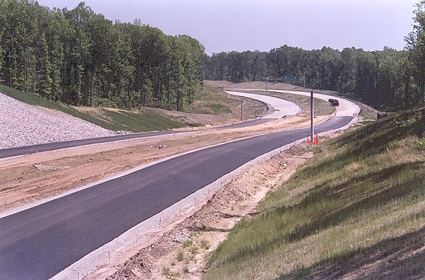
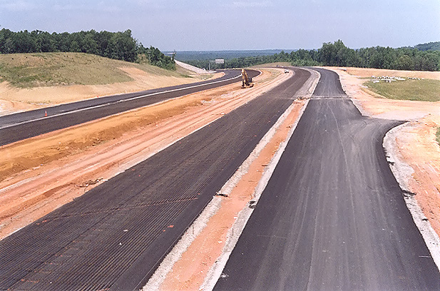
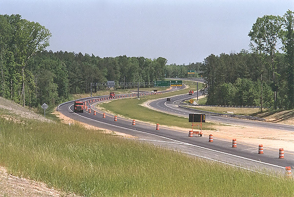
Looking north from where Charter Colony Parkway crosses Route 288. As in the previous four photos, paving operations are underway. |
 |
Looking north from where Charter Colony Parkway crosses Route 288. This photo was taken about 100 feet to the right of the previous photo. |
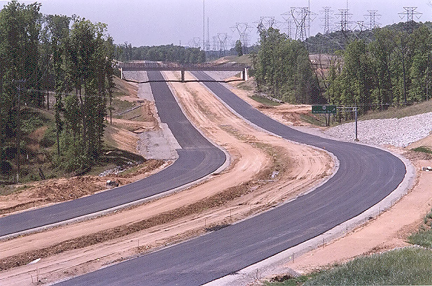 |
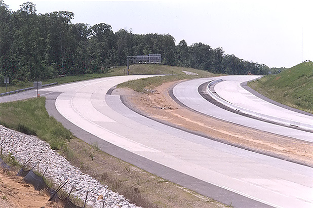
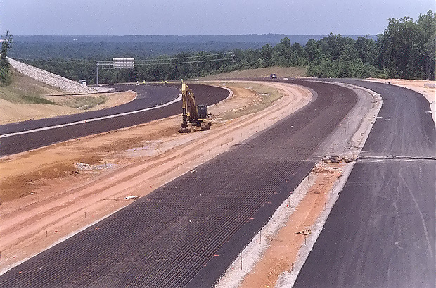
Looking north from where Charter Colony Parkway crosses Route 288. This photo was taken from the same vantage point as the previous photo, but it was taken with a 135mm (2.7x) telephoto lens, instead of the 50mm (1.0x) regular lens used previously. The interchange and overpass for Woolridge Road is visible in the distance. |
The following 3 photos were taken from US-60 Midlothian Turnpike in Chesterfield County.
 |
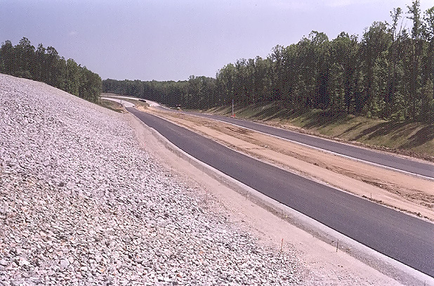
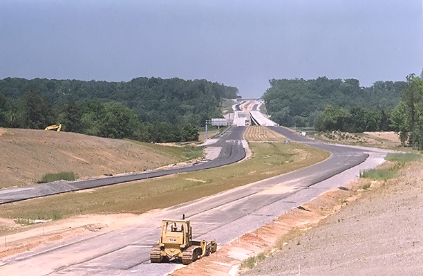
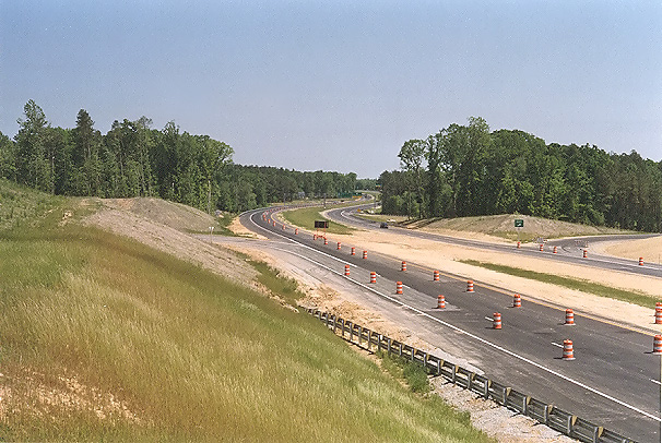
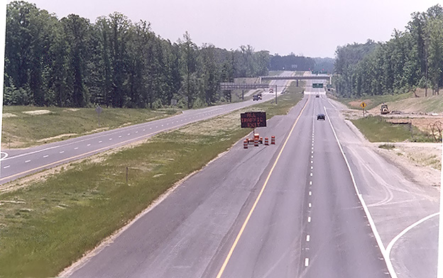
Looking south from the overpass where US-60 Midlothian Turnpike crosses Route 288. Paving operations are underway on Route 288, with placement of the layer of aggregate base stone, with an asphalt stabilized open graded drainage layer on top of the aggregate base, and with a grid of reinforcing steel rods ("re-bar") being placed on top of the asphalt stabilized open graded drainage layer. Continuously reinforced concrete pavement will placed on top of the asphalt stabilized open graded drainage layer, with the re-bar grid encased inside the 10-inch-deep concrete slab. I have details of the concrete pavement design on my webpage Route VA-288 Construction - October 2003. The Route 288 overpasses over the Norfolk-Southern Railway are visible in the distance. At this interchange area, Route 288 will have two mainline 2-lane roadways and two collector-distributor 2-lane roadways, and the interchange will be a full cloverleaf design. |
 |
Looking north from the overpass where US-60 Midlothian Turnpike crosses Route 288. This photo was taken a few minutes after the previous photo, but looking in opposite direction. |
 |
Looking north from the overpass where US-60 Midlothian Turnpike crosses Route 288. This photo was taken from the same vantage point as the previous photo, but it was taken with a 135mm (2.7x) telephoto lens, instead of the 50mm (1.0x) regular lens used previously. |
The western 17.5-mile-long section of Route 288 will have continuously reinforced concrete pavement on the 6.5-mile-long southern portion, and asphalt pavement on the 11.0-mile-long northern portion, with the pavement type change point being about 100 feet south of the county line between Chesterfield County and Powhatan County.
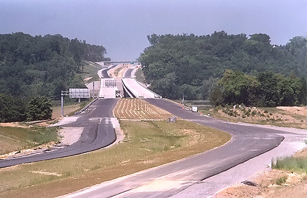
The following 4 photos were taken from VA-711 Huguenot Trail in Powhatan County.
 |
Looking north from VA-711 Huguenot Trail. VA-288 roadways under construction are visible, and asphalt paving operations are underway. The completed twin 3,642-foot-long bridges over the James River are visible in the distance, along with the large earthwork cut just north of the river, and the VA-650 River Road overpass is visible at the very limit of the visible construction. VA-711 Huguenot Trail will have a diamond interchange with VA-288. South of the river (this side) is in Powhatan County, and north of the river is in Goochland County. |
 |
Looking north from VA-711 Huguenot Trail. This photo was taken from the same vantage point as the previous photo, with a telephoto lens (135 mm or 2.7x) with a 2x teleconverter, effectively providing 270 mm or 5.4x; instead of the 135mm (2.7x) regular lens used previously. |
 |
Looking north from the VA-711 Huguenot Trail overpass over VA-288, from vantage point about 150 feet to the left of the previous two photos. VA-288 roadways under construction are visible, and asphalt paving operations are underway. |
 |
Looking north from the VA-711 Huguenot Trail overpass over VA-288. This photo was taken from the same vantage point as the previous photo, with a telephoto lens (135 mm or 2.7x) with a 2x teleconverter, effectively providing 270 mm or 5.4x; instead of the 135mm (2.7x) regular lens used previously. |
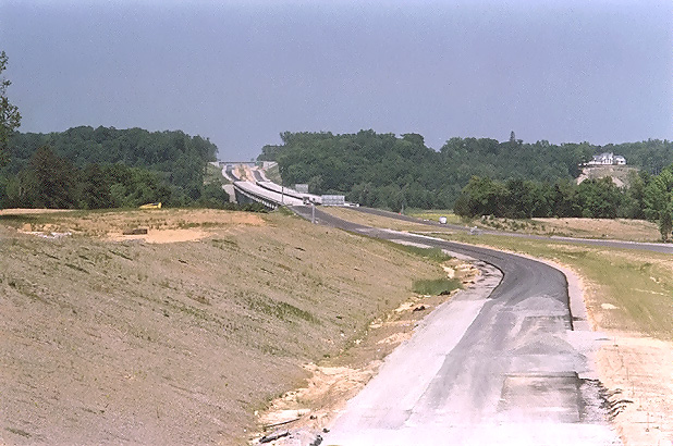
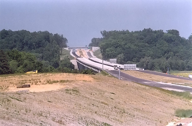
The following 6 photos were taken from VA-650 River Road in Goochland County.
 |
Looking south from the VA-650 River Road overpass, photo of the large earthwork cut just north of the VA-288 James River Bridge, with the completed river bridges visible in the distance. Paving is nearing completion on both Route 288 roadways. This side of the river is in Goochland County, the other side of the river is in Powhatan County. |
 |
Looking south from the VA-650 River Road overpass. This photo was taken from the same vantage point as the previous photo, but it was taken with a 135mm (2.7x) telephoto lens, instead of the 50mm (1.0x) regular lens used previously. |
 |
Looking south from the VA-650 River Road overpass. This photo was taken from a similar vantage point and lens as the previous photo, but from about 50 feet to the left. |
 |
Looking south from the VA-650 River Road overpass. This photo was taken from a similar vantage point as the previous photo. I took this photo with a telephoto lens (135 mm or 2.7x) with a 2x teleconverter, effectively providing 270 mm or 5.4x. The twin-span 3,642-foot-long Route 288 James River bridges are visible, and in the far distance the VA-711 Huguenot Trail overpass and interchange is visible. |
 |
Looking north from the VA-650 River Road overpass, paving is nearing completion on both Route 288 roadways. This is in Goochland County. |
 |
Looking north from the VA-650 River Road overpass. This photo was taken from the same vantage point as the previous photo, but it was taken with a 135mm (2.7x) telephoto lens, instead of the 50mm (1.0x) regular lens used previously. |
The following 2 photos were taken from VA-6 Patterson Avenue in Goochland County.
 |
Looking north, from VA-6 Patterson Avenue, at Route 288, which was opened to traffic from VA-6 northward on May 1, 2004. |
 |
Looking north, from VA-6 Patterson Avenue, at Route 288. This photo was taken from the same vantage point as the previous photo, but it was taken with a 135mm (2.7x) telephoto lens, instead of the 50mm (1.0x) regular lens used previously. |
The following 4 photos were taken from the Capital One Southern Access Road (Broad Branch Drive) overpass in Goochland County.
 |
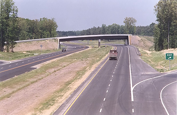
Looking south, Route 288 section which opened to 4 lanes on May 1, 2004. Photo taken from the vantage point of the Capital One Southern Access Road (Broad Branch Drive) overpass over Route 288. This is in Goochland County. |
 |
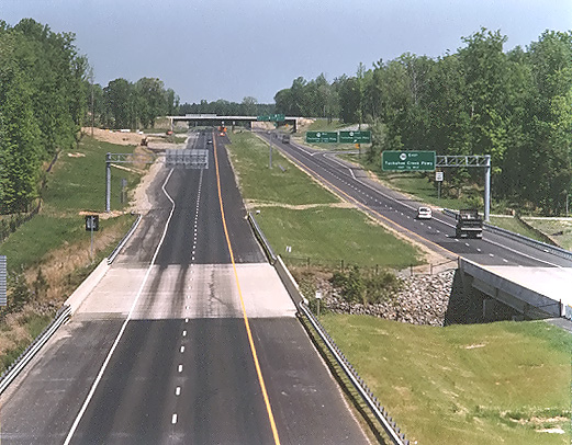
Looking north, Route 288 section which opened to 4 lanes on May 1, 2004. Photo taken from the vantage point of the Capital One Southern Access Road (Broad Branch Drive) overpass over Route 288. |
 |
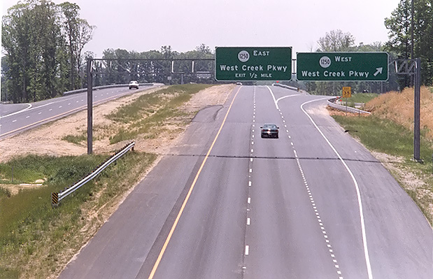
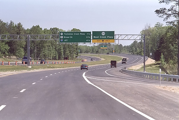
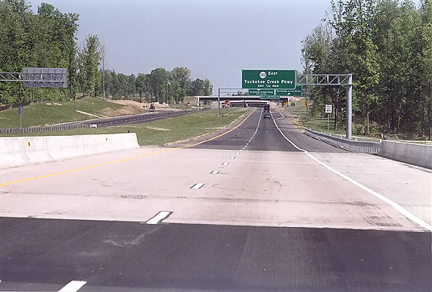
Looking north, Route 288, this photo was taken from the same vantage point as the previous photo, but it was taken with a 135mm (2.7x) telephoto lens, instead of the 50mm (1.0x) regular lens used previously. The twin bridges in the VA-288 roadways cross Broad Branch Creek. The overpass in the distance is the Tuckahoe Creek Parkway, which has a full cloverleaf interchange with Route 288. |
 |
Looking north, Route 288, similar vantage point to previous two photos, but to the left, over the other Route 288 roadway. |
The following 4 photos were taken from: the first, from Tuckahoe Creek Parkway, and the remainder, from the Tuckahoe Creek Parkway overpass over Route 288, in Goochland County.
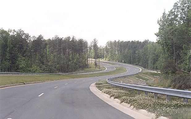 |
Looking west, Tuckahoe Creek Parkway, near Capital One northern entrance. Tuckahoe Creek Parkway was completed along its 1.5 mile first section on May 1, 2004, and it is a 4-lane divided east-west thoroughfare, with a full cloverleaf interchange with Route 288, and the interchange includes a pair of 2-lane high-speed semi-directional ramps that connect northerly Route 288 directly with the Capital One complex that is 1/4 mile west of Route 288. The Capital One business complex is partly built and the rest still under construction, and it will eventually have over 4,000 employees. The Tuckahoe Creek Parkway was fully opened on May 1st (it had a 1/2 mile 2-lane segment between Route 288 and Capital One that opened a year ago). |
 |
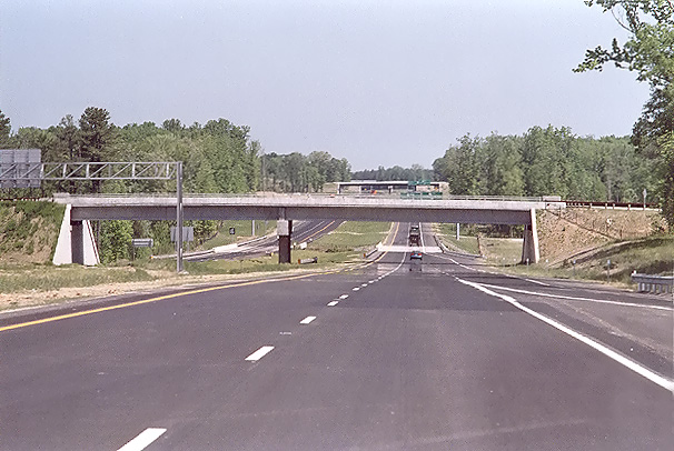
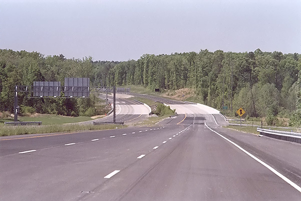
Looking south, Route 288 section that was fully opened to 4-lane traffic on May 1, 2004. Photo taken from the vantage point of the Tuckahoe Creek Parkway overpass over Route 288, over the southbound Route 288 roadway. The extra-wide left shoulder on the southbound roadway, is a result of this roadway being utilized for 2-lane 2-way traffic from the time of its opening in 1997, and the location at this spot of a temporary at-grade intersection that opened in 2003 for Capital One. |
 |
Looking south, Route 288 section that was fully opened to 4-lane traffic on May 1, 2004. Photo taken from the vantage point of the Tuckahoe Creek Parkway overpass over Route 288, over the northbound Route 288 roadway. |
 |
Looking north, Route 288 section that was fully opened to 4-lane traffic on May 1, 2004. Photo taken from the vantage point of the Tuckahoe Creek Parkway overpass over Route 288, over the northbound Route 288 roadway. The overpass ahead carries the northbound 2-lane high-speed semi-directional ramp that connects the Capital One complex to northbound Route 288. |
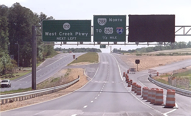
This Route 288 section includes 0.9 mile of new 4-lane freeway between Patterson Avenue and West Creek Parkway, and 3.0 miles of parallel 2-lane roadway between West Creek Parkway and 1/2 mile south of US-250 (the original 3.5 miles of VA-288 between West Creek Parkway and US-250 opened in 1997 as a 2-lane highway on a 4-lane limited access right-of-way). The new freeway section, the parallel roadway, and 2 1/2 interchanges opened on May 1st, so the entire 3.9 mile section of Route 288 is now a 4-lane freeway. The northernmost 1.1 mile of Route 288 opened on December 22, 2003, and this includes the Route 288 interchanges with Interstate 64 and US-250 Broad Street Road; so these two sections combined amount to 5.0 miles of Route 288 that is now fully complete and open to traffic in Goochland County, between VA-6 Patterson Avenue and Interstate 64.
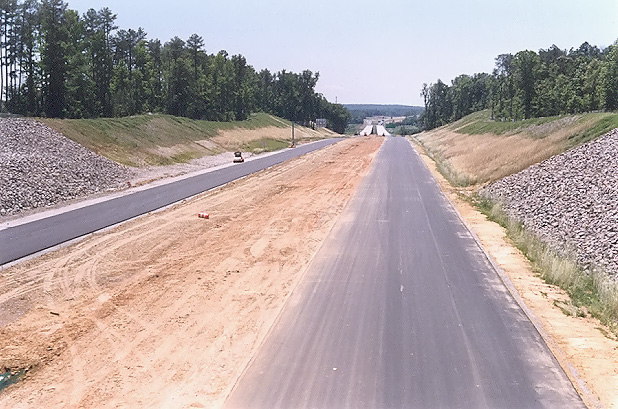
The following 5 photos were taken from the section of the Route 288 roadway that was completed on May 1, 2004, 3.9 miles of Route 288 between VA-6 Patterson Avenue and Tuckahoe Creek 1/2 mile south of US-250, in Goochland County.
 |
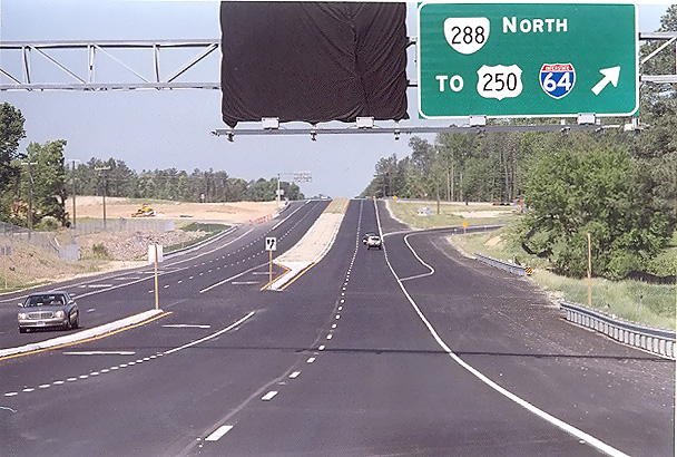
Heading north on Route 288, 1/4 mile north of VA-6 Patterson Avenue. |
 |
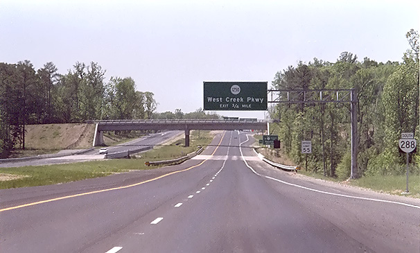
Heading north on Route 288, 1/4 mile north of West Creek Parkway, approaching the Capital One Southern Access Road (Broad Branch Drive) overpass. |
 |
Heading north on Route 288, 1/4 mile north of the Capital One Southern Access Road (Broad Branch Drive), approaching the bridge in the Route 288 roadway which crosses Broad Branch Creek. |
 |
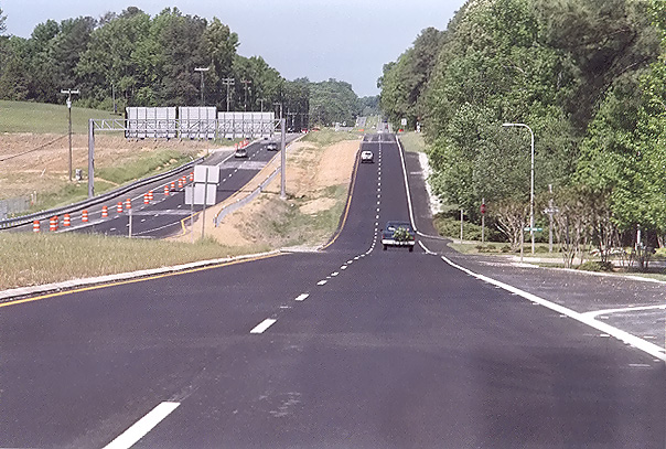
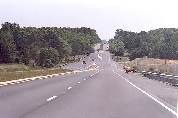
Heading south, 1/4 mile south of US-250 Broad Street Road, on the section of Route 288 that opened to traffic in December 2003, approaching the bridges over Tuckahoe Creek. |
 |
Heading south on Route 288, 1/4 mile south of Tuckahoe Creek Parkway, approaching the bridge in the Route 288 roadway which crosses Broad Branch Creek, and the Capital One Southern Access Road (Broad Branch Drive) overpass. |
VA-6 Patterson Avenue is a 4-lane divided highway, and 1.1 mile of that highway was rebuilt in the area of where it has a cloverleaf interchange with Route 288, to provide an alignment properly designed to accommodate the new interchange. The rebuilt section of Patterson Avenue was reopened to 4 lanes on May 2nd, as it had been reduced to 2 lanes during the reconstruction. The ramps and loops are open for the northerly Route 288 direction, so 1/2 of the interchange is open.
The following 4 photos were taken from the section of VA-6 Patterson Avenue whose reconstruction was completed on May 2, 2004, in the area of the Route 288 interchange.
 |
Heading west, on VA-6 Patterson Avenue in Goochland County. This photo is from the east end of the connection, looking toward the Route 288 interchange. |
 |
Heading west on VA-6 Patterson Avenue, west of the bridge over Route 288. |
 |
Heading east, on VA-6 Patterson Avenue. This photo is from the west end of the connection, looking toward the Route 288 interchange. |
 |
Heading east on VA-6 Patterson Avenue, east of the bridge over Route 288. |
Lead article for Route VA-288 Construction - Western Section
All photos taken by Scott Kozel.
Copyright © 2004 by Scott Kozel. All rights reserved. Reproduction, reuse, or distribution without permission is prohibited.
By Scott M. Kozel, Roads to the Future
(Created 7-1-2004)