
| Route VA-288 Construction - November 2003 |
Here are 18 photos of Route VA-288 under construction, taken in November, 2003. Click the thumbnail photo for a larger photo (they range in size from 83 KB to 257 KB, and most are less than 140 KB).
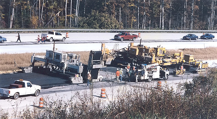 |
Route
288 construction, photo taken from
near Lucks Lane in Chesterfield County. Concrete paving operation is underway
on the 2-lane southbound mainline roadway. View of the paving train, with
the 3 separate machines visible, from right to left (the direction of the
paving operation), the curing and texturing machine, the slipform paving
machine, and the spreader machine. This is the same paving operation that I discussed in depth on my previous month's Route 288 update webpage Route VA-288 Construction - October 2003. |
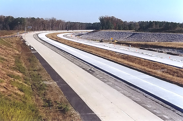 |
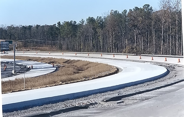
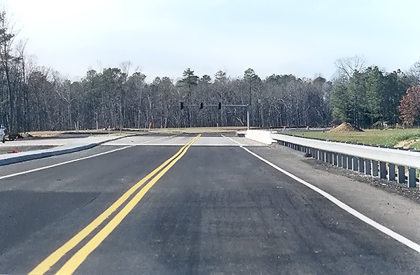
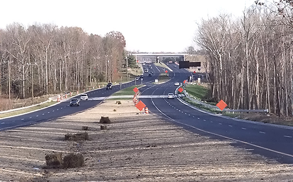
Route 288 construction, looking south from Lucks Lane. The northbound and southbound mainline roadways have been paved with concrete pavement, completing the concrete paving operation on Route 288 between south of VA-76 Powhite Parkway and north of Lucks Lane. |
 |
Route 288 construction, looking south from Lucks Lane. This photo was taken from the same vantage point as the previous photo, but it was taken with a 135mm (2.7x) telephoto lens, instead of the 50mm (1.0x) regular lens used previously. |
 |
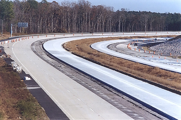
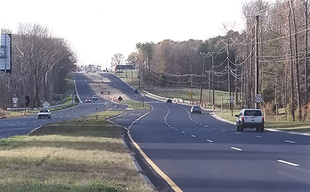
Route 288 construction, looking north from Lucks Lane. This photo was taken a few minutes after the previous photo. A 135mm (2.7x) telephoto lens exaggerates the amount of horizontal curvature on the highway, as the curve will be safe at 60 mph. |
 |
Route 288 construction, looking north, a closer view of the roadway that was just paved. The 135mm (2.7x) telephoto lens was utilized. |
 |
Route 288 construction, looking north, a closer view of the roadway that was just paved. The Lucks Lane overpass is in the background. The 135mm (2.7x) telephoto lens was utilized. |
 |
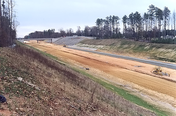
Looking south from the overpass where US-60 Midlothian Turnpike crosses VA-288. Paving operations are underway on Route 288, with placement of the layer of aggregate base stone. In places where unsuitable earth material needs to be removed and replaced with select earth backfill, up to 24 inches depth of coarse aggregate stone is placed under the aggregate base layer, and in this photo and in the following photo the placement of the 24 inches depth of coarse aggregate can be seen. |
 |
Looking south from the overpass where US-60 Midlothian Turnpike crosses VA-288. This photo was taken from the same vantage point as the previous photo, but it was taken with a 135mm (2.7x) telephoto lens, instead of the 50mm (1.0x) regular lens used previously. The Route 288 overpass over the Norfolk-Southern Railway is under construction in the distance. At this interchange area, Route 288 will have two mainline 2-lane roadways and two collector-distributor 2-lane roadways, and the interchange will be a full cloverleaf design. |
 |
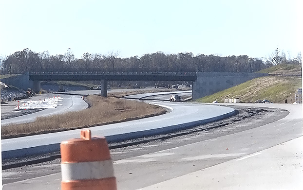
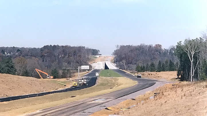
Route 288 construction, the VA-711 Huguenot Trail connection, which involves rebuilding 0.9 mile of the 2-lane VA-711 to provide a properly-aligned 4-lane divided highway where VA-711 will have a diamond interchange with VA-288. A temporary roadway carried VA-711 for a year, so that a 4-lane overpass could be built over VA-288, and the new connection built. The westbound 2-lane roadway of the VA-711 connection was completed in November 2003, and two-lane two-way traffic is now operating on this roadway, shown in this photo, with the overpass bridge visible in the center of the photo. The eastbound 2-lane roadway of the VA-711 connection is still under construction. |
 |
Looking north, standing on the VA-711 Huguenot Trail overpass. VA-288 roadways under construction are visible, and asphalt paving operations are underway. The completed twin 3,642-foot-long bridges over the James River are visible in the distance, along with the large earthwork cut just north of the river, and the VA-650 River Road overpass is visible at the very limit of the visible construction. South of the river is in Powhatan County, and north of the river is in Goochland County. |
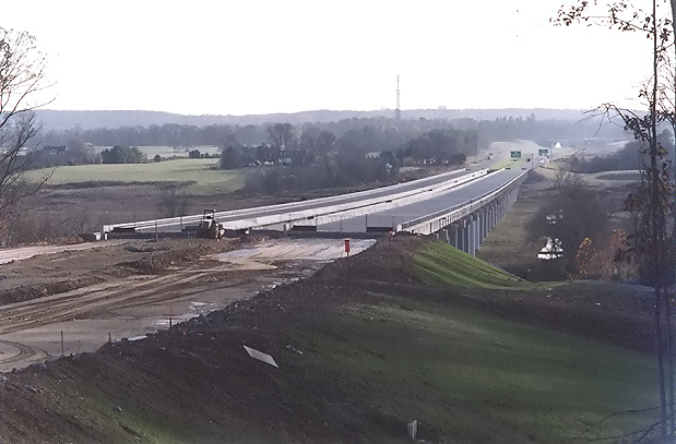 |
Looking south, photo of construction the fill and roadways just north of the Route 288 James River Bridge, and the bridges themselves. The VA-711 Huguenot Trail overpass is visible at the very limit of the visible construction. |
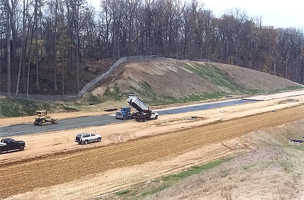 |
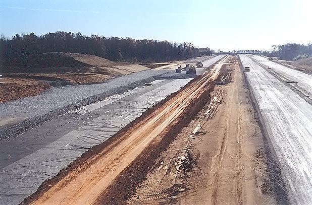
Looking south, photo of construction of the large earthwork cut just north of the VA-288 James River Bridge. The northbound roadway has been fine-graded, and the operation is underway to place the aggregate base layer of the pavement, 150 mm (5.91 inches) depth of Cement Stabilized Aggregate Material, Type 1, No. 21A, with 4 Percent Cement By Weight. This side of the river is in Goochland County, and the other side is in Powhatan County. |
 |
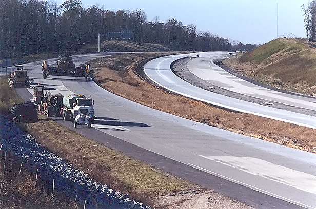
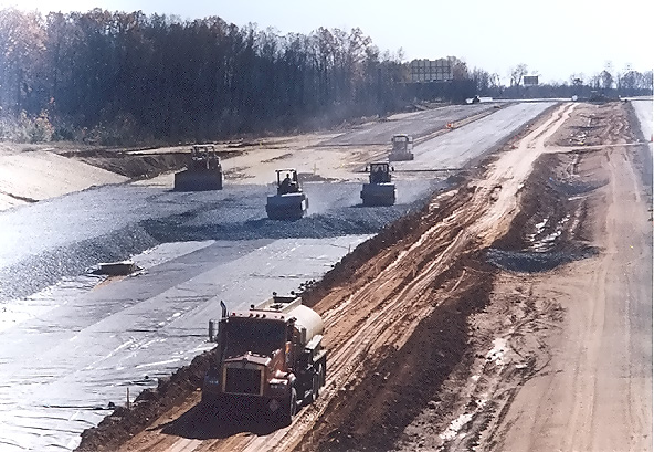
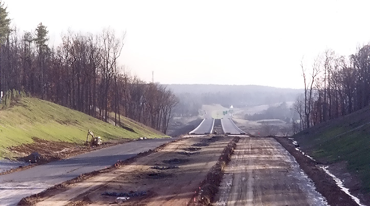
Looking north, construction of the VA-288 roadways. Similar vantage point to previous photo, taken a few minutes later, but looking to the north. Heavy grading has been completed, and fine grading and asphalt paving is underway. |
 |
Looking south from the VA-650 River Road overpass, photo of construction of the large earthwork cut just north of the 3,642-foot-long VA-288 James River Bridge, with the completed river bridges visible in the distance, and the VA-711 Huguenot Trail overpass is visible at the very limit of the visible construction. This side of the river is in Goochland County, and the other side is in Powhatan County. This cut is 1/2 mile long, a maximum of 65 feet deep, with a total of about 300,000 cubic yards of excavation removed from the cut. |
 |
Looking north, photo of the parallel northbound span of the VA-288 Tuckahoe Creek Bridge in Goochland County about 1/2 mile south of US-250 Broad Street Road. Asphalt paving operation is underway for the surface course. |
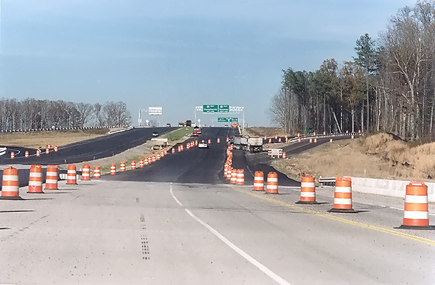 |
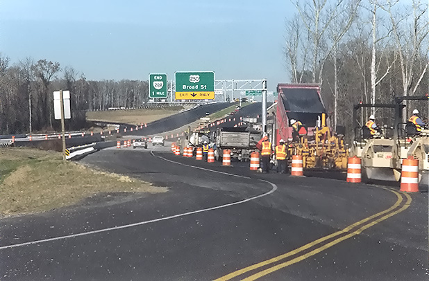
Looking north, photo of the parallel northbound span of the VA-288 Tuckahoe Creek Bridge in Goochland County about 1/2 mile south of US-250 Broad Street Road. This section of Route 288 opened to traffic on December 22, 2003, from just south of the Tuckahoe Creek Bridge to I-64, joining seamlessly with the 2-lane 3.5-mile-long section of Route 288 that was opened in 1997 between US-250 and West Creek Parkway. |
 |
Looking east, widened US-250 Broad Street Road, west of the VA-288 interchange. The VA-288 overpasses can be seen in the distance. The 2-lane US-250 was widened to 6-lanes-divided east of Tuckahoe Creek (the new US-250 Tuckahoe Creek bridges are visible ahead in the photo), transitioning from 6 lanes to 4 lanes west of those bridges, with the western project limit about 1/4 mile west of the VA-623 intersection. |
 |
Looking west, widened US-250 Broad Street Road, west of VA-288 interchange. The 135mm (2.7x) telephoto lens was utilized. |