
| Route VA-288 Construction - November 2004 |
Here are 28 photos of Virginia Route 288 under construction, taken in November, 2004. Click the thumbnail photo for a larger photo (they range in size from 72 to 224 kilobytes, with most being less than 133 kilobytes).
The following 3 photos were taken from Genito Road in Chesterfield County.
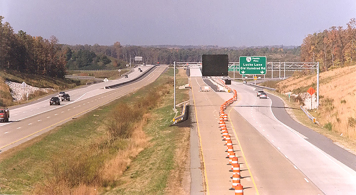 |
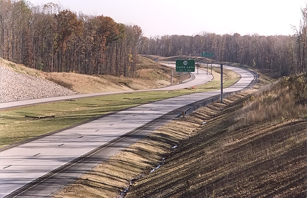
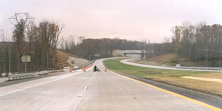
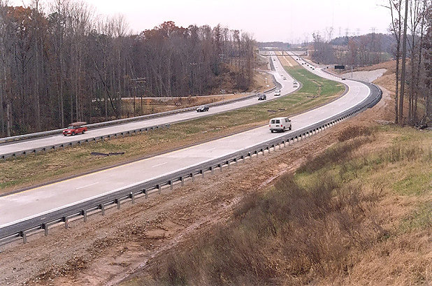
Route 288 construction, looking north from the Genito Road overpass. Route 288 ended ahead at VA-76 Powhite Parkway until the current project extended it in November 2002 to Lucks Lane. The project to extend Route 288 northward provided a new full cloverleaf interchange with northbound and southbound Route 288 2-lane collector-distributor (C-D) roadways along with three new bridges over VA-76. |
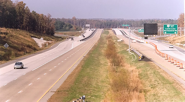 |
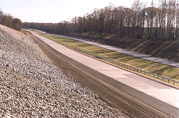
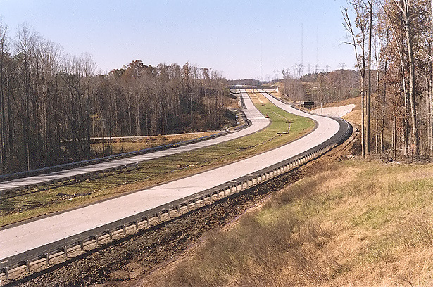
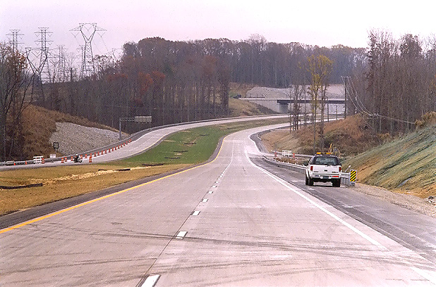
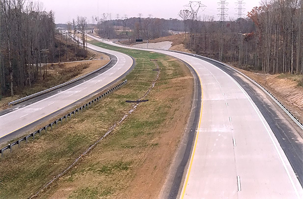
Route 288 construction, looking north from the from the Genito Road overpass, a few minutes after the previous photo from about 50 feet to the left. The light-colored concrete pavement is the new pavement, the darker brown concrete pavement was placed in 1988 when Route 288 ended ahead (at the limit of pavement visibility) at VA-76 Powhite Parkway. |
 |
Route 288 construction, looking north from the Genito Road overpass, a few minutes after the previous photo from about 50 feet to the left. Traffic is using the Route 288 C-D roadways in this photo, and the mainline (inner) roadways are closed to traffic. These C-D roadways are almost 2 miles long, and are built to full freeway standards, so Route 288 in this area is an 8-lane freeway on a 2x2x2x2 lane configuration. The Route 288 mainline (inner) roadways here opened on November 19, 2004, along with the 3.7 miles of Route 288 between Lucks Lane and US-60 Midlothian Turnpike in Chesterfield County, after this photo was taken. |
The following 7 photos were taken from Charter Colony Parkway in Chesterfield County.
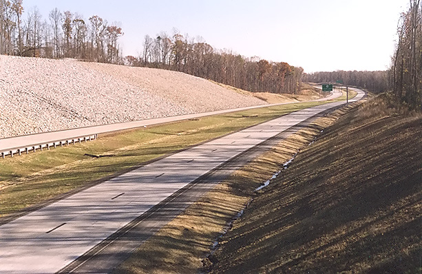 |
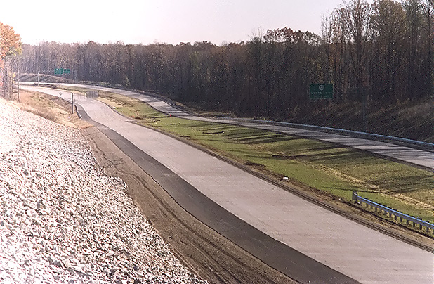
Route 288 construction, looking south from the Charter Colony Parkway overpass over Route 288, in Chesterfield County. Paving operations are underway on Route 288, and continuously reinforced concrete pavement has been placed in a 10-inch-deep concrete slab. I have details of the concrete pavement design on my webpage Route VA-288 Construction - October 2003. Shoulder paving was just completed, along with grading and seeding of median and roadside slopes. |
 |
Route 288 construction, looking south from the Charter Colony Parkway overpass over Route 288. This photo was taken from the same vantage point as the previous photo, but it was taken with a 135mm (2.7x) telephoto lens, instead of the 50mm (1.0x) regular lens used previously. |
 |
Route
288 construction, looking south from the Charter Colony Parkway overpass over
Route 288. This vantage point is from the opposite side of Route 288 as the
two previous two photos.
The Charter Colony Parkway overpass bridge has a high fence on the south side, so I had to take photos from either end of the bridge. |
 |
Route 288 construction, looking south from the Charter Colony Parkway overpass over Route 288. This photo was taken from the same vantage point as the previous photo, but it was taken with a 135mm (2.7x) telephoto lens, instead of the 50mm (1.0x) regular lens used previously. |
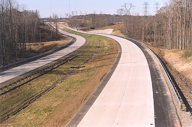 |
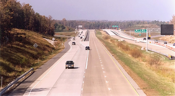
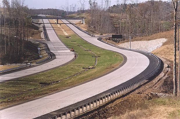
Route
288 construction, looking north from the Charter Colony Parkway overpass over
Route 288. The new highway is nearly ready for traffic. This section of Route 288 opened to traffic on November 19, 2004 (after these photos were taken). |
 |
Route 288 construction, looking north from the Charter Colony Parkway overpass over Route 288. Shoulder paving was just completed, along with guardrail installation, and grading and seeding of median and roadside slopes. |
 |
Route 288 construction, looking north from the Charter Colony Parkway overpass over Route 288. This photo was taken from the same vantage point as the previous photo, but it was taken with a 135mm (2.7x) telephoto lens, instead of the 50mm (1.0x) regular lens used previously. The interchange and overpass for Woolridge Road is visible in the distance. |
The following 18 photos were taken on the November 19, 2004 opening day.
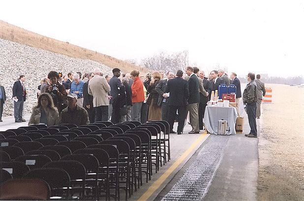
The opening ceremony was at 10:00 that morning, underneath the Woolridge Road overpass in Chesterfield County, and about 150 people attended, there were speeches by Thomas Hawthorne, the Virginia Department of Transportation (VDOT) Richmond District Administrator; John Watkins, the state Senator for the region; Kelly Miller, the Chairman of the Chesterfield County Board of Supervisors; Lane Ramsey, the Chesterfield County Administrator; and Whittington W. Clement, the state Secretary of Transportation. The final ceremonial act was a ribbon cutting.
 |
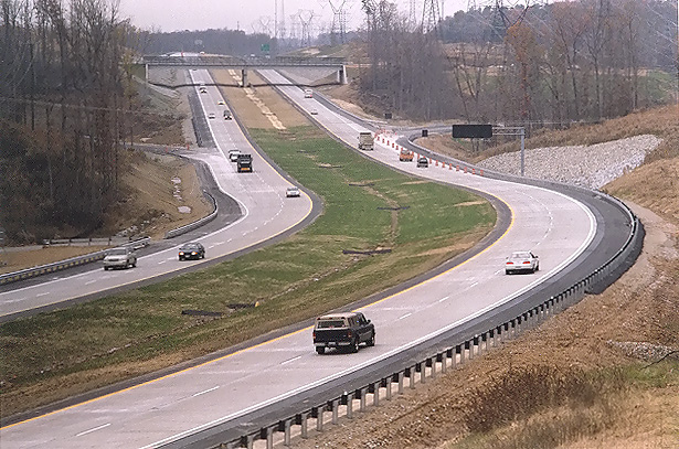
The speakers' platform for the opening ceremony is on the southbound Route 288 roadway under the Woolridge Road overpass ahead. The party is starting to gather, and cars are parked along the shoulder of northbound Route 288. The weather is overcast. |
 |
Route 288 southbound roadway, looking from under the Woolridge Road overpass. |
 |
Route 288 southbound roadway, looking from under the Woolridge Road overpass. This photo was taken from the same vantage point as the previous photo, but it was taken with a 135mm (2.7x) telephoto lens, instead of the 50mm (1.0x) regular lens used previously. The overpass for Charter Colony Parkway is visible in the distance. |
 |
The party is starting to gather, and the chairs are facing the speakers' platform. |
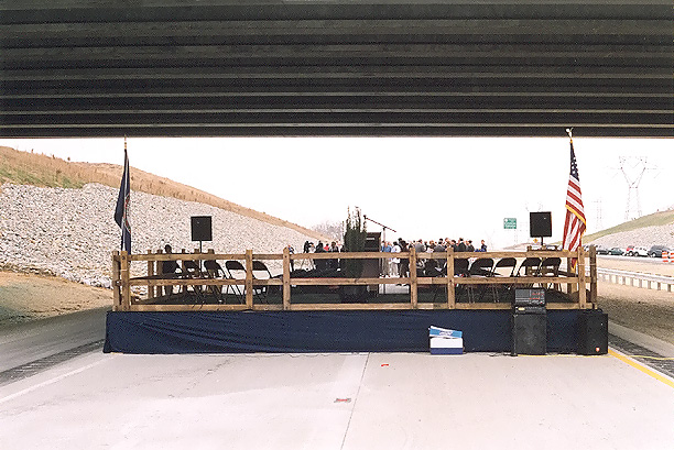 |
The Woolridge Road overpass is overhead, the rear of the speakers' platform is underneath. |
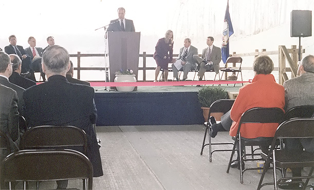 |
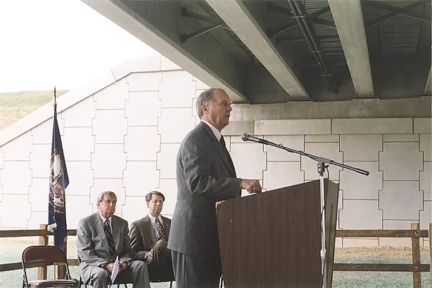
Thomas Hawthorne of VDOT speaking. The 'floor' under the audience's chairs is the Route 288 concrete roadway. |
 |
John Watkins, the state Senator for the region, speaking. His seat is the 10th District, which includes Amelia County (all), Chesterfield County (part), Cumberland County (part), Goochland County (part), Henrico County (part), Powhatan County (all), and Richmond City (part). |
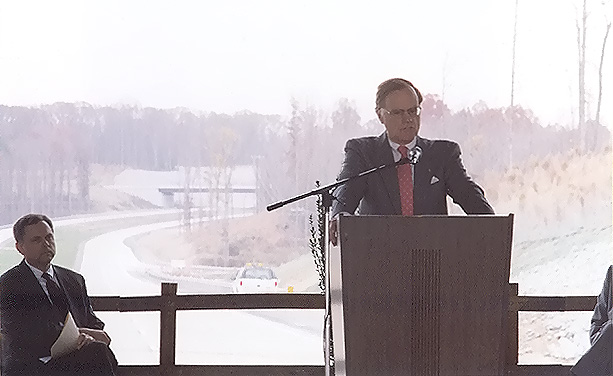 |
Virginia Secretary of Transportation, Whittington W. Clement, speaking. |
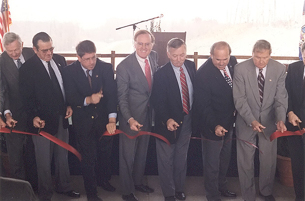 |
Ribbon cutting at the dedication ceremony. |
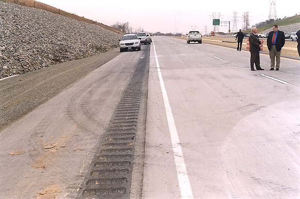 |
Close view of the shoulder design, with rumble strip. |
 |
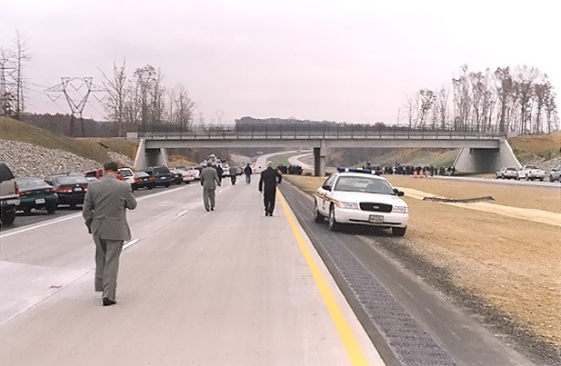
After the ceremony, the attendee traffic drove south on the Route 288 northbound roadway (where I took this photo), and made a u-turn on the Route 288 northbound off-ramp to Woolridge Road, and then used Woolridge Road to reach Charter Colony Parkway. |
 |
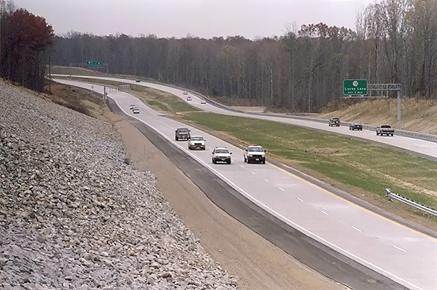
Route 288, looking north from the Charter Colony Parkway overpass over Route 288, in Chesterfield County. Photo taken about 30 minutes after ceremony ended. |
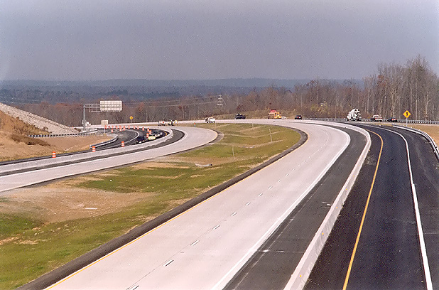 |
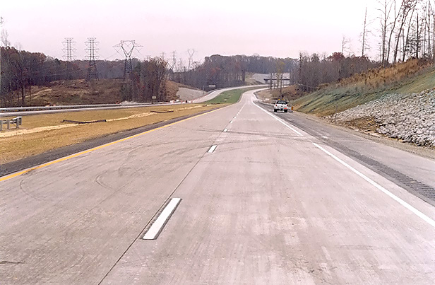
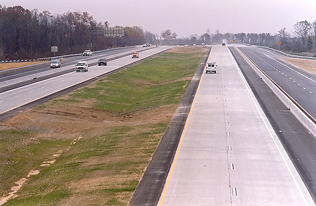
Looking north from the overpass where US-60 Midlothian Turnpike crosses Route 288. Route 288 has continuously reinforced concrete pavement on the two 2-lane mainline roadways, asphalt on the shoulders, and asphalt on the collector-distributor (C-D) roadways. At this interchange area, Route 288 has two mainline 2-lane roadways and two collector-distributor roadways, and the interchange is a full cloverleaf design, with all the Route 288 ramp terminals interfacing with the C-D roadways. |
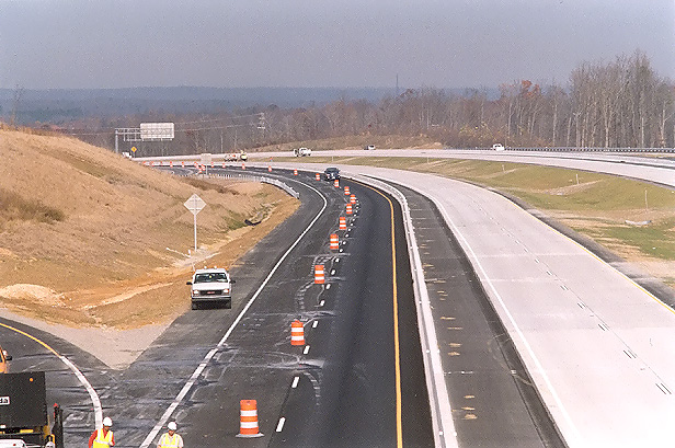 |
Looking north from the overpass where US-60 Midlothian Turnpike crosses Route 288. This photo was taken a few minutes after the previous photo, but standing over the southbound Route 288 roadway. This and the previous photo were taken about an hour after the ceremony ended. Route 288 traffic to and from the north utilizes the C-D roadways to access the ramps to US-60, and the mainline roadways were not open yet (all opened a couple hours later). |
 |
Route 288, looking north from the Charter Colony Parkway overpass over Route 288, in Chesterfield County, a couple hours after the opening of the final segment. |
 |
Looking north from where Charter Colony Parkway crosses Route 288, a couple hours after the opening of the final segment. This photo was taken from the same vantage point as the previous photo, but it was taken with a 135mm (2.7x) telephoto lens, instead of the 50mm (1.0x) regular lens used previously. The interchange and overpass for Woolridge Road is visible in the distance, still unopened as of Dec. 31st. |
 |
Route 288, looking south from the Charter Colony Parkway overpass over Route 288, a couple hours after the opening of the final segment. |
 |
Looking south from the overpass where US-60 Midlothian Turnpike crosses Route 288, a couple hours after the opening of the final segment. The Route 288 overpasses over the Norfolk-Southern Railway are visible in the distance. |
Lead article for Route VA-288 Construction - Western Section
All photos taken by Scott Kozel.
Copyright © 2005 by Scott Kozel. All rights reserved. Reproduction, reuse, or distribution without permission is prohibited.
By Scott M. Kozel, Roads to the Future
(Created 1-1-2005)