
| Route VA-288 Construction - September 2004 |
Here are 21 photos of Virginia Route 288 under construction, taken in September, 2004. Click the thumbnail photo for a larger photo (they range in size from 77 to 242 kilobytes, with most being less than 150 kilobytes).
The following 6 photos were taken from Charter Colony Parkway in Chesterfield County.
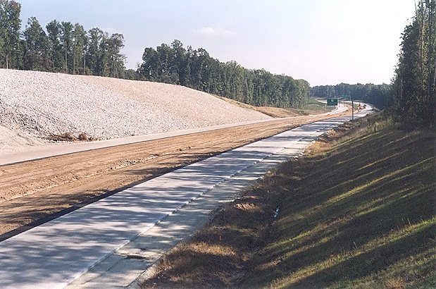 |
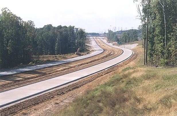
Route 288 construction, looking south from the Charter Colony Parkway overpass over Route 288. Paving operations are underway on Route 288, and continuously reinforced concrete pavement has been placed in a 10-inch-deep concrete slab. I have details of the concrete pavement design on my webpage Route VA-288 Construction - October 2003. This is in Chesterfield County. |
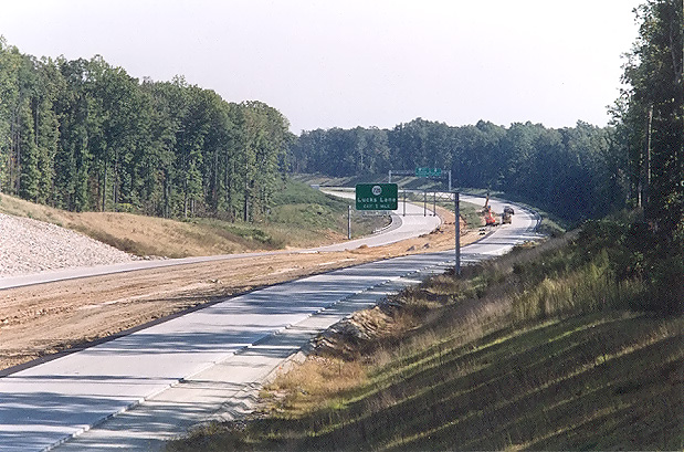 |
Route 288 construction, looking south from the Charter Colony Parkway overpass over Route 288. This photo was taken from the same vantage point as the previous photo, but it was taken with a 135mm (2.7x) telephoto lens, instead of the 50mm (1.0x) regular lens used previously. Paved shoulder construction is about to begin. |
 |
Route 288 construction, looking south from the Charter Colony Parkway overpass over Route 288. This vantage point is from the opposite side of Route 288 as the two previous two photos. |
 |
Route 288 construction, looking south from the Charter Colony Parkway overpass over Route 288. This photo was taken from the same vantage point as the previous photo, but it was taken with a 135mm (2.7x) telephoto lens, instead of the 50mm (1.0x) regular lens used previously. |
 |
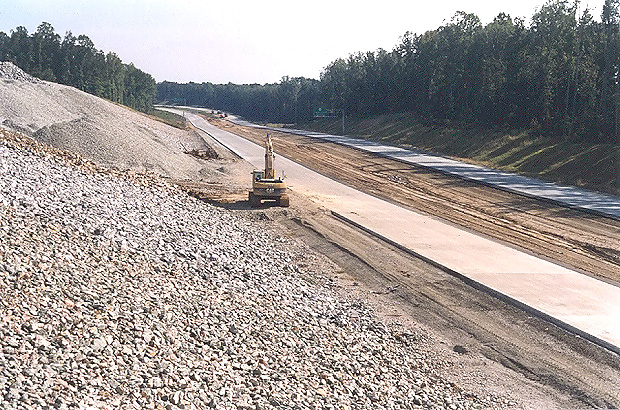
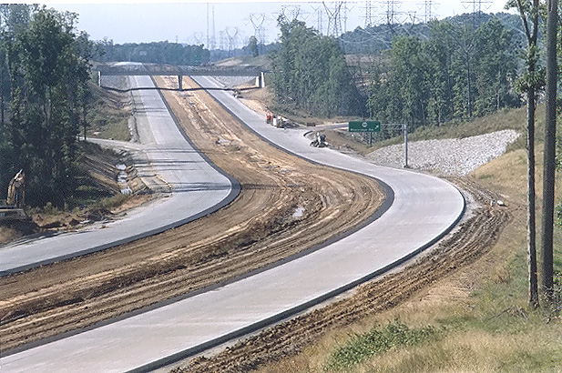
Looking north from where Charter Colony Parkway crosses Route 288. Paving operations are underway on Route 288, and continuously reinforced concrete pavement has been placed in a 10-inch-deep concrete slab. Paved shoulder construction is about to begin. |
 |
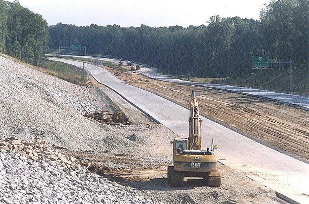
Looking north from where Charter Colony Parkway crosses Route 288. This photo was taken from the same vantage point as the previous photo, but it was taken with a 135mm (2.7x) telephoto lens, instead of the 50mm (1.0x) regular lens used previously. The interchange and overpass for Woolridge Road is visible in the distance. |
The following 15 photos were taken from an early September drive of the new section of Route 288 that opened to traffic on August 27th, the 6.7 miles of Route 288 between US-60 Midlothian Turnpike in Chesterfield County and VA-6 Patterson Avenue in Goochland County, including the Route 288 James River bridge.
|
NORTHBOUND |
|
 |
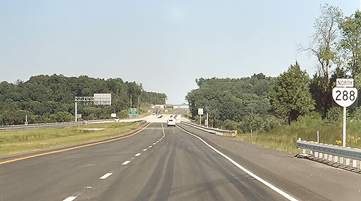
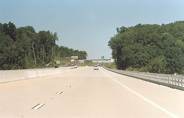
Route 288 northbound, two miles north of US-60 Midlothian Turnpike, in Powhatan County, just north of the boundary of Powhatan County and Chesterfield County. The Route 288 mainline pavement is comprised of asphalt north of the county line, and of continuously reinforced concrete pavement south of the county line. |
 |
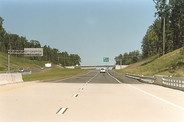
Route 288 northbound, in Powhatan County, a mile south of the VA-711 Huguenot Trail / Robious Road interchange. Route 288 crosses over Bernards Creek on twin 570-foot-long curved bridges, just south of the VA-711 interchange, and each bridge has 2 through lanes for Route 288 and one auxiliary lane for the VA-711 ramp. |
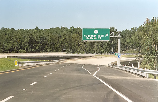 |
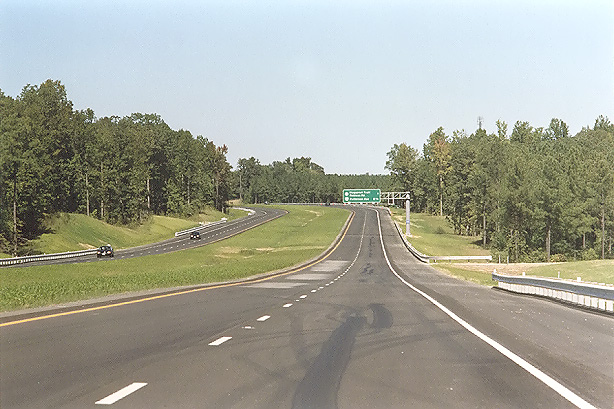
Route 288 northbound, in Powhatan County, a mile south of the VA-711 Huguenot Trail / Robious Road interchange. The Route 288 bridges ahead are the twin bridges over Bernards Creek. |
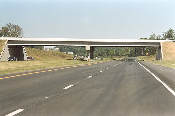 |
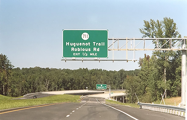
Route 288 northbound, in Powhatan County, at the VA-711 Huguenot Trail / Robious Road interchange, a diamond interchange with two signalized intersections between the ramp terminals and the four-lane divided VA-711. The bridge ahead is the four-lane VA-711 overpass. The James River bridge is just around the curve ahead and is not visible in this photo, but the VA-650 River Road overpass is visible in the far distance. |
 |
Route 288 northbound, in Powhatan County, approaching the twin-span 3,642-foot-long James River bridge. |
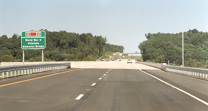 |
Route 288 northbound, in Powhatan County, approaching the James River bridge. The highway sign on the left has the WWII veterans campaign ribbon, and the name World War II Veterans Memorial Bridge. |
 |
Route 288 northbound, about midpoint on the James River bridge. The VA-650 River Road overpass is visible in the distance. |
 |
Route 288 northbound, approaching the north end of the James River bridge. North of the bridge is in Goochland County. A large earthwork cut between the James River bridge and VA-650, is up to 65 feet deep. |
 |
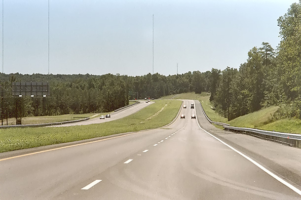
Route 288 northbound, in Goochland County, about 1/4 mile north of the James River bridge, approaching the VA-650 River Road overpass. |
 |
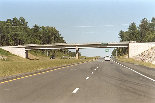
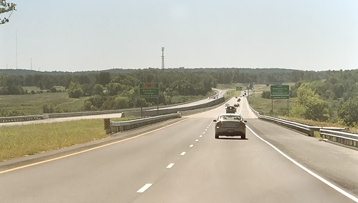
Route 288 northbound, in Goochland County, approaching the VA-6 Patterson Avenue overpass. VA-6 is a four-lane divided highway, and has a cloverleaf interchange with Route 288. |
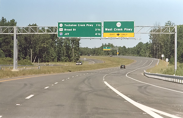 |
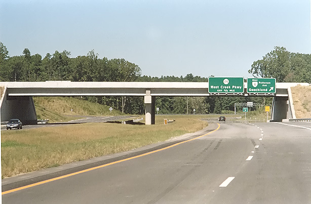
Route 288 northbound, in Goochland County, north of the VA-6 Patterson Avenue interchange, approaching the West Creek Parkway interchange. |
| SOUTHBOUND | |
 |
Route 288 southbound, in Goochland County, approaching the twin-span 3,642-foot-long James River bridge. The highway sign on the left has the WWII veterans campaign ribbon, and the name World War II Veterans Memorial Bridge. |
 |
Route 288 southbound, two and a half miles north of US-60 Midlothian Turnpike, in Powhatan County, just north of the boundary of Powhatan County and Chesterfield County. The Route 288 mainline pavement is comprised of asphalt north of the county line, and of continuously reinforced concrete pavement south of the county line. |
 |
Route 288 southbound, in Chesterfield County, two miles north of US-60 Midlothian Turnpike. Notice the continuously reinforced concrete pavement. |
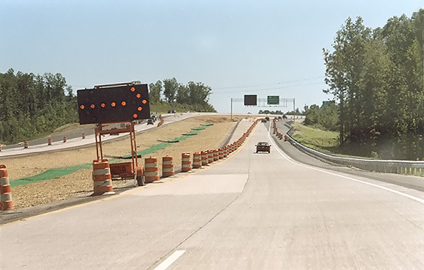 |
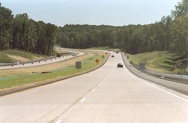
Route 288 southbound, in Chesterfield County, one mile north of US-60 Midlothian Turnpike. The line of barrels on the left is set to close the left lane and to channel all Route 288 southbound traffic off of the mainline roadway onto the collector-distributor (C-D) roadway which accesses the ramps to US-60. Route 288 at the time this photo was taken ended at US-60, and the Route 288 segment between US-60 and Lucks Lane opened on November 19, 2004, completing the last section of Route 288. |
Lead article for Route VA-288 Construction - Western Section
All photos taken by Scott Kozel.
Copyright © 2004 by Scott Kozel. All rights reserved. Reproduction, reuse, or distribution without permission is prohibited.
By Scott M. Kozel, Roads to the Future
(Created 11-1-2004, updated 12-1-2004)