
The Baltimore Metro rapid rail transit line operates along a 15.5-mile (24.8
km) long route between downtown Baltimore and Owings Mills in the northwest suburbs,
with 14 stations serving the communities along the system.
Links to sections:
Overview
Early Planning
for Rapid Rail Transit in the Baltimore Area
Funding Secured
to Begin Baltimore Subway Construction
Section "A" Design
and Construction
Section "B" - Owings
Mills Extension
Section "C" - Johns
Hopkins Extension
Station
Architecture and Artwork
Rail Cars and
Metro System Operation
Structure of Maryland
Department of Transportation
Sources
Links
Overview
The Baltimore Metro rapid rail transit line operates along a 15.5-mile (24.8
km) long route between downtown Baltimore and Owings Mills in the northwest suburbs,
with 14 stations serving the communities along the system, and it was built in
three sections (opened 8 miles in 1983, 6 miles in 1987 and 1.5 miles in 1995)
for a total cost of $1.392 billion. Metro trains are available every eight minutes
during morning and afternoon rush hours and every 10-20 minutes other times. Traveling
the entire line takes approximately 25 minutes. Free parking is available at all
Metro stations between Owings Mill and Mondawmin, inclusive. In addition, many
MTA bus lines serve the Metro Subway stations, offering convenient connections
to popular Baltimore area destinations. On September 2, 2001, a milestone was
reached with Sunday service being added, providing full 7-days-per-week service.
Even though most of the Baltimore Metro is aboveground, the term "subway" is commonly
used to denote the system, both today as well as in the past back to the system
planning stages in the 1970s.
The original planning name for the Baltimore heavy rail system was the Baltimore
Region Rapid Transit System (BRRTS). That rather unpleasant-sounding acronym gave
way to the name Baltimore Metro, which was what the subway was called upon opening
on November 21, 1983. "Metro" is a name recognized around the world in many cities
for a rapid rail transit system. Further extensions of the Baltimore Metro are
desirable, but none are actively planned at this time. Planning studies and maps
back in the 1970s detailed an extensive Baltimore region heavy rapid rail transit
system 71 miles long, with extensive downtown and suburban coverage similar in
concept to the Washington Metro (WMATA). Due to funding limitations, Baltimore
today has 15.5 miles of heavy rail transit and 30 miles of light rail transit.
Both lines traverse the downtown, and three suburban lines reach the northwest,
north, and south suburbs. The light rail extensions provide service to Baltimore-Washington
International (BWI) Airport and downtown Pennsylvania Station (Amtrak and MARC
commuter rail). The Metro line is completely grade-separated. The light rail system
is mostly grade-separated, with the line running on the surface of Howard Street
in downtown Baltimore.

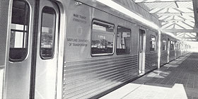
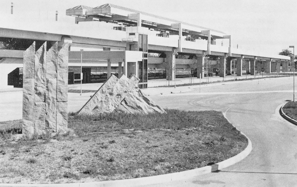
MDOT photo
Here is a map of the system with a list of the stations, and locations -
Baltimore, Maryland, Metro - Map.
Maryland
Transit Administration schedules for
Metro Subway.
Early Planning for Rapid Rail Transit in Baltimore
Area
Serious planning for rapid rail transit (as defined by electric heavy rail
transit with railroads with at least 2 tracks and full grade separation, and urban
and suburban service with high-platform multiple-unit trains) for the Baltimore
area began in the 1960s with an officially sponsored study that resulted in a
report published in 1968, looking at engineering and economic feasibility as well
as ridership projections. This report provided proposed line locations for a 71-mile-long
(114.3 km) regional rapid rail transit system with six radial lines and with a
downtown hub, with extensive downtown and suburban coverage similar in concept
to the Washington Metrorail system which was also in early planning and design
stages then. Due to funding limitations, further studies refined the Baltimore
system concept to a smaller 28-mile-long (44.8 km) system report called the Phase
1 Plan, published in 1971, using two lines from the 71-mile system, and the Phase
1 Plan system had a northwest line from the downtown to Owings Mills, and a south
line from the downtown to Glen Burnie and Friendship International Airport (today's
Baltimore-Washington International Airport (BWI)). The two lines in the Phase
1 Plan had a downtown junction at an underground two-level transfer station at
Charles Center. The rapid rail transit south line eventually fell victim to funding
limitations and local opposition.
See my article
Baltimore
Region Rapid Transit System for maps,
routes, train, station and cost information about the 1968-proposed 71-mile system
and the 1971-proposed 28-mile system. These include the references from the two
following reports. Baltimore Region Rapid Transit System, Feasibility and
Preliminary Engineering, prepared for The Mass Transit Steering Committee,
Regional Planning Council, Baltimore, Maryland, July 1968. Baltimore Region
Rapid Transit System, Phase 1 Plan, prepared by the Metropolitan Transit
Authority, January 1971. [1], [2]
See my article
Baltimore Central Light Rail Line for details
and photos of the 30-mile long Central Light Rail Line. The Central Light Rail
Line was built along a similar route to that of the once-planned rapid rail transit
south line, and it runs on Howard Street through downtown Baltimore, and it has
a north line to Timonium and Hunt Valley in the north suburbs. The proposed 71-mile
BRRTS system of 1968 also had a north line to Timonium, but its city routing was
a couple miles east of where the Central Light Rail Line was ultimately built.
Central Light Rail Line construction spanned 1992-1997, at a cost of $506 million.
There have been study proposals in 2000 and 2001 to build a downtown light rail
transit loop, and that could possibly entail extending the light rail spur which
now terminates at Penn Station (Penn Station handles AMTRAK intercity trains and
MARC commuter rail trains), and this extension would loop around the east edge
of the downtown and would connect into the existing light rail line near the stadium
complex at Camden Yards. The downtown light rail loop would provide better downtown
distribution of riders as well as provide more light rail system capacity through
the downtown. The new downtown loop line proposals are from 2 to 3 miles long,
and would cost from $250 million to $300 million. A $200 million Double Tracking
Project is now (in 2001) underway by MTA to double track most of the 1/3 of the
Central Light Rail Line system that was built with a single track (the rest was
built double tracked). Only the northernmost one mile just south of the Hunt Valley
north terminal, will remain single tracked. The Baltimore Metro and the Central
Light Rail Line do not have a direct junction station joining them, but each system
has a Lexington Market Station in the downtown, one block apart.
Funding Secured to Begin Baltimore Subway Construction
The whole saga of securing the public financial and political commitments to
begin the construction of Baltimore's first subway line, took a number of years
and a lot of work at the local, state and federal level. Baltimore like most large
cities had an extensive trolley/streetcar system for a number of decades, which
gradually became obsolete and gave way to systems of motor buses operating on
the road and highway system. Baltimore's last trolley lines closed in 1962. Subway/elevated
rail systems in general have much higher average speeds and much higher passenger
capacity, compared to the old trolleys.
The initial section of the system is the 8-mile long Section "A", which was
placed under construction in December 1976 and was opened to passenger service
November 21, 1983, and the total final cost for engineering, right-of-way and
construction, was $797 million, funded 80% with federal transit funds and 20%
from the Maryland Transportation Trust Fund. This was the largest public works
project in the history of Maryland up to that time. [9], [6], others
The 1968 and 1971 BRRTS planning studies laid the groundwork for the Baltimore
Metro, but no funding for construction was allocated then. A major legislative
struggle took place in the 1976 Maryland General Assembly, and the outcome was
full funding being put in place to build and make operational the 8 miles of Section
"A". A ceremonial groundbreaking occurred in 1974, but significant construction
did not begin until December 1976. Baltimore's delegation to the Maryland Senate
helped win a narrow victory in a confrontation with rural and suburban highway
interests in the 1976 Assembly. The Baltimore legislators obtained help from senators
representing the Washington suburbs, and Governor Marvin Mandel helped to persuade
the uncommitted members to favor the subway. [3]
In 1965, the Baltimore Area Mass Transportation Plan was published, and it
suggested a six-leg rail system, extending to all corners of the city, including
a central city loop. That plan led to the 1968 BRRTS Feasibility and Preliminary
Engineering study. The northwest line was seen as the ideal starting point for
construction of the system, because the northwest corridor was the most congested
traffic corridor in the city. The northeast corridor in the city was also pretty
congested, but the advantage that the northwest line had was that an existing
mainline railroad corridor, the Western Maryland Railway, occupied that corridor
from Wabash Avenue to Reisterstown Road, and would make an ideal path for almost
half of the northwest line to parallel aboveground, with just over half of the
8-mile line needing to be built belowground. [27]
In 1971, the MDOT Mass Transit Administration (MTA) officially recommended
the 28-mile-long Phase 1 Plan that I mentioned above. Without much controversy,
the 1972 Maryland General Assembly voted in 1972 to finance the construction of
Phase 1. The whole development process had gone fairly smoothly up until then,
but then various major controversies erupted. [27]
Citizens and political leaders in Anne Arundel County expressed fears about
"undesirable elements" coming into their area via the subway, and many transit
buffs cite this as the origin of the term "LOOT rail", a takeoff of "light rail"
meaning that criminals without cars who live in the city would take the subway
to the suburbs, commit burglaries and robberies, and then take the subway back
to the city; and that by building a subway to the suburbs, that such crimes would
be greatly facilitated. Most people would think this line of thinking to be nonsense,
since most people know how to drive and can borrow or steal a car if they have
criminal intentions. Still, in some other cities as well, including the D.C. area,
a significant number of suburbanites had these kind of general fears about having
city subway lines extended out to the suburbs.
The upshot of this in the Baltimore area, was that in November 1975, MTA officially
eliminated the entire south line from the Phase 1 Plan, in response to the above
kind of complaints. Controversy over the planned Northwest Expressway delayed
the portion of Phase 1 that would extend beyond the Reisterstown Road area near
the northwest Baltimore city line, to Owings Mills in the northwest suburbs. The
plan was to put the rapid rail transit line and stations in the median of the
expressway from Reisterstown Plaza to Owings Mills, and controversies over the
expressway's location delayed the process, and then finally the proposed section
of the expressway from the I-695 Baltimore Beltway to the Wabash Avenue / Liberty
Heights Avenue area in the City of Baltimore was deleted from the plans due to
inability to find an acceptable location for the expressway. Since MDOT was planning
the Northwest Expressway and the rapid rail transit line west of the city line
as a jointly designed and constructed project with a joint environmental impact
statement, the delays on the expressway also delayed the rail line. This controversy
also occurred in 1975, and at that point MTA indefinitely postponed the Owings
Mills extension, leaving only the 8 miles of the northwest line from the downtown
to the northwest city line in Phase 1, known as Section "A". At that point, Section
"A" was estimated to cost $721 million, or $90 million per mile at 1975 prices,
and substantial Maryland legislative skepticism arose to the wisdom of spending
that much money on a relatively short rapid rail transit line, which had no firm
plans for any extensions at any time in the near future, a line which would have
much more limited ridership potential than the previous, more extensive system
plans would have attracted. [27]
The 8-mile Section "A" was the subject of a major battle in the Maryland General
Assembly in early 1976. The General Assembly needed to approve legislation for
Maryland's 20% share of the funding for Section "A", which was $144.2 million
of the then-estimated $721 million total cost. That was a large sum of state tax
dollars, and many rural legislators began raising objections, fearing that the
subway would take money away from improvements to their highways. This was at
a time when over 20 miles of the then-proposed I-68 National Freeway in Western
Maryland was still unfunded, and when key 2-lane bottlenecks existed on the Eastern
Shore on US-50 and MD-404 at Cambridge and Vienna and Denton with 4-lane bypasses
proposed but as of then unfunded. US-50 and MD-404 on the Eastern Shore are major
vacation travel routes between the Baltimore-Washington area and the Atlantic
Ocean beaches at Ocean City and Rehoboth Beach. Maryland has a large demographic
political diversity, highly Democratic in the Baltimore-Washington area, but more
Republican-leaning on the Eastern Shore and in Western Maryland. As is typical
in federal and state legislatures in the U.S., the Maryland Senate is apportioned
based on land area, giving the rural senatorial legislators power above proportion
to their population. Governor Marvin Mandel and Baltimore Mayor William Donald
Shaefer were the most prominent advocates in favor of the subway, and Mandel spent
over a year marshaling the votes to pass the subway appropriation, meeting individually
with each delegate and senator. In April 1976, though, 22 senators opposed to
the subway mounted an 8-day filibuster to try to block it. The filibuster ended
with a compromise, and the vote was taken in the Senate, and the state budget,
which included the subway appropriation, passed by two votes. The budget bill
then went to the House of Delegates, where it passed easily on the last day of
the session. This cleared the final hurdle to construction of Section "A", which
began in December of 1976. [27]
Section "A" Design and Construction
Section "A" of the Baltimore Metro opened on November 21, 1983 at a cost of
$797 million. It runs from Charles Center Station in downtown Baltimore to the
Reisterstown Plaza Station near the northwest city line. It is 8 miles (12.8 km)
long, with the first 4-1/2 miles in subway, coming to the surface for about a
half mile, and the remaining 3 miles is on aerial structure. So the stations Charles
Center, Lexington Market, State Center, Upton, Penn-North, and Mondawmin are in
subway, and West Cold Spring, Rogers Avenue, and Reisterstown Plaza are aerial.
Section "A" construction ran from 1976 to 1983, and was the most expensive Maryland
public works project up to that time. Completion marked the opening of the first
heavy rail subway in Baltimore. Metro trains are up to six cars long.
Construction began in December 1976, and proceeded relatively smoothly after
overcoming some early problems in the construction of the subway Charles Center
Station in the downtown. The six subway stations were built by the cut-and-cover
construction method. This included excavation of the street and under the street,
underpinning of some adjacent buildings, and relocation of underground utilities,
all of which had to be kept in service without disruption. When cut-and-cover
construction passed under a street, the heavy downtown motor vehicle traffic was
carried on timber beam decking, which provided a temporary street roadway. Subway
construction took place in the huge excavated trench below. The concrete station
box was built in the trench, with the access shafts and escalators to the street.
Then the area around and over the station area was backfilled with earth up to
the street level, and the street pavement was rebuilt in its former location.
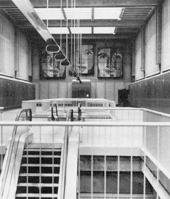
Station finishing work completed the station. All subway stations have three levels
- an entrance, a mezzanine where fares are paid, and a center platform for boarding
trains. The subway stations also have escalators, stairways, farecard vending
machines, fare gates, and elevators for the elderly and handicapped. [5]
All the tunnel sections between the underground stations, were built by the
bored tunnel construction method. There is a total of 1-1/2 mile of subway that
was tunneled through soft earth using a hydraulic shield which is jacked against
an erected steel liner. Compressed air is forced into the tunnel to stabilize
the surrounding earth while the shield advances. Another total of 1-3/4 miles
of subway was tunneled through rock, which was pre-split with small explosive
charges, and the rock and soil was excavated from the tunnel. In each method,
a reinforced concrete subway tunnel was then built inside the excavated tunnel.
Tracks, power and signaling equipment was built inside the concrete tunnel. The
underground portions of the system were built under portions of Baltimore Street,
Eutaw Street, Pennsylvania Avenue and Liberty Heights Avenue; and three horizontal
curve transitional underground sections were not under a specific street. The
Penn North Station is the deepest station on the system, with its train platform
120 feet below street level, and long escalators carrying patrons between the
street level and the station mezzanine. [5]
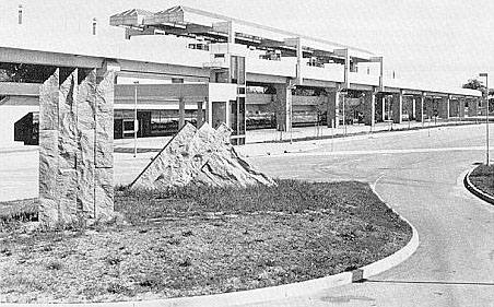
At the end of the Mondawmin Tunnel, the rapid transit line transitions from
subway to aerial structure, with a half mile of line at surface level in the transition.
Aerial line is built by clearing the land, then driving steel piles to reinforce
the foundations of the aerial structure, then building footers as foundations,
then building a reinforced concrete column on each footer, then building a T-shaped
reinforced concrete block on top of the column, then laying steel girders on top
of the piers from pier to pier, then building a reinforced concrete deck for trackway
on top of the girders. Tracks, power and signaling equipment was built on the
aerial structure. The aerial stations, like the subway stations, have three levels
- a ground level entrance, a mezzanine and a platform. Trains pull up to center
platforms which are about 25 to 28 feet above the ground. At the aerial stations,
parking spaces and kiss-n-ride bays are provided, and feeder buses link bus service
from neighboring communities to the rapid transit line. Reisterstown Plaza Station
has a parking lot for 2,500 automobiles, Rogers Avenue Station has a parking lot
for 320 automobiles, and West Cold Spring Station has a parking lot for 270 automobiles.
[5]
The system and its trains are powered and operated by electricity, which is
supplied to the system by a series of power substations adjacent to the rail line.
Traction power to the trains is supplied by a contact third rail, which is on
the railroad track bed just outside of the two train running rails.
The Operations Control Center for Baltimore Metro is located atop of the Metro
Lexington Market Station. The rail yard for service, inspection, repair and storage
of rail cars for the Baltimore Metro system is located just off of the main line,
near the Reisterstown Plaza Station.
In June 1981, the name of the system was changed from the Baltimore Region
Rapid Transit System (BRRTS) to the Baltimore Metro. "Metro" is the name recognized
around the world in various cities to denote their rapid rail transit system.
As I mentioned before, the acronym "BRRTS" was used for the Baltimore system at
least as far back as 1968, and came to be disliked by various officials and citizens.
L.A. (Kim) Kimball, the MDOT MTA administrator when the change was made, explained
the reasons for the change, and the desire to give the system a more universal,
international flavor. The name Baltimore Area Rapid Transit was an obvious possibility,
but its acronym, BART, was already used by the San Francisco system Bay Area Rapid
Transit; and MTA officials didn't want to use a name that already had been taken
and had a national identity. Regarding the BRRTS name, how would that be pronounced:
"burts" or perhaps "brits"? The Baltimore Sun had this to say:
"What do you do when the initials of
your city's rapid transit system - the Baltimore Region Rapid Transit System,
in this case - approximate the phonetic spelling of a Bronx cheer? If you're the
Mass Transit Administration, you change it to something that you hope will be
more easily identifiable, and certainly more pronounceable. Which is what the
MTA did yesterday. Henceforth, the system is to be called the Baltimore Metro".
Kimball was quoted,
"Metro is an international term that
means subway and rapid transit systems, not necessarily underground. Europe's
been using it for years, and now it's in use in this country".
[4]
The Section "A" construction started in December 1976, and the estimate for
total cost was $721 million, and the projected opening date was in Fall 1982.
With a final completion cost of $797 million and actual opening of the line on
November 21, 1983, it can be seen that the final product came in fairly close
to budget and time.
Section "B" - Owings Mills Extension
Section "B" of the Baltimore Metro, the
6-mile (9.6 km) extension from Reisterstown Plaza to Owings Mills, opened in July
1987. This includes the stations Milford Mill, Old Court, and Owings Mills. This
extension is essentially at surface level. The line enters Interstate expressway
right-of-way when it reaches the I-695 Baltimore Beltway. It occupies the median
of the I-795 Northwest Expressway from I-695 to the Owings Mills Boulevard interchange.
The Owings Mills Station is in the I-795 median, and the other two are east of
I-695. The Owings Mills Station is the suburban terminal of the northwest line
of the Baltimore Metro, and it has a huge park-and-ride lot with 3,500 parking
spaces for automobiles, and bays for kiss-n-ride and feeder buses. The I-795 Northwest
Expressway opened from I-695 to Owings Mills Boulevard around 1984, and the expressway
was designed and built specifically to accommodate the Baltimore Metro rapid rail
transit extension to Owings Mills, with the rail line in the median. The Owings
Mills Extension cost $255 million, and opened in July 1987. The federal funding
for the extension came from Interstate highway transfer funds, from the cancelled
segment of I-70 in the City of Baltimore running from Security Boulevard to proposed
I-170. The total funding package for Section "B" was comprised of 85% federal
Interstate highway transfer funds and 15% state tax funds. [30, 31]
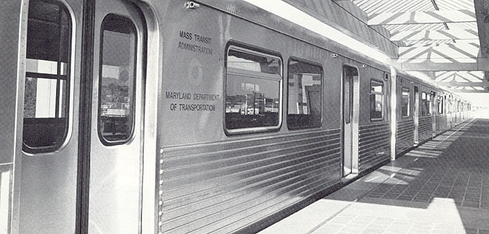
The Baltimore Metro rail car fleet was expanded for the opening of Section
"B", with 28 cars ordered, so after all the cars were delivered, the original
fleet of 72 cars was expanded to 100 cars. The 100-car fleet was intended to fill
the needs Section "A", the Owings Mills Extension then under construction, and
the then-proposed extension to Johns Hopkins Hospital. In 2001, the Metro fleet
consists of 100 heavy-rail cars in 50 married pairs. [30, 31]
Section "C" - Johns Hopkins Extension
The 1.5-mile (2.4 km) extension of the Baltimore Metro from the Charles Center
Station to Johns Hopkins Hospital opened in May 1995, and includes the Shot Tower/Market
Place Station. The line extension and two stations are in subway, and it cost
$340 million to build, funded 80% with federal transit funds and 20% from the
Maryland Transportation Trust Fund. This extension runs from the Charles Center
station in downtown Baltimore to the Shot Tower/Market Place area in downtown
Baltimore's east side and Johns Hopkins Hospital, one of the state's largest employers.
The Shot Tower/Market Place Metro station is located within walking distance of
the historic Shot Tower and City Life Museum. The Johns Hopkins Metro station
was built in the center of the Johns Hopkins Hospital campus with an underground
walkway connecting the hospital to the south entrance of the Metro station. The
northern end of the line north of the Johns Hopkins Station, was designed to be
compatible with a future northeast extension of the rapid rail transit line. [31]
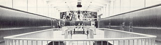
Station Architecture and Artwork
Baltimore Metro rapid transit stations have varied architectural designs. The
Washington Metro used common station design themes, and a high vaulted arch in
the subway stations. The Baltimore Metro subway stations have the more conventional
box structure, but by using differing mezzanine ceiling heights, some of which
are quite high, each subway station in the system has its own unique signature
from an architectural standpoint. The canopies of the aerial stations also differ
from station to station.
There was no need to worry that Baltimore's new rapid transit system would
be indistinguishable from other rapid transit systems. The system has a character
of its own, and each of the nine Section "A" neighborhood stations was designed
by a different architect and accented by its own signature artwork. The Lexington
Market Station easily has the most to offer the senses, with the open-air food
market Lexington Market just outside of the station.
"On a succession
of beams over the platform level is Baltimore artist Patricia Alexander's internationally
flavored ceramic tile mosaic. It instantly catches the eye as the train enters
and leaves: blue-green motifs from one side, red-yellow from the other, moving
together and separating as perspective changes in a warm blur of color. Walking
from one end of the platform another, a visitor can pass through olfactory zones
of baking bread and steak subs and (maybe) pizza, and whatever the nose recognizes
from the grills and stalls of the market. It wasn't planned, says subway spokeswoman
Jane Howard, but the Lexington station is the only one that can be identified
by smell."
[24]
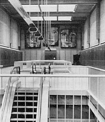
Large works of art were also created for each rapid transit station, to provide
even more architectural enhancement. Works of art were created for the nine Section
"A" stations under a $600,000 program funded 80% by the federal government and
20% by the state. The artists, who included four Baltimoreans, were selected by
a Mass Transit Administration (MTA MDOT) Fine Arts Selection Panel composed of
local art professionals and practicing artists and approved by MTA. Considerable
time was spent by the panel studying the architecture of the six subway and three
aerial stations before recommending to the MTA the type of art and artist which
would best complement the stations.
"The art-in-the-stations program has improved the visual environments of our stations,"
said MTA Administrator David A. Wagner, "while providing the opportunity for a
number of artists to get broad exposure through a major public art project."
[14, 19]
Here's an art summary of each Section "A" station -
Charles Center Station - neon tube sculpture by Stephen Antonakos of New
York, $64,350.
Lexington Market Station - multicolored ceramic tile mosaic adapting ethnic
designs by Patricia Alexander of Baltimore, $68,300.
State Center Station - mobile sculpture crafted by Paul Daniel of Baltimore,
$39,000.
Upton Station - glass and ceramic mosaic by Romare Bearden of New York,
$114,000.
Penn-North Station - abstract environmental work by E. Marc Treib of California,
$48,265.
Mondawmin Station - backlit photographic montage by R. Thomas Gregory of
Baltimore, $85,000.
West Cold Spring Station - abstract sandstone sculpture by Jim Sanborn
of Washington, D.C., $39,000.
Rogers Avenue Station - abstract weathering steel sculpture employing machinery
imagery by Gregory Moring of Baltimore, $39,000.
Reisterstown Plaza Station - "sun and neon" piece by Rockne Krebs of Washington,
D.C., $39,000.
Rail Cars and Metro System Operation
The hub and nerve center of the Baltimore Metro is the Operations Control Center,
which is located at Eutaw and Saratoga Streets in downtown Baltimore. Control
of the operations of the Metro system and other Metro systems such as communications
and traction power is maintained from this center. The Operations Control Center
is located atop of the Metro Lexington Market Station. Operations of the rapid
rail transit line is largely automatic, but human supervision still has an important
role in ensuring system reliability and safety. In the central control room, a
rail transportation supervisor monitors both rail vehicle activity on the line
as well as communications with the operators on each train. The control room has
modern train control panels, indicator panels, monitors, and a computer and video
display terminal. A large wall-display panel has a straight-line schematic of
the rail system, and small red lights are used so that the rail supervisor can
track each train as it travels from station to station on the main line, and also
track the movement of a train as it enters the main line from the main yard, or
leaves the main line and enters the main yard. Another major panel in the central
control room is the traction power panel, where a supervisor can instantly see
the complete status of electrical power being supplied to the system to power
the trains and stations. [15]
The rail yard for service, inspection, repair and storage of rail cars for
the Baltimore Metro system is located just off of the main line, near the Reisterstown
Plaza Station near the Baltimore city line.
The train control system of the Baltimore Metro is made up of three sub-systems
- Protection, Operation and Supervision. The Protection sub-system is automatic
and will provide a minimum of 2-minute headways (spacing between trains), and
also provides overspeed protection. The Operation sub-system is semi-automatic
and it directs trains to start and stop, regulates speeds, spaces trains and routes
them through crossovers and switches; and the train operator person opens and
closes the doors, and as an alternative the train operator can operate the train
manually. The Supervision sub-system is semi-automatic and includes train dispatch,
performance and routing. [15]
Initial operation of Section "A" provided service from 5:00 A.M. to 8:00 P.M.,
Monday through Friday, with rush hour per-direction service of a train every 8
minutes and with 10-minute spacing during other hours. Patrons gain access to
the system by a farecard that is purchased from farecard vending machines located
near the station entrances, where a one-way or round-trip ticket, with or without
bus transfer privileges, can be purchased. Monthly pass users and ticket users
use their card to electronically open a faregate so that they can gain access
to the train platform, where they can wait for the next train, get on board, and
then exit the train at their destination. They use the same farecard to exit the
faregate to leave the system, and the fare is deducted from the card in the case
of a value card. [16]
MDOT MTA increased its police force to 100 sworn officers when Section "A"
opened in 1983. The officers travel on trains and buses, in plain clothes and
in uniform, to "establish a strong presence, so that people will know that it
is safe". Each rail car is equipped with emergency telephones. The stations are
well-lighted and are designed with few barriers that criminals can hide behind,
and with clear sight lines so that passengers and police can easily see from one
end of the platform to the other, and with closed-circuit television to monitor
those parts of the station that can not be seen from the station attendant's booth.
Ron Hartman, deputy MTA administrator when Section "A" opened in 1983, was quoted
as saying,
"We hope we will follow in Washington's footsteps
and be able to say you are safer on the subway than on the streets. We're doing
everything we possibly can to assure people the system will be safe. If people
perceive the system as safe, then they will ride it".
The system has a complex fire control safety
system with sprinklers along the tracks and overhead in each station to create
a "curtain of water" through which passengers could escape a fire. MTA worked
closely with city fire marshals when they designed this fire control safety system.
Exhaust fans are placed throughout the tunnels and are designed to push or pull
smoke wherever necessary. Each tunnel tube has emergency exits and cross passages
so that passengers can get from one track to the other in an emergency, and to
exit the system. [21]
Modern rail transit cars are quite complex and expensive, and their construction
has often been on the critical path of delays in expanding rail transit service
in various cities.
"Subway cars are among the most sophisticated
pieces of equipment running on rail lines today", according to Paul O. Sichert,
Jr., a Budd vice president. "Each car, which is self-propelled, has 38,000 parts.
It's like you have a locomotive under each car".
It typically takes 24 months from signing
a contract to design and build a group of cars, before the first one is delivered
to the customer. These cars also utilize large amounts of stainless steel and
high-tensile carbon steel, 80 different thicknesses to make side frames, walls,
doors, roofs and floors. All the complicated propulsion, braking, heating and
cooling, signaling and automatic train control systems are installed under the
floor of the car with connections to sophisticated computers inside the car. Up
to 20,000 feet (6,096 meters) of wire and cables, tubes and conduits of different
lengths and thicknesses pass from one assembly housing to another under the floor
of the car and into the on-board computer system and controls in the booth from
which the operator runs the car. Testing of the completed car is complex also,
with about 70 different tests being carried out over a period of time. [23]
The system and its trains are powered and operated by electricity, which is
supplied to the system by a series of power substations adjacent to the rail line.
Traction power to the trains is supplied by a contact third rail, which is on
the railroad track bed just outside of the two train running rails.
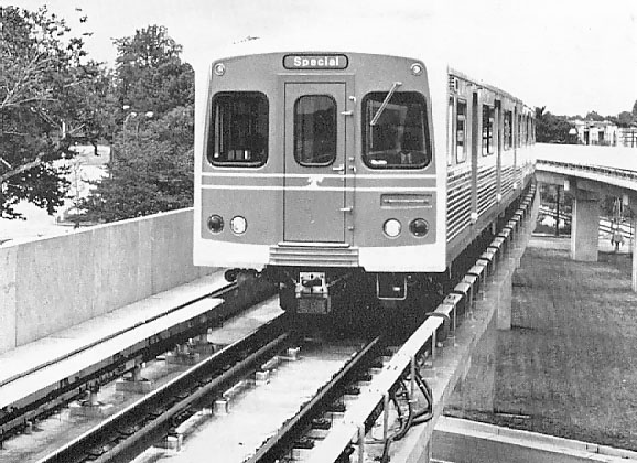
The Baltimore Metro vehicles were built in the same contract as that of the
Miami, Florida rapid rail transit system. Both Miami and Baltimore cars are identical
except for the paint design. The Baltimore Subway car is the Budd Universal Rapid
Transit Car (BURT). It is 75 feet long, 10 feet 2.5 inches wide, 12 feet high,
3 feet 6.5 inches floor height, weighs 76,000 lbs., has 76 seats, has 275 passenger
crush load, uses 700 VDC electric power, has a maximum speed of 70 MPH, with minimum
horizontal radius of 250 feet, with chopper control, and air conditioning. There
are 3 sets of biparting doors on each side. The cars do have train doors at each
end, however passenger passing between cars is prohibited. There are air initiated,
hydraulic tread brakes that are regenerative, with a dynamic brake also. The cars
operate in married pairs, and there is a full width cab at one end of the car.
The operator controls are on the left side (same as a bus). All Baltimore Metro
stations have island platforms. Baltimore Metro operates 2, 4, and 6 car trains
as needed, with station platform length limiting the maximum train length to 6
cars.
As it turned out, both the Baltimore Metro and the Miami Metrorail approached
their first line opening at about the same time in late 1983. Miami had 136 rail
cars on order, and Baltimore had 72 on order to be delivered first before Miami,
and the whole rail car contract was behind schedule. In July 1983, Baltimore had
only 32 cars delivered, and needed at least 58 cars to begin operation on Section
"A". Miami needed at least 40 cars to begin operation on its first section (the
whole Miami Metrorail system eventually expanded to 18 miles of route). Miami
Metrorail officials approached the Budd Company and MDOT MTA and requested delivery
of its first 40 cars after Baltimore had received its first 58 cars. At first,
MDOT MTA refused to delay its order for 72 cars, but a compromise was worked out
between officials of the two rail systems, where Baltimore would get 58 cars,
then Miami would get 40 cars, and then Baltimore would get its final 14 cars,
and then Miami would get the remainder of its order. Baltimore Metro opened its
Section "A" with 58 cars in November 1983, Miami Metrorail opened its first section
with 40 cars in December 1983, and Baltimore Metro got its final 14 cars in 1984.
The key persons in resolving this whole issue in a manner which would benefit
both cities, were William Lehman, Florida Democrat in the U.S. House of Representatives,
who then was the chairman of the Appropriations subcommittee which allocated $27
billion annually in federal transportation funds in the U.S., and Congressional
colleague Steny H. Hoyer, a Maryland Democrat; and Lehman engineered an agreement
with Hoyer. The deal was that Miami would get its cars and Maryland would get
more than $100 million in extra federal transportation grants plus the friendship
of an influential Congressman. [6, 8, 23]
Initial ridership projections while the system was being planned was that weekday
ridership would be 83,000 passengers per day after Section "A" opened, increasing
to 104,000 when the Section "B" Owings Mills Extension opened. [3] Actual ridership
in November 1984 was 38,000. [29] Ridership in 2001 is about 55,000. [31]
Structure of Maryland Department of Transportation
In the article "A Unique City-State Relationship", Mass Transit
magazine, September 1983, by Frederic B. Hill, is a good description of the Maryland
Department of Transportation as was structured in 1983. Much of the same basic
structure is still in place today in 2001. Maryland is one of the smallest states
in the country in land area, rank number 42, while still having substantial population,
now over 5 million residents. A number of unusual features, including its geographical
location, have contributed to a transportation organization that is rare in the
United States. All public transportation activities are extraordinarily centralized,
in a manner that fits the demographic and geographical factors of the state of
Maryland. About 90% of the state's population is concentrated in the Baltimore
area and in the Washington, D.C. suburbs, and the two areas now conjoin and are
considered by the U.S. Census Bureau as a consolidated metropolitan statistical
area, the Baltimore-Washington area, with 7.6 million population in the 2000 Census
(2.5 million in the Baltimore area, 5.1 million in the Washington area). There
are no other large cities in Maryland, and there are large rural areas with a
collection of small towns and small cities, including regional areas called Western
Maryland, Southern Maryland and the Maryland Eastern Shore. Various small cities
and towns in Maryland have public transit also, but the high-capacity systems
for rail and bus mass transit in Maryland are concentrated in the Baltimore-Washington
area. [7]
In addition to the two large and costly transportation systems in the Baltimore-Washington
area, Maryland also has a large commercial airport, and the third-busiest port
on the East Coast, and a heavily traveled network of Interstate highways and other
freeways. Maryland was the first state to establish a statewide Department of
Transportation. The
Maryland Department of Transportation (MDOT)
was created in 1971, and it is comprised of seven agencies, for highways, port
administration, airports, mass transit, toll facilities, railroads and motor vehicles.
The Mass Transit Administration (MTA) administers the bus, Metro rail and light
rail systems in the Baltimore area, as well as the MARC commuter rail systems
in the Baltimore area and in the Washington area. Baltimore has the only totally
state-operated subway system in the U.S.
The
Washington
Metropolitan Area Transit Authority (WMATA)
operates the 103-mile Metrorail system and the Metrobus system in the District
of Columbia and its Maryland and Virginia suburban areas. WMATA as a political
unit is an interstate compact between D.C., Maryland and Virginia, and the compact
includes the localities of the District of Columbia, the Maryland counties of
Montgomery and Prince George's, the Virginia counties of Fairfax, Arlington and
Loudoun, and the Virginia cities of Alexandria and Fairfax. The states and localities
chartered the interstate compact with approval of the U.S. Congress in 1968.
WMATA's political structure reflects the interstate nature of bus and rail
transit in the Washington, D.C. metropolitan area. MDOT MTA administers the bus
and rail systems in the Baltimore metropolitan area, and the whole MARC commuter
rail (local passenger trains operating on a mainline railroad) system, which serves
both areas. Maryland was the first state to have a full-fledged transportation
trust fund, where all transportation tax and fee revenues, including bus and rail
fares, are deposited. The MDOT Consolidated Transportation Program (CTP) is the
annually-updated TIP (common acronym for transportation improvement program) where
transportation trust funds are programmed for allocation over a 5-year period.
Only highway toll facilities have their own separate fund, due to a more direct
link to state toll revenue bonds.
Today in 2001, to meet the needs of travelers and commerce, MDOT operates as
an integrated system encompassing six distinct agencies including the
Maryland
State Highway Administration, the
Maryland Transit Administration, the
Maryland Aviation Administration,
the
Maryland Port Administration,
the
Maryland Motor Vehicle Administration,
and the
Maryland Transportation Authority. The MDTA is a public enterprise that develops,
finances and operates the State's seven toll facilities. Maryland is one of just
a few states that include all modes of transportation under one self-financed
agency. The State's Transportation Trust Fund finances all of MDOT's capital and
operating costs giving the flexibility to direct adequate funding to priority
transportation projects across the State no matter what mode of transportation
is required to meet Maryland's transportation needs.
From MDOT's website in October 2001, the following quote is from
Transportation Trust Fund
(blue text):
Transportation needs in Maryland are funded from an integrated account called
the Transportation Trust Fund. The Transportation Trust Fund was created in 1971
to establish a dedicated fund to support the Maryland Department of Transportation
(MDOT). The use of this integrated trust fund approach allows Maryland a tremendous
flexibility to meet varying transportation service and infrastructure needs. The
continuing commitment to these needs has provided Maryland with the excellent
infrastructure system necessary to support the economic growth of the State. All
activities of the Department are supported by the Trust Fund, including debt service,
maintenance, operations, administration, and capital projects. Unexpended funds
remaining in the Trust Fund at the close of the fiscal year are carried over and
are not reverted to the State's General Fund.
All funds dedicated to the Department are deposited in the Trust
Fund and disbursements for all programs and projects are made from the Trust Fund.
Revenues are not earmarked for specific programs; the allocation of funds to projects
and programs is made in conjunction with state and local elected officials. Sources
of funds include motor fuel taxes, motor vehicle excise (titling) taxes, motor
vehicle fees (registrations, licenses and other fees), and federal-aid. In addition,
the Trust Fund also includes corporate income taxes, operating revenues (e.g.,
transit fares, port fees, airport fees), and bond proceeds. Federal-aid projections
are based on current appropriations and the match required to meet capital program
cashflow requirements. Bonds are issued to support the cashflow requirements of
the planned capital program while maintaining debt coverage requirements.
Certain Trust Fund revenues are shared with other state agencies
and local governments based on statutory requirements. The funds in the Gasoline
and Motor Vehicle Revenue Account are distributed 70 percent to MDOT, 15 percent
to Baltimore City, and 15 percent to the counties and municipalities based on
motor vehicle registrations and road miles. Deductions are also made for certain
General Fund purposes, including environmental, fuel tax collection, and state
police programs. After the state agency and local government deductions, the remaining
funds are allocated for debt service, MDOT operating expenditures, and MDOT capital
expenditures. MDOT expenditures are for various modes of transportation: State
Highway Administration (SHA), Maryland Transit Administration (MTA and MARC),
Washington Area Transit Programs (WMAT), Maryland Port Administration (MPA), Maryland
Aviation Administration (MAA), and Motor Vehicle Administration (MVA and ISC).
The Transportation Trust Fund permits the State tremendous flexibility
to meet the needs of a diverse transportation system. Although Maryland was one
of the first states to have an integrated trust fund, it is a model copied by
other states. By working closely with the rating agencies and maintaining financially
prudent criteria regarding the Trust Fund, the Department has one of the highest
credit ratings given to transportation agencies.
Sources
1. Baltimore Region Rapid Transit System, Feasibility and Preliminary
Engineering, prepared for the Mass Transit Steering Committee, Regional
Planning Council, Baltimore, Maryland, July 1968.
2. Baltimore Region Rapid Transit System, Phase 1 Plan, prepared
by the Metropolitan Transit Authority, January 1971.
3. "Struggles Continue for Baltimore", Mass Transit magazine, March
1980, article by Kenneth T. Berents, transit reporter for the newspaper
Baltimore Sun.
4. "MTA gives BRRTS backseat to Metro", Baltimore Sun, June 1981,
article by Tom Linthicum.
5. "Building the Baltimore Region Rapid Transit System", MDOT MTA, about 1981.
6. "Baltimore Welcomes New Metro as Vital to Continuing Renewal", Mass Transit
magazine, September 1983, article by Frederic B. Hill, transportation reporter
for the newspaper Baltimore Evening Sun.
7. "A Unique City-State Relationship", Mass Transit magazine, September
1983, article by Frederic B. Hill.
8. "Baltimore Metro Opens", Modern Railroads magazine, September
1983.
9. "Baltimore Transit Begins New Era", Transit Today, Maryland Department
of Transportation, Mass Transit Administration (MDOT MTA), Fall 1983.
10. "Cooperative Funding Propels Metro From Planning to First Rider", Transit
Today, MDOT MTA, Fall 1983.
11. "Section B Goal: 1987", Transit Today, MDOT MTA, Fall 1983.
12. "MTA Looks to the Northeast", Transit Today, MDOT MTA, Fall
1983.
13. "Facts About the Baltimore Metro Car", Transit Today, MDOT MTA,
Fall 1983.
14. "Metro Art Improves Environment", Transit Today, MDOT MTA, Fall
1983.
15. "Control Center Voices are Key to Train Movement", Transit Today,
MDOT MTA, Fall 1983.
16. "MTA Opens Easy-to-use Baltimore Metro System", news release from MDOT MTA,
November 1983.
17. "Baltimore Metro Ready for Passengers", news release from MDOT MTA, November
1983.
18. "Baltimore Metro Accessible to Handicapped", news release from MDOT MTA, November
1983.
19. "Baltimore Metro Stations Feature Specially Commissioned Art Works", news
release from MDOT MTA, November 1983.
20. "Baltimore Metro Facts and Figures", handout sheet from Maryland Department
of Transportation, Mass Transit Administration, November 1983.
21. "Small as subways go, line is No. 1 among Md. public works", by Joel McCord,
Baltimore Sun newspaper, November 20, 1983, Page B7.
22. "Is 8 miles worth $797 million?", by Joel McCord, Baltimore Sun,
November 20, 1983, Page B7.
23. "Cars made of tons of steel, miles of wire - and Velcro", by Joel McCord,
Baltimore Sun, November 20, 1983, Page B8.
24. "Stations distinguished by their artwork, and in one case, aromas", by Luther
Young, Baltimore Sun, November 20, 1983, Page B8.
25. "Future Metro stations to cost localities more", Baltimore Sun,
November 20, 1983, Page B8.
26. "Mayor fears that subway is not being promoted enough", by Patrick A. McGuire,
Baltimore Sun, November 20, 1983, Page B9.
27. "Politics, not philosophy, got subway past '76 filibuster", by Patrick A.
McGuire, Baltimore Sun, November 20, 1983, Page B7.
28. "San Francisco's BART overcame rocky start as subway pioneer", by Joel McCord,
Baltimore Sun, November 20, 1983, Page B9.
29. "Baltimore Metro - A Blessing in Disguise?", Mass Transit magazine,
April 1985, article by Frederic B. Hill, transportation reporter for the newspaper
Baltimore Evening Sun.
30. "Baltimore Metro: Two, and Growing", Railway Age magazine, November
1985.
31.
Maryland Department of Transportation (MDOT)
32. Washington
Metropolitan Area Transit Authority (WMATA)
Links
See my article
Baltimore Region Rapid Transit System
for maps, routes, train, station and cost information about the 1968-proposed
71-mile system and the 1971-proposed 28-mile system. These include the references
from the two following reports. Baltimore Region Rapid Transit System, Feasibility
and Preliminary Engineering, prepared for The Mass Transit Steering Committee,
Regional Planning Council, Baltimore, Maryland, July 1968. Baltimore Region
Rapid Transit System, Phase 1 Plan, prepared by the Metropolitan Transit
Authority, January 1971. [1], [2]
See my article
Baltimore Metro Subway - Photos,
for links to photos of various parts of the Baltimore Metro system. Currently,
these are the stations on the article -- Charles Center Station - 5 photos; Shot
Tower Station - 1 photo; Johns Hopkins Hospital Station - 4 photos.
Jon Bell has information and several photos of the Baltimore Metro -
Baltimore, Maryland: Metro Subway.
Copyright © 1997-2002 by Scott Kozel. All rights reserved. Reproduction, reuse,
or distribution without permission is prohibited.
Back to top
By Scott M. Kozel, Roads to the Future
(Created 10-30-1997, expanded 10-23-2001, updated 10-13-2002)
