
| Capital Beltway (I-495 and I-95) |
Capital Beltway (I-495 and I-95)
 |
The Capital Beltway is the 64-mile-long Interstate freeway that encircles Washington, D.C., passing through Virginia and Maryland, carrying the Interstate I-495 designation throughout, and carrying the overlapping Interstate I-95 designation on the eastern portion of the Beltway. |  |
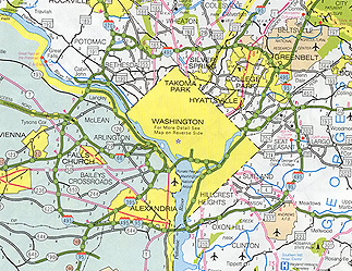 |
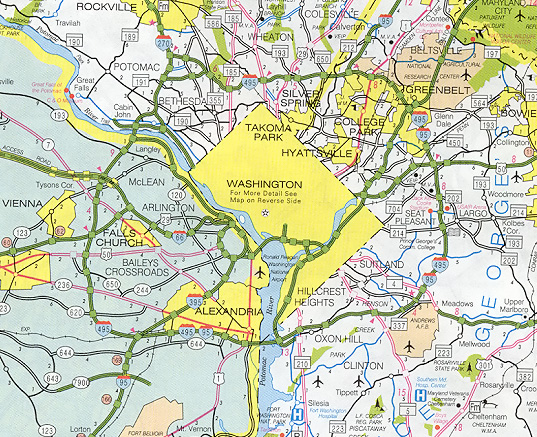
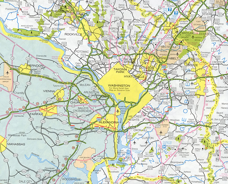
Capital Beltway is I-495, from MDOT SHA 2000 state map. Larger images - medium (235K), and large (469K). |
The name of this freeway while it was still in the planning stages in the 1950s was the Washington Circumferential Highway. Formal planning for the Beltway began in 1950, and it was included as part of the 41,000-mile national Interstate Highway System in the Federal Aid Highway Act of 1956, and construction of the highway began in 1955. The highway was officially named "Capital Beltway" by actions of Maryland and Virginia officials in June, 1960, and that has been the official name since then.
The I-495 Capital Beltway was fully completed when its final segment was opened to traffic on August 17, 1964. I-495 is 64 miles long; with 22 miles in Virginia, and 42 miles in Maryland. When opened, road was four lanes wide (two each way) for 14 miles between I-95 at Springfield, Virginia, and the American Legion Memorial Bridge over the Potomac River near Cabin John, Maryland. The Legion Bridge and the remaining 50 miles of the Beltway had six lanes (three each way).
For more Capital Beltway historical
details, see Capital Beltway dot com
article:
Capital
Beltway History.
Capital Beltway dot com is the Capital Beltway annex to Roads to the Future.
In the span of 1972 to 1992, nearly the entire Beltway was widened to eight lanes (four each way). In 1972, Maryland completed Beltway widening to eight lanes (four each way) between MD-210 Indian Head Highway and MD-97 Georgia Avenue, a distance of 29 miles. In 1977, Virginia completed Beltway widening to eight lanes between US-1 Jefferson Davis Highway and VA-193 Georgetown Pike, a distance of 21 miles. In 1990, Maryland completed Beltway widening to eight lanes between MD-97 Georgia Avenue and I-270/MD-355, a distance of 4 miles. In 1991-92, Maryland and Virginia completed Beltway widening to eight lanes between I-270 Spur and VA-193, a distance of 5 miles; this included the American Legion Memorial Bridge and approaches to each interchange closest to the river, which was widened to 10 lanes. The 3 miles of Beltway between I-270/MD-355 and I-270 Spur is adequate at six lanes, as the traffic volume is about 1/2 of that of the adjoining sections of the Beltway.
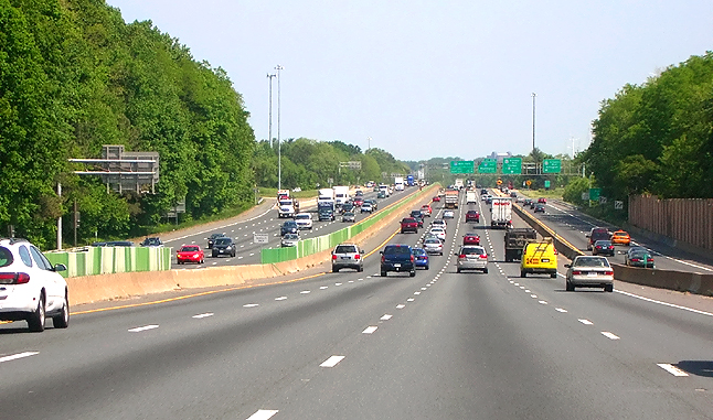 |
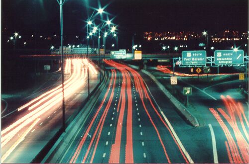
I-495
Capital Beltway northbound (Inner Loop, heading toward American Legion Bridge),
approaching US-50 Arlington Boulevard interchange in Fairfax County, Virginia.
Photo taken May 15, 2007 by Scott
Kozel. Click photo for large image.
These two photos show generally typical views of the current Capital Beltway. |
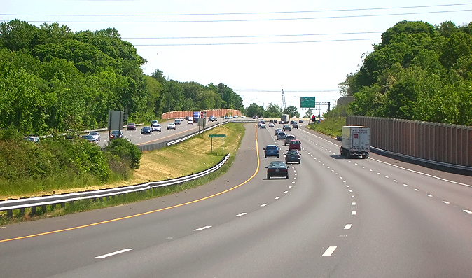 |
I-95/I-495 Capital Beltway northbound (Outer Loop, heading toward Baltimore), approaching MD-5 Branch Avenue interchange in Prince Georges County, Maryland. Photo taken May 13, 2007 by Scott Kozel. Click photo for large image. |
The Beltway was designated I-495 throughout from 1964 to 1977. In 1977, the eastern portion became I-95, and Shirley Highway inside the Beltway was changed from I-95 to I-395. This was done because of the cancellation of proposed I-95 from New York Avenue in the District of Columbia northward into Prince George's County, Maryland, to I-495. The I-95 designation was moved to the eastern half of the I-495 Beltway in 1977, and I-495 was removed from the eastern half of the Beltway, and I-395 replaced the I-95 designation on Shirley Highway from I-495 to the 14th Street Bridge, on the 14th Street Bridge itself, on the Southwest Freeway in D.C. and on the Center Leg Freeway in D.C.
Many regional motorists never fully adjusted to having a full-circle beltway with halves with two different numbers (I-95 and I-495). In 1989, the I-495 designation was applied back to the eastern portion of the beltway, so the whole beltway is again I-495, and the eastern portion is I-95 also. The beltway has the clockwise direction (as in looking at a map of the Beltway) signed as the Inner Loop, and the counter-clockwise direction is signed as the Outer Loop.
The Capital Beltway was originally built with 38 interchanges, and today it has 40 interchanges (the Eisenhower Avenue Connector interchange and the FedEx Field interchange were added recently). High-speed high-capacity directional ramps were completed at the northern I-95/I-495 junction in 1986. A number of interchanges have been expanded. There are studies underway at present to widen sections of the beltway to ten or twelve lanes. The traffic volumes on the beltway range as high as 225,000 vehicles per day.
The only remaining six-lane Beltway section (other than the adequate six-lane section between the I-270 wyes) is the 2 miles of Beltway comprised of the Woodrow Wilson Bridge (WWB) and approaches from US-1 to just east of I-295. See Roads to the Future article Woodrow Wilson Bridge (I-495 and I-95) for all the details about the planning, design and construction of this project to expand a 7.5-mile-long section of the Beltway to 10 to 12 lanes. See the official Woodrow Wilson Bridge Project Website.
The interchange between Shirley Highway (I-95, I-395) and the Capital Beltway (I-95, I-395, I-495) and between VA-644 and I-95, has been reconstructed and expanded. See Roads to the Future article Springfield Interchange Project. See the official VDOT website Springfield Interchange Improvement Project.
Sources: news articles, engineering magazine articles, WWB info from design public hearing brochures and WWB website, traffic volumes from VDOT traffic volume book, widening dates from personal notes.
Capital Beltway near the Woodrow Wilson Bridge.
Photo taken about 1978, from the George Washington Parkway overpass, looking west
toward the US-1 interchange, in Alexandria, Virginia. This is the six-lane section
that is due to be widened to 12 lanes. Originally, there was a lane-drop each
way on I-495 at this interchange, so the mainline had two lanes each way. In 1973
it was widened to three lanes each way, the ramps were adjusted, and the Jersey
barrier was installed. Photo taken by Scott Kozel.
In July 2002, the American
Road & Transportation Builders Association (ARTBA) had a website article "Hampton
Roads Bridge-Tunnel & Capital Beltway Selected Virginia's Top Transportation Infrastructure
Projects of 20th Century". Excerpt (blue text):
ARTBA had a June 2002 website article "Chesapeake
Bay Bridge, Capital Beltway & Baltimore Harbor Tunnels Selected Maryland's Top
Transportation Infrastructure Projects of 20th Century". Excerpt (blue
text):
Completed in 1964 at a cost
of $190 million, the 64-mile Capital Beltway (42 miles of which are in Maryland)
today carries as many as 225,000 cars a day. Called a "road of opportunity" at
its ribbon cutting, the road often defines Washington, D.C., even though it completely
encircles—but does not touch—the Nation's Capital. Originally called the "Washington
Circumferential Highway," the Capital Beltway was approved for construction in
1956 as part of the Interstate Highway System (I-495), and today not only provides
a way for traveling motorists to bypass Washington, but as a driving economic
engine for the region.
FHWA By Day,
August 17, 1964, excerpt (blue text):
Near the New Hampshire Avenue interchange, Maryland Governor J. Millard Tawes
cuts a ribbon officially opening the Capital Beltway around Washington, DC. He
calls it a "road of opportunity." Administrator Rex Whitton calls it a "huge wedding
ring for the metropolitan area", while Representative Carlton R. Sickles (MD)
makes the day's briefest speech: "I'm so happy, I can't express myself."
See the link for 1964 photos of the Capital Beltway, including a photo
of the American Legion Memorial Bridge (I-495 northern Potomac River crossing).
FHWA By Day,
December 28, 1961, excerpt (blue text):
Secretary of Commerce Luther
Hodges, Administrator Rex Whitton, NPS Director Conrad Wirth, and State and local
officials participate in a ceremony opening the 5,900-foot Woodrow Wilson Memorial
Bridge, which will carry Capital Beltway traffic across the Potomac River. Mrs.
Woodrow Wilson, widow of the President, was to have unveiled a plaque in the memory
of her husband, but she is gravely ill. The bridge, which spans three jurisdictions
(Maryland, Virginia, and the District of Columbia), was authorized when President
Dwight D. Eisenhower approved House Bill 83-704 on August 30, 1954. In 1958, BPR
began construction, which involved 13 contracts. The total cost of the bridge
was $14 million. Only short sections of the beltway on either side of the bridge
are open, but traffic on the bridge quickly reaches 18,000 vehicles per day.
See the link for an original photo of the
Woodrow Wilson Bridge
(I-95/I-495 southern Potomac
River crossing).
Beltway Basics, by the Northern Virginia Transportation Alliance. Discussion of the existing Beltway, and proposed improvements to the Beltway.
Capital Beltway Study, by Virginia Department of Transportation. VDOT began the Capital Beltway Study in 1995 to gain a more comprehensive understanding of the current problems and future transportation needs along the Beltway in Virginia. Capital Beltway Study - study of improvements to I-495 in Fairfax County, and link to project website. See the link for detailed discussion of alternatives and plan views.
PPTA Capital Beltway High-Occupancy Toll (HOT) Lanes Proposals, by Virginia Department of Transportation. The detailed and conceptual Fluor Daniel public-private partnership proposal for HOT lanes on the Virginia side of the Beltway.
On January 20, 2005, the Commonwealth Transportation Board (CTB) approved a 12-lane location alternative for improving 14 miles of Virginia’s Capital Beltway between Springfield and VA-193 Georgetown Pike. Fluor Daniel proposes to build two HOT lanes in each direction on this 8-lane segment of the Capital Beltway. According to the proposal, HOT lanes would be free to carpoolers, buses and emergency vehicles; cars carrying only one or two people would pay a variable toll to use the lanes. Large trucks would not be allowed to use HOT lanes. Negotiations are underway and should they be successful, a comprehensive agreement would follow, and if the federally-mandated environmental impact statement for the project is approved, construction of the project would follow.
CTB Approves 12-Lane Alternative for Capital Beltway, VDOT news release, January 20, 2005.
Capital Beltway Corridor Rail Feasibility Study, by Virginia Department of Rail and Public Transportation (VDRPT). See the links to report Conclusions and Recommendations (PDF) and Executive Summary (PDF).
Capital Beltway Study, by the Maryland Department of Transportation (MDOT), the Maryland State Highway Administration (SHA), the Maryland Mass Transit Administration (MTA) and the Washington Metropolitian Area Transit Authority (WMATA).
I-495 Capital Beltway by Mike Hale. History, information and exit list.
Beltway Benders - from Quirks Magazine, Montgomery County, Md.; I-495 history; good timeline.
Interstate 495 - Maryland and Virginia, by AARoads.com.
Braving the Beltway - by
WTOP Radio, August 17, 2007. A series of 10 reports about the Capital
Beltway by WTOP, the all-news radio station in the Washington, D.C. area.
There are also links to the 10 mp3 audio reports if you click one of the URLs
on the lower left of the webpage. The Roads to the Future author
was interviewed in the segments
Part
3: The Layout and Design, and Part 4: History.
For more details, see
Capital Beltway dot com
article:
Capital
Beltway History
For more details, see
Roads to the Future
articles:
Springfield Interchange Project
Woodrow Wilson Bridge (I-495 and I-95)
Interstate 95 in Virginia
Interstate 395 in Virginia
Interstate 495 in Virginia
Copyright © 1997-2007 by Scott Kozel. All rights reserved. Reproduction, reuse, or distribution without permission is prohibited.
By Scott M. Kozel, Roads to the Future, Capital Beltway dot com
(Created 8-14-1997; last updated 9-30-2007)