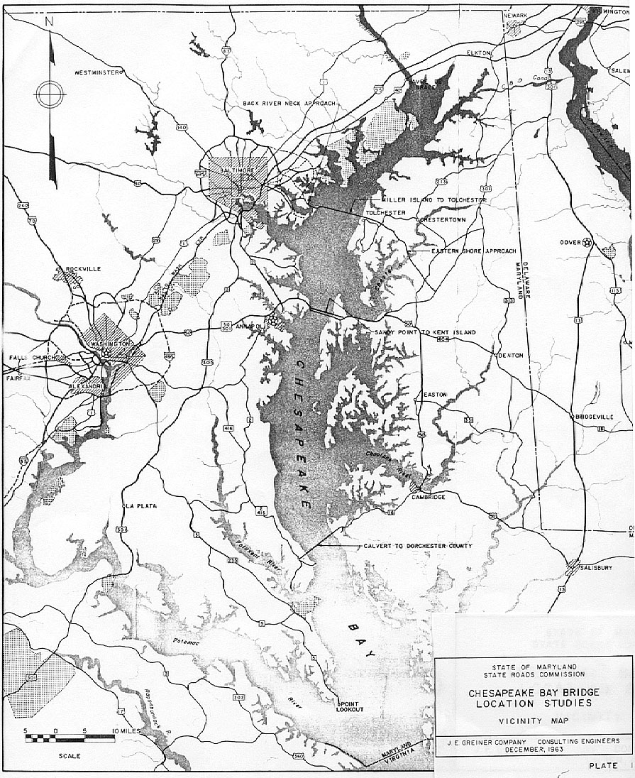
The unbuilt Northern Bay Bridge and the unbuilt Southern Bay Bridge were active
proposals until the 1970s, and over 20 years ago I saw later (about 1970) engineering
studies for them, but I'll have to do more research to find them. The proposed
locations were very similar to those of this 1964 study.
The Northern Bay Bridge would have been about 6.9 miles long, with 2 lanes,
connecting between Miller Island east of Edgemere in Baltimore County, and Tolchester
Beach in Kent County, and it would have also involved a bridge about 1.0 mile
long connecting Miller Island to the Western Shore either at Cedar Point on the
Essex Peninsula or at North Point on the Dundalk Peninsula. Connecting highway
would have extended west (with several different alternative possibilities) to
the then-as-yet-unbuilt eastern portion of the Baltimore Beltway and the then-as-yet-unbuilt
Patapsco Freeway, and east to US-301 about 3 miles east of Centreville in Queen
Anne's County.
The Southern Bay Bridge would have been about 6.3 miles long, with 2 lanes,
and connecting highway would have extended west to MD-2/MD-4 and extended east
to MD-16. MD-4 wasn't on the map in the report, it was MD-416 then. The facility
would have connected between Lusby in Calvert County and Taylors Island in Dorchester
County.
The MdTA
William Preston Lane Jr. Memorial (Bay) Bridge Fact Sheet posts similar info
about the early proposals, albeit in more summarized form. It also says that all
the early proposals were for crossings along the Miller Island - Tolchester Beach
corridor, and it wasn't until 1938 that legislative proposals were advanced for
the current Bay Bridge location, since it wasn't until then that a highway system
in that area existed that would provide approaches for such a crossing.
The 1938 legislation marked the beginning of the "pooled toll financing" concept
that Maryland uses for its highway toll facilities. Today there are 7 such facilities,
and they are jointly financed by common revenue bond issues which are serviced
by pooled toll collections. Even though most of the facilities are not connected
to each other and are located in 4 different regions of the state, this is the
way that Maryland administers its highway toll facilities. The Maryland Transportation
Authority (MdTA) is the administrative agency.
The existing location of the Bay Bridge is centrally located for both the Baltimore
and Washington, D.C. areas, for traffic access between them and the Eastern Shore
and ocean resorts in Maryland and Delaware.
In 1964, the 2-lane 1952-built Chesapeake Bay Bridge was already experiencing
major traffic congestion at weekend peak traffic periods, with brief one-way traffic
operation at times. The parallel 3-lane span was completed on June 28, 1973. This
1964 report was a major foundational planning study that ultimately resulted in
the second span.
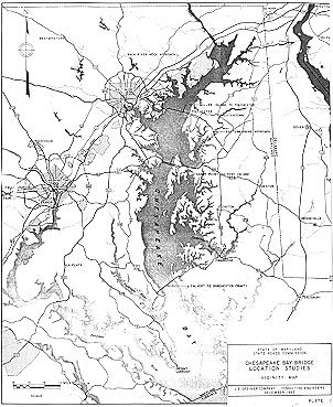
Location Studies - Chesapeake Bay Crossings, for State Roads Commission
of Maryland, by consulting engineers J.E. Greiner Company and Coverdale & Colpitts,
January, 1964.
(verbatim copy from public document follows, in
HISTORICAL DEVELOPMENT
When the Chesapeake Bay Bridge at Sandy Point was opened to traffic on July
30, 1952, it not only marked the physical connection of the Eastern and Western
Shores of Maryland, but also marked the successful completion of a forty-five
year struggle to accomplish this purpose. Prior to this time, travelers between
shores were compelled to use ferries or to journey around the head of the Bay.
Prior to the construction of the present bridge, and with the development of
the motor vehicle, even the long trip around the northern head of the Bay shortened
the old uncomfortable but slow daily trips of the river boats between the Eastern
and Western Shores, separated as they are for 130 miles by the Chesapeake Bay.
According to the early history of the State, a ferry plied the Bay between
Kent Island and points at or near Annapolis, and recurring stories indicate that
sketchy preliminary studies were made during the latter part of the 19th century
to span the Bay by bridge. The records show that in 1907, coincident with the
development of interurban trolley lines, there was a proposal by private capital
interests to bridge the Bay, and although the proposal was endorsed by the Merchants
and Manufacturers Association of Baltimore, the project did not advance beyond
a very preliminary stage. In 1918, private capital interests again considered
the possibility of a double deck structure to carry both railroad and trolley
lines across the bay. Again in 1919, before revenue bond financing acquired its
impetus after the depression of 1929, private capital interests undertook preliminary
studies to bridge the bay between Miller Island and Tolchester.
During the forty years prior to construction of the present bridge, while the
river boats gave way to motor vehicles, it may be said that Bay ferries were used
as temporary expedients until the hope of the years for a fixed bay crossing could
be realized.
Private interests operated the Bay ferries, one between Baltimore and Tolchester,
another between Baltimore and Love Point and another between Annapolis and Matapeake
and Claiborne. The latter was operated successively by Claiborne-Annapolis Ferry,
Incorporated, and the Claiborne-Annapolis Ferry Company. The assets of the latter
were taken over by the State Roads Commission of Maryland under an Act of Legislature
of 1941 and the Annapolis-Matapeake Ferry, later the Sandy Point-Matapeake Ferry,
was operated by the State until the time that the present bridge was opened to
traffic.
The Chesapeake Bay Bridge Company, chartered by Maryland in 1926, received
legislative authority in 1931 to construct the Miller Island-Tolchester Bridge,
and the Legislature in 1935 provided that the authority of the company would be
null and void unless the Company should commence construction of the bridge within
two years and complete its construction within five years from June 1, 1935. The
company abandoned its efforts and its charter was annulled in 1938. Governor Ritchie
meanwhile in 1931 had appointed a commission to study the problem of spanning
the Bay through the revenue bond financing method.
By 1935, the public demand for a Bay crossing became so great that the Legislature
in 1935 created the Chesapeake Bay Authority, as a public body, with power to
construct the Miller Island-Tolchester Bridge under the revenue bond financing
method and with further powers to acquire the assets and franchises of the Claiborne-Annapolis
Ferry Company. The Chesapeake Bay Authority, however, was abolished by the Legislature
in 1941.
The Legislature of Maryland in 1937, during the administration of Governor
Nice, authorized a comprehensive State plan for the construction of bridges or
tunnels and gave authority to the State Roads Commission to issue revenue bonds
of the State, payable solely from earnings to pay the cost of construction. Under
the authority of the 1937 Act, the State Roads Commission initiated studies for
four principal crossings by bridge or tunnel. These studies were covered by the
report entitled "Maryland's Primary Bridge Program" prepared for the Commission
by J.E. Greiner Company in 1938. Included in these studies was a bridge over the
Chesapeake Bay at the Miller Island-Tolchester site, or as an alternative, at
the Sandy Point-Kent Island site. The Act of Congress, approved April 7, 1938,
authorized any two or more of the four crossings to be jointly financed by a single
issue of revenue bonds to be serviced by the pooling of tolls, construction to
be commenced within three years and to be completed within five years from April
7, 1938. Two of those structures, the Susquehanna River Bridge and the Potomac
River Bridge, treated as a single project for financing purposes, were commenced
in 1938 during the administration of Governor Nice and were completed in 1940
during the administration of Governor O'Conor.
The State Roads Commission in 1938 had determined to construct the Chesapeake
Bay Bridge at the Sandy Point-Kent Island site, as well as the Susquehanna and
Potomac River Bridges; and the Trust Indenture of October 1, 1938, between the
State Roads Commission and the Safe Deposit & Trust Company of Baltimore, as Trustee,
in providing for the issuance of revenue bonds for the Susquehanna and Potomac
River Bridges, contained a provision for the issuance at any time prior to July
1, 1942 of additional bonds for the cost of the Chesapeake Bay Bridge, including
the cost of acquiring the ferry. World War II, of course, prevented the construction
of the Bay Bridge as then contemplated.
During the administration of Governor Lane, the Legislature, at its General
Session of 1947, passed a comprehensive Act, amended at the Extraordinary Session
of 1947, providing an additional or alternative method for the construction and
financing of bridges, tunnels and motorways under the revenue bond financing method.
This Act authorized the State Roads Commission, upon determining to construct
a Chesapeake Bay crossing from Sandy Point to Kent Island, to finance the same
by the issuance of revenue bonds and to refund outstanding bonds on existing bridges
whose tolls would be pooled with those from the Chesapeake Bay crossing. Construction
plans, specifications and contract documents were started in July 1948, with the
result that the actual construction of the approach roads commenced the following
January. By the middle of November of 1949, the entire substructure and superstructure
work was under construction.
Following the opening of the bridge in 1952, annual traffic volumes nearly
doubled in the first decade. Traffic volumes during off-peak or normal periods
are within the present capacity of the present facility. Lately, however, weekend
traffic during the summer months has been practically twice the daily average
for the month and greatly exceeds the capacity of the facility. As traffic volumes
have grown, the frequency and duration of the delays have increased. Certain measures
of a temporary nature, such as short time one-way operation of the structure,
have reduced delays during the peak periods of traffic. However, the limited capacity
inherent in the present crossing will impose repetitive and prolonged delays to
patrons and result in reduced standards of service and declining rates of growth.
With the increase in the use of the Eastern Shore resorts, the increase in
the number of automobiles, the increase in population and the demand of the traveling
public, it is apparent that existing facilities for connecting the Eastern and
Western Shores are inadequate and additional facilities will be required in the
near future.
