
| D.C. Interstate System |
D.C. Interstate System
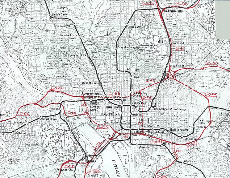 |
This map shows the original proposed D.C. area Interstate system. I drew the routes in red on a section of map from the map of the 1972-proposed WMATA Metro system. The dashed red lines indicate tunneled sections. The routing information comes from the design study, District of Columbia Interstate System, by DeLeuw, Cather Associates and Harry Wesse & Associates, LTD, 1971. This was the last official preliminary design for the D.C. Interstate system. I have marked the proposed location of I-595. Click on the map for a larger image (176K).
Copyright © 1998-2004 by Scott Kozel. All rights reserved. Reproduction, reuse, or distribution without permission is prohibited.
Lead article for Washington D.C. Interstates and Freeways
By Scott M. Kozel, Roads to the Future
(Created 3-6-1998; last updated 6-21-2004)