
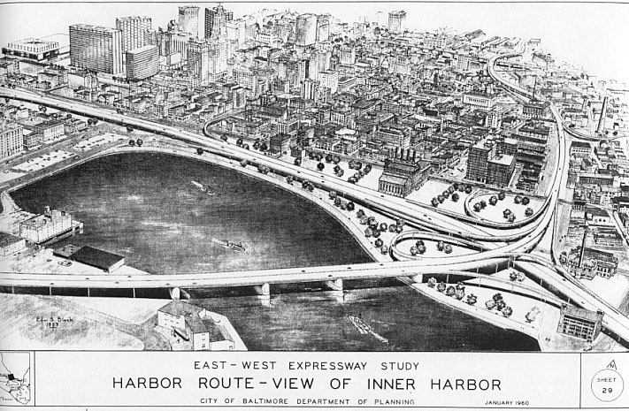
| East-West Expressway Harbor Route - Aerial View |
East-West Expressway Harbor Route - Aerial View
This map shows the proposed expressway system in downtown Baltimore as of 1960.
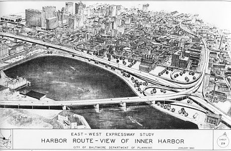
Source: A Study for an East-West Expressway, by the City of Baltimore, Department of Planning, January 1960.
Click for larger map images: Full (146 KB).
Lead article for Baltimore Early Expressway Planning
Copyright © 2001-2003 by Scott Kozel. All rights reserved. Reproduction, reuse, or distribution without permission is prohibited.
By Scott M. Kozel, Roads to the Future
(Created 2-3-2001; last updated 6-1-2003)