Route 895 Construction - October 2001 - Photos 25-28
The four aerial photos on this page were taken in October 2001 by VDOT, that they have given me and permitted me to post here.
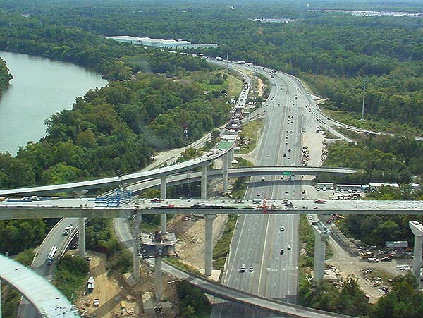
Above, I-95 interchange, looking south.
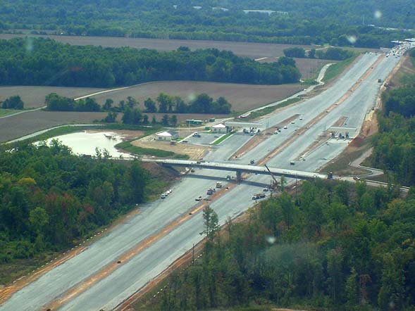
Above, Route 895 mainline toll plaza, looking west. The east end of the James River Bridge is visible in the upper right corner of the photo. The overpass in the foreground is Wilton Road.
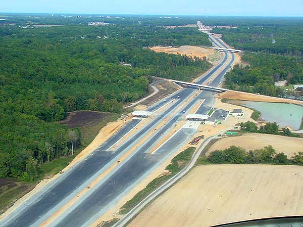
Above, Route 895 mainline toll plaza, looking east. The overpasses on Route 895 visible, in order from closest to farthest, are Wilton Road, Osborne Turnpike, Laburnum Avenue, and VA-5 New Market Road. The toll plaza has manned cash and automatic cash toll booths that traffic will ramp to the right to use. Smart Tag (electronic toll collection) users will be able to use the two mainline freeway lanes in each direction, without slowing down, and an overhead gantry will have electronic equipment to communicate with each vehicle's Smart Tag transponder, thereby recording the toll transaction in the driver's account.
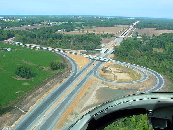
Above, looking east, Laburnum Avenue interchange, which is a trumpet interchange with Route 895. The Cornelius Creek bridges are visible beyond the Laburnum Avenue overpass, and VA-5 New Market Road overpass is visible beyond that. This interchange's ramps will have automatic toll booths for traffic to and from the east, with a 50 cent toll for cars. Laburnum Avenue traffic to and from the west does not need to be tolled here, since all that traffic will pass through the mainline toll plaza to the west of here.
© Copyright 2002 by Scott Kozel. All rights reserved.
Lead page for Route 895 Construction - October 2001
Lead page for Route 895 Construction
Lead page for Route 895 Connector
By Scott M. Kozel,
Roads to the Future(Created 3-1-2002