
| US-58 Mecklenburg Widening and Bypasses - Photos |
US-58 Mecklenburg Widening and Bypasses - Photos
Click to go to LATEST INFORMATION UPDATE
The following 6 photos were taken by the Roads to the Future author in September 1998.
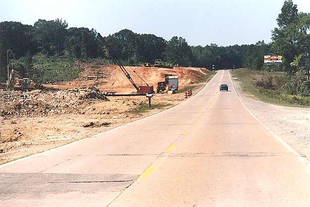 |
U.S. Route 58, looking westbound, 1/2 mile east of VA-702; or about 2 1/2 miles east of Clarksville. Construction of new eastbound roadway is in the stage of heavy grading. |
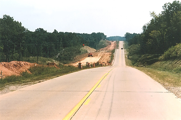 |
U.S. Route 58, looking eastbound, 1/2 mile east of VA-608; or about 2 miles east of Boydton. Construction of the new westbound roadway is in the stage of heavy grading. |
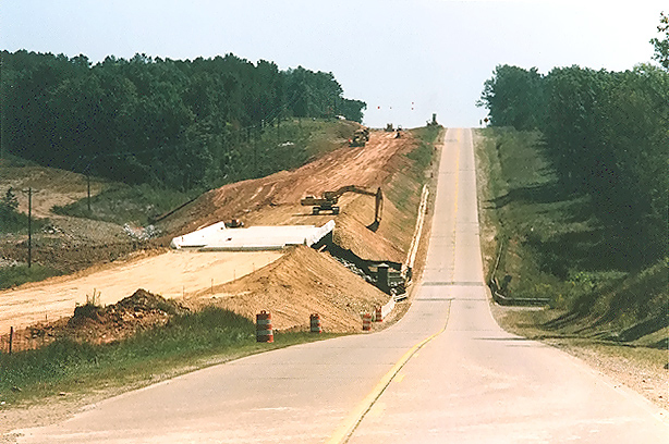 |
U.S. Route 58, looking eastbound, Allens Creek bridges ahead; about 3 and 1/2 miles east of Boydton. Construction of the new westbound roadway is in the stage of heavy grading. |
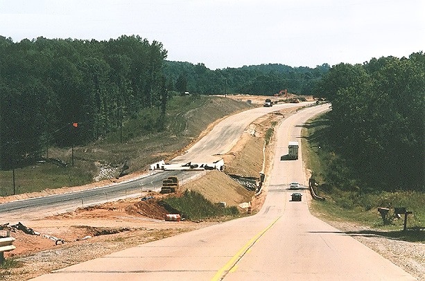 |
U.S. Route 58, looking eastbound, Long Branch bridges ahead; about 4 miles east Boydton. Construction of the new westbound roadway is in the stage of laying subgrade for asphalt paving. |
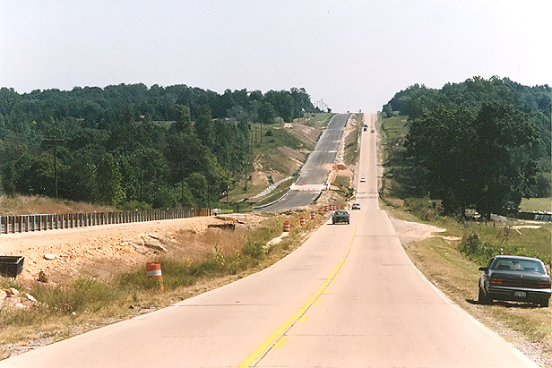 |
U.S. Route 58, looking eastbound, Cox Creek bridges ahead; about 4 miles west of the US-1/US-58 intersection at Big Fork. Construction of the new westbound roadway is in the stage of asphalt base paving. |
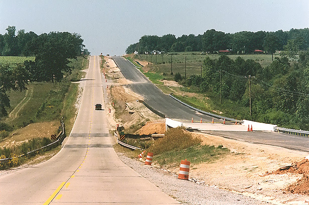 |
U.S. Route 58, looking westbound, Cox Creek bridges ahead; about 3 and 1/2 miles west of Big Fork. Construction of new westbound roadway is in the stage asphalt base paving. |
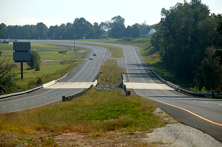
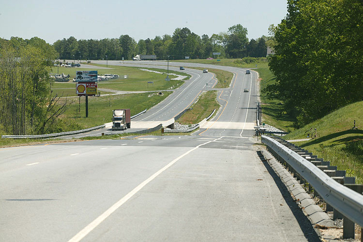
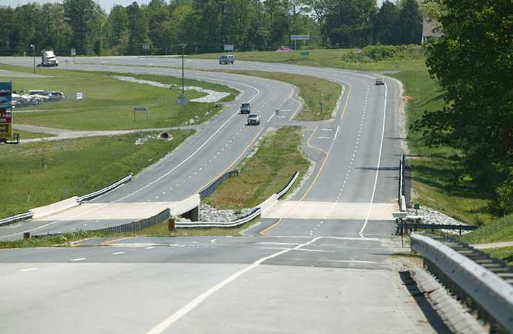
The 3.5 miles of US-58 four-lane widening just west of South Hill cost of $10 million for construction. The speed limit is 55 mph throughout. Most of the project (about 2.7 miles) has five 12-foot-wide lanes, with the center lane for left turns only. The intersection with US-1 at Big Fork has been rebuilt so that US-58 is the through route, and US-1 curves and junctions at a T-intersection with US-58. The curve on US-58 at Big Fork has been built to a 55 mph design speed. From the US-1 intersection to the west end of the project (about 0.8 mile), the new highway has 4 lanes with a median 40 feet wide. The whole project has 10-foot paved right shoulders. Near the west end of the project, US-58 crosses Miles Creek, and a new westbound 2-lane bridge was built and the original 2-lane bridge was demolished and a new 2-lane bridge was built for eastbound traffic. The west end of the project seamlessly ties into the US-58 highway that was dualized in 2001. The east end of the project seamlessly ties into the 5.2-mile-long, $35.1 million US-58 South Hill Bypass that was opened in 2000.
These photos were taken the Virginia Department of Transportation, and are posted here with their permission, and I utilized Adobe PhotoDeluxe Business Edition to brighten all the photos and to align and crop some of the photos. Click on the photo to get a large version of the photo. In later versions of Netscape and Internet Explorer, you probably will need to use Full Screen mode (the F11 key can be utilized to swap back and forth between Full Screen and Regular) to see the full size of the large photo without browser-induced image shrinkage. The large photos have sizes ranging from 328 to 460 kilobytes, with most of them being under 392 kilobytes. With a broadband or network Internet connection each photo will download within seconds, but with a dial-up Internet connection it will be slow.
The following 4 photos were taken of the above project by VDOT in September 2004, and are used here with their permission.
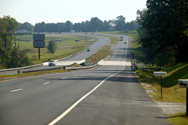 |
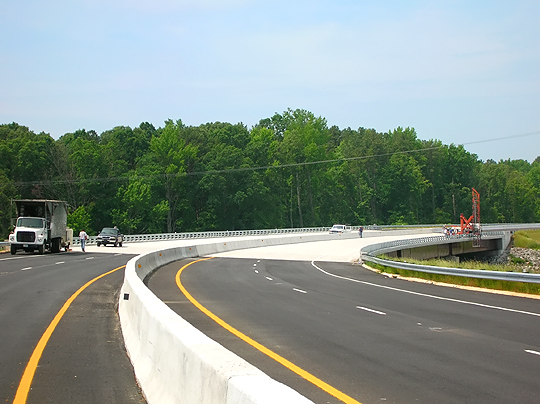
U.S. Route 58, looking eastbound, Miles Creek bridges ahead; about 1/2 miles west of the US-1/US-58 intersection at Big Fork. The US-1/US-58 intersection is just after the curve in the distance. |
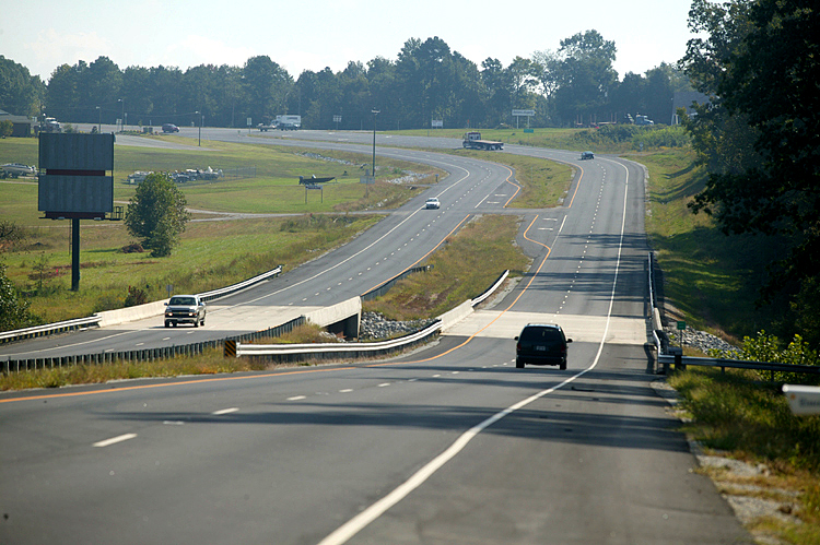 |
U.S. Route 58, looking eastbound, Miles Creek bridges ahead; about 1/2 miles west of the US-1/US-58 intersection at Big Fork. Similar vantage point as the previous photo, but with more telephoto. |
 |
U.S. Route 58, looking eastbound, Miles Creek bridges ahead; about 1/2 miles west of the US-1/US-58 intersection at Big Fork. Similar vantage point as the previous photo, but from the median. |
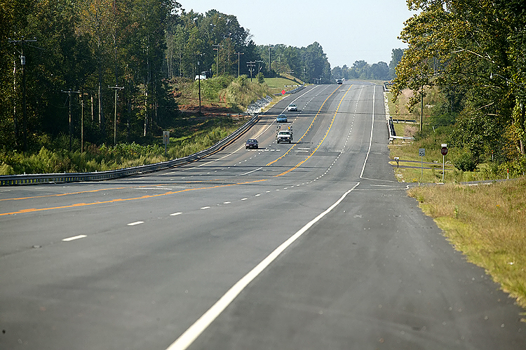 |
U.S. Route 58, the rebuilt 5-lane highway east of Big Fork. |
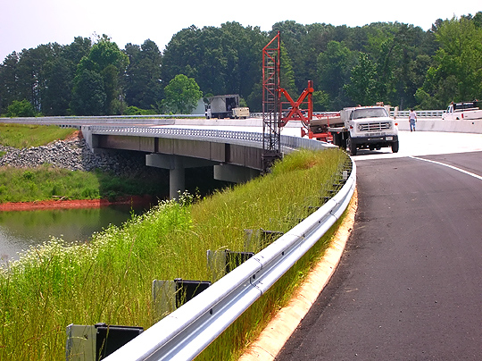
The following 8 photos were taken by VDOT in September 2004, and are used here with their permission.
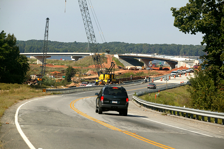 |
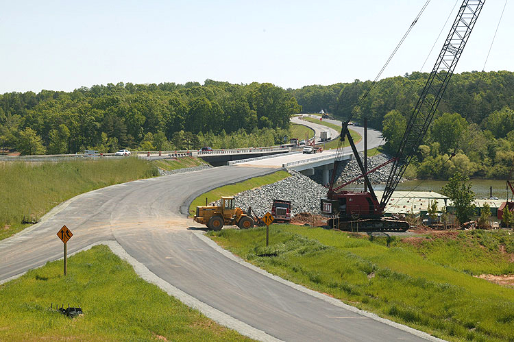
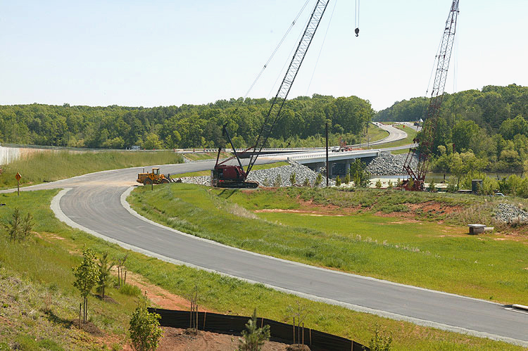
U.S. Route 58, looking westbound, 1/2 mile east of the John H. Kerr Reservoir (also known as Buggs Island Lake). The construction of the new twin bridges over the Occoneechee Harbor (Sandy Creek), is in the foreground, and the flyover ramp under construction in the distance will access the new bridge over the lake. |
 |
U.S. Route 58, looking westbound, 1/2 mile east of the John H. Kerr Reservoir (also known as Buggs Island Lake). The construction of the new twin bridges over the Occoneechee Harbor (Sandy Creek), is in the foreground, and the flyover ramp under construction in the distance will access the new bridge over the lake. |
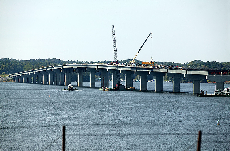 |
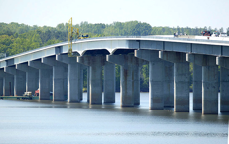
U.S. Route 58, new 4-lane 4,800-foot-long bridge under construction over the John H. Kerr Reservoir (also known as Buggs Island Lake), looking west from the eastern shoreline. |
 |
U.S. Route 58, new 4-lane 4,800-foot-long bridge under construction over the John H. Kerr Reservoir, looking west from the eastern shoreline. |
 |
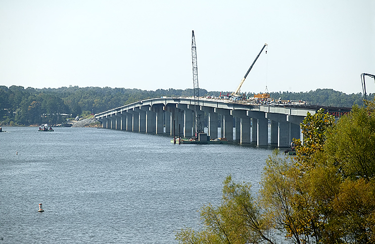
U.S. Route 58, new 4-lane 4,800-foot-long bridge under construction over the John H. Kerr Reservoir, looking west from the eastern shoreline. |
 |
U.S. Route 58, new 4-lane 4,800-foot-long bridge under construction over the John H. Kerr Reservoir, looking west from the eastern shoreline, north of the new bridge. |
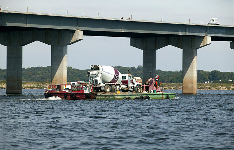 |
U.S. Route 58, new 4-lane 4,800-foot-long bridge under construction over the John H. Kerr Reservoir. Close view of a barge carrying a ready-mix concrete truck to the site of the pier construction in the following photo. |
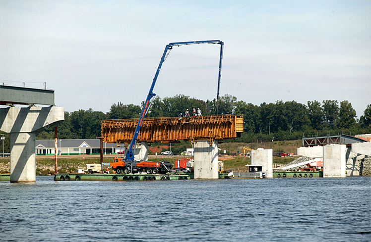 |
U.S. Route 58, new 4-lane 4,800-foot-long bridge under construction over the John H. Kerr Reservoir. Bridge pier under construction, with a barge that has a concrete pump on board; the concrete pump has the long high boom that is utilized to pump the fluid concrete to the pier cap under construction. |
**LATEST INFORMATION UPDATE follows**
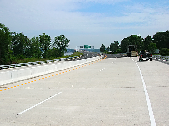
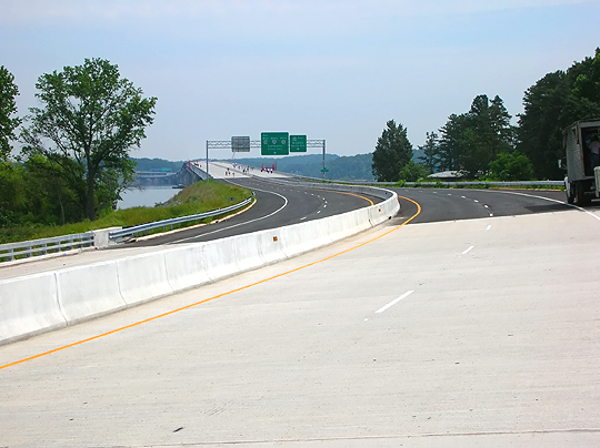
The following 13 photos were taken by VDOT in May 2005, and are used here with their permission.
 |
U.S. Route 58, new 4-lane 4,800-foot-long bridge under construction over the John H. Kerr Reservoir (also known as Buggs Island Lake), looking west from the eastern shoreline. |
 |
U.S. Route 58, new 4-lane 4,800-foot-long bridge under construction over Buggs Island Lake, looking west from the eastern shoreline. |
 |
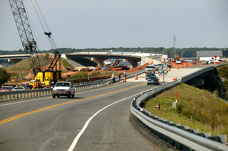
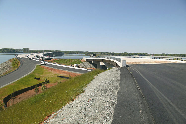
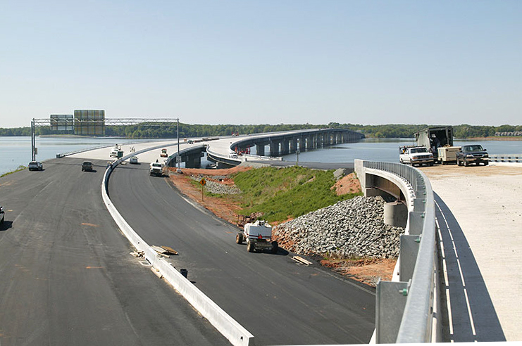
U.S. Route 58, looking eastbound, 1/4 mile east of Buggs Island Lake. The construction of the new twin bridges over the Occoneechee Harbor (Sandy Creek), is in the background. |
 |
U.S. Route 58, looking westbound, 1/4 mile east of Buggs Island Lake. Photo taken from the flyover ramp that will access the new bridge over the lake, for US-58 westbound traffic. |
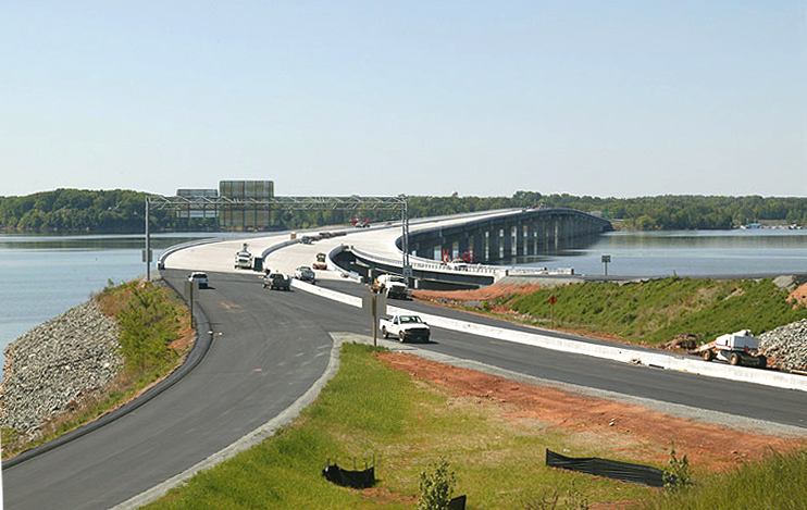 |
U.S. Route 58, looking westbound, 1/4 mile east of Buggs Island Lake. Photo taken from the flyover ramp that will access the new bridge over the lake, for US-58 westbound traffic. |
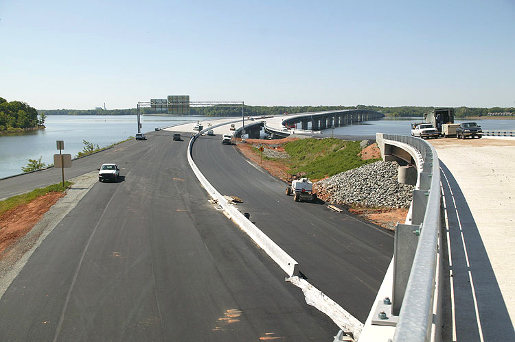 |
U.S. Route 58, looking westbound, 1/4 mile east of Buggs Island Lake. Photo taken from the flyover ramp that will access the new bridge over the lake, for US-58 westbound traffic. |
 |
U.S. Route 58, looking westbound, 1/4 mile east of Buggs Island Lake. Photo taken from the flyover ramp that will access the new bridge over the lake, for US-58 westbound traffic. |
 |
U.S. Route 58, looking eastbound, 1/4 mile east Buggs Island Lake. The construction of the new twin bridges over the Occoneechee Harbor (Sandy Creek), is in the background. |
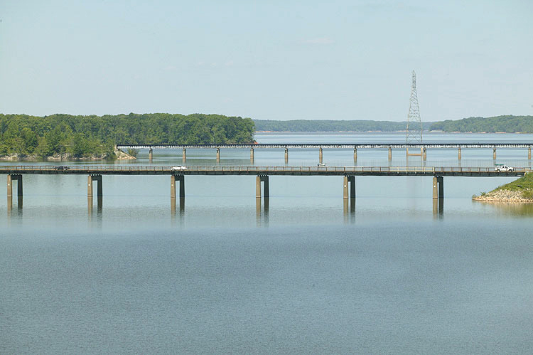 |
Pre-existing 2-lane US-58 bridge and causeway over Buggs Island Lake, railroad bridge visible in far distance. |
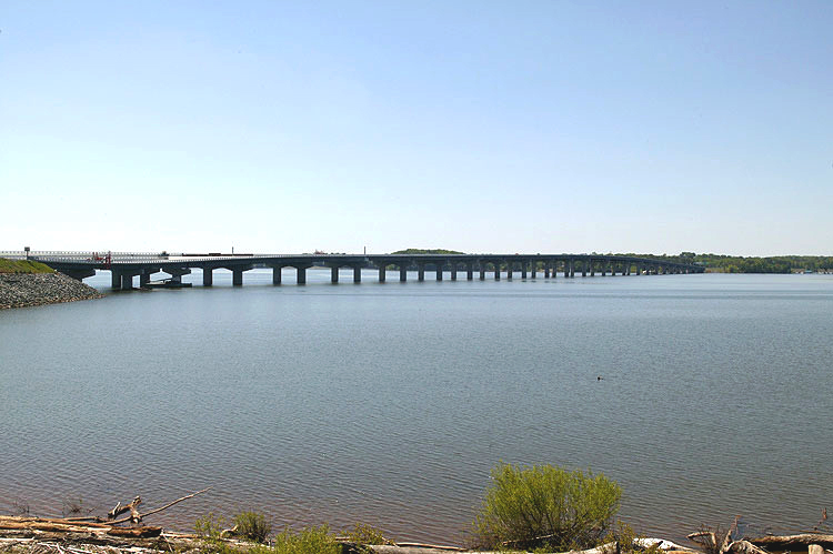 |
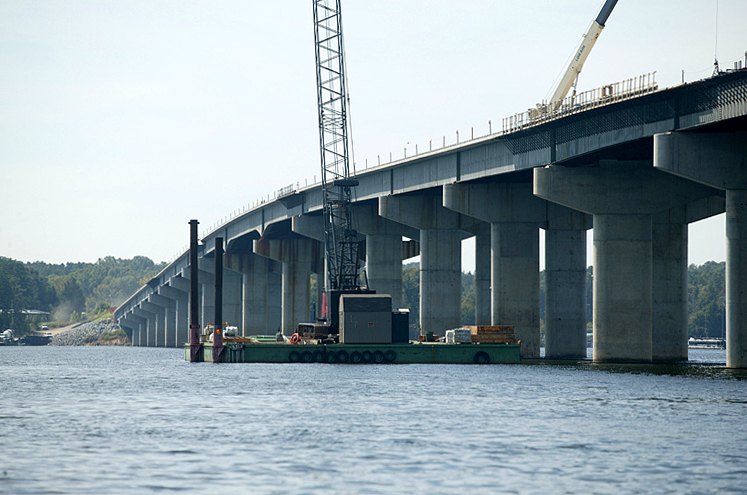
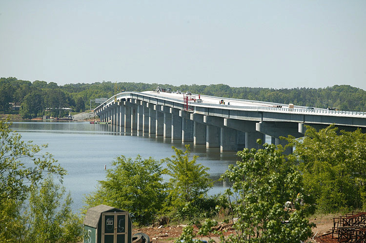
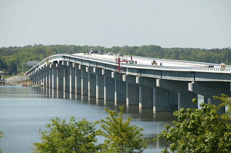
Looking westward at entire Buggs Island Lake bridge, from eastern shoreline, north of the bridge. |
 |
U.S. Route 58, new 4-lane 4,800-foot-long bridge under construction over Buggs Island Lake, looking west from the eastern shoreline, south of the new bridge. Closeup view of the main span, which has 60 feet of vertical navigational clearance for marine traffic. |
 |
U.S. Route 58, looking eastbound, Miles Creek bridges ahead; about 1/2 miles west of the US-1/US-58 intersection at Big Fork. The US-1/US-58 intersection is just after the curve in the distance. |
 |
U.S. Route 58, looking eastbound, Miles Creek bridges ahead; about 1/2 miles west of the US-1/US-58 intersection at Big Fork. Similar vantage point as the previous photo, but with more telephoto. |
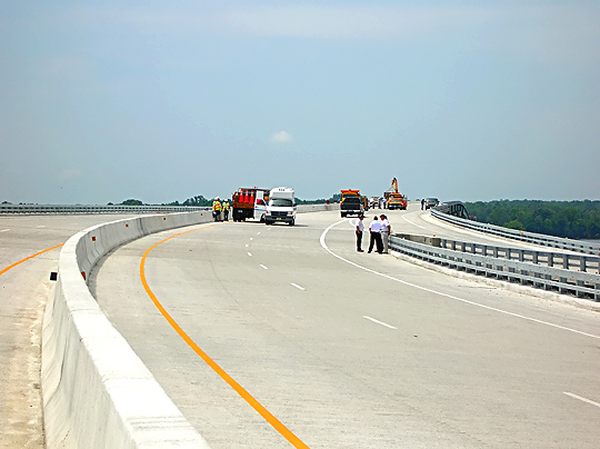
The following 14 photos were taken by the Roads to the Future author at the US-58 Clarksville Bypass Dedication Ceremony on June 8, 2005.
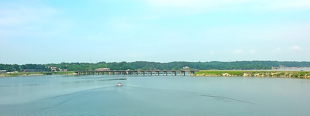 |
Pre-existing US-58 bridge and causeway over Buggs Island Lake, town of Clarksville in background, railroad bridge visible in far distance. |
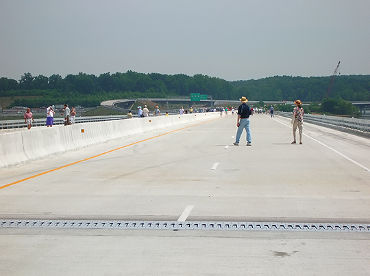 |
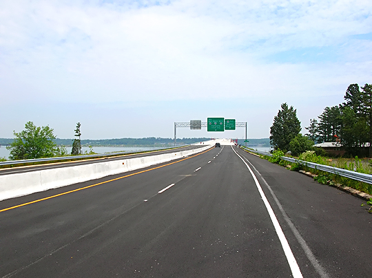
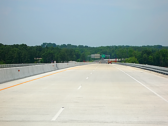
All following photos are of the new 4,800-foot-long 4-lane US-58 bridge
over Buggs Island Lake, and its approaches. The highway will have a 55 mph
speed limit, so a telephoto lens exaggerates the highway's horizontal
curvature on some photos. Looking east from highest point of bridge |
 |
The 492-foot-long bridge over the Clarksville small boat harbor (actually a branch of the harbor that sees little boating use). |
 |
Standing on bridge over the Clarksville small boat harbor, looking east toward lake bridge, zooming from wide angle to telephoto (this photo wide angle). |
 |
Standing on bridge over the Clarksville small boat harbor, looking east toward the Buggs Island Lake bridge, zooming from wide angle to telephoto (this photo medium focus). |
 |
Standing on bridge over the Clarksville small boat harbor, looking east toward the Buggs Island Lake bridge, zooming from wide angle to telephoto (this photo telephoto). |
 |
Standing west of Buggs Island Lake bridge, looking east, zooming from wide angle to telephoto (this photo wide angle). |
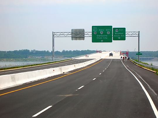 |
Standing west of Buggs Island Lake bridge, looking east, zooming from wide angle to telephoto (this photo telephoto). |
 |
Looking west at 492-foot bridge over the Clarksville small boat harbor. |
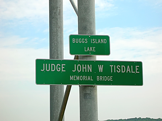 |
Buggs Island Lake bridge name marker, at west end of the bridge. |
 |
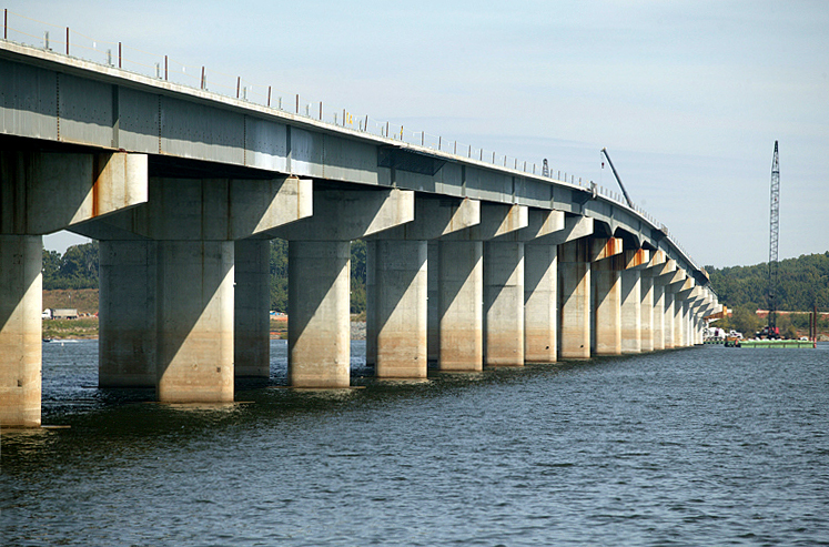
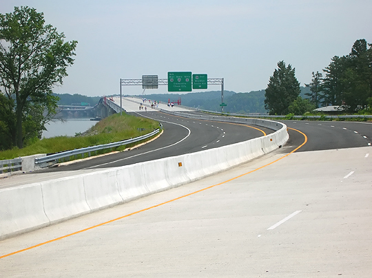
Looking west from highest point of the Buggs Island Lake bridge. |
 |
Heavy steel bridge parapet design that allows views of the lake from the bridge
over Buggs Island Lake. This steel bridge parapet design is massive, with heavy steel I-beams for the vertical posts which have strong bolted studs through the concrete bridge deck, and the vertical posts are on 6-foot spacing, and the horizontal rails are tubes of about 3/4 inch thick steel. |
 |
Looking west from near the east end of the Buggs Island Lake bridge. |
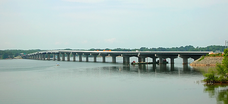 |
Looking westward at entire Buggs Island Lake bridge, from US-58 bridge over the Occoneechee Harbor (Sandy Creek). |
Lead page for US-58 Widening and Bypasses in Mecklenburg County
Copyright © 2005 by Scott Kozel. All rights reserved. Reproduction, reuse, or distribution without permission is prohibited.
By Scott M. Kozel, Roads to the Future
(Created 6-1-2005, updated 9-1-2005)