Route VA-288 Construction - March 2002 - Photos 1-4
Here are photos of Route VA-288 under construction, taken in mid March, 2002.
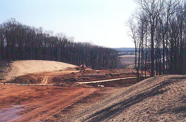
Above, looking south, heavy excavation for the construction of the VA-288 roadways. Large backhoes and large dump trucks are being used to excavate this cut. There will be a major earthwork cut in this area, for the highway mainline roadways that descend downgrade to the James River Bridge. This is looking southward toward the James River Bridge construction which can be seen through the trees on the right side of the photo.
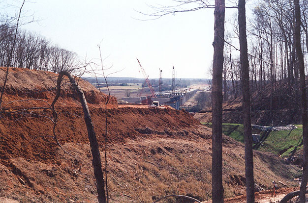
Above, looking south, toward the James River Bridge construction, from a vantage point along the western VA-288 right-of-way line, closer to the bridge than the previous photo.
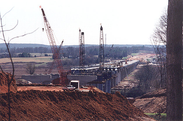
Above, looking south, toward the James River Bridge construction, from a vantage point along the western VA-288 right-of-way line. North of the river is Goochland County, and south of the river is Powhatan County. This photo was taken from the same vantage point as the previous photo, but it was taken with a 135mm (2.7x) telephoto lens, instead of the 50mm (1.0x) regular lens used previously.
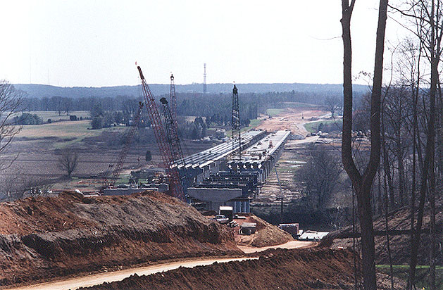
Above, looking south, photo of construction of the 3,642-foot-long VA-288 James River Bridge, and major earthwork cut on the north side of the river. About 60 bridge columns have been built, and about 60 pier caps on top of the columns. Pier construction in the river is nearing completion. Beams and deck construction is underway on both bridges. Construction is moving rapidly. The bridge will be of a concrete girder design (steel girders for the over-river spans), with two spans each with two lanes and full right shoulders. North of the river is Goochland County, and south of the river is Powhatan County. The James River is about 200 feet wide at this point. The length of these bridges is dictated by the large flood plain of the James River, since a large flood such as the ones associated with Hurricane Camille in 1969 and Hurricane Agnes in 1972 (downgraded to tropical storms by the time that they dumped huge amounts of rainfall in the western part of Virginia), can cause the river to rise 20 to 25 feet above flood stage.
Next: Route VA-288 Construction - March 2002 - Photos 5-8
© Copyright 2002 by Scott Kozel, and all photos taken by same. All rights reserved.
Lead page for
Route VA-288 Construction - March 2002Lead page for Richmond Beltway (I-295 and VA-288)
By Scott M. Kozel,
Roads to the Future(Created 5-1-2002)