
| Route VA-288 Construction - January 2005 |
Here are 27 photos of Virginia Route 288, taken in January, 2005. Click the thumbnail photo for a larger photo (they range in size from 69 to 171 kilobytes, with most being less than 113 kilobytes).
The following 6 photos were taken from Woolridge Road in Chesterfield County.
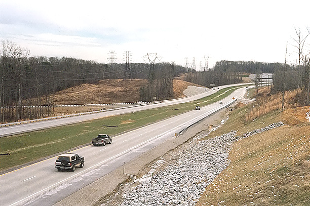 |
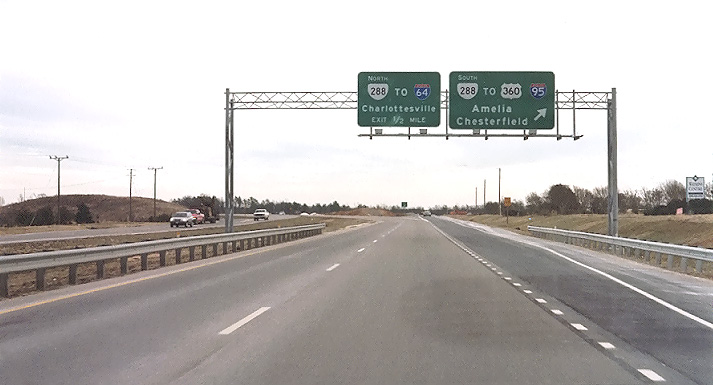
Route 288, open to traffic, looking south from the Woolridge Road overpass over Route 288. The mainline roadways are comprised of continuously reinforced concrete pavement, placed in a 10-inch-deep concrete slab. I have details of the concrete pavement design on my webpage Route VA-288 Construction - October 2003. |
 |
Route 288, open to traffic, looking south from the Woolridge Road overpass over Route 288. This photo was taken from the same vantage point as the previous photo, but it was taken with a 135mm (2.7x) telephoto lens, instead of the 50mm (1.0x) regular lens used previously. |
 |
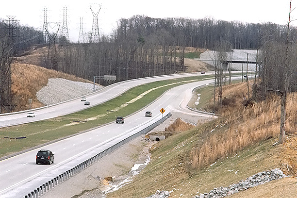
Route 288, open to traffic, looking south from the Woolridge Road overpass over Route 288. This vantage point is from the opposite side of Route 288 as the previous two photos. A high fence on this side of the overpass prevented taking photos directly over the highway. |
 |
Route 288, open to traffic, looking south from the Woolridge Road overpass over Route 288. This photo was taken from the same vantage point as the previous photo, but it was taken with a 135mm (2.7x) telephoto lens, instead of the 50mm (1.0x) regular lens used previously. |
 |
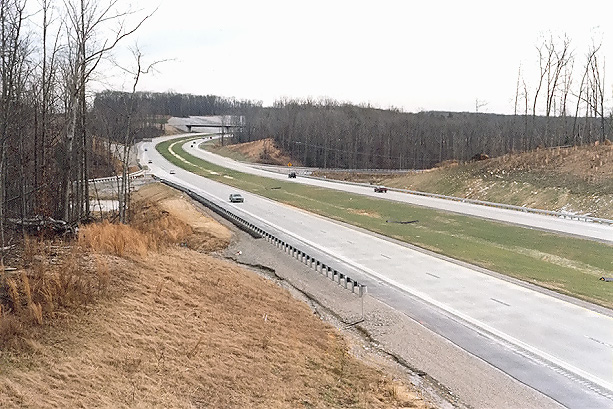
Woolridge Road Extension, westbound, open to traffic. The interchange with Route 288 is ahead. |
 |
Woolridge Road Extension, westbound, open to traffic. This photo was taken from the same vantage point as the previous photo, but it was taken with a 135mm (2.7x) telephoto lens, instead of the 50mm (1.0x) regular lens used previously. |
The following 21 photos were taken on a mid-January drive of the new section
of Route 288 that opened to traffic on November 19, 2004, the 3.7 miles of Route
288 between Lucks Lane and US-60 Midlothian Turnpike in Chesterfield County, the
final section of Route 288 to open to traffic. These supplement the photos of
the same section of highway that I took in December and published on my website
article
Route VA-288 Construction - December 2004.
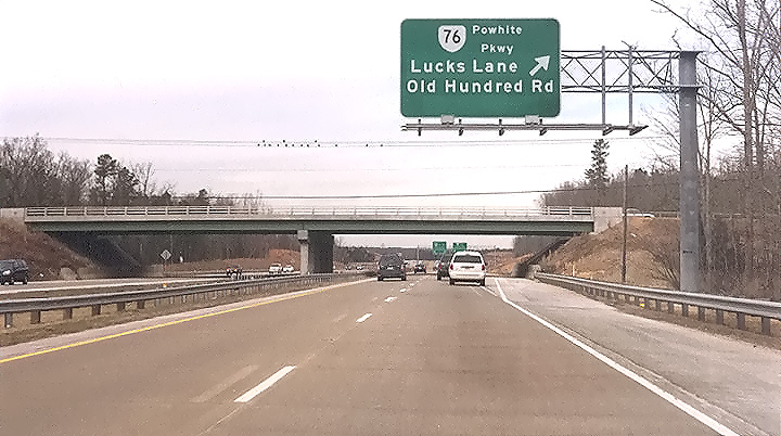
| VA-76 POWHITE PARKWAY | |
 |
Route 76 Powhite Parkway, westbound, approaching the Route 288 interchange. The bridges in the mainline of Powhite Parkway, just ahead, cross Falling Creek. The 4-lane freeway Powhite Parkway Extension west of VA-150, was opened to traffic in October 1988, and its mainline roadways are comprised of continuously reinforced concrete pavement. |
 |
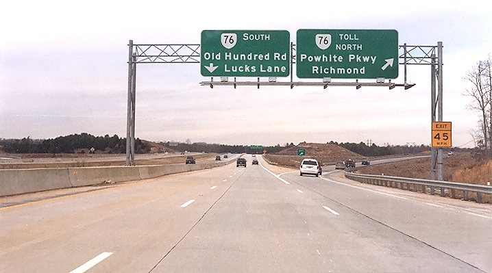
Route 76 Powhite Parkway, westbound, approaching the Route 288 interchange. The overpass bridges are Route 288, and the weave section on the right connects the two loop ramps to and from Route 288. Route 288 and Route 76 have a full cloverleaf interchange connecting the two highways, with 2-lane collector-distributor (C-D) roadways on Route 288 that connect Route 288 traffic to the ramps. |
 |
Route 76, eastbound, approaching the intersection with VA-754, with the Route 288 overpass bridges visible 0.7 mile in the distance. The 9-mile-long Powhite Parkway Extension ends just west of VA-754, with a traffic signal at VA-754, and the Powhite Parkway continues as a 2-lane highway on a 4-lane right-of-way for 1/2 mile west of VA-754. A future Powhite Parkway Western Extension has been proposed since the 1980s as a 4-lane freeway extension of Powhite Parkway for 8 miles further west to US-360 at Winterpock, with an interchange between Routes 76 and 754 at this location. |
 |
Route 76 Powhite Parkway, eastbound, approaching the Route 288 interchange. The overpass bridges are Route 288, and the weave section on the right connects the two loop ramps to Route 76. |
| US-60 MIDLOTHIAN TURNPIKE | |
 |
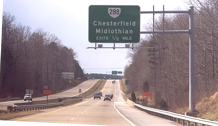
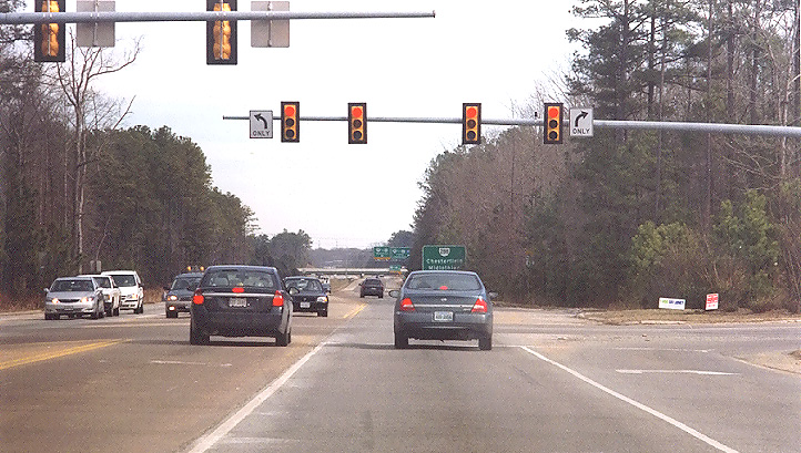
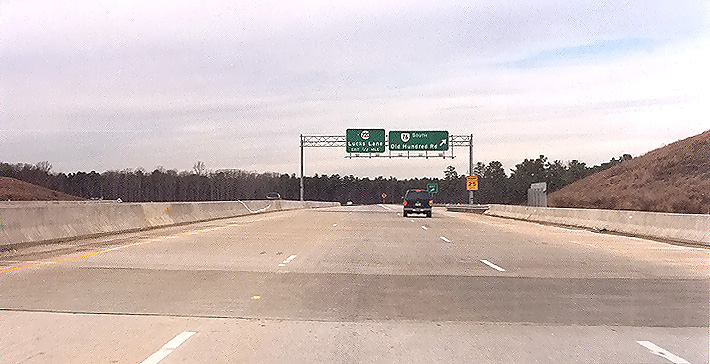
US-60 Midlothian Turnpike westbound, approaching the Route 288 interchange. |
 |
US-60 Midlothian Turnpike westbound, in the Route 288 interchange, approaching the weave section that connects the two loop ramps to and from Route 288. Route 288 and US-60 have a full cloverleaf interchange connecting the two highways, with collector-distributor (C-D) roadways on Route 288 that connect Route 288 traffic to the ramps. |
 |
US-60 Midlothian Turnpike eastbound, approaching the Route 288 interchange |
|
|
US-60 Midlothian Turnpike eastbound, in the Route 288 interchange. The 3-lane eastbound US-60 bridge crosses over Route 288, and the weave section on the right connects the two loop ramps to and from Route 288. US-60 is a 4-lane divided nonlimited-access highway with a 55 mph speed limit, and these weave sections between the loop ramps are about 1,000 feet long, an ample length for such a cloverleaf weave section. |
|
288 NORTHBOUND |
|
 |
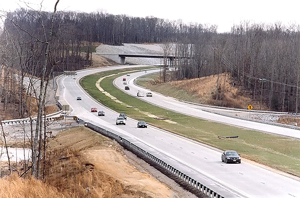
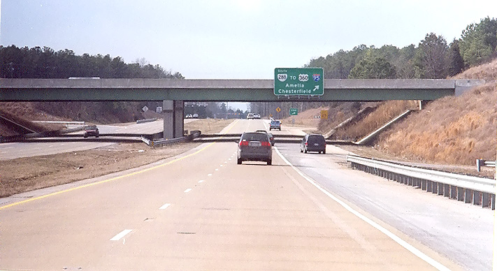
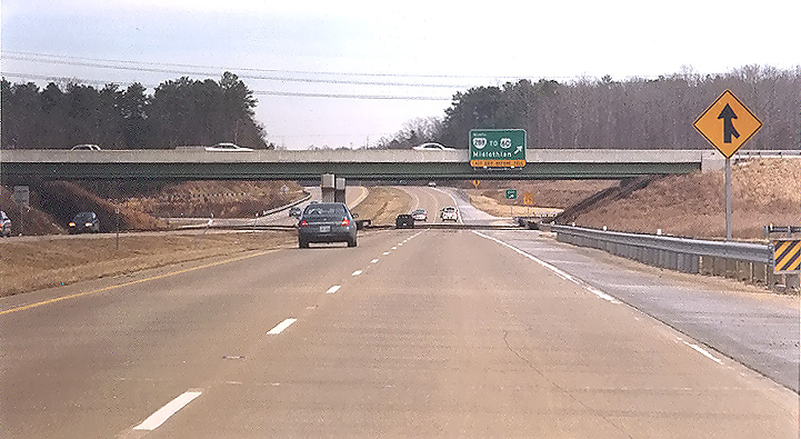
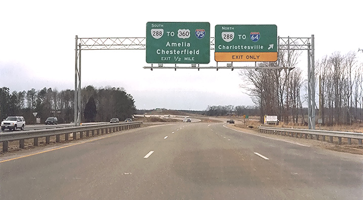
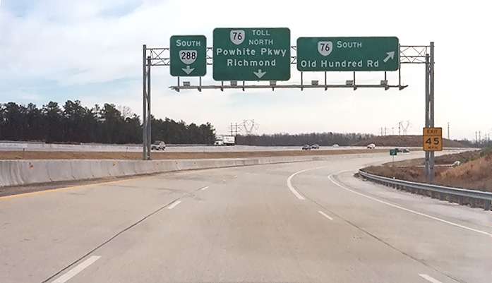
Route 288 northbound, approaching Genito Road overpass. The widening to the right for the Route 288 northbound 2-lane collector-distributor (C-D) roadway begins ahead to the right. The Route 288 C-D roadways are almost 2 miles long, and are built to full freeway standards, and intercept all the ramp movements for the Lucks Lane and Route 76 interchanges. The 2.7 miles of Route 288 between US-360 Hull Street Road and Route 76 Powhite Parkway, opened in October 1988, the remainder of southern Route 288 to I-95 opened by 1990, and the Western Route 288 project 1999-2004 extended Route 288 to I-64 in Goochland County, and the Route 76/288 interchange was rebuilt and expanded. |
 |
Route 288 northbound, on the Route 288 northbound 2-lane collector-distributor (C-D) roadway, approaching the Route 76 Powhite Parkway interchange. |
 |
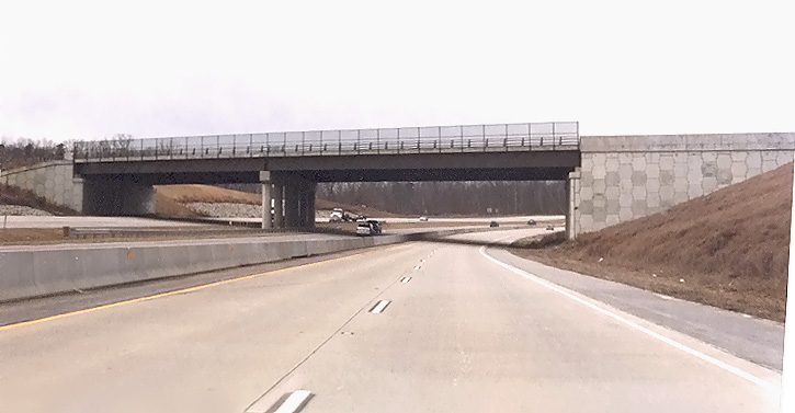
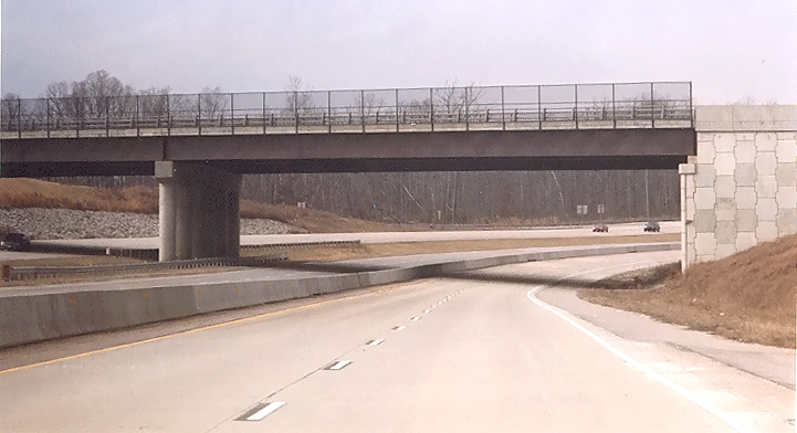
Route 288 northbound, on the Route 288 northbound 2-lane collector-distributor (C-D) roadway, in the Route 76 Powhite Parkway interchange, on the 3-lane bridge over Route 76. |
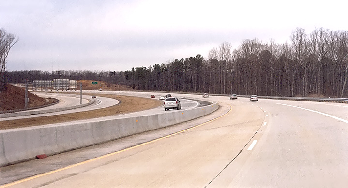 |
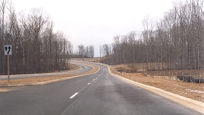
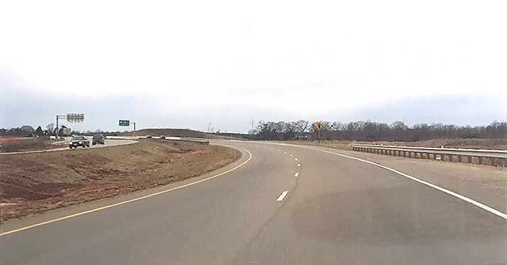
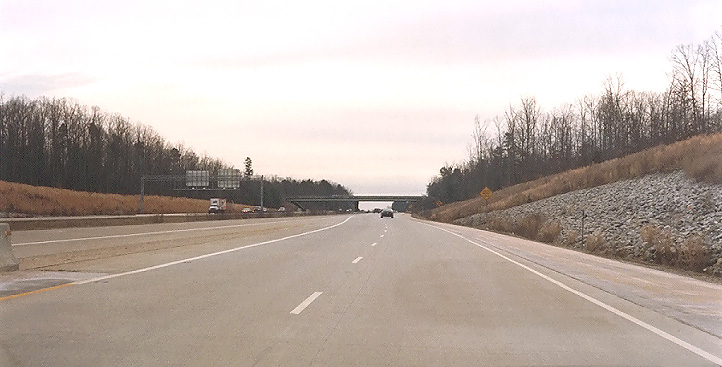
Route 288 northbound 2-lane collector-distributor (C-D) roadway, on the long curve between Route 76 Powhite Parkway and Lucks Lane. The curve is designed for 65 mph, and the speed limit is 65 mph. The Route 288 northbound mainline roadway is to the left of the C-D roadway. |
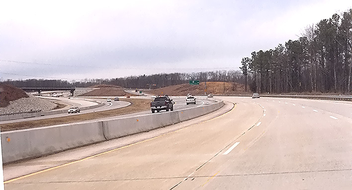 |
Route 288 northbound 2-lane collector-distributor (C-D) roadway, on the long curve between Route 76 Powhite Parkway and Lucks Lane, with the Lucks Lane interchange and overpass visible ahead. |
 |
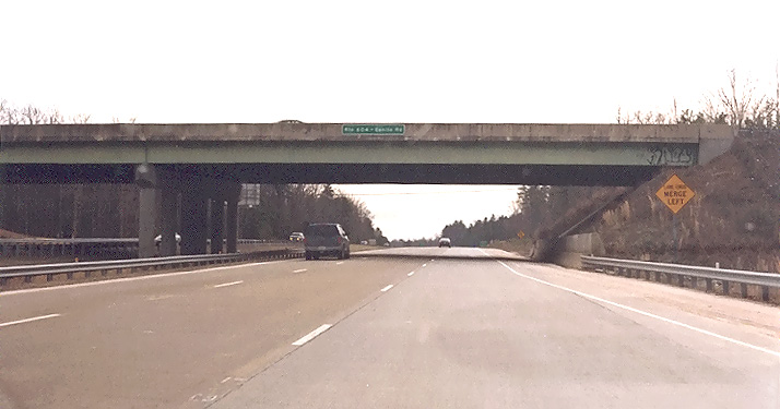
Route 288 northbound 2-lane collector-distributor (C-D) roadway, approaching the Lucks Lane overpass, which is a 4-lane bridge. |
 |
Route 288 northbound, on the Route 288 northbound 2-lane collector-distributor (C-D) roadway, approaching the Lucks Lane overpass. |
| 288 SOUTHBOUND | |
|
|
Route 288 southbound, two miles north of US-60 Midlothian Turnpike. The sign denotes the boundary between Chesterfield County and Powhatan County, and this is the point where the Route 288 asphalt pavement to the north of there transitions to the continuously reinforced concrete pavement to the south of there, and the pavement transition is visible ahead. |
 |
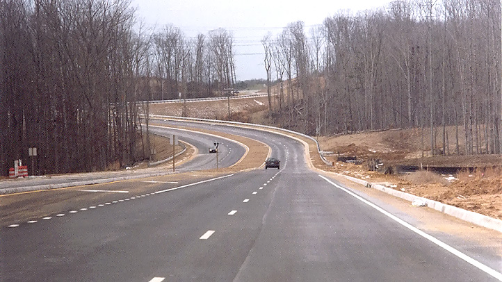
Route 288 southbound 2-lane collector-distributor (C-D) roadway, on the long curve between Route 76 Powhite Parkway and Lucks Lane, approaching the Route 76 Powhite Parkway interchange. The Route 288 southbound mainline roadway is to the left of the C-D roadway. |
|
|
Route 288 southbound, on the Route 288 southbound 2-lane collector-distributor (C-D) roadway, in the Route 76 Powhite Parkway interchange, on the 3-lane bridge over Route 76. |
 |
Route 288 southbound, on the Route 288 southbound 2-lane collector-distributor (C-D) roadway, south of the Route 76 Powhite Parkway interchange. |
 |
Route 288 southbound, the Route 288 southbound 2-lane collector-distributor (C-D) roadway at this point is merging into the Route 288 southbound mainline roadway, and the overpass ahead is Genito Road which is a 4-lane highway. |
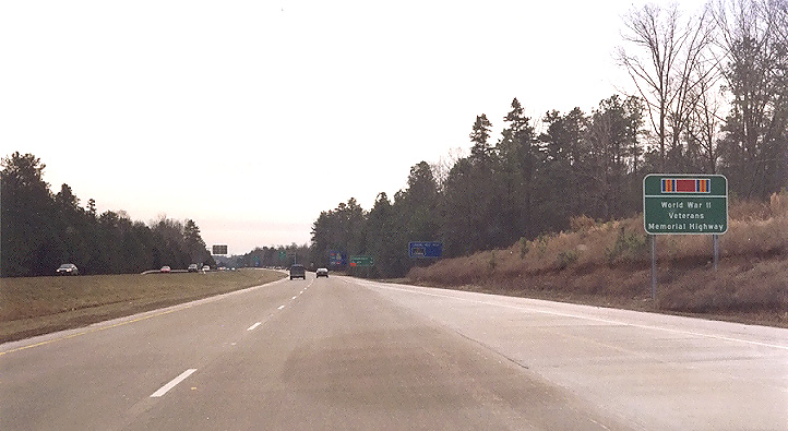 |
Route 288 southbound, the Route 288 southbound collector-distributor (C-D) roadway at this point has merged into the Route 288 southbound mainline roadway, with a single lane merging and ending ahead, marking the southern end of the Western Route 288 project. The 2.7 miles of Route 288 between US-360 Hull Street Road and Route 76 Powhite Parkway, opened in October 1988, and the Western Route 288 project from 1999-2004 extended Route 288 to I-64 in Goochland County. Notice the sign denoting the World War II Veterans Memorial Highway. |
Lead article for Route VA-288 Construction - Western Section
All photos taken by Scott Kozel.
Copyright © 2005 by Scott Kozel. All rights reserved. Reproduction, reuse, or distribution without permission is prohibited.
By Scott M. Kozel, Roads to the Future
(Created 3-1-2005)