
| Route VA-288 Construction - July 2004 |
Here are 37 photos of Virginia Route 288 under construction, taken in July, 2004. Click the thumbnail photo for a larger photo (they range in size from 101 to 242 kilobytes, with most being less than 165 kilobytes). As usual, the grouping sequence is from south to north. Each group was taken in the same 'photo session' of 30 minutes or less.
The following 8 photos were taken from Charter Colony Parkway in Chesterfield County.
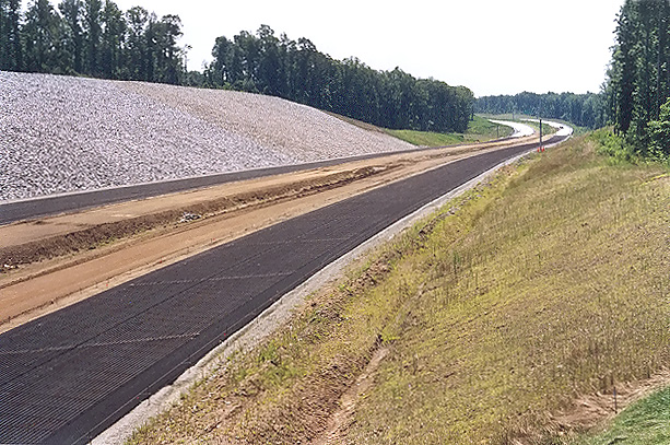 |
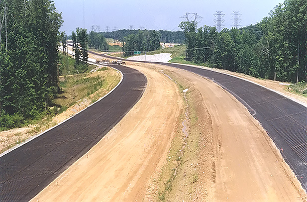
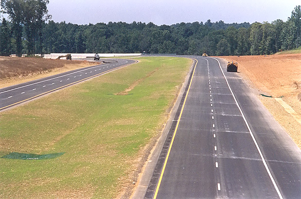
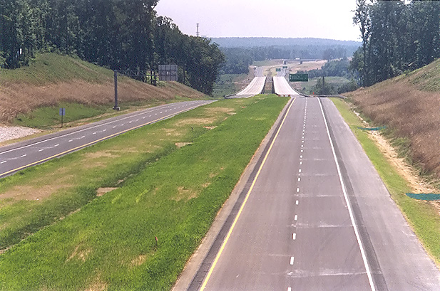
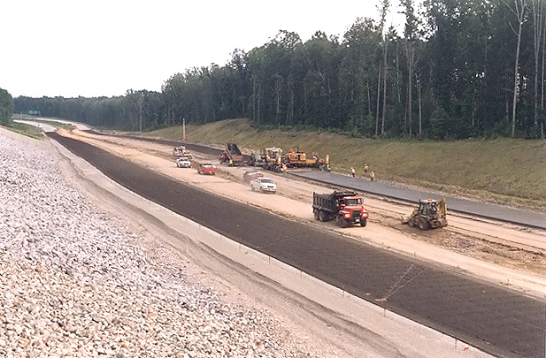
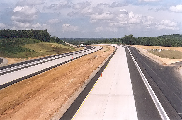
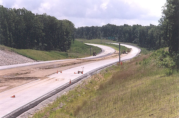
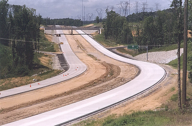
Route 288 construction, looking south from the Charter Colony Parkway overpass over Route 288. Visible in the distance, is the north end of the completed VA-288 section from VA-76 to north of Lucks Lane. The completed portion visible here is north of Lucks Lane and is not yet open to traffic. Paving operations are underway on Route 288, with placement of the layer of aggregate base stone, with an asphalt stabilized open graded drainage layer on top of the aggregate base, and with a grid of reinforcing steel rods ("re-bar") being placed on top of the asphalt stabilized open graded drainage layer. Continuously reinforced concrete pavement will placed on top of the asphalt stabilized open graded drainage layer, with the re-bar grid encased inside the 10-inch-deep concrete slab. I have details of the concrete pavement design on my webpage Route VA-288 Construction - October 2003. This is in Chesterfield County. |
 |
Route 288 construction, looking south from the Charter Colony Parkway overpass over Route 288. This photo was taken from the same vantage point as the previous photo, but it was taken with a 135mm (2.7x) telephoto lens, instead of the 50mm (1.0x) regular lens used previously. |
 |
Route 288 construction, looking south from the Charter Colony Parkway overpass over Route 288. This vantage point is from the opposite side of Route 288 as the two previous two photos. |
 |
Route 288 construction, looking south from the Charter Colony Parkway overpass over Route 288. This photo was taken from the same vantage point as the previous photo, but it was taken with a 135mm (2.7x) telephoto lens, instead of the 50mm (1.0x) regular lens used previously. |
 |
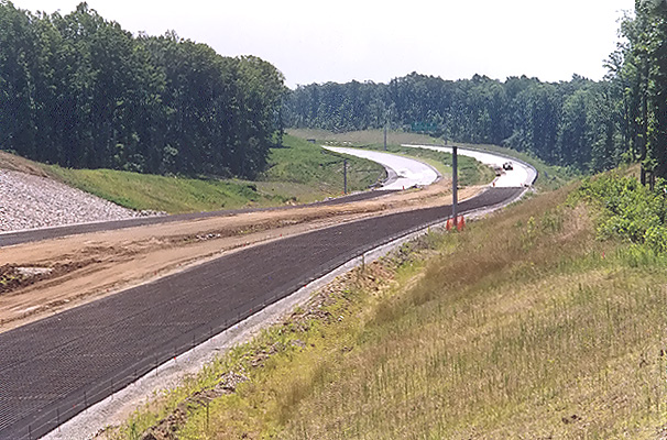
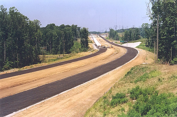
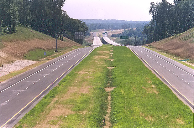
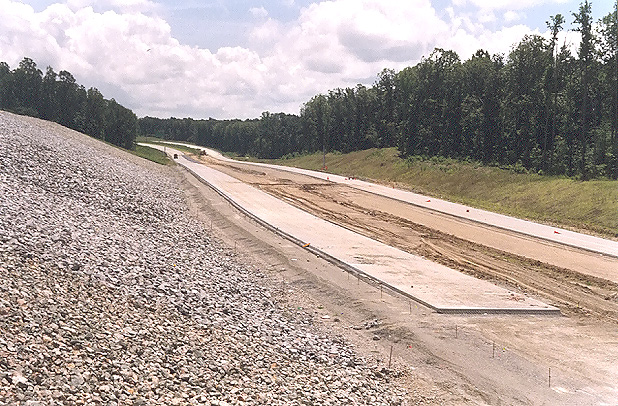
Looking north from where Charter Colony Parkway crosses Route 288. As in the previous four photos, paving operations are underway. |
 |
Looking north from where Charter Colony Parkway crosses Route 288. This photo was taken about 100 feet to the right of the previous photo. |
 |
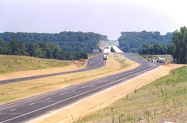
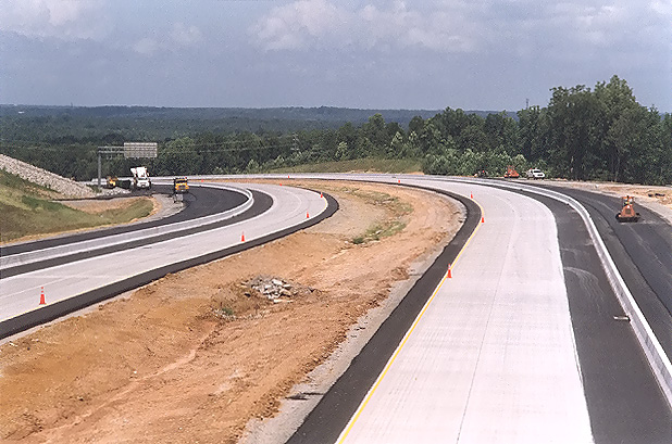
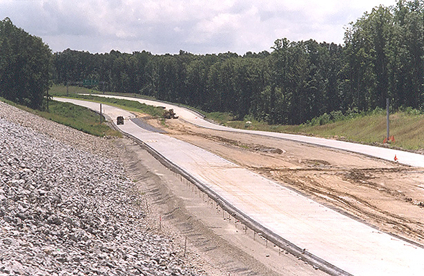
Looking north from where Charter Colony Parkway crosses Route 288. The concrete paving train is visible on the southbound roadway, with concrete pavement placed behind it; the paving train is advancing to the south, although this photo was taken on a Sunday when no work was underway. This photo was taken from the same vantage point as the previous photo, but it was taken with a 135mm (2.7x) telephoto lens, instead of the 50mm (1.0x) regular lens used previously. The interchange and overpass for Woolridge Road is visible in the distance. |
 |
Looking north from where Charter Colony Parkway crosses Route 288. This photo was taken about 100 feet to the left of the previous photo. |
The following 3 photos were taken from VA-711 Huguenot Trail in Powhatan County.
 |
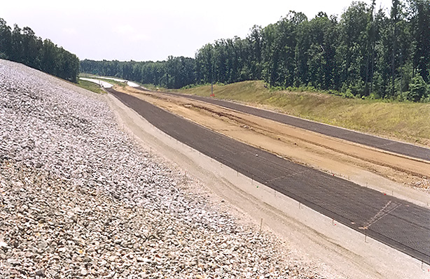
Looking south from VA-711 Huguenot Trail. VA-288 roadways under construction are visible, and asphalt paving operations are complete on this section, with lines painted on the roadways. |
 |
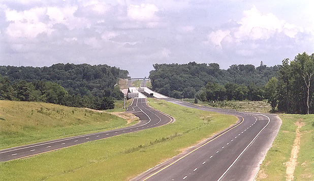
Looking north from VA-711 Huguenot Trail. VA-288 roadways under construction are visible, and asphalt paving operations are complete on this section, with lines painted on the roadways. The completed twin 3,642-foot-long bridges over the James River are visible in the distance, along with the large earthwork cut just north of the river, and the VA-650 River Road overpass is visible at the very limit of the visible construction. VA-711 Huguenot Trail will have a diamond interchange with VA-288. South of the river (this side) is in Powhatan County, and north of the river is in Goochland County. |
 |
Looking north from VA-711 Huguenot Trail. This photo was taken about 100 feet to the left of the previous photo. |
The following 5 photos were taken from VA-650 River Road in Goochland County.
 |
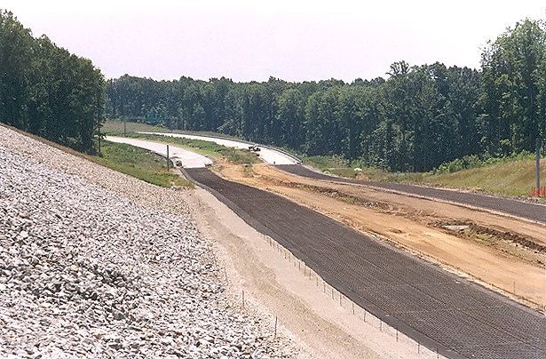
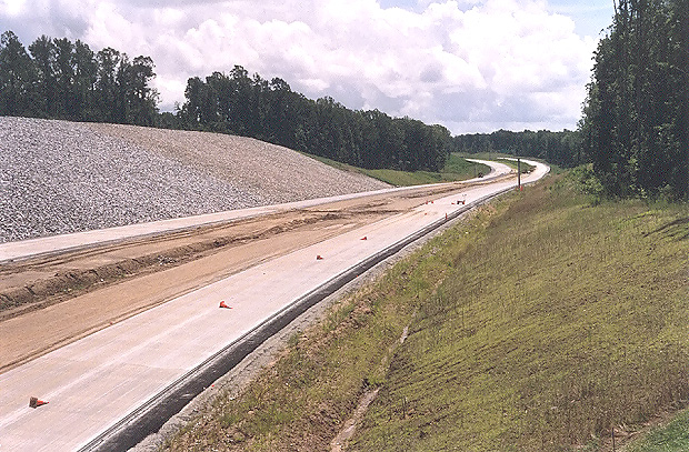
Looking south from the VA-650 River Road overpass, photo of the large earthwork cut just north of the VA-288 James River Bridge, with the completed river bridges visible in the distance. Asphalt paving operations are complete on this section, with lines painted on the roadways. This side of the river is in Goochland County, the other side of the river is in Powhatan County. |
 |
Looking south from the VA-650 River Road overpass. This photo was taken from the same vantage point as the previous photo, but it was taken with a 135mm (2.7x) telephoto lens, instead of the 50mm (1.0x) regular lens used previously. |
 |
Looking south from the VA-650 River Road overpass. This photo was taken from a similar vantage point and lens as the previous photo, but from about 50 feet to the left. |
 |
Looking north from the VA-650 River Road overpass. Asphalt paving operations are complete on this section, with lines painted on the roadways. This is in Goochland County. |
 |
Looking north from the VA-650 River Road overpass. This photo was taken from the same vantage point as the previous photo, but it was taken with a 135mm (2.7x) telephoto lens, instead of the 50mm (1.0x) regular lens used previously. |
The western 17.5-mile-long section of Route 288 will have concrete pavement
on the 6.7-mile-long southern portion, and asphalt pavement on the 10.8-mile-long
northern portion. The entire 17.4-mile-long southern section of Route 288 in Chesterfield
County (between I-95 and VA-76) that was completed in 1989, has continuously reinforced
concrete pavement, and the new western section of Route 288 will extend from where
the highway ended in 1989 at VA-76 Powhite Parkway, paving with continuously reinforced
concrete pavement from that point to about 100 feet south of the county line between
Chesterfield County and Powhatan County. Route 288 will have asphalt pavement
from near the Chesterfield / Powhatan county line to where Route 288 ends at I-64
in Goochland County. The following two articles of mine have detailed discussion
and 36 photos of the concrete paving operation, and about concrete pavement itself,
including the typical section of the VA-288 concrete pavement:
Route VA-288 Construction - October 2003
Route VA-288 Construction - November 2003
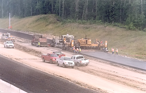
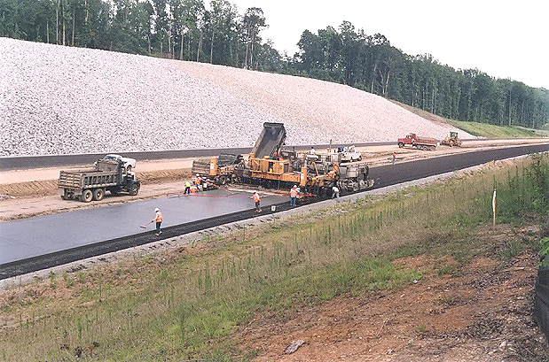
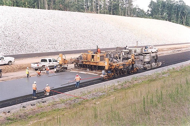
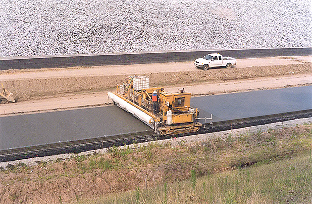
The following 10 photos were taken from (and near) Charter Colony Parkway in Chesterfield County, a week after the group of 8 photos from the same site at the top of this webpage. These show concrete paving operations.
 |
Concrete paving operation is underway on the 2-lane southbound roadway. |
 |
Concrete paving operation is underway on the 2-lane southbound roadway. This photo was taken from the same vantage point as the previous photo, but it was taken with a 135mm (2.7x) telephoto lens, instead of the 50mm (1.0x) regular lens used previously. |
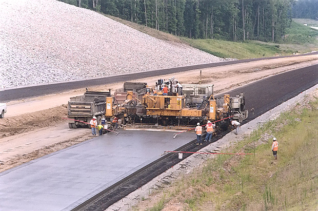 |
Concrete paving operation is underway on the 2-lane southbound roadway. The slipform paving machine (yellow color) , and the spreader machine (white color) is visible, with the just-placed and still-plastic 10-inch depth concrete slab behind the slipform paving machine. |
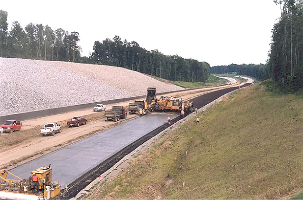 |
Longer view of the paving train, with the 3 separate machines visible, from left to right (the direction of the paving operation), the curing and texturing machine, the slipform paving machine, and the spreader machine. |
 |
Another view of the concrete paving operation, with the slipform paving machine and the spreader machine. |
 |
View of the curing and texturing machine, which follows behind the slipform paving machine and the spreader machine. The overpass is Charter Colony Parkway. |
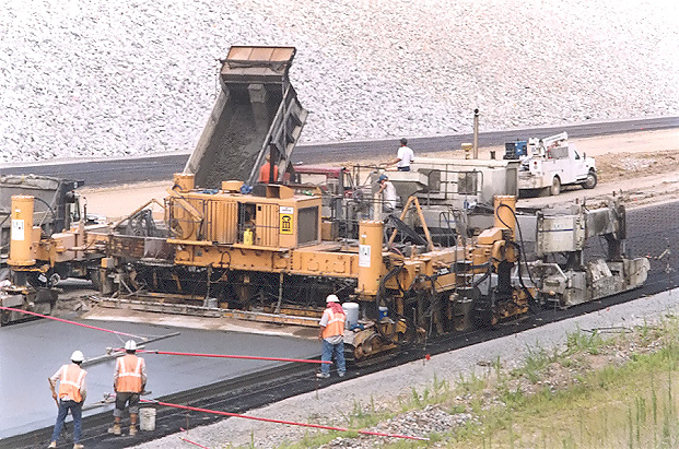 |
A dump truck that received its load from the central mix concrete plant, is depositing a load of wet concrete onto a conveyor belt that deposits the concrete onto the roadway. After several loads of concrete are piled in a large mound, the spreader machine moves forward (it has treads) and shapes the wet concrete into the approximate cross-section of the final product. After the spreader machine has shaped the wet concrete into the approximate cross-section of the final product, the slipform paving maching follows right behind (it has treads also), and shapes the concrete slab into the exact shape of the pavement cross-section. |
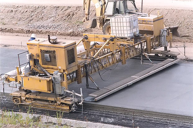 |
After the slipform paving machine has shaped the concrete slab into the exact shape of the pavement cross-section, the curing and texturing machine follows right behind, and makes a 'backward pass' with a screed to apply a longitudinal set of grooves about 1/2 inch deep in the surface of the pavement; and then makes a 'forward pass' to apply a curing compound to the surface of the pavement. |
 |
Another view of the concrete paving operation, with the slipform paving machine and the spreader machine. Workers perform hand-shaping of the concrete slab. |
 |
Another view of the curing and texturing machine. |
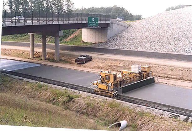
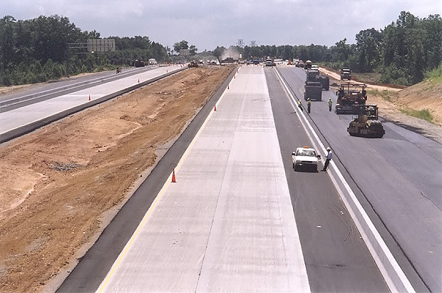
The following 4 photos were taken from US-60 Midlothian Turnpike in Chesterfield County.
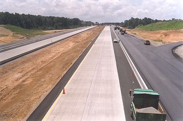 |
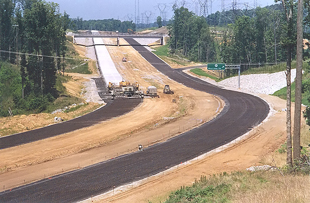
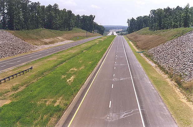
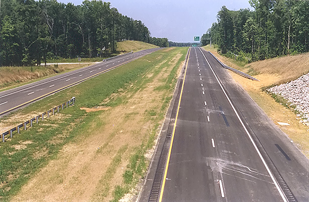
Looking south from the overpass where US-60 Midlothian Turnpike crosses Route 288. Paving operations are nearly complete on this section of Route 288, with continuously reinforced concrete pavement on the two 2-lane mainline roadways, asphalt on the shoulders, and asphalt on the collector-distributor (C-D) roadways. At this interchange area, Route 288 will have two mainline 2-lane roadways and two collector-distributor roadways, and the interchange will be a full cloverleaf design, with all the Route 288 ramp terminals interfacing with the C-D roadways. |
 |
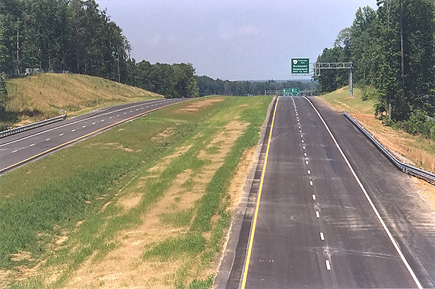
Looking south from the overpass where US-60 Midlothian Turnpike crosses Route 288. The Route 288 overpasses over the Norfolk-Southern Railway are visible in the distance. This photo was taken from the same vantage point as the previous photo, but it was taken with a 135mm (2.7x) telephoto lens, instead of the 50mm (1.0x) regular lens used previously. |
 |
Looking north from the overpass where US-60 Midlothian Turnpike crosses Route 288. This photo was taken a few minutes after the previous photo, but looking in opposite direction. |
 |
Looking north from the overpass where US-60 Midlothian Turnpike crosses Route 288. This photo was taken from the same vantage point as the previous photo, but it was taken with a 135mm (2.7x) telephoto lens, instead of the 50mm (1.0x) regular lens used previously. |
The following photo was taken from VA-711 Huguenot Trail in Powhatan County, later in the month.
 |
Looking north from VA-711 Huguenot Trail. VA-288 roadways under construction are visible, and asphalt paving operations are complete on this section, with lines painted on the roadways. The completed twin 3,642-foot-long bridges over the James River are visible in the distance, along with the large earthwork cut just north of the river, and the VA-650 River Road overpass is visible at the very limit of the visible construction. VA-711 Huguenot Trail will have a diamond interchange with VA-288. South of the river (this side) is in Powhatan County, and north of the river is in Goochland County. |
The following 6 photos were taken from Charter Colony Parkway in Chesterfield County, two weeks after the group of 8 photos from the same site at the top of this webpage.
 |
Route 288 construction, looking south from the Charter Colony Parkway overpass over Route 288. Paving operations are underway on Route 288, and both 2-lane roadways have had their 10-inch-deep slab of continuously reinforced concrete pavement placed. |
 |
Route 288 construction, looking south from the Charter Colony Parkway overpass over Route 288. This photo was taken from the same vantage point as the previous photo, but it was taken with a 135mm (2.7x) telephoto lens, instead of the 50mm (1.0x) regular lens used previously. |
 |
Route 288 construction, looking south from the Charter Colony Parkway overpass over Route 288. This vantage point is from the opposite side of Route 288 as the two previous two photos. |
 |
Route 288 construction, looking south from the Charter Colony Parkway overpass over Route 288. This photo was taken from the same vantage point as the previous photo, but it was taken with a 135mm (2.7x) telephoto lens, instead of the 50mm (1.0x) regular lens used previously. |
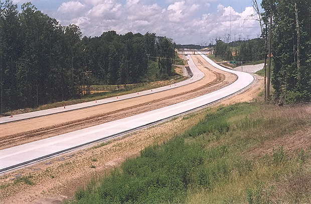 |
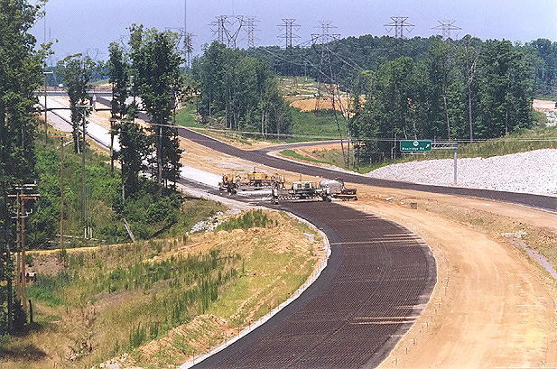
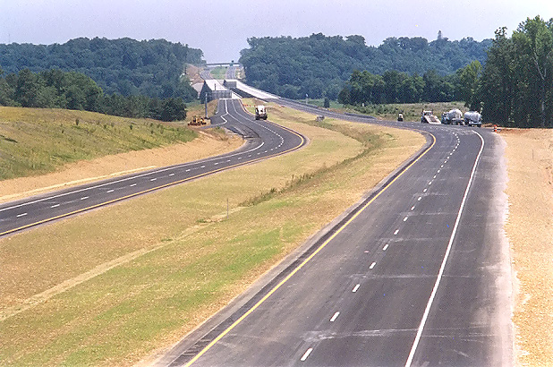
Looking north from where Charter Colony Parkway crosses Route 288. Paving operations are underway on Route 288, and both 2-lane roadways have had their 10-inch-deep slab of continuously reinforced concrete pavement placed. |
 |
Looking north from where Charter Colony Parkway crosses Route 288. This photo was taken from the same vantage point as the previous photo, but it was taken with a 135mm (2.7x) telephoto lens, instead of the 50mm (1.0x) regular lens used previously. The interchange and overpass for Woolridge Road is visible in the distance. |
Lead article for Route VA-288 Construction - Western Section
All photos taken by Scott Kozel.
Copyright © 2004 by Scott Kozel. All rights reserved. Reproduction, reuse, or distribution without permission is prohibited.
By Scott M. Kozel, Roads to the Future
(Created 9-1-2004)