
|
|
| Richmond-Petersburg Turnpike (I-95/I-85) and I-295 |
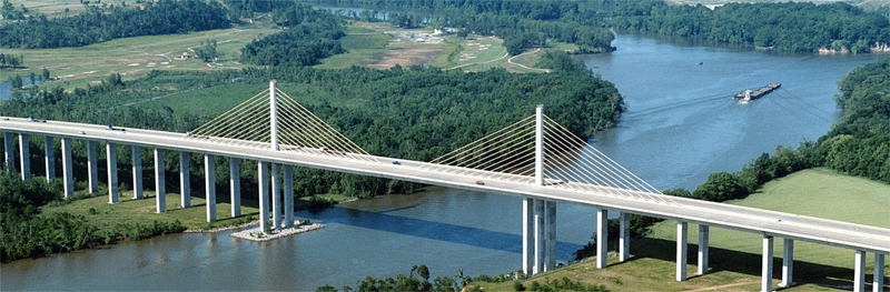
I-295 Varina-Enon Bridge. Click on photo for larger version.
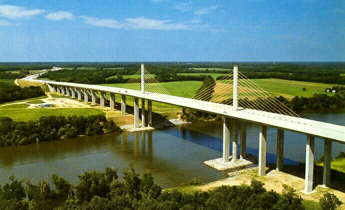
Photo by Virginia Department of Transportation,
1991.
Here's a link to another aerial photo of the Varina-Enon Bridge. Photo taken and scanned (284K) by Virginia Department of Transportation.
Virginia got federal approval in the late 1970s to build a new Interstate corridor to parallel the Richmond-Petersburg Turnpike (RPT). The RPT was designated with I-95 for most of its length, and with I-85 on the southern 4 miles. The RPT was a state-built tollroad, opened in 1958; no federal funds were used. The new Interstate would provide a new I-85 and new I-95, south and east of Petersburg. The RPT would have had the Interstate signing removed, and become a state route. Two sections of federally-funded Interstate leading to the RPT would have been bypassed also; about 3 miles of I-85 west of Petersburg would have become I-385, and about 4 miles of I-95 south of Petersburg would have become I-795. I-295 northeast of Richmond would have become I-95, and I-95 from I-295 (north junction) to I-195 would have become I-195. In other words, what today is the I-295 bypass of I-95, would have been I-95.
The new I-85 section south of Petersburg was never built. The new I-95 east of Petersburg and Richmond was built from 1984 to 1992. The state and federal project numbers on the design documents were for I-95. As sections opened to traffic, southward from US-60 east of Richmond, they extended the I-295 corridor southward and carried the I-295 signage. When the road was completed, it all carried the I-295 signage. The decision was made to leave the I-95 and I-85 signage on the RPT, and to sign the new road as I-295. Incidentally, when the new road opened, the tolls ceased on the RPT, and the toll booths were removed within six months.
The I-295 Varina-Enon Bridge at Dutch Gap was opened to traffic in July 1990. It has six lanes (three lanes each way) with full right and left shoulders, and is a cable-stayed bridge with 150 feet of vertical navigational clearance and 630 feet of horizontal navigational clearance. The bridge crosses the James River, and the shipping channel that leads to the Richmond Marine Terminal. The overall bridge length is 4,680 feet.
The following 4 photos were taken on July 20, 2008 by Roads to the Future, in the late afternoon, from the Henricus Historical Park, on the south bank of the river, looking eastward.
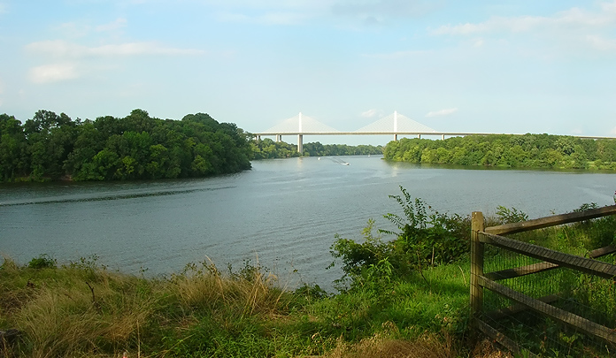 |
James River with I-295 Varina-Enon Bridge in distance. |
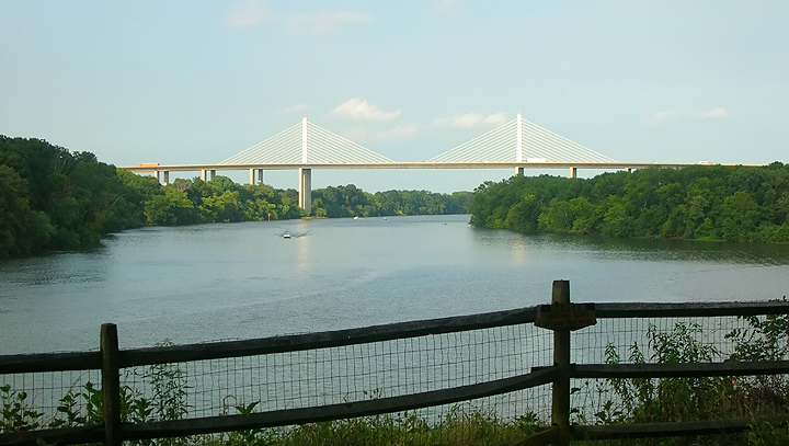 |
James River with I-295 Varina-Enon Bridge in distance, more zoom than previous photo. |
 |
James River with I-295 Varina-Enon Bridge in distance, more zoom than previous photo. |
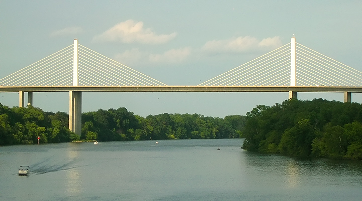 |
James River with I-295 Varina-Enon Bridge, more zoom than previous photo. |
For more details, see Roads to the Future articles:
Richmond
Beltway (I-295 and VA-288)
Route 895
- Pocahontas Parkway
Richmond
Interstates and Expressways
Copyright © 1997-2008 by Scott Kozel. All rights reserved. Reproduction, reuse, or distribution without permission is prohibited.
By Scott M. Kozel, Roads to the Future
(Created 8-14-1997, updated 7-20-2008)