
| Chesapeake Bay Bridge Walk |
The Chesapeake Bay Bridge has been the site of an annual Bay Bridge Walk since 1975. It is typically on a Sunday in early May. The eastbound span is closed to traffic for use by the walkers, and the westbound three-lane span has two-way vehicular traffic that is controlled by overhead lane control signals.
Take a walk with me as you view the site through my camera, on the 1987 Bay Bridge Walk. I have 12 photos, and the sequence is as I walk from the east end of the bridge to the west end of the bridge, and all photos were taken on the same day on the same Bridge Walk. Click on each photo for a larger version.
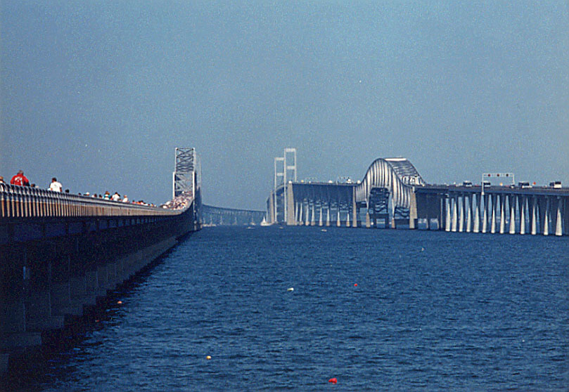
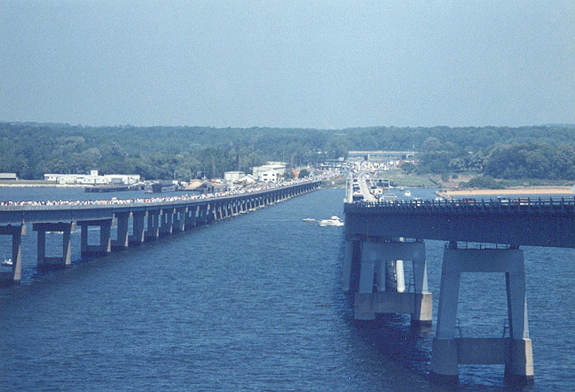
Above, I am standing on the eastern shoreline
looking west. The Eastern Channel cantilever bridges are about 1-1/3 mile away,
and the Chesapeake Channel suspension bridges are about 2-2/3 miles away. Click
on the photo for a larger version (124K).
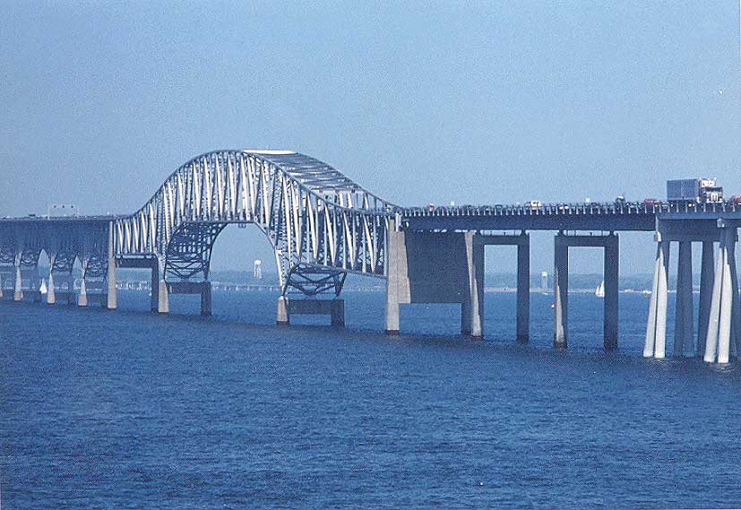
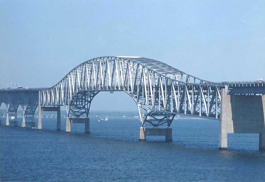
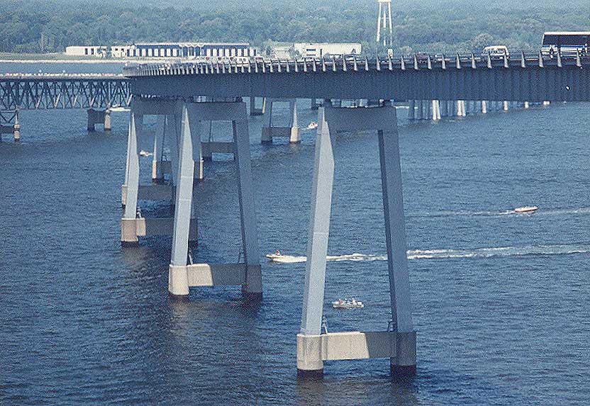
Above, the Eastern Channel bridges are
cantilever bridges with 58 feet of vertical navigational clearance and 690 feet
of horizontal navigational clearance. The water is over 80 feet deep there. Click
on the photo for a larger version (144K).
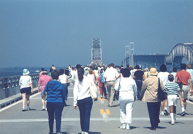
Above, the bridge walkers make their way
toward the Eastern Channel bridge. Click on the photo for a larger version (127K).
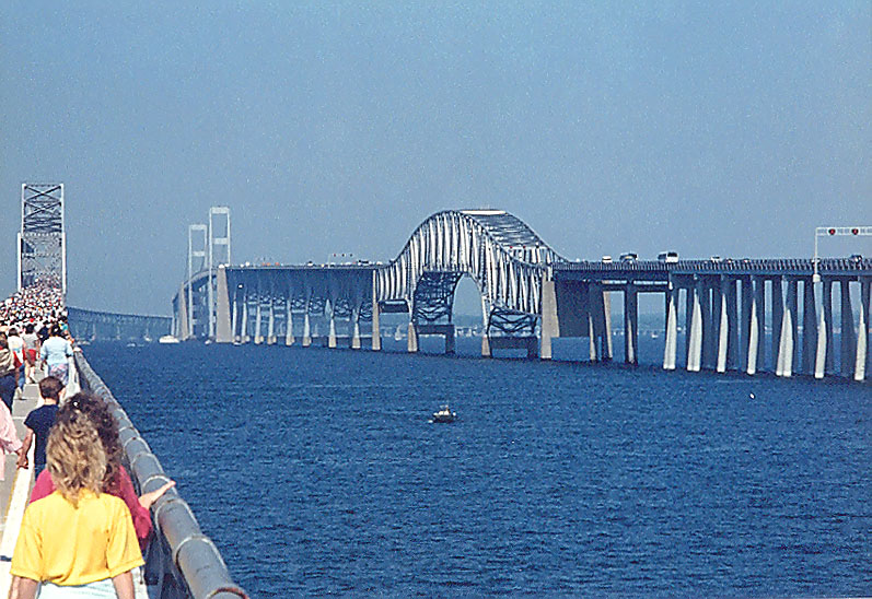
Above, a closer view of the westbound
Eastern Channel bridge. Click on the photo for a larger version (86K).
Above, a closer view of the westbound
Eastern Channel bridge. Click on the photo for a larger version (51K).
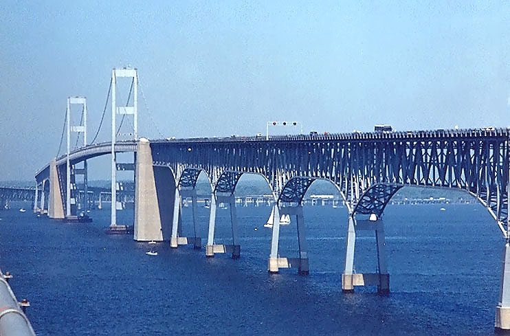
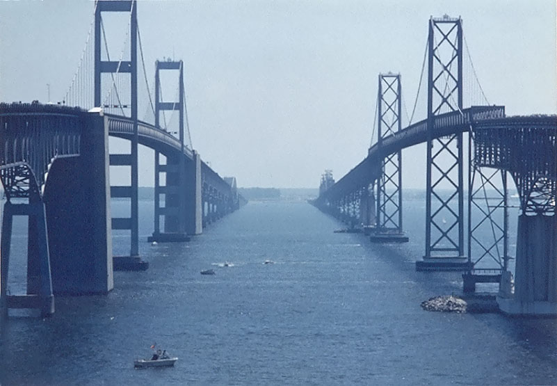
Above, the high-level approaches to the
suspension span are a long-span steel truss construct. Click on the photo for
a larger version (92K).
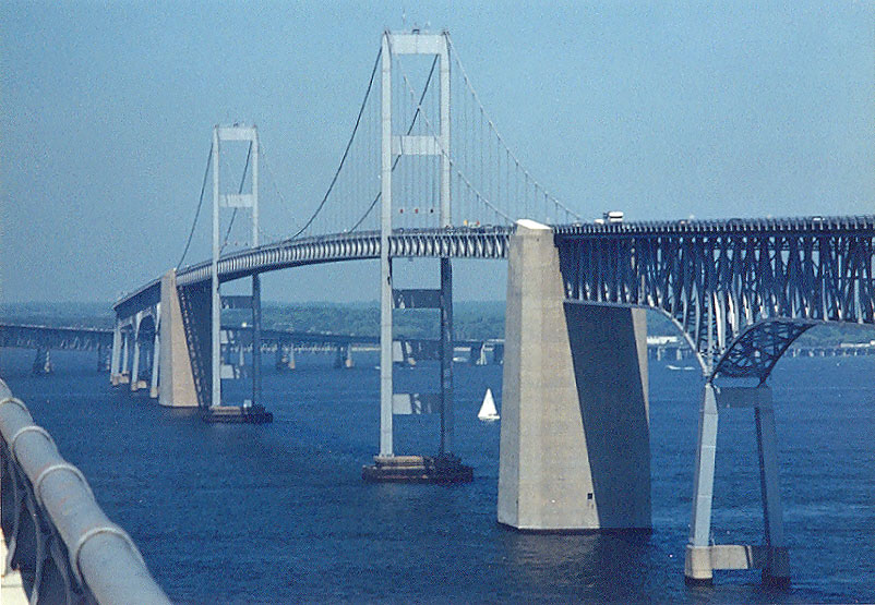
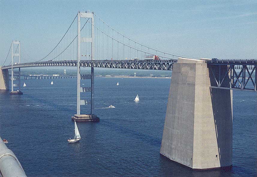
Above, the main two suspension spans have
186 feet of vertical navigational clearance and 1,500 feet of horizontal navigational
clearance, which is sufficient for safe high-speed passage of two-way traffic
by the largest ocean-going ships. The main spans cross the main shipping channel,
Chesapeake Channel, at a right angle, necessitating the curve on the western portion
of the complex, since a straight line from the most effective landings for each
end of the bridge (based on the 1952 requirements of where the approach highway
should be), would cross the main shipping channel at a considerable angle away
from a right angle, causing a considerably longer main span than the 1,500 feet
required for navigation. So that explains why the bridges have a dogleg in them,
rather than a straight line from shore to shore; it was cheaper to build them
with a small increase in overall length rather than have them straight with a
longer main suspension span. The water at the main span is about 55 feet deep;
deep enough so that dredging is not needed. Click on the photo for a larger version
(152K).
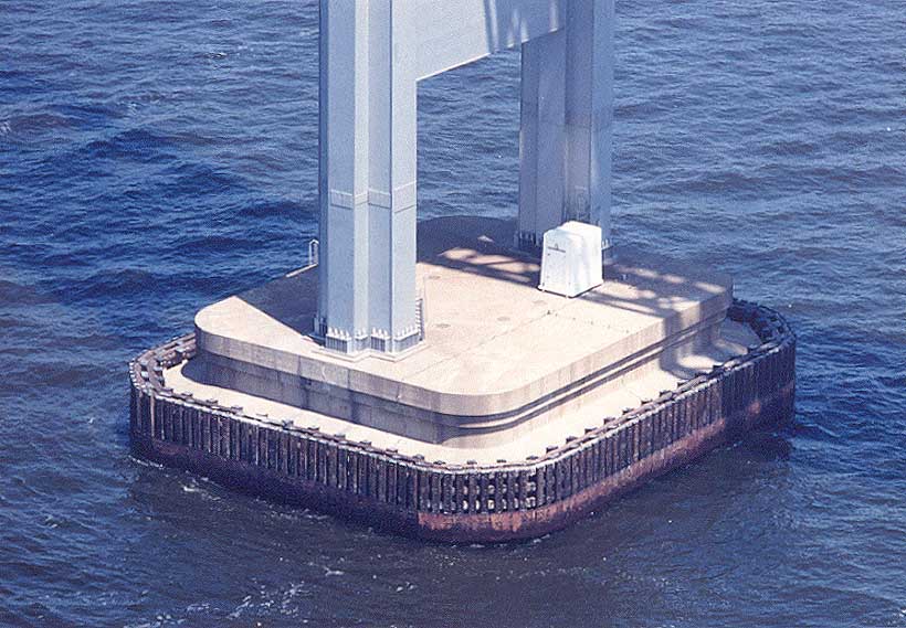
Above, foundation of tower of suspension
span. Click on the photo for a larger version (87K).
Above, the main suspension span, which
I already described in detail a couple photos previously. I took this photo with
a 50mm (1.0x) regular lens, while all other of my "Chesapeake Bay Bridge Walk"
photos were taken with a 135mm (2.7x) moderate telephoto lens. This photo shows
well just how massive that the reinforced concrete anchorages are on the westbound
bridge. Click on the photo for a larger version (84K).
Above, western high-level approaches to
the main suspension span. Click on the photo for a larger version (133K).
Above, western bridge approaches.
The Western Shore is one mile away. Click on the photo for a larger version (143K).
Eastbound motorists in the left lane have
this view for fleeting seconds. The main spans are about a mile away, the Eastern
Channel spans are about 2-1/3 miles away, and the Western Shore is about 3-2/3
miles away. From about Memorial Day to Labor Day, the Bay is chocked full of pleasure
boats. The bridge walk takes place before Memorial Day. Click on the photo for
a larger version (83K).
Lead article for
Chesapeake Bay Bridge Walk
Main article for
Chesapeake Bay Bridge
All photos taken by Scott Kozel.
Copyright © 2001-2005 by Scott Kozel. All rights reserved. Reproduction, reuse, or distribution without permission is prohibited.
By Scott M. Kozel, Roads to the Future
(Created 12-17-2001, updated 2-6-2005)